March 25 , 2025.
Italy / Sicily , Etna :
Etna Activity Update, March 24, 2025, 9:23 AM (8:23 UTC).
The National Institute of Geophysics and Volcanology, Osservatorio Etneo, reports that due to weather conditions, there is no possibility of observing any ongoing activity.
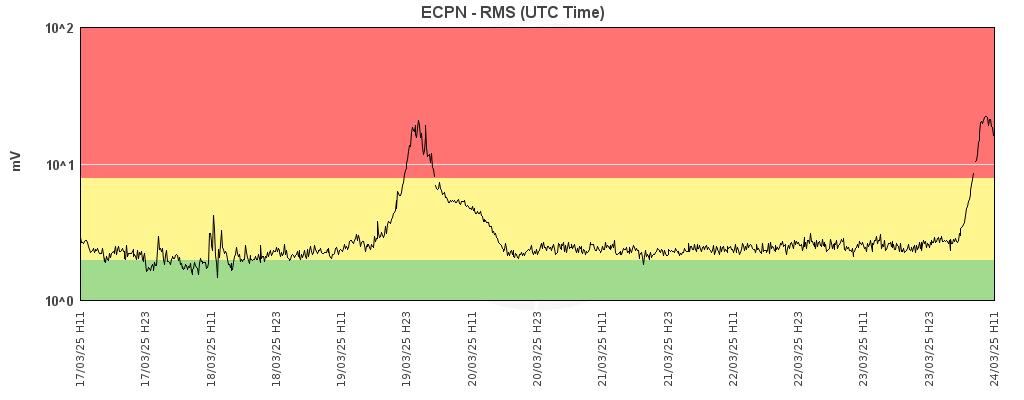
From a seismic perspective, starting at 4:30 UTC today, the average amplitude of volcanic tremor shows a sudden increase, and at 7:00 UTC, it reached the high range, with a further current upward trend. The location of the centroid of the tremor sources is in the southeast crater area at an altitude of approximately 2,900 m above sea level. Infrasound activity appears to be absent at this time; However, it cannot be ruled out that due to adverse weather conditions, the assessment of the state of infrasound activity may be significantly compromised.
Data from the inclinometric and GNSS monitoring networks of Etna’s ground deformation showed no significant variations in any of the measured parameters.
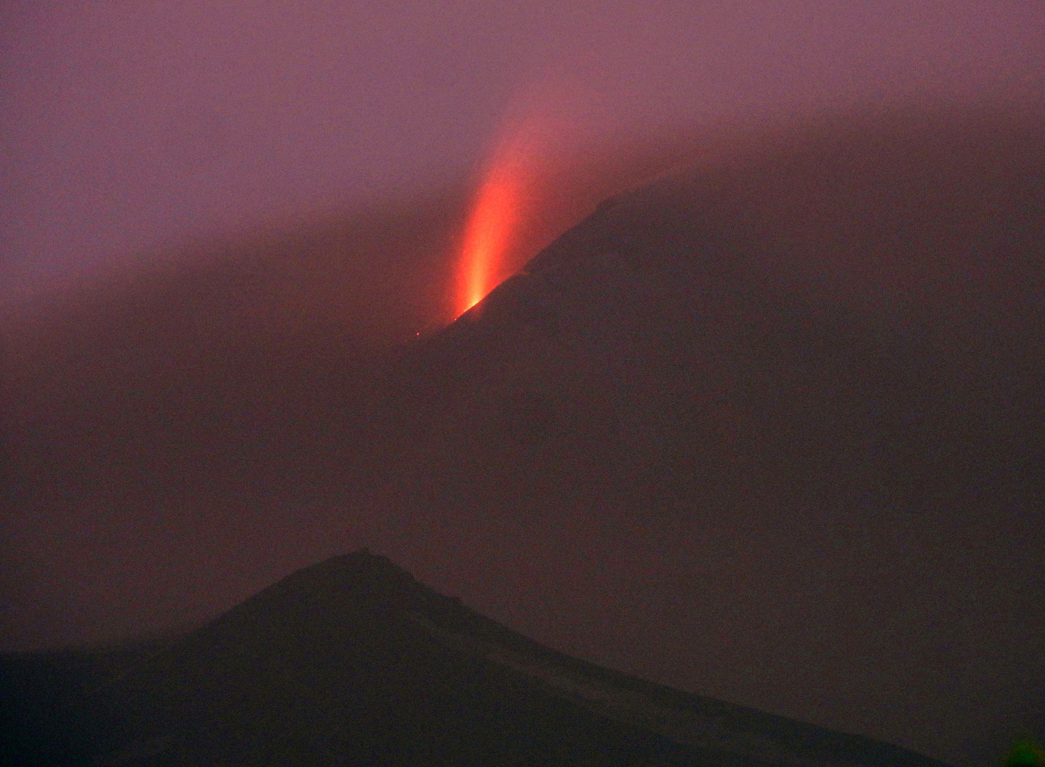
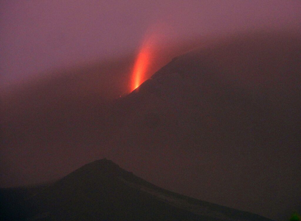
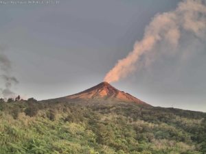
The third episode of Strombolian activity in 10 days at Etna’s Southeast Crater occurred on March 24, 2025. Unfortunately, the adverse weather conditions made observations nearly impossible; however, images taken by the INGV thermal camera on Montagnola showed a small lava overflow on the southern flank of the Southeast Crater. In the afternoon, activity decreased, as could be deduced from the decreased amplitude of the volcanic tremor. In the evening, the clouds opened slightly, and I was able to capture some of the small explosions still ongoing in the Southeast Crater. The view is from Nicolosi. ( B. Behncke)
March 24, 2025, 11:47 (10:47 UTC).
The National Institute of Geophysics and Volcanology, Osservatorio Etneo, reports that following an improvement in weather conditions in the summit area of Etna, explosive activity has been observed in the southeast crater through INGV-OE surveillance cameras since approximately 10:22 UTC. The forecast model indicates the dispersion of the eruptive cloud in a northeast direction.
Following today’s previous announcement, the average amplitude of volcanic tremor has continued to increase and since approximately 08:40 UTC, it appears to have stabilized at high values.
The centroid of the tremor sources is located in the southeast crater area, at a depth between 2,900 m and 3,000 m above sea level. Beginning around 08:30 UTC, there was modest infrasound activity that appears to have increased slightly over the past hour.
Data from Etna’s inclinometer and GNSS ground deformation monitoring networks showed no significant variation in any of the measured parameters.
The dilatometer at the DRUV station shows a significant variation since 09:25 UTC.
Further updates will be provided shortly.
Source : INGV
Photos : Boris Behncke , INGV.
New Zealand , White Island :
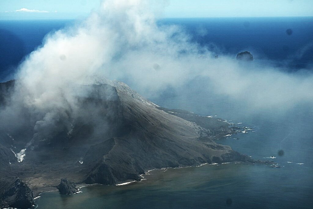
Steam and gas plumes with minor presence of volcanic ash continue to be observed, along with evidence of occasional, more explosive activity. Volcanic Alert Level remains at 2 and Aviation Colour Code remains at Orange. Published: Tue Mar 25 2025 9:00 AM
Over the past couple of weeks, our webcams at Whakatāne and Te Kaha have continued to record steam and gas plumes with a minor but variable presence of volcanic ash. On occasions our colleagues at MetService have also detected small amounts of volcanic ash in the plume on satellite imagery. From the coast, this can sometimes be seen as a hazy plume trailing downwind from the volcano.
Recent gas and observation flights have confirmed what has been observed from the coast. Friday’s observation flight has also recorded minor changes in the active vent area, this has enlarged slightly. We also observed impact craters, suggesting that some occasional, more explosive activity has recently occurred, ejecting ballistic blocks up to about 600 m from the active vent, on the crater floor. The exact timing and number of these more explosive events is unknown, but this type of activity is not uncommon for Whakaari as active vents grow. The impact of these events remained confined to the Main Crater floor.
Thermal InfraRed temperature measurements of the active vent are also up from the previous measurements, rising from 220 °C in January to 360 °C on Friday, but remain well below the highs of over 580 °C in August 2024. Sulphur dioxide (SO₂) emissions continue to be detected by satellite under suitable conditions. During northerly wind conditions the minor ash load in the steam and gas plume and the gas may be noticed by residents on the coast as sulphur odours.
Steam, gas, and volcanic ash emissions remain variable as they have been for the past few months. Recent activity is consistent with moderate-heightened unrest and the Volcanic Alert Level therefore remains at Level 2. Because of the continued observations of volcanic ash emissions from the volcano the Aviation Colour Code remains Orange. These levels acknowledge the current level of activity but also reflect the degree of uncertainty about the level of unrest due to the current lack of consistent, usable real-time monitoring data—volcanic activity could escalate with little or no warning. Further sudden, more explosive events could therefore affect the crater floor area and immediate vicinity of the island. The Bay of Plenty coast remains unaffected by such short-term variations in activity.
Source : Geonet / Brad Scott / Duty Volcanologist
Photo : Geonet / White Island 14/ 12 /2024 .
Indonesia , Dukono :
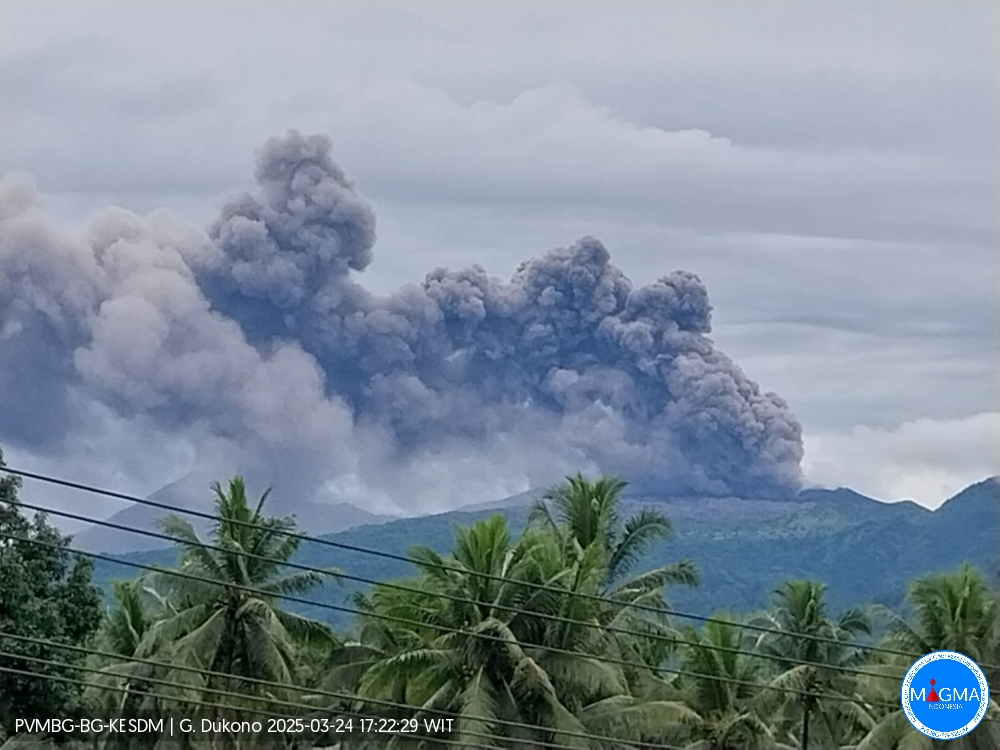
An eruption of Mount Dukono occurred on Monday, March 24, 2025, at 5:12 PM WIT with an observed ash column height of ± 800 m above the peak (± 1887 m above sea level). The ash column was observed to be white to gray in color with a thick, eastward-facing intensity. At the time of writing, the eruption was still ongoing.
Seismicity Observation:
257 eruptive earthquakes with an amplitude of 6 to 34 mm and a duration of 35.04 to 162.21 seconds.
1 Continuous Tremor earthquake with an amplitude of 1-5 mm, dominant value 3 mm.
Recommendation
(1) People near Mount Dukono and visitors/tourists should not engage in activities, climb, or approach the Malupang Warirang crater within a 4 km radius.
(2) Given that volcanic ash eruptions occur periodically and the distribution of ash follows wind direction and speed, such that the area where ash lands is not constant, people around Mount Dukono are recommended to always wear masks/nose and mouth coverings to use when needed to avoid the threat of volcanic ash to the respiratory system.
Source et photo : Magma Indonésie .
Chile , Tupungatito :
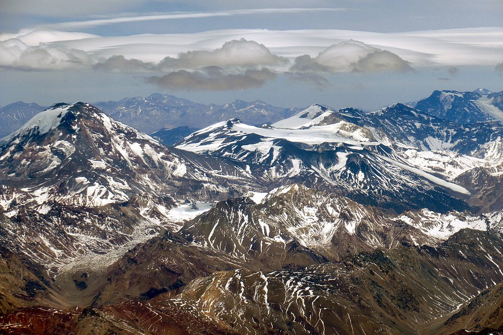
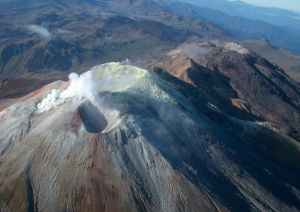
Special Report on Volcanic Activity (REAV), Metropolitan Region of Santiago, Tupungatito Volcano, March 24, 2025, 4:32 a.m. local time (mainland Chile).
The National Geology and Mining Service of Chile (SERNAGEOMIN) publishes the following preliminary information, obtained using the monitoring equipment of the National Volcanic Monitoring Network (RNVV), processed and analyzed at the Southern Andean Volcanological Observatory (OVDAS):
On Monday, March 24, 2025, at 4:13 a.m. local time (March 24, 7:13 a.m. UTC), monitoring stations installed near the Tupungatito Volcano recorded an earthquake associated with rock fracturing (volcano-tectonic type).
The characteristics of the earthquakes after their analysis are as follows:
TIME OF ORIGIN: 04:13 local time (07:13 UTC)
LATITUDE: 33.252° S
LONGITUDE: 69.777° W
DEPTH: 1.9 km
LOCAL MAGNITUDE: 3.2 (ML)
OBSERVATIONS:
Since the occurrence of the volcano-tectonic event mentioned in yesterday’s report, 20 other earthquakes with similar characteristics, but of lower energy, have been recorded. The event described in this report is the second most energetic of this episode.
The Volcanic Technical Alert remains at Green.
Source : Sernageomin
Photo : WeHaKa / wikimedia
Costa Rica , Poas :
ERUPTION REPORT – OVSICORI-UNA
Location: N10.20 W84.23
Mass Height: 2687 m (8813 ft)
Date: 03/24/2025 Time: 23:50
Plume Height: Unknown
Plume Observation Source: Seismic, acoustic, and IR camera recording.
Observed Activity:
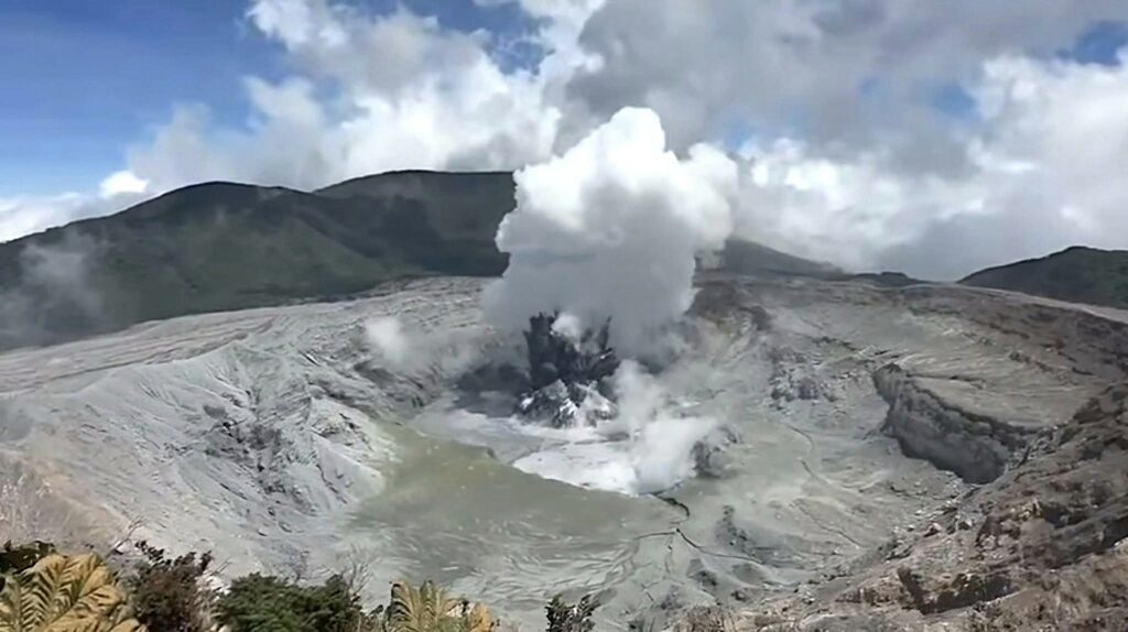
A small eruption lasting approximately two minutes was recorded from vent C. A few minutes before the eruption, an increase in the tremor amplitude was observed.
After the eruption, the tremor amplitude increased, and signals associated with small eruptions (geyser-like) were recorded on seismic and acoustic instruments, which are very frequent and persist to this day. There is no visibility in the cameras; however, the emission of fine particles in a southerly and southeasterly direction cannot be ruled out.
The seismic and acoustic tremors have been intensifying since 11:00 PM. On March 24, an increase in the CO2/SO2 gas ratio was observed.
Activity Level: WARNING.
Source : Ovsicori.
Photo : Rod Cortes / FB ( 15/03/2025) .

