March 14 , 2025.
Iceland : Reykjanes Peninsula :
Earthquake swarm ongoing offshore Reykjanestá . 13.3.2025
Up to 600 earthquakes detected so far
Many seismic swarms occurred in the area since 2021
The activity may continue with intermittent behavior
No clear evidence of deformation in the area
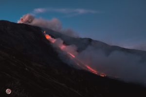
At around 14:30 yesterday (12 March 2025), a rather intense earthquake swarm began offshore Reykjanestá. The swarm was most intense at the beginning when about 50 – 60 earthquakes were recorded in the first few hours. As the day progressed, the activity decreased but then increased again shortly before midnight when an earthquake of magnitude 3.5 occurred. When the activity increased again in the evening, it shifted slightly westward as the image shows (blue circles indicate the location of earthquakes that occurred at the beginning of the swarm yesterday, while yellow and red ones show earthquakes from late last evening and night).
More than three months have passed since the last eruption ended at the Sundhnúkagígar crater row.
So far, about 600 earthquakes have been detected within in the area, including six earthquakes over magnitude M3. Reports have been received that some earthquakes were felt in populated areas, including Grindavík town, which is about 12 km east of the activity. The behavior of the swarm so far shows that the activity can decrease and then suddenly increase again. Since 2023, five earthquake swarms have occurred in the same area where the activity is now. In addition, there have been considerable swarms there in 2021 and 2022, to name a few examples. The earthquakes are possibly trigger earthquakes due to changes in the stress field on the Reykjanes Peninsula in conjunction with seismic activities and magmatic intrusions in the recent years. Deformation data over the past few days do not show clear evidence that the current seismic activity is due to magma movement at depth. However, scientists at the Icelandic Meteorological Office are closely monitoring all measurements around Reykjanesstá to identify the most likely cause of the earthquake swarm.
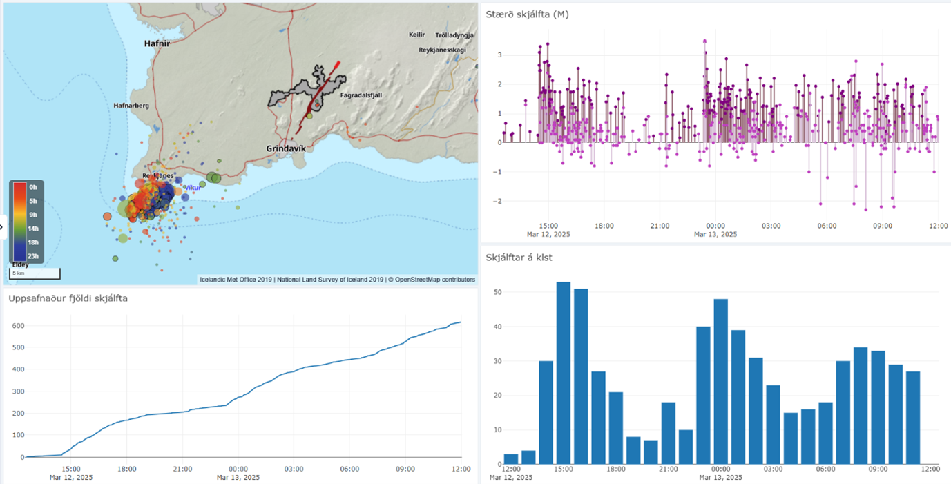
Data from Skjálfta-Lísa, the Icelandic Met Office’s earthquake monitoring system. The map shows the locations of earthquakes that have occurred since noon on March 12, divided into two distinct groups. The graph below the map represents the cumulative number of earthquakes since the start of the swarm. The top-right graph shows the magnitudes of the earthquakes, with analyzed earthquakes in darker colors and automatic magnitudes in lighter shades. The bar graph on the right shows the number of earthquakes per hour since noon yesterday.
Source : IMO
Photos : mbl.is/Eggert Jóhannesson
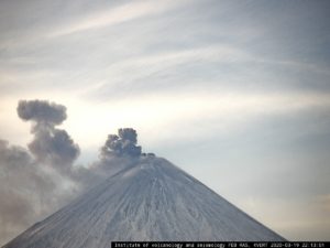
Indonesia , Raung :
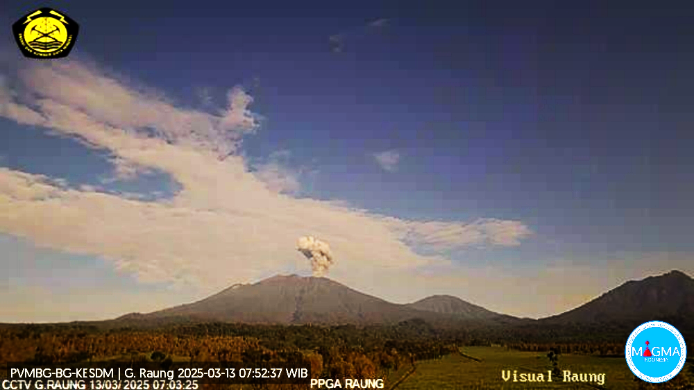
An eruption of Mount Raung occurred on Thursday, March 13, 2025, at 06:59 WIB with an observed ash column height of ± 1500 m above the peak (± 4832 m above sea level). The ash column was observed to be gray in color with a thick intensity, oriented toward the West and Northwest. This eruption was recorded on a seismograph with a maximum amplitude of 7 mm and a duration of 34 seconds.
VOLCANO OBSERVATORY NOTICE FOR AVIATION – VONA
Issued : March 12 , 2025
Volcano : Raung (263340)
Current Aviation Colour Code : ORANGE
Previous Aviation Colour Code : unassigned
Source : Raung Volcano Observatory
Notice Number : 2025RAU001
Volcano Location : S 08 deg 07 min 30 sec E 114 deg 02 min 31 sec
Area : East java, Indonesia
Summit Elevation : 10662 FT (3332 M)
Volcanic Activity Summary :
Eruption with volcanic ash cloud at 23h59 UTC (06h59 local).
Volcanic Cloud Height :
Best estimate of ash-cloud top is around 15462 FT (4832 M) above sea level or 4800 FT (1500 M) above summit. May be higher than what can be observed clearly. Source of height data: ground observer.
Other Volcanic Cloud Information :
Ash cloud moving from west to northwest. Volcanic ash is observed to be gray. The intensity of volcanic ash is observed to be medium.
Remarks :
Eruption recorded on seismogram with maximum amplitude 7 mm and maximum duration 34 second. Tremor recorded on seismogram with maximum amplitude 1 mm. Volcanic activity is characterised by continous tremor and emission quake
Source et photo : Magma Indonésie .
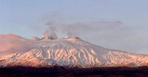
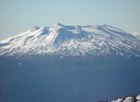
Chile , Puyehue-Cordon Caulle :
Special Volcanic Activity Report (REAV), Los Lagos region, Puyehue-Cordon Caulle volcanic complex, March 11, 2025, 10:34 PM local time (mainland Chile).
The National Geology and Mining Service of Chile (SERNAGEOMIN) publishes the following preliminary information, obtained using the monitoring equipment of the National Volcanic Monitoring Network (RNVV), processed and analyzed at the Southern Andean Volcanological Observatory (OVDAS):
On Tuesday, March 11, 2025, at 10:20 PM local time (Wednesday, March 12, 1:20 AM UTC), monitoring stations installed near the Puyehue-Cordon Caulle volcanic complex recorded an earthquake associated with rock fracturing (volcano-tectonic type).
The earthquake characteristics after analysis are as follows:
TIME OF ORIGIN: 22:20 local time (Wednesday, March 12, 2025, 01:20 UTC)
LATITUDE: 40.559° S
LONGITUDE: 72.161° W
DEPTH: 7.2 km
LOCAL MAGNITUDE: 3.6 (ML)
OBSERVATIONS:
At the time of this report, no changes in the monitored parameters or earthquakes of similar characteristics have been recorded.
The Volcanic Technical Alert remains at Green.
Source: Sernageomin
Photo : Christian Franz – Cara sureste
Italy , Campi Flegrei :
Campi Flegrei: The Md 4.4 earthquake of March 13, 2025, and the state of the caldera. March 13, 2025
On March 13, 2025, at 1:25 a.m., an earthquake with a preliminary magnitude of 4.4 ± 0.3 occurred in the Campi Flegrei at a depth of 2.5 km, with its epicenter near the coast on Via Napoli in the municipality of Pozzuoli.
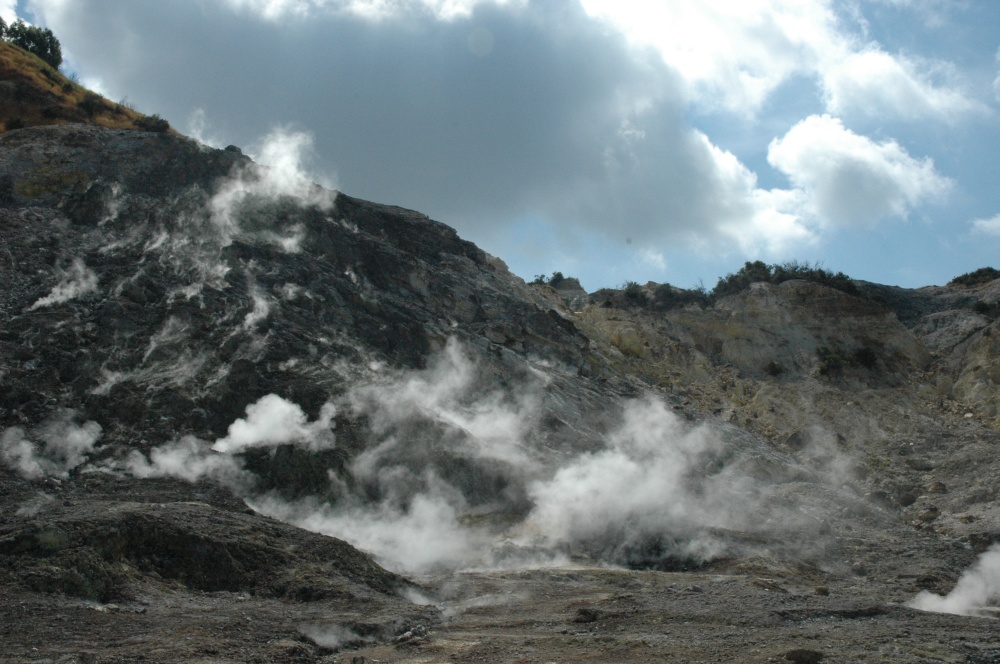
The ground acceleration produced by the earthquake was significant, as shown in the tremor map; in fact, it was also felt in a large part of the city of Naples.
This is one of the most energetic events since we began instrumentally monitoring the area, and it occurs at a time when there is an acceleration in the ground uplift rate, which has increased to about 3 cm/month in the area of maximum uplift.
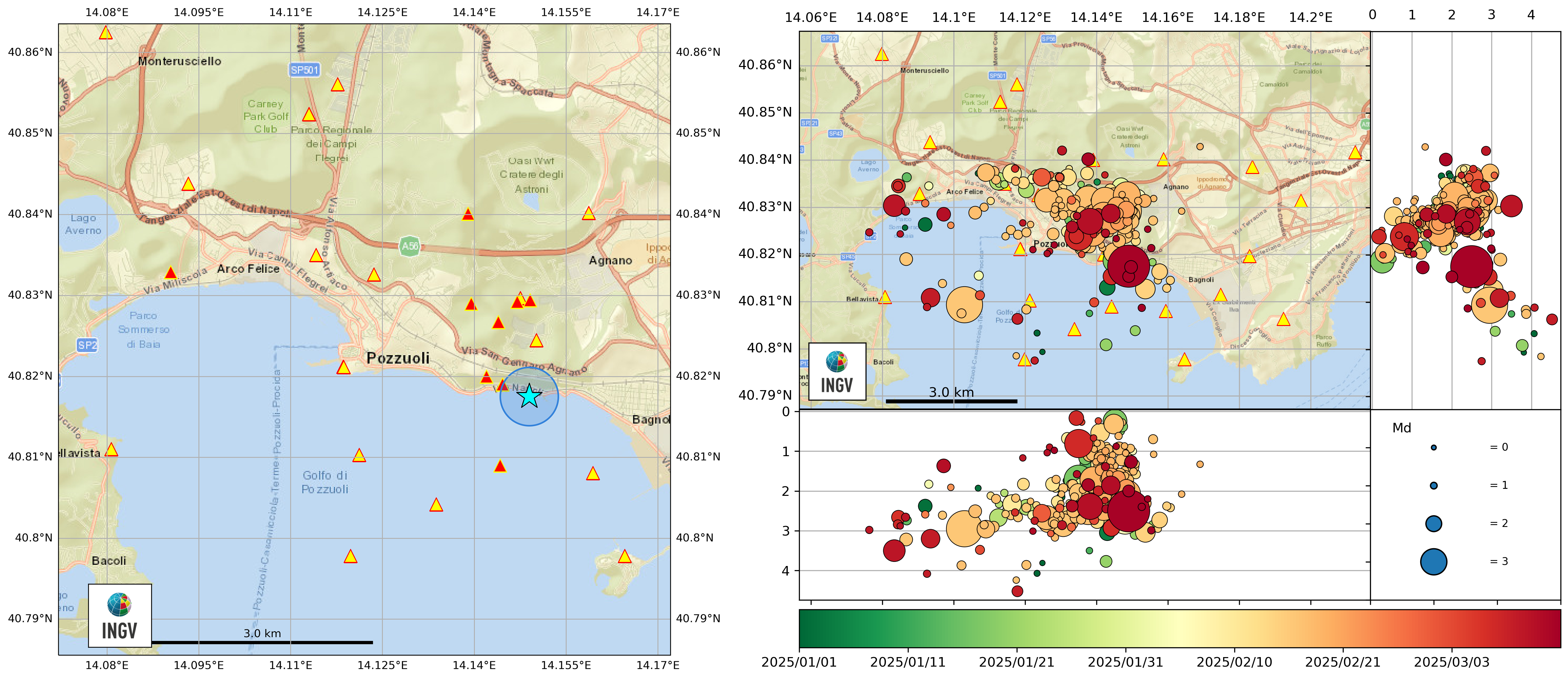
Location map of the Md 4.4 event of March 13, 2025 (left) and the locations of Md > 1 earthquakes recorded in the period January-March 2025 in the Campi Flegrei (right).
The continuous multiparameter monitoring system of the INGV-Osservatorio Vesuviano, although currently recording variations in certain parameters such as ground deformation rate and CO2 emissions, does not show signs of an imminent volcanic eruption (Monthly Bulletin of the Campi Flegrei).
The INGV-Osservatorio Vesuviano regularly publishes real-time information on the website ov.ingv.it and through weekly and monthly bulletins on the parameters monitored in the Campi Flegrei.
Source : INGV Vulcani
Photos : Stanley-goodspeed , INGV.
Colombia , Chiles / Cerro Negro :
San Juan de Pasto, March 11, 2025, 4:15 p.m.
Monitoring the activity of the Chiles/Cerro Negro volcanoes, the Colombian Geological Survey (SGC), an entity affiliated with the Ministry of Mines and Energy, reports that:
Between March 4 and 10, 2025, volcanic activity continued to fluctuate, with a downward trend. Compared to the previous period, the following significant changes were observed:
• A decrease was recorded in both the occurrence and the released seismic energy, with processes associated with rock fractures within the volcano predominating.
The recording of earthquakes associated with fluid dynamics continued, some of which showed evidence of magma or gas movement within the volcano.
• Earthquakes associated with both rock fracture and fluid movement have been located. Most of the seismic activity has been located in the Chiles Volcano collapse zone, from the highest part of the volcano to approximately 2 km to the north, with depths ranging from 2 to 6 km from the volcano’s summit (4,700 m above sea level) and a maximum magnitude of 1.2. A smaller number of earthquakes have been located scattered throughout the Chiles volcanic edifice.
• Instruments recording crustal deformation and satellite remote sensing continue to show changes associated with an inflationary process in this volcanic area.
Based on the above, the SGC recommends closely monitoring developments through weekly bulletins and other information published through our official channels, as well as instructions from local and departmental authorities and the National Disaster Risk Management Unit (UNGRD).
Volcanic activity remains on alert Yellow: active volcano with changes in the baseline of monitored parameters and other manifestations.
Source et photo : SGC.