February 23 , 2025 .
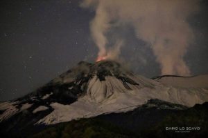
Alaska , Spurr :
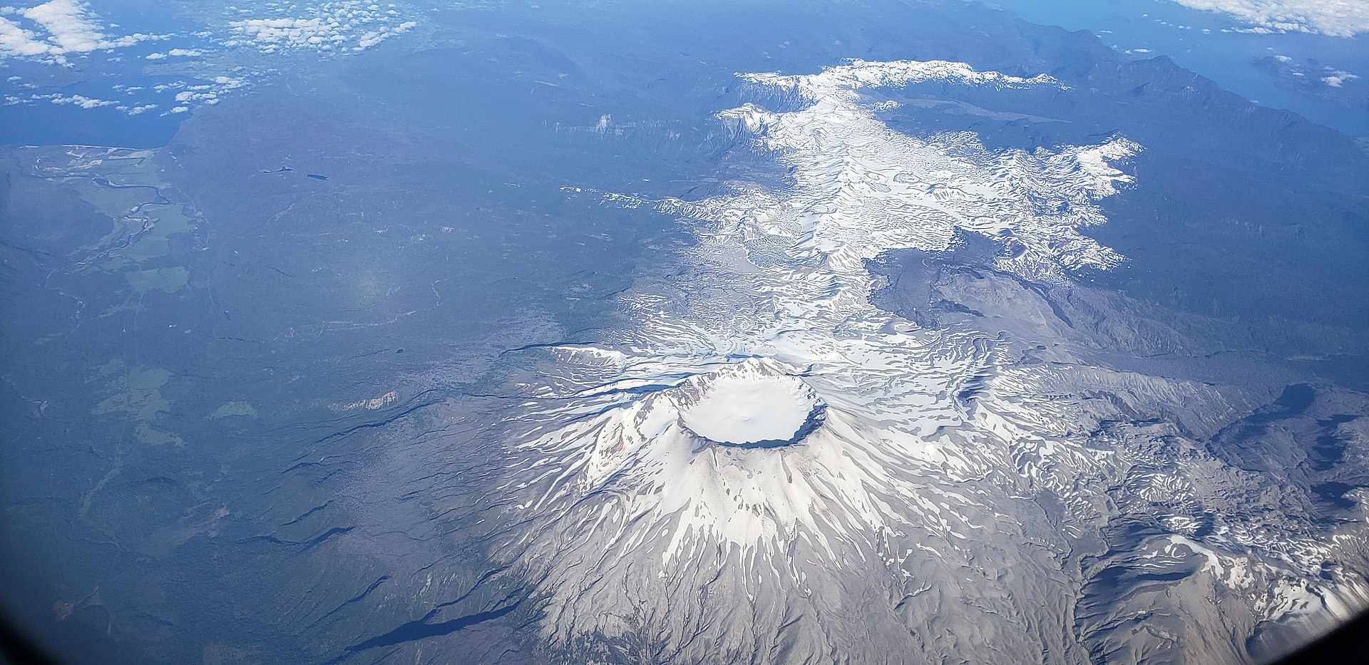
Volcanic unrest continues at Mount Spurr and is characterized by ongoing earthquake activity and surface deformation. This continues the trend seen in these monitoring parameters. Over the past week 184 earthquakes were mostly located under the north side of the Spurr summit, and a lesser number located under Crater Peak. Data from GNSS stations show that outward inflation continues at about the same rate as has been occurring since spring of 2024. The Spurr monitoring network is functioning well although the CKT web camera remains mostly obscured by snow and ice.
AVO continues to closely monitor activity at Mount Spurr for signals that would indicate that the volcano is moving closer to an eruption using local seismic, infrasound, web camera, and GNSS stations along with regional infrasound, lightning networks and satellite data. Based on previous eruptions, additional changes in earthquakes, ground deformation, the summit lake, and fumaroles would be expected if magma begins to move closer to the surface. Therefore, it is very likely that if an eruption were to occur it would be preceded by additional signals that would allow advance warning.
Source : AVO
Photo : McGimsey, Game ( 2016)
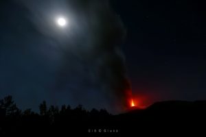
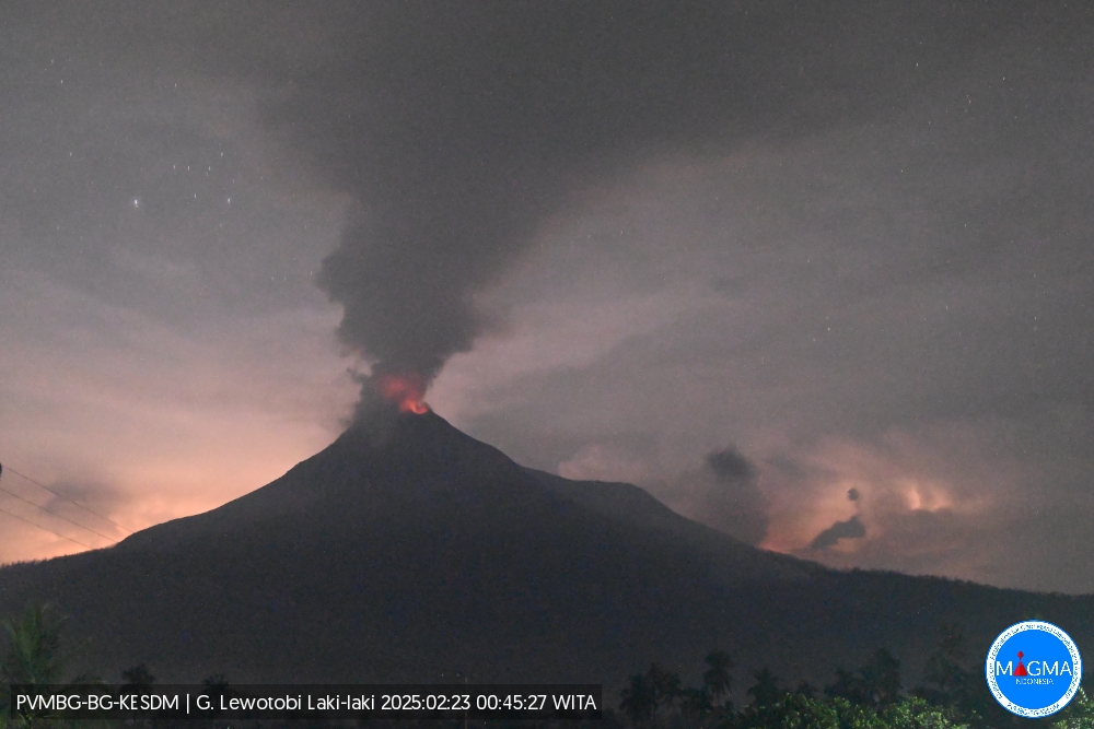
Indonesia , Lewotobi Laki-laki :
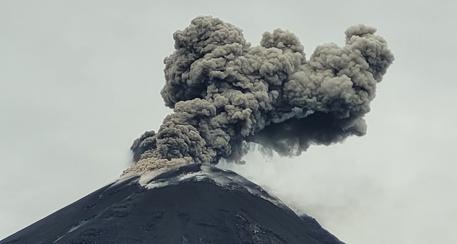
An eruption of Mount Lewotobi Laki-laki occurred on Sunday, 23 February 2025 at 00:44 WITA with an observed ash column height of ±1000 m above the peak (±2584 m above sea level). The ash column was observed to be grey in colour with a thick intensity, oriented towards the West. This eruption was recorded on a seismograph with a maximum amplitude of 18.5 mm and a duration of 65 seconds.
Seismicity observation
4 f Emission earthquakes with an amplitude of 2.9 to 7.4 mm and a duration of 44 to 121 seconds.
1 Harmonic tremors with an amplitude of 3.7 mm, and an earthquake duration of 28 seconds.
4 Distant tectonic earthquakes with an amplitude of 2.2 to 2.9 mm, and an earthquake duration of 79 to 203 seconds.
Recommendation
1. The community around Mount Lewotobi Laki-laki and visitors/tourists should not carry out any activities within a radius of 5 km around the eruption center of Mount Lewotobi Laki-laki and the Southwest – North – Northeast sector up to 6 km.
2. The public should remain calm and follow the instructions of the local government and not believe information from unclear sources.
Source et photo : Magma Indonésie.
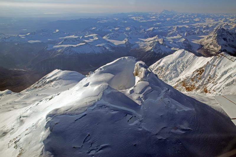
Chile , Puyehue / Cordon Caulle :
Seismology
The seismological activity of the period was characterized by the recording of:
122 VT-type seismic events, associated with rock fracturing (Volcano-Tectonic). The most energetic earthquake had a local magnitude (ML) value of 2.8, located 4.6 km to the South-Southwest and with a depth of 4.5 km from the 2011 emission center.
8 LP-type seismic events, associated with fluid dynamics within the volcanic system (Long Period). The size of the largest earthquake estimated from the reduced displacement parameter (DR) was equal to 7 cm2.
1 TR-type seismic event, associated with sustained fluid dynamics within the volcanic system over time (TRemor). The size of the earthquake estimated from the reduced displacement parameter (DR) was equal to 5 cm2.
Fluid Geochemistry
No anomalies in atmospheric sulfur dioxide (SO2) emissions have been reported in the area near the volcanic complex, according to data published by the Tropospheric Monitoring Instrument (TROPOMI) and the Ozone Monitoring Instrument (OMI) Sulfur Dioxide Group.
Geodesy
Based on data obtained by a GNSS station, it is observed that the uplift process continues, decreasing its magnitude compared to the annual average of the year 2024. The horizontal displacement rate recorded for the last period is 1.1 cm/month, while the uplift rate corresponds to 0.7 cm/month.
From the Sentinel 1A radar images and using the radar interferometry technique, it is observed that the inflation process of the graben area continues, with minimal variations in the uplift pattern.
Thermal anomalies by satellites
During the period, low power anomalies were recorded associated with the area where the laccolith is located, northeast of the 2011 emission center. These recorded a maximum volcanic radiative power (VRP) of 2.7 MW on February 13, a value considered low according to the data processed by the VIIRS sensor of the Mid-Infrared Volcanic Activity Observation Platform (MIROVA). The Sentinel 2-L2A and Landsat 8-9 satellite images did not detect any anomalous brightness anomalies.
Surveillance cameras
Images from fixed cameras installed near the volcanic complex did not record degassing columns or variations associated with surface volcanic activity.
Satellite geomorphological analysis
From the Planet Scope Scene (3 m spatial resolution) and Sentinel 2-L2A satellite images, no morphological changes are identified in the volcanic system.
The volcanic activity of the complex remains similar to the previous period. The inflationary deformation process continues at a slightly lower rate than in the previous period and without significant variations for other monitoring parameters, including seismicity.
For the above reasons, the technical volcanic alert is maintained at:
YELLOW TECHNICAL ALERT: Changes in the behavior of volcanic activity.
Source : Sernageomin.
Photo : Wikipédia.
Costa Rica , Poas :
Latitude: 10.20°N;
Longitude: 84.23°W;
Altitude: 2687 m
Current activity level: Warning
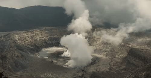
Between 12 and 15 February, four episodes of intense, spasmodic and almost monochromatic seismic-acoustic tremor were recorded. These episodes lasted several hours. The first was accompanied by mainly distal, but sometimes proximal, volcano-tectonic (VT) seismicity. In the afternoon of 14 February, a proximal VT earthquake of magnitude 3 was recorded, the largest in recent months. The fourth episode of spasmodic tremor was then observed, and then eruptive activity began, characterized by frequent explosions (about one per minute) of low acoustic magnitude (< 3). It peaked on 17 February and has remained constant since then at a baseline level. Since the beginning of the eruptive activity, seismicity has been characterized by continuous low-frequency (<1 Hz) and moderate-amplitude tremors, as well as occasional distal VT earthquakes.
Geodetic monitoring has recorded an episode of crustal inflation since November 2024 with the largest from late December to late January. Inflation has stopped in the last two weeks, but the crater continues to widen.
The MultiGAS station recorded higher SO2 concentrations this week (up to 65 ppm). The SO2/CO2 ratio rose to 3.1 and then gradually decreased to lower values of about 0.5. The H2S/SO2 ratio remains low. The SO2 concentrations measured at the Visitors Observatory this week were lower than the previous week, with a maximum of about 3 ppm. The SO2 flux increased this week, reaching an average of 487 ± 97 t/d. The average of the previous week was 267 ± 97 t/d. The OMI instruments on the SENTINEL satellite continue to detect SO2 in the atmosphere with average values higher than those of 2024.
The level of the hyperacid lake decreased rapidly by about 0.8 m in 1 week until the onset of rains on Thursday 20 February. The lake records a temperature of 65°C and an increase in acidity (pH = 0.16) and maintains a relatively high evaporation rate at its surface, releasing plumes rich in water vapor and gas. The lake waters are enriched in chlorides and suspended colloidal minerals such as silica (SiO2) and colloidal sulfur (S⁰).
Source : Ovsicori
Photo : Webcam 2024
Ecuador , El Reventador .
DAILY STATE REPORT OF THE REVENTADOR VOLCANO , Saturday, February 22, 2025.
Information Geophysical Institute – EPN.
Surface Activity Level: High , Surface Trend: No Change
Internal Activity Level: Moderate , Internal Trend: No Change
From February 21, 2025, 11:00 a.m. to February 22, 2025, 11:00 a.m.:
Seismicity:
Due to data transmission problems, it was not possible to count volcanic events in the last 24 hours.
Rainfall / Lahars:
No rain was recorded in the volcano area. **Heavy rains could remobilize accumulated material, generating mud and debris flows that would flow down the sides of the volcano and flow into adjacent rivers.**
Emission/ash column:
Since yesterday afternoon, several emissions of gas and ash have been recorded via the surveillance camera network in the West and Southwest directions with heights between 400 and 900 meters above the crater level. In connection with this activity, the Washington-VAAC agency has published a report of an ash cloud in a Southwest direction and at a height of 700 meters above the crater level.
Observation:
Despite the cloud cover in the area, several episodes of incandescent material falling on the South-East flank of the volcano up to 900 meters below the crater level were recorded by surveillance cameras last night. At the time of closing this report, satellite monitoring showed that the volcano area remained completely cloudy.
Alert Level – SGR: Orange
Source : IGEPN
Photo : igepn