February 16 , 2025 .
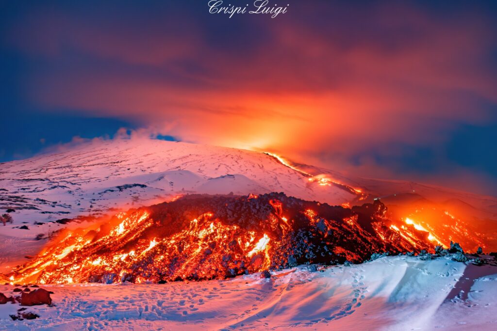
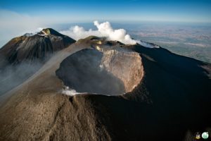
Italy / Sicily , Etna :
The eruption of Etna continues without ANY comment or bulletins from INGV other than VONA messages.
VOLCANO OBSERVATORY NOTICE FOR AVIATION (VONA)
Issued: February 14 , 2025
Volcano: Etna 211060
Current Color Code: ORANGE
Previous Color Code: red
Source: Etna Volcano Observatory
Notice Number: 2025/0010/01F02
Volcano Location: 3744N 01500E
Area: Italy
Summit Elevation: 3300 m
Volcanic Activity Summary:
Explosive activity decreases; low ash emission still occurring.
Volcanic cloud height: N/A
Other volcanic cloud information:
VOLCANIC ASH IS CONFINED TO THE SUMMIT AREA. THE PHENOMENON IS OBSERVED BY INGV’S PERSONNEL ON THE FIELD AND BY VISIBLE AND THERMAL SURVEILLANCE CAMERAS
Next Notice:
A new VONA will be issued if conditions change significantly or color code changes.
Source : INGV
Photo : Luigi Crispi via FB.
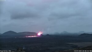
Philippines , Kanlaon :
KANLAON VOLCANO ERUPTION UPDATE , 15 February 2025 , 06:30 PM
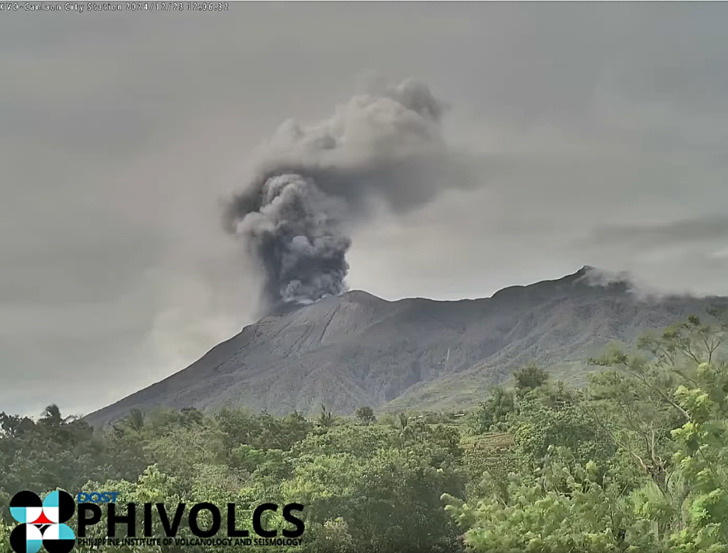
After a minor explosive eruption on 6 February 2025 that was followed by a pause in activity, an episode of significant ash emission occurred from the summit crater of Kanlaon Volcano at 2:32 PM today, 15 February 2025. The event lasted for eight (8) minutes based on the seismic record and generated a plume that rose 1,500 meters above the crater before drifting to the west-northwest. Ashfall and sulfurous smells were reported in several localities of Bago City, Negros Occidental: Brgy. Mailum (Purok Lunao, Kakapihan I and II, Kamotihan I and II, Kalubihan II, Kasagingan, Kapahuan, Katubuhan and Rakel, Pili, Durar-og, Abacca, Humayan, Esperanza, Kawayanan, Tabidiao I and II; Brgy. Maao (Proper, Pandan); Brgy. Binubuhan (Purok Waterlily); Brgy. Abuanan (Purok Rose); Brgy. Dulao (Purok Reola); Brgy. Atipuluan (Purok Paglaum, Pagsilak, Riverside, Masinadyahon, Mainuswagon), and; Brgy. Ilijan (Purok Malungay B). Sulfurous smells were also reported in Brgy. Bacong, Bago City. Prior to the event, SO2 flux was measured today at an average of 2,625 tonnes/day, less than the medium-term average since 03 June 2024 of 4,440 tonnes/day, while degassing from the summit crater has been weak since 6 February 2025. The eastern upper slopes of the edifice have been undergoing inflation or swelling since 10 January 2025, while inflation-deflation cycles have been recorded on the western upper and eastern middle slopes for the same period. This ground deformation behavior likely results from occasional plugging and unplugging of the volcanic conduit, causing weakened degassing and eruptive activity at the crater respectively, a pattern of unrest that may be expected while similar levels of monitoring parameters persist.
Alert Level 3 (magmatic unrest) prevails over Kanlaon Volcano. This means that magmatic unrest could generate similar ash emission and even short-lived explosive eruptions in the short term which may generate life-threatening volcanic hazards. It is recommended that communities within a 6-km radius from the summit crater remain evacuated due to the danger of pyroclastic density currents or PDCs, ballistic projectiles, ashfall, rockfall and other related hazards. Local government units must continue to prepare their communities within the PDC hazard zone for subsequent evacuation in case unrest further escalates and hazardous worst-case explosive eruption becomes imminent. Increased vigilance against potential syn-eruption lahars and sediment-laden streamflows in channels draining the edifice is strongly advised should intense rains occur during eruptive unrest. Civil aviation authorities must also advise pilots to avoid flying close to the volcano’s summit as ash from any sudden eruption can be hazardous to aircraft.
DOST-PHIVOLCS maintains close monitoring of Kanlaon Volcano and any new development will be communicated to all concerned stakeholders.
Source et photo : DOST-PHIVOLCS
Colombia , Puracé – Chaîne volcanique Los Coconucos :
Popayán, February 14, 2025, 10:30 a.m.
Following the monitoring of activity in the Los Coconucos volcanic chain, the Colombian Geological Survey (SGC), an entity attached to the Ministry of Mines and Energy, reports that:
As of 12:00 p.m., from February 13 until the time of publication of this bulletin, an increase in seismic signals has been recorded, mainly those related to the movement of fluids, located under the crater of the Puracé volcano, at depths of less than 2 km. The most notable fracture seismicity was an earthquake that occurred on February 13 at 6:05 p.m., located 1 km northwest of the crater of the Puracé volcano at a depth of 4 km, which reached a magnitude of 1.6.
The deformation measurements do not show any significant variations and the degassing levels reported in previous bulletins are maintained.
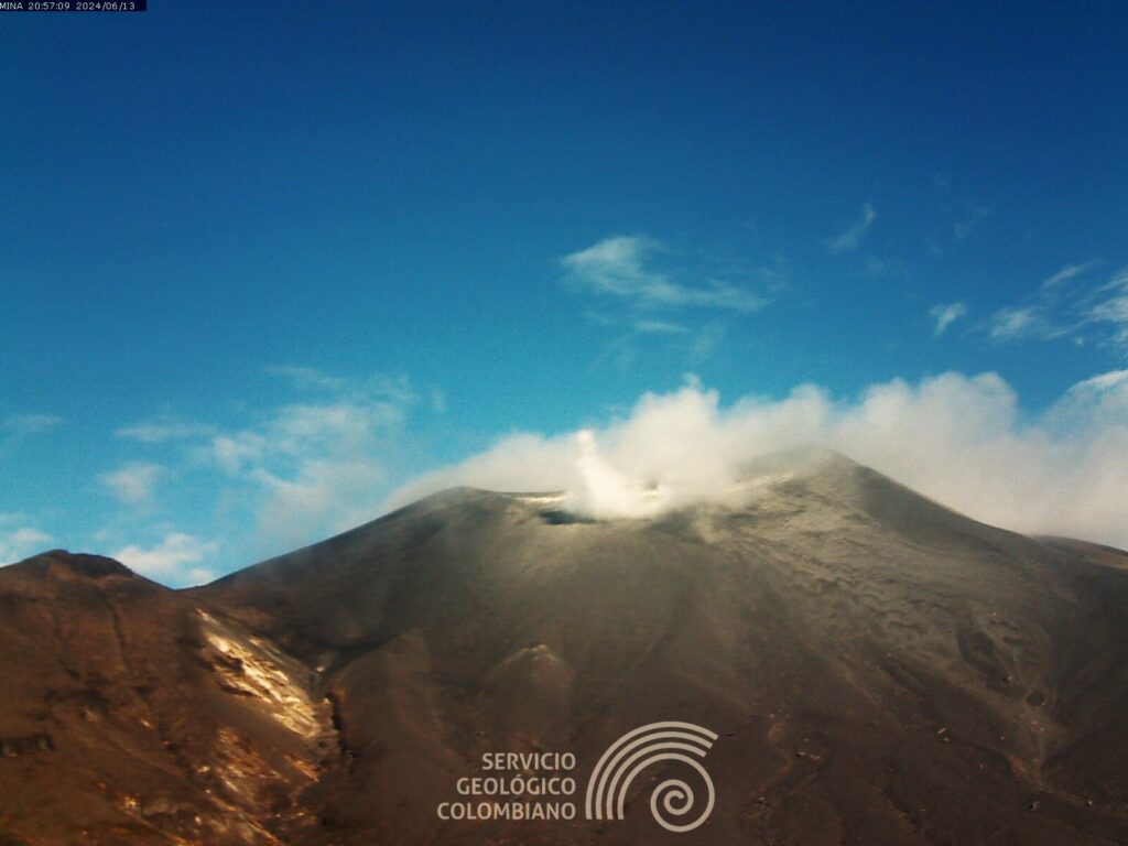
In Yellow Alert status, the volcano may present phenomena such as sporadic ash emissions (minor eruptions) whose scope and effects are limited and the dispersion of ash depends on the wind direction, the presence of some incandescences, small explosions in the crater, low-energy thermal anomalies, noises, felt earthquakes, odors, precipitation of elemental sulfur near the crater and in hot springs and fumaroles, degassing in areas other than the crater, formation of fissures and appearance of minor lahars.
Based on the above, the SGC recommends closely monitoring the evolution through the extraordinary bulletins and other information published through our official channels, as well as the instructions of the local and departmental authorities and the National Disaster Risk Management Unit (UNGRD).
The state of volcanic activity remains in Yellow Alert: Active volcano with changes in the behavior of the base level of the monitored parameters and other manifestations.
Source et photo : SGC
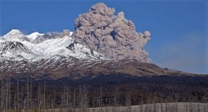
Indonesia , Ili Lewotolok :
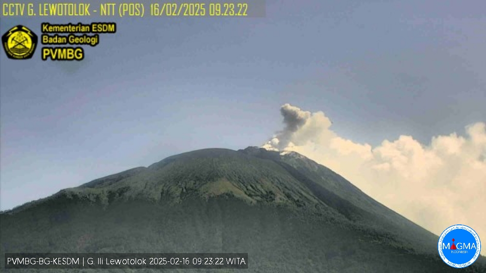
An eruption of Mount Ili Lewotolok occurred on Sunday, 16 February 2025 at 09:22 WITA with an observed ash column height of ±100 m above the peak (±1523 m above sea level). The ash column was observed to be white to grey in colour with a thick intensity, oriented towards the east. This eruption was recorded on a seismograph with a maximum amplitude of 3.7 mm and a duration of 40 seconds.
Seismicity observation:
1 eruption earthquake with an amplitude of 12.1 mm and a duration of 35 seconds.
85 emission earthquakes with an amplitude of 1 to 4.6 mm and a duration of 28 to 30 seconds.
1 distant tectonic earthquake with an amplitude of 0.9 mm, the duration of the earthquake was 159 seconds.
Recommendation
At Activity Level II (Alert), it is recommended:
(1) The community around Mount Ili Lewotolok and visitors/climbers/tourists should not enter and not conduct activities within a 2 km radius around the activity center of Mount Ili Lewotolok, and the community of Lamatokan Village and Jontona Village should always be aware of the potential threat of avalanche/landslide hazard, lahars from the eastern part of the peak/crater of Mount Ili Lewotolok. (2) The community around Mount Ili Lewotolok, as well as visitors/climbers/tourists and the community of Jontona and Todanara villages shall not enter and carry out activities in the South and South-East sectoral areas within 2.5 km from the activity centre of Mount Ili Lewotolok, and shall be aware of the potential threat of avalanche/lahar hazard from the South and South-East parts of the peak/crater of Mount Ili Lewotolok.
Source et photo : Magma Indonésie .
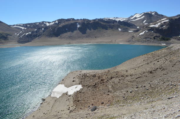
Chile , Laguna del Maule :
Special Report on Volcanic Activity (REAV), Maule Regions, Laguna del Maule Volcanic Complex, February 13, 2025, 10:20 local time (Continental Chile)
The National Geology and Mining Service of Chile (Sernageomin) announces the following PRELIMINARY information, obtained through the monitoring equipment of the National Volcanic Monitoring Network (RNVV), processed and analyzed at the Southern Andean Volcano Observatory (Ovdas):
On Thursday, February 13, 2025, starting at 08:32 (11:324 UTC), the monitoring stations installed near the Laguna del Maule volcanic complex recorded an increase in the occurrence of earthquakes associated with both rock fracturing and fluid dynamics within the volcanic system (Hybrid type), reaching more than 100 earthquakes in the last 3 hours , characteristics of an earthquake swarm.
The characteristics of the earthquake after its analysis are as follows:
TIME OF ORIGIN: 08:37 local time (11:37 UTC)
LATITUDE: 36.176° S
LONGITUDE: 70.457° W
DEPTH: 7.8 km
REDUCED DISPLACEMENT: 1528 cm*cm
Observation:
Later, as mentioned in the previous report, an increase in hybrid seismicity was recorded in the volcanic complex of Laguna del Maule, this activity presents earthquakes of low to moderate energy. The events are mainly concentrated in the Barrancas sector, to the south-southeast of the lagoon.
Just before this swarm, two earthquakes of similar type were recorded, with the following characteristics:
TIME OF ORIGIN: 08:32 local time (11:32 UTC)
LATITUDE: 36.176° S
LONGITUDE: 70.460° W
DEPTH: 7.3 km
REDUCED DISPLACEMENT: 913 cm*cm
TIME OF ORIGIN: 08:37 local time (11:37 UTC)
REDUCED DISPLACEMENT: 1528 cm*cm
The technical volcanic alert is maintained at GREEN level.
Source : Sernageomin
Photo : Claudio Arriagada

