January 27 , 2025.
Hawaii , Kilauea :
Sunday, January 26, 2025, 9:55 AM HST (Sunday, January 26, 2025, 19:55 UTC)
19°25’16 » N 155°17’13 » W,
Summit Elevation 4091 ft (1247 m)
Current Volcano Alert Level: WATCH
Current Aviation Color Code: ORANGE
Activity Summary:
Kīlauea summit eruption paused at 12:36 p.m. HST on January 25. A new eruptive episode is most likely to begin in the next 1-5 days within Halemaʻumaʻu.
Kīlauea’s current eruption in Halemaʻumaʻu crater within Kaluapele (the summit caldera) began on December 23, 2024. There have been six episodes of lava fountaining separated by pauses in activity. The sixth episode ended on January 25, 2025, at 12:36 p.m. HST after about 13 hours of eruptive activity from the north vent. The eruption is most likely to begin within the next 1-5 days based on current rates of summit inflation. Seismicity is low with less than 10 small earthquakes beneath the summit and rift zones of Kīlauea. All eruptive activity has occurred in Hawai’i Volcanoes National Park. No unusual activity has been noted along Kīlauea’s East Rift Zone or Southwest Rift Zone.
Current hazards include volcanic gas emissions and windblown volcanic glass (Pele’s Hair) that may impact Hawai’i Volcanoes National Park and nearby communities.
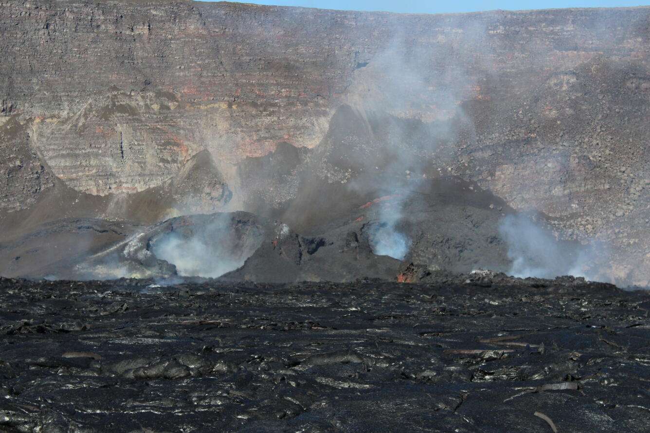
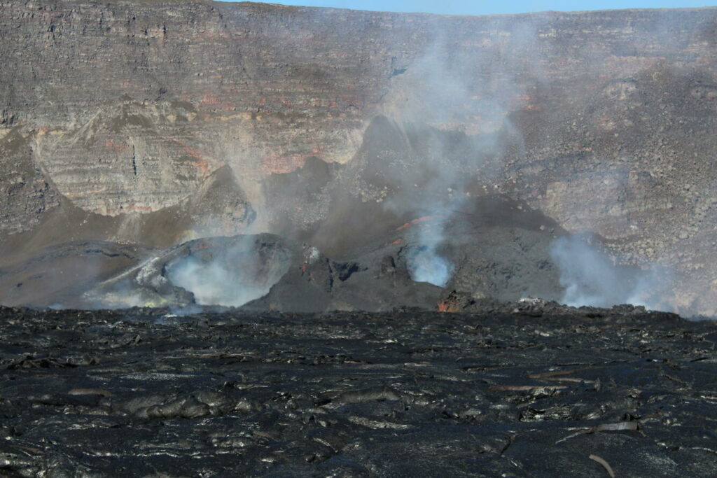
USGS Hawaiian Volcano Observatory geologists captured this view across Kaluapele floor, showing the cones that have formed around the recently active north and south vents.
Summit Observations:
Episode 6 began on January 24 at 11:28 p.m. and ended just over 13 hours later. Lava fountain activity gradually declined throughout the morning of January 25 and fountain-fed lava flows stopped erupting out of the north vent at 12:36 p.m. Lava flows from episode 6 covered nearly half of Halemaʻumaʻu crater floor. A massive overturn of erupted lava started around 1:58 p.m. during drainback into the north vent, and the lava surface level in the center of the crater floor dropped about 1.6 feet (0.5 meters). Spots of orange glow can be seen at night on the crater floor as the lava continues to cool. Strong glow from the north vent indicates that magma remains close to the surface.
Seismic tremor began dropping and deflationary tilt stopped on January 25 around 12:00 p.m., about 30 minutes before the eruption paused. Seismicity remains low. Two earthquakes with magnitudes less than 1 were recorded over the past 24 hours. The tiltmeter at Uēkahuna (UWD) recorded about 3 microradians of deflation during episode 6, about the same as episode 5. Deflation changed to inflation on January 25 at 1:00 p.m. UWD has recorded approximately 1.5 microradians of inflation since the end of episode 6.
Volcanic gas emissions remain elevated. A sulfur dioxide (SO2) emission rate of approximately 10,000 tonnes per day was measured on January 22 at the start of episode 5. Emission rates at the start of episode 6 were likely similar. Light winds are currently blowing the plume to the southwest away from the summit and communities near Hawai’i Volcanoes National Park.
Volcanic gas emissions remain elevated. Emissions rates have decreased since episode 6 ended and are currently estimated to be near 1,000 tonnes per day.
Strands of volcanic glass known as Pele’s Hair that formed during recent eruptive episodes have been found on surfaces throughout the summit area of Hawai’i Volcanoes National Park and surrounding communities.
Rift Zone Observations:
Rates of seismicity and ground deformation remain very low in the East Rift Zone and Southwest Rift Zone with less than 10 small earthquakes in the past 24 hours.
Source : HVO
Photo : USGS / J. Barnett.
Indonesia , Marapi :
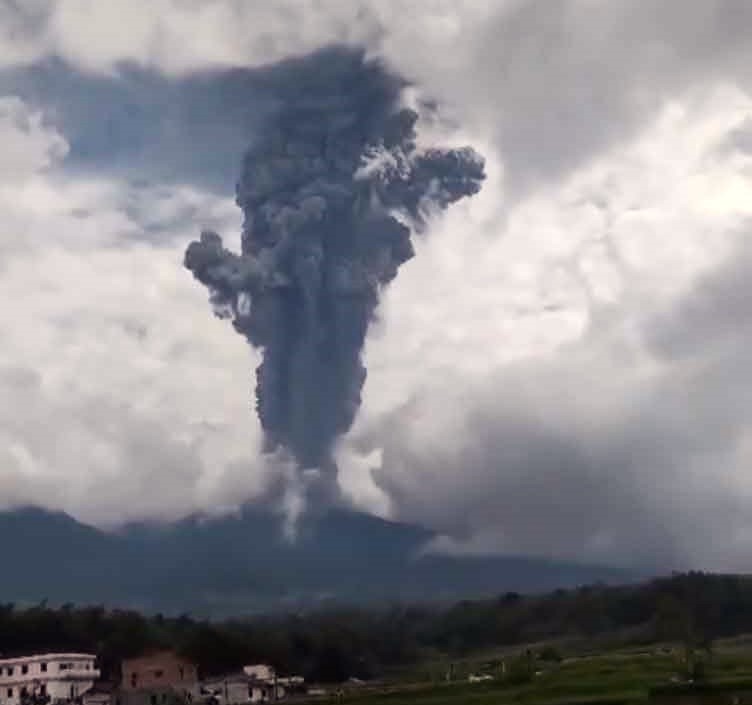
An eruption of Mount Marapi occurred on Sunday, January 26, 2025 at 19:14 WIB with an observed ash column height of ± 500 m above the peak (± 3391 m above sea level). The ash column was observed to be gray in color with a thick intensity, oriented towards the northwest. This eruption was recorded on a seismograph with a maximum amplitude of 30.2 mm and a duration of 29 seconds.
VOLCANO OBSERVATORY NOTICE FOR AVIATION – VONA
Issued : January 26 , 2025
Volcano : Marapi (261140)
Current Aviation Colour Code : YELLOW
Previous Aviation Colour Code : yellow
Source : Marapi Volcano Observatory
Notice Number : 2025MAR011
Volcano Location : S 0 deg 22 min 52 sec E 100 deg 28 min 23 sec
Area : West Sumatra, Indonesia
Summit Elevation : 9251 FT (2891 M)
Volcanic Activity Summary : Increasing in volcanic activity.
Volcanic Cloud Height :
Best estimate of ash-cloud top is around 10851 FT (3391 M) above sea level or 1600 FT (500 M) above summit. May be higher than what can be observed clearly. Source of height data: ground observer.
Other Volcanic Cloud Information :
Ash cloud moving to northwest. Volcanic ash is observed to be gray. The intensity of volcanic ash is observed to be thick.
Remarks :
Eruption recorded on seismogram with maximum amplitude 30.2 mm and maximum duration 29 second.
Source : Magma Indonésie .
Photo : , Jro Yudhiani ( 23/08/2024 FB via Volcanodiscovery)
Ecuador , El Reventador :
DAILY REPORT ON THE STATE OF THE REVENTADOR VOLCANO, Sunday, January 26, 2025.
Information Geophysical Institute – EPN.
Surface Activity Level: High, Surface Trend: No Change
Internal Activity Level: Moderate, Internal Trend: No Change
From January 25, 2025, 11:00 a.m. to January 26, 2025, 11:00 a.m.:
Seismicity:
The count of seismic events recorded at the station is detailed below.
Explosion (EXP) 67
Long Period (LP) 13
Emission Tremor (TREMI) 15
Harmonic Tremor (TRARM) 1
Rainfall/Lahars:
No rain has been recorded in the areas surrounding the volcano. **In the event of heavy rain, it could remobilize the accumulated material, generating mud and debris flows that would descend the sides of the volcano and flow into adjacent rivers.
Emission/Ash Column:
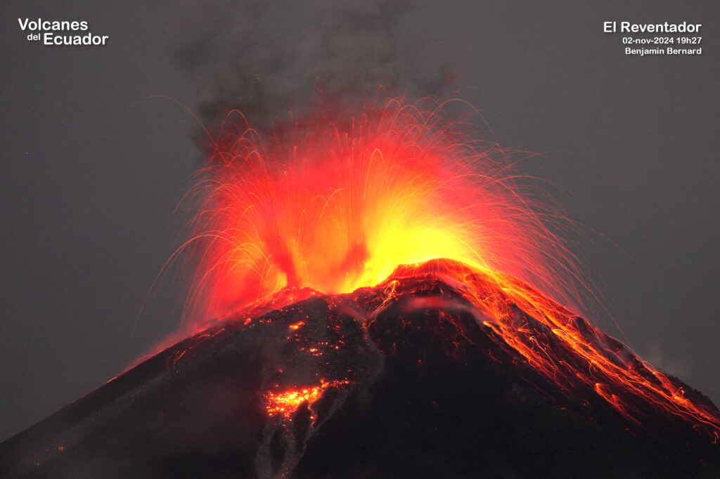
In the last 24 hours, gas and ash emissions have been recorded between 400 and 800 meters above the crater level, in a northwesterly direction. The Washington VAAC agency has not published any reports on this activity.
Other monitoring parameters:
The FIRMS and MIROVA satellite systems have not recorded any thermal anomalies in the last 24 hours.
Observation:
During the last 24 hours, several episodes of incandescent material falling between 100 and 900 meters below the level of the crater were observed by the surveillance camera system. On the other hand, the volcano remained completely cloudy most of the time.
Alert Level – SGR: Orange
Source : IGEPN
Photo : Volcanesdelecuador (02-nov-2024 19h27, CC BY-NC Benjamin Bernard) .
Guatemala , Santiaguito :
Weather conditions: Clear.
Wind: Northeast.
Precipitation: 0.0 mm.
Activity:
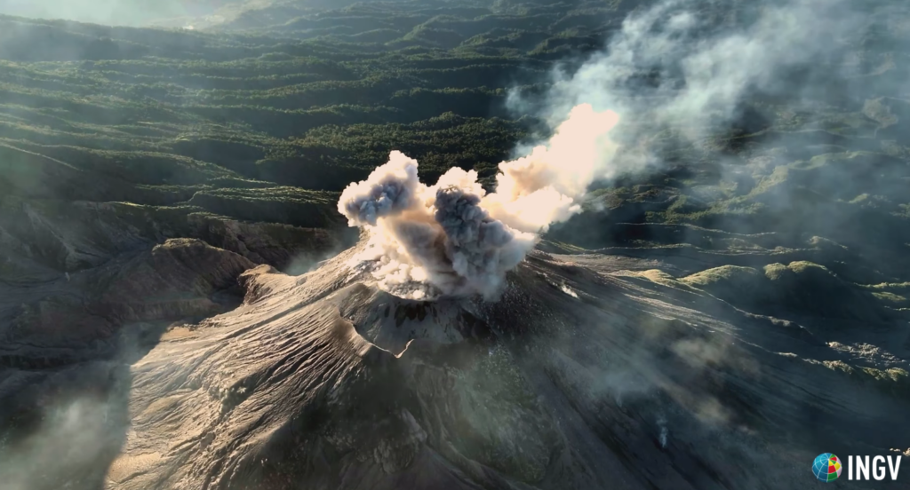
The observatory reports activity in the Caliente dome, with moderate and abundant degassing columns continuously dispersing in a west, southwest and northwest direction due to wind variability. There are 3 to 6 weak to moderate explosions per hour, accompanied by moderate block avalanches in the south and southwest directions, as well as an accumulation of hot material mainly towards the southwest flank in the upper part of the lava flow.
The summit crater area is clearly visible, with the dome inside (despite less than excellent visibility). The group of researchers from the National Institute of Geophysics and Volcanology INGV who are carrying out measurements and films within the framework of the BACIO project/experiment, report a frequency of explosions varying between 10 minutes and one hour. The explosions are mainly located along annular fractures at the margin between the lava dome (Na-rich dacite) and the crater rim and consist of jets of pressurized gas (with some, but not abundant, ash). The ejection velocities of pyroclastic fragments seem to be lower than those of basaltic magma explosions.
At night, intermittent incandescence can be observed during moderate avalanches and sustained incandescence in the crater and at the beginning of the lava flow. The accumulation of new material has caused an avalanche collapse in front of the lava flow. Moderate to strong explosions lift columns of gas and ash up to heights of 3,700 m (12,140 ft) and trigger the descent of short-distance pyroclastic flows that extend on all flanks and weak and/or strong avalanches that can be audible several kilometers from the volcano. The occurrence of moderate to strong block and ash flows is not excluded, as well as possible long-distance pyroclastic flows in different directions, therefore the recommendations of special bulletin BESAN-004-2024 should be followed.
Source : Insivumeh
Photo : capture d’écran INGV Dr. Riccardo Civico
Alaska , Spurr :
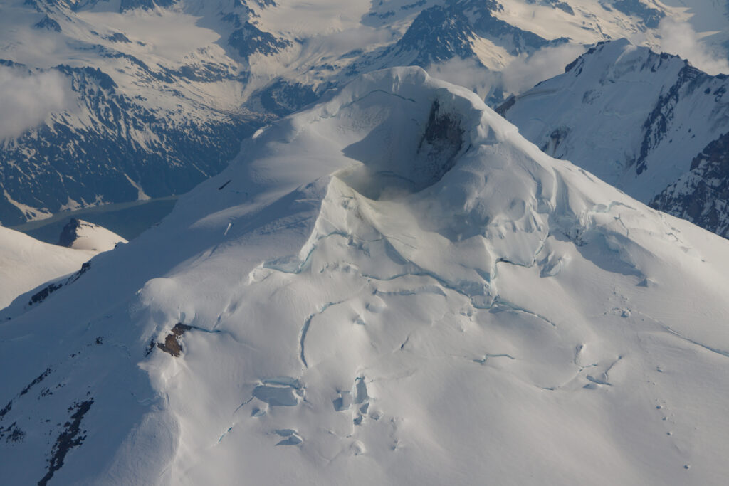
Unrest continues at Mount Spurr, with shallow volcanic earthquakes detected beneath the volcano over the past day. The Spurr network is still experiencing some data telemetry issues but we are still able to detect earthquakes. Web camera and satellite views of the volcano were obscured by clouds of the past day . AVO continues to monitor activity at Mount Spurr for signals that would indicate that the volcano is moving closer to an eruption.
Based on previous eruptions, changes from current activity in the earthquakes, ground deformation, summit lake, and fumaroles would be expected if magma began to move closer to the surface. Therefore, it is very likely that if an eruption were to occur it would be preceded by additional signals that would allow advance warning.
The volcano is monitored using local seismic, infrasound, web camera, and GNSS stations along with regional infrasound, lightning networks and satellite data.
Source : AVO
Photo : Mota, Rui / Alaska Volcano Observatory / U.S. Geological Survey , june 224

