09 January 09 2025 .
Japan , Sakurajima :
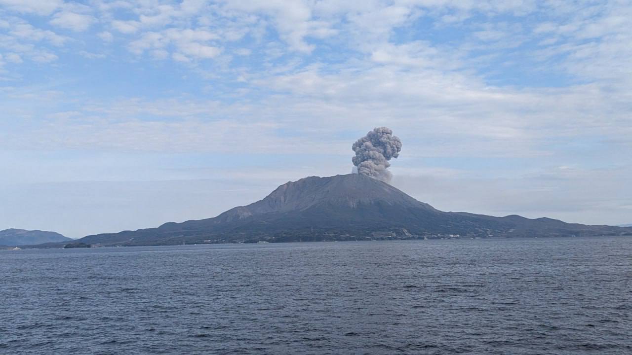
The Japan Meteorological Agency (JMA) reported ongoing eruptive activity at Minamidake Crater (Aira Caldera’s Sakurajima volcano) during 30 December 2024-6 January 2025. Nightly crater incandescence was visible in webcam images. Eruptive events at 13h17 and 20h29 on 31 December, at 06h58 and 14h43 on 1 January, at 13h35 and 22h24 on 2 January, and 10h02 and 10h45 on 5 January produced ash plumes that rose 1-1.4 km above the crater rim and drifted NE, E, and SE. Explosions at 13h17 and 20h29 on 31 December, at 03h48 on 3 January, at 01h25 on 4 January, and at 10h02 and 10h45 on 5 January produced ash plumes that rose 0.5-1.5 km above the crater rim and drifted S and SE. All of the explosions, except at 14h51 on 6 January, ejected large blocks 300-900 m from the crater rim. The Alert Level remained at 3 (on a 5-level scale), and the public was warned to stay 1 km away from both craters.
The Aira caldera in the northern half of Kagoshima Bay contains the post-caldera Sakurajima volcano, one of Japan’s most active. Eruption of the voluminous Ito pyroclastic flow accompanied formation of the 17 x 23 km caldera about 22,000 years ago. The smaller Wakamiko caldera was formed during the early Holocene in the NE corner of the caldera, along with several post-caldera cones. The construction of Sakurajima began about 13,000 years ago on the southern rim and built an island that was joined to the Osumi Peninsula during the major explosive and effusive eruption of 1914. Activity at the Kitadake summit cone ended about 4,850 years ago, after which eruptions took place at Minamidake. Frequent eruptions since the 8th century have deposited ash on the city of Kagoshima, located across Kagoshima Bay only 8 km from the summit. The largest recorded eruption took place during 1471-76.
Sources: Japan Meteorological Agency (JMA) , GVP.
Photo : Alex Terry.
Ethiopia , Fentale :
Seismicity and deformation data acquired from satellite radar images indicated that a magmatic intrusion began in late September 2024 in the Afar Region between the Fentale caldera and Dofen volcano. Interferograms, which show upward and downward land movement using sequenced satellite radar data, indicated that a magmatic intrusion aligned along the central to northern part of an axis connecting these two locations began in late September 2024, according to the UK Centre for Observation and Modelling of Earthquakes, Volcanoes and Tectonics (COMET). Many felt earthquakes M 4 and above were associated with the intrusion. Data from 18 October indicated that the intrusion had slowed or paused. A second phase of the intrusion occurred during the end of 2024. An interferogram processed and interpreted by the Universitas Insan Pembangunan Indonesia (UNIPI) group in support of the Addis Abeba University showed very clear ground movement (over 40 cm of uplift) along almost the entire axis from Fentale to Dofen during 17-29 December.
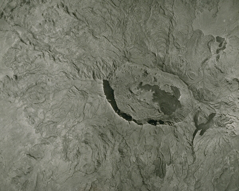
A vertical aerial photo of the Quaternary Fentale volcanic complex, lying along the main Ethiopian rift zone, has a prominent summit caldera and lava flows along its flanks. The 3 x 4 km caldera with steep-sided walls up to 500 m high is elongated perpendicular to the direction of the regional fissures of the Ethiopian Rift. Note the recent rhyolitic obsidian lava flow to the NE (upper right) marked with curved flow ridges. The dark lava flow on the caldera floor was erupted in 1820.
Seismicity continued to be elevated in the region at least through 4 January and was likely associated with the intrusion according to the Ethiopian Geological Institute. A M 5 on 29 December located near Awash Fentale caused the collapse of more than 30 homes and cracks in roads and the ground in the Dulecha and Awash Fentale districts. On 3 January footage of increased activity at a geothermal area near Dofen was reported by news sources. The video showed water, sediment, and rocks being vigorously ejected above vents; the activity was non-volcanic in origin though it increased fears among residents that is was connected to the intrusion and potential volcanic activity. At least 10 earthquakes were recorded during 3-4 January with the largest, a M 5.8, occurring on 4 January. The Ethiopian Geological Institute reported that thousands of people had evacuated to other areas in the region.
Sources: Washington Post, The UK Centre for Observation and Modelling of Earthquakes, Volcanoes and Tectonics (COMET), Carolina Pagli, Università di Pisa, Crisis 24, Ethiopian Disaster Risk Management Commission (EDRMC), Ethiopian Geological Institute, VOA News GVP.
Photo : Imperial Highway Authority of Ethiopia (published in Green and Short, 1971).
Indonesia , Ibu :
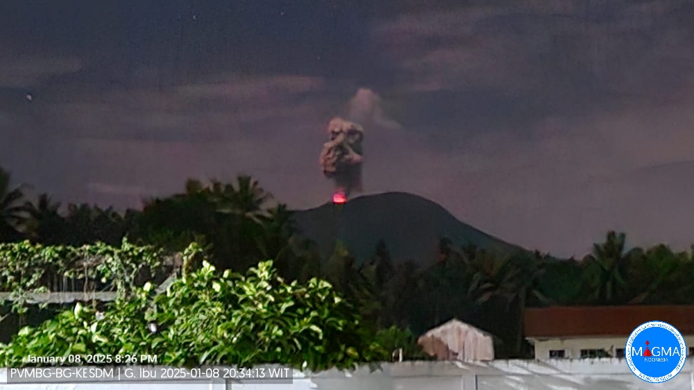
An eruption of Mount Ibu occurred on Wednesday, 8 January 2025, at 20:25 WIT with an observed ash column height of ± 800 m above the peak (± 2125 m above sea level). The ash column was grey in colour with moderate to thick intensity, oriented towards the northeast and east. This eruption was recorded on a seismograph with a maximum amplitude of 28 mm and a duration of 60 seconds.
Seismicity observation:
20 eruption/explosion earthquakes with an amplitude of 21 to 28 mm and a duration of 50 to 90 seconds.
29 emission earthquakes with an amplitude of 2 to 19 mm and a duration of 21 to 54 seconds.
5 harmonic tremors with an amplitude of 2 to 10 mm and an earthquake duration of 30 to 255 seconds.
91 shallow volcanic earthquakes with an amplitude of 2 to 10 mm and a duration of 4 to 19 seconds.
1 local tectonic earthquake with an amplitude of 28 mm, and an earthquake duration of 75 seconds.
3 distant tectonic earthquakes with amplitudes of 2 to 28 mm, and earthquake duration of 41 to 92 seconds.
Recommendation
1. Communities around Mount Ibu and visitors/tourists should not carry out activities within a 4 km radius, with a sectoral extension of 5.5 km towards the crater opening in the northern part of the active crater of Mount Ibu.
2. In case of ash rain, people active outside the house are advised to use nose, mouth (mask) and eye (goggles) protection.
Source et photo : Magma Indonésie.
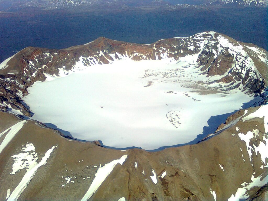
Chile , Puyehue-Cordon Caulle :
Seismology
The seismological activity of the period was characterized by the recording of:
310 VT-type seismic events, associated with rock fracturing (Volcano-Tectonic). The most energetic earthquake had a local magnitude (ML) value equal to 2.1, located 2.0 km north-northeast of the volcanic building, at a depth of 2.8 km from the emission center of the year 2011.
29 LP-type seismic events, associated with fluid dynamics within the volcanic system (Long Period). The size of the largest earthquake estimated from the reduced displacement parameter (DR) was equal to 12 cm2.
Fluid Geochemistry
No anomalies in sulfur dioxide (SO2) emissions into the atmosphere were reported in the area near the volcanic complex, according to data published by the Tropospheric Monitoring Instrument (TROPOMI) and the Ozone Monitoring Instrument (OMI) Sulfur Dioxide Group.
Thermal anomalies by satellites
During the period, no thermal alerts were recorded in the area associated with the volcanic complex, according to the analytical processing of Sentinel 2-L2A satellite images, in combination with false-color bands.
Geodesy
According to the data obtained through the GNSS network, it is observed that the uplift process continues with vertical uplift rates reaching a maximum of 1.2 cm/month.
The Sentinel 1A satellite radar data show the deformation of the area without significant changes during the last month. An average displacement of 0.9 cm/month is estimated for the last period, in agreement with what was observed through the GNSS equipment network.
Surveillance cameras
The images from the surveillance cameras installed near the volcanic complex did not record any degassing columns or variations related to surface activity.
Satellite geomorphological analysis
According to the processing of SkySat Collect (25-12-2024), Planet Scope and Pléiades satellite images, no morphological changes attributable to basal volcanic activity are identified.
Evaluating the geodetic network and InSAR data, the inflationary deformation process continues at rates similar to those observed in recent months. Seismicity maintains the sporadic presence of events of notable magnitude, a situation perceived since the middle of last year. Other surface volcanic features evaluated by remote sensing remain absent.
In conclusion, the continuity of the deformation and the presence of seismic activity allow maintaining the technical volcanic alert in:
YELLOW TECHNICAL ALERT: Changes in the behavior of volcanic activity
Source : Sernageomin
Photo : Sergio Osses
Philippines , Kanlaon :
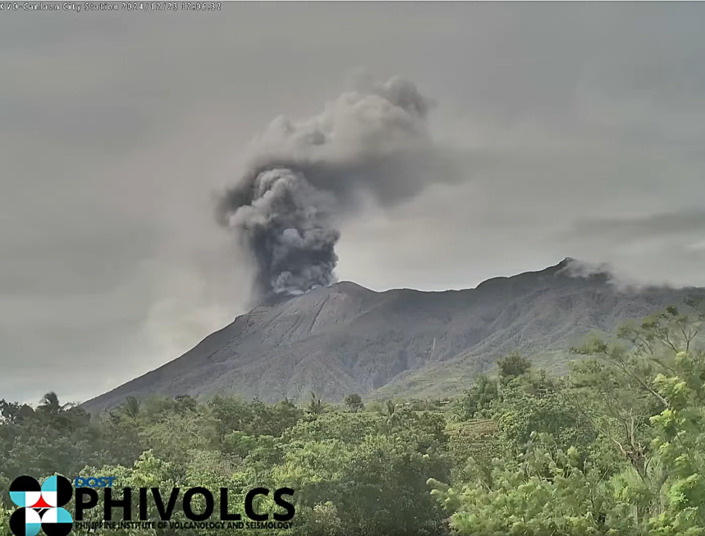
The Philippine Institute of Volcanology and Seismology (PHIVOLCS) reported continuing eruptive activity at Kanlaon during 31 December 2024-6 January 2025. The seismic network recorded 23-45 daily volcanic earthquakes that, during 31 December-2 January and on 4 January, included 3-12 periods of volcanic tremor lasting four minutes to four hours and 42 minutes. Daily sulfur dioxide emissions ranged from 3,406 to 5,840 tonnes per day. There were 5-8 daily period of ash emissions during 31 December-2 January, each as short as five minutes to as long as four hours and 24 minutes. The emissions were voluminous, rising 300-400 m above the summit and drifting W and NW. One ash emission lasting one hour and 51 minutes on 4 January produced voluminous plumes that rose 500 m above the summit and drifted SW. Gas-and-steam plumes during 3 and 5-6 January that were sometimes voluminous and continuous rose as high as 1.4 km above the summit and drifted NW, W, and SW.
The eruption continued to impact residents. The National Disaster Risk Reduction and Management Council (NDRRMC) report issued at 08h00 on 7 January stated that 13,246 people (4,070 families) were spread across 34 evacuation centers and another 7,458 people (2,351 families) were staying elsewhere. The report also stated that 34 cities were under a “state of calamity”, jobs continued to be affected, and some classes remained suspended. The Alert Level remained at 3 (on a scale of 0-5); the public was warned to stay 6 km away from the summit and pilots were warned not to fly close to the volcano.
Sources: Philippine Institute of Volcanology and Seismology (PHIVOLCS), The National Disaster Risk Reduction and Management Council (NDRRMC) , GVP.
Photo : Capture d’écran 12/2024

