January 03 , 2025.
Hawaii , Kilauea :
Thursday, January 2, 2025, 8:10 AM HST (Thursday, January 2, 2025, 18:10 UTC)
19°25’16 » N 155°17’13 » W,
Summit Elevation 4091 ft (1247 m)
Current Volcano Alert Level: WATCH
Current Aviation Color Code: ORANGE
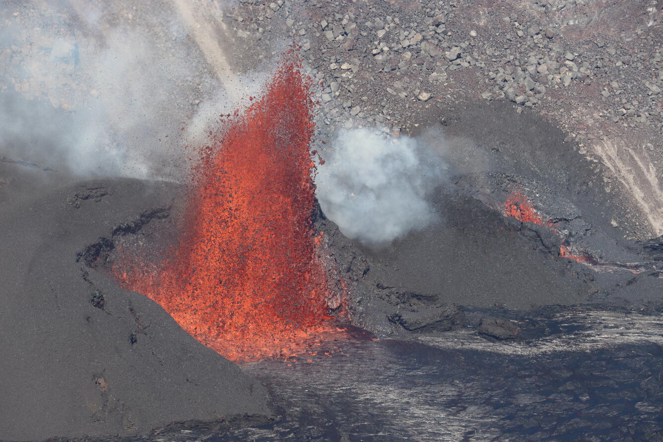
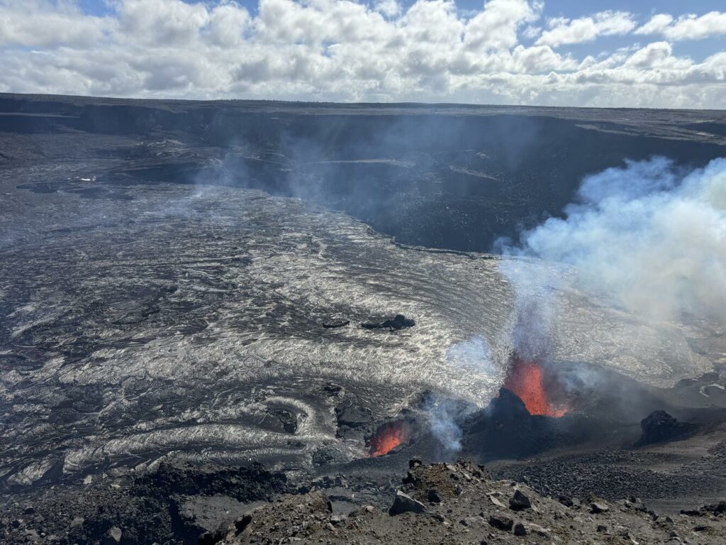
A view from the west rim of Kaluapele (Kīlauea summit caldera) of the vents erupting at Kīlauea summit.
Activity Summary:
The eruption at Kīlauea volcano that began on Monday, December 23, continues this morning. Over the past day, vents in the southwest portion of the caldera have continued producing a fan of lava flows covering the western portion of the crater floor during sustained lava fountaining. Eruptive activity has been confined to Halemaʻumaʻu and the down-dropped block within the caldera. No unusual activity has been noted along Kīlauea’s East Rift Zone or Southwest Rift Zone.
Summit Instrumental Observations:
Seismicity at the summit over the last 24 hours has been low with 10 small detected earthquakes, 2 in the upper ERZ, and 3 in the SWRZ. Seismic tremor remains increased during this period of lava fountaining but has remained constant over the past 24 hours. Summit tiltmeters continue to record deflationary tilt that began just after midnight on December 29. SO2 emissions remain elevated, with a gas plume rising above the caldera this morning that is being carried to the southwest.
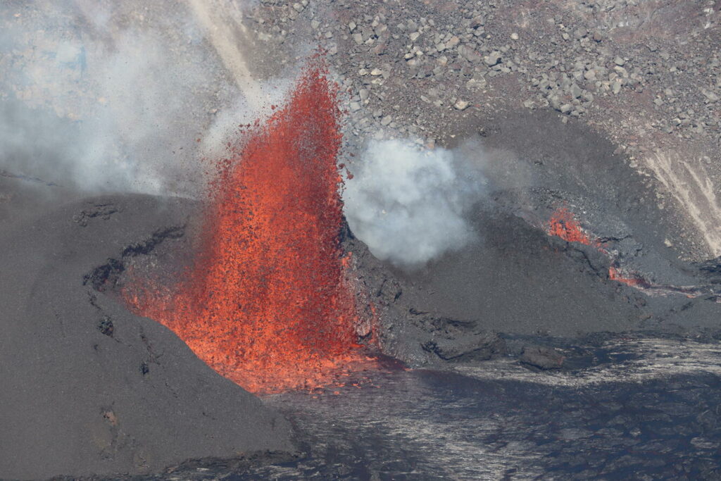
Two vents were active today at Kīlauea summit. The southern vent was producing the dominant fountain (left side of image) and had built a large pyroclastic cone abutting the western caldera wall. The northern vent had a lower fountain (right side of image) and a smaller cone.
Summit Eruption Observations:
Webcam images indicate that the eruption within Kaluapele (the summit caldera) continues this morning from vents on the southwest side of Halemaʻumaʻu. Effusion of lava over the past day continues to produce a broad area of flows covering the western portion of the crater. HVO geologists in the field on the morning of December 31, 2024 report fountain reaching about 20-30 m (65-100 ft) high, which continues to be the case for the lava fountains this morning.
Rift Zone Observations:
Shallow earthquake counts on the East Rift Zone (ERZ) remain at low levels. Over the last 24 hours, there were 2 earthquakes in the East Rift Zone. The ESC tiltmeter in the upper part of the East Rift Zone shows deformation associated with the ongoing summit eruption. Deformation rates remain low in the middle and lower East Rift Zone and Southwest Rift Zone as recorded by GPS instruments and tiltmeters.
Source : HVO
Photos : USGS / M. Patrick.
Indonesia , Rokatenda :
Decrease in the activity level of G.Rokatenda
The assessment report on the activity of Rokatenda Volcano – East Nusa Tenggara Province is hereby submitted as follows:
I. Visual observation
Visual observations of Mount Rokatenda between 16 and 31 December 2024 generally showed the volcano clearly until it was covered by fog. No smoke from the crater was observed. The weather is sunny to rainy, with weak to strong winds.
II. Instrumental observation
The earthquakes recorded during the period from 16 to 31 December 2024 were 19 shallow volcanic earthquakes, 16 deep volcanic earthquakes, 13 local tectonic earthquakes and 18 distant tectonic earthquakes.
III. Assessment
Visual observations during the period 16-31 December 2024 showed that no smoke from the crater was observed. Weather conditions, often marked by heavy rain, could cause an increase in the height of the smoke and a sulfur smell.
Instrumental monitoring recorded in seismic shows a decrease in deep and shallow volcanic earthquakes compared to the previous period, indicating a reduction in magma input.
Local tectonic earthquakes during this period have seen a slight increase, as well as distant tectonics, local tectonic activity around Palue Island could influence the volcanic activity of Mount Rokatenda.
Recommendation
Based on the results of a comprehensive analysis and assessment of visual and instrumental monitoring, the activity level of Mount Rokatenda has been downgraded from Level II (WASPADA) to Level I (normal) as of 1 January 2025 at 12:00 WITA.
Source : PVMBG
Photo : G Vitton
Indonesia , Ibu :
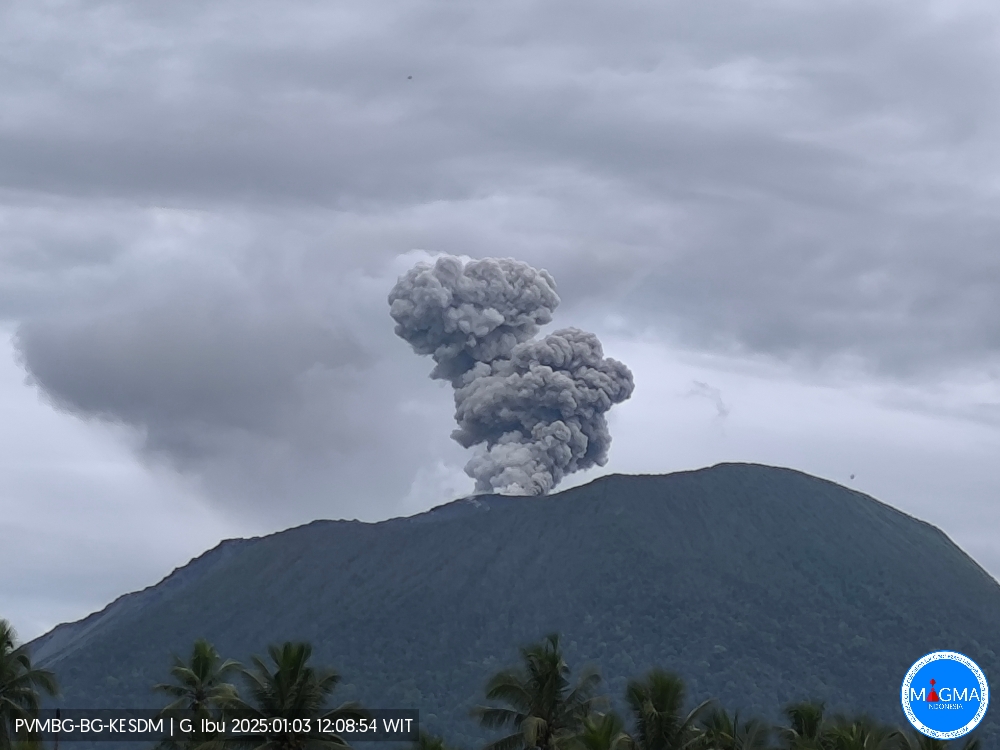
An eruption of Mount Ibu occurred on Friday, 3 January 2025 at 12:08 WIT with the height of the ash column observed at ± 400 m above the summit (± 1725 m above sea level). The ash column was grey in colour with a thick intensity, oriented towards the North-East and East. This eruption was recorded on a seismograph with a maximum amplitude of 28 mm and a duration of 80 seconds.
Seismicity observation:
16 eruption earthquakes with an amplitude of 19 to 28 mm and a duration of 46 to 81 seconds.
27 resignation earthquakes with an amplitude of 2 to 17 mm and an earthquake duration of 19 to 55 seconds.
4 harmonic tremors with an amplitude of 2 to 28 mm and an earthquake duration of 50 to 93 seconds.
78 shallow volcanic earthquakes with an amplitude of 2 to 12 mm and a seismic duration of 4 to 19 seconds.
6 deep volcanic earthquakes with an amplitude of 2 to 10 mm, and an earthquake duration of 14 to 19 seconds.
4 distant tectonic earthquakes with an amplitude of 2 to 11 mm, and the duration of the earthquake was 35 to 68 seconds.
Recommendation
1. Communities around Mount Ibu and visitors/tourists should not carry out activities within a radius of 4 km, with a sectoral extension of 5.5 km towards the crater opening in the northern part of the active crater of Mount Ibu.
2. In the event of ashfall, people who carry out activities outside the house are advised to protect their nose, mouth (mask) and eyes (goggles).
Source et photo : Magma Indonésie.
United-States , Yellowstone :
Wednesday, January 1, 2025, 9:54 AM MST (Wednesday, January 1, 2025, 16:54 UTC)
44°25’48 » N 110°40’12 » W,
Summit Elevation 9203 ft (2805 m)
Current Volcano Alert Level: NORMAL
Current Aviation Color Code: GREEN
Summary
Yellowstone Caldera activity remains at background levels, with 82 located earthquakes in December (maximum = M2.7). Deformation measurements indicate a small amount of caldera subsidence since early October.
Recent Work and News
Minor eruptions began at Steamboat Geyser in mid-December, suggesting that a major eruption may occur during the first few weeks of 2025. The geyser experienced 6 major eruptions during 2024, the fewest since the geyser became frequently active in 2018.
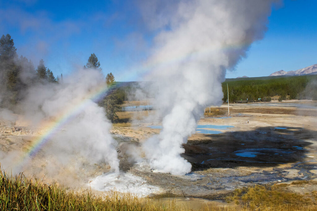
A rainbow rises over Ledge Geyser in Yellowstone National Park in Wyoming. « Ledge is the second largest geyser in the Norris Geyser Basin, capable of shooting water 125 feet (38 meters) into the air. However, because it shoots at an angle, the water sometimes reaches the ground 220 feet (67 meters) away. » – NPS
Seismicity
During December 2024, the University of Utah Seismograph Stations, responsible for the operation and analysis of the Yellowstone Seismic Network, located 82 earthquakes in the Yellowstone National Park region. The largest event of the month was a micro earthquake of magnitude 2.7 located about 8 miles south-southeast of Old Faithful in Yellowstone National Park on December 15 at 6:10 AM MST.
There were no swarms identified during the month of December.
Yellowstone earthquake activity is currently at background levels.
Ground Deformation
Continuous GPS stations in Yellowstone Caldera recorded a small amount (less than 1 centimeter, or a fraction of an inch) of subsidence since October. Overall, the caldera subsided by about 3 centimeters (1.2 inches) during 2024, continuing a trend that started in 2015–2016. No significant deformation was measured by a continuous GPS station near Norris Geyser Basin over the past month, and overall deformation in that area during 2024 included about 1–1.5 centimeters (0.4 – 0.6 inches) of subsidence.
Source et photo : YVO
Chile , Laguna del Maule :
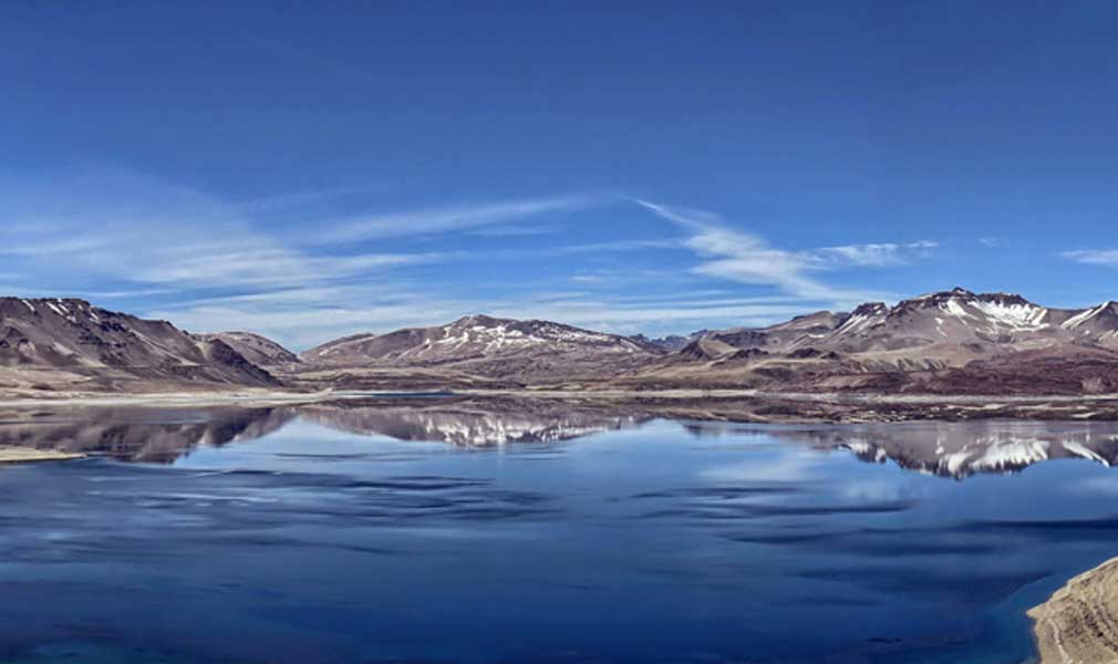
Special Report on Volcanic Activity (REAV), Maule Regions, Laguna del Maule Volcanic Complex, January 1, 2025, 8:28 p.m. local time (Continental Chile)
The National Geology and Mining Service of Chile (Sernageomin) announces the following PRELIMINARY information, obtained through the monitoring equipment of the National Volcanic Monitoring Network (RNVV), processed and analyzed at the Southern Andean Volcano Observatory (Ovdas):
On Wednesday, January 1, 2025, at 8:00 p.m. (23:00 UTC), the monitoring stations installed near the Laguna del Maule volcanic complex recorded a volcano-tectonic earthquake (associated with rock fracturing).
The characteristics of the earthquake after its analysis are as follows:
TIME OF ORIGIN: 20:00 local time (23:00 UTC)
LATITUDE: 36.165° S
LONGITUDE: 70.446° West
DEPTH: 5.6 km
LOCAL MAGNITUDE: 3 (ML)
Observation:
Following the M3.0 event, 11 events of similar characteristics of lower energy were recorded.
The volcanic technical alert is maintained at GREEN level.
Source : Sernageomin
Photo : Senapred / Rayen Gho.

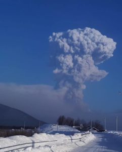
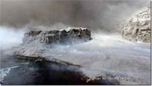
There are reports that Dofen volcano in Ethiopia has just erupted in the same area of a recent dike emplacement event.
The earthquake swarm is quite large in areal terms and is likely reflecting a very large intrusion has taken place. .
While unlikely, a much bigger eruption is possible given several different volcanoes are in the vicinity of the dike.