December 26 , 2024.
Hawaii , Kilauea :
Tuesday, December 24, 2024, 11:48 AM HST (Tuesday, December 24, 2024, 21:48 UTC)
19°25’16 » N 155°17’13 » W,
Summit Elevation 4091 ft (1247 m)
Current Volcano Alert Level: WATCH
Current Aviation Color Code: ORANGE
Activity Summary:
The eruption at Kīlauea volcano that began yesterday, December 23, slowed starting around 3 p.m. HST yesterday. The eruption paused through the night and reactivated at several of the vents along the southwest of Halema‘uma‘u crater floor. Eruptive activity remains confined to Halemaʻumaʻu and the downdropped block within the caldera and may fluctuate in vigor over the coming days. No unusual activity has been noted along Kīlauea’s East Rift Zone or Southwest Rift Zone.
The eruption at Kīlauea volcano that began yesterday, December 23, slowed starting around 3 p.m. HST yesterday. The eruption paused through the night and reactivated this morning at several of the vents along the southwest of Halema‘uma‘u crater floor. Eruptive activity remains confined to Halemaʻumaʻu and the downdropped block within the caldera and may fluctuate in vigor over the coming days. No unusual activity has been noted along Kīlauea’s East Rift Zone or Southwest Rift Zone.
Summit Instrumental Observations:
Seismicity at the summit over the last 24 hours has been low with approximately 8 earthquakes, all below magnitude-2.0. At the onset of the eruption yesterday morning, seismic tremor was high. However, around 3 p.m. yesterday, seismic tremor began to decrease, and currently there is low to moderate tremor related to vent activity. Immediately after the summit eruption commenced, summit tilt meters recorded rapid to moderate deflation until late afternoon. Around 3 p.m. yesterday, Kīlauea’s summit began slowly inflating. Based on ground instruments, the SO2 emissions were estimated to be over 100,000 tonnes per day during the initial stages of the eruption and dropped to about half of that by mid-day yesterday before the pause. The infrasound array picked up a clear signal from the summit around 10 a.m. this morning corresponding to low-level fountaining. A data problem last night resulted in images from Halemaʻumaʻu crater being displayed on a Nāpau Crater camera site. There is no eruptive activity in Nāpau Crater, and the camera has been temporarily taken offline for maintenance.
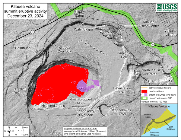
This reference map depicts the new Kīlauea summit eruption within Halema‘uma‘u crater on December 23, 2024, constructed using data captured during a USGS Hawaiian Volcano Observatory helicopter overflight at 9:30 a.m. The eruption started in the early morning with lava fountains on the crater floor and in the western wall, where activity gradually focused as the morning progressed. By the time of the overflight, new lava flows had covered approximately 650 acres (265 hectares) of the crater floor to an average depth of about 10 feet (3 meters).
Summit Eruption Observations:
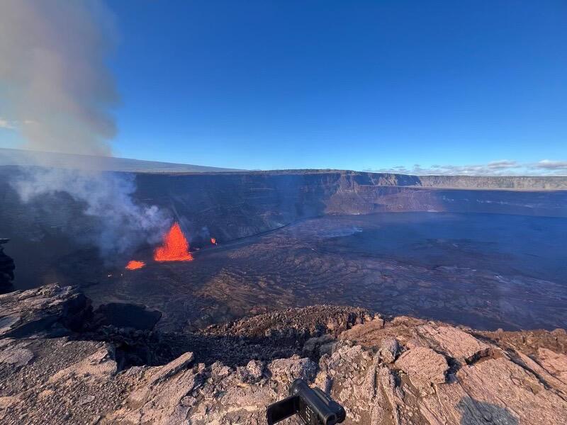
Webcam images indicate that the new eruption started within Kaluapele (the summit caldera) in Hawai‘i Volcanoes National Park at 2:20 a.m. HST on December 23. The main eruptive vent is located on the southwest side of Halemaʻumaʻu crater. By mid-day yesterday, lava flows had erupted across Halema‘uma‘u crater floor and overflowed onto the down-dropped block area to the east. Lava flows covered 650 acres (1 square mile or 2.6 square kilometers), which is about one quarter of the entire caldera floor of Kaluapele. Large glowing bombs, pumice, and Peleʻs hair were deposited downwind of Halemaʻumaʻu during the peak of the eruption. Fountaining decreased abruptly at 3:30 p.m. yesterday and had ceased by 4:00 p.m. Drainback of lava into the original vents began soon after fountaining stopped and continued through the night. Drainback reversed around 8 a.m. this morning, December 24, and low-level eruption of sluggish lava occurred from several of yesterday’s vents. Fountains began increasing in vigor around 11:00 a.m., signaling the onset of a second episode of this eruption. Breakouts of red lava are also visible on the surface of the lava lake as it continues to circulate.
Wednesday, December 25, 2024, 11:27 AM HST (Wednesday, December 25, 2024, 21:27 UTC)
Activity Summary:
Episode 2 of the summit eruption of Kīlauea paused just before 11:00 a.m. on Christmas Day.
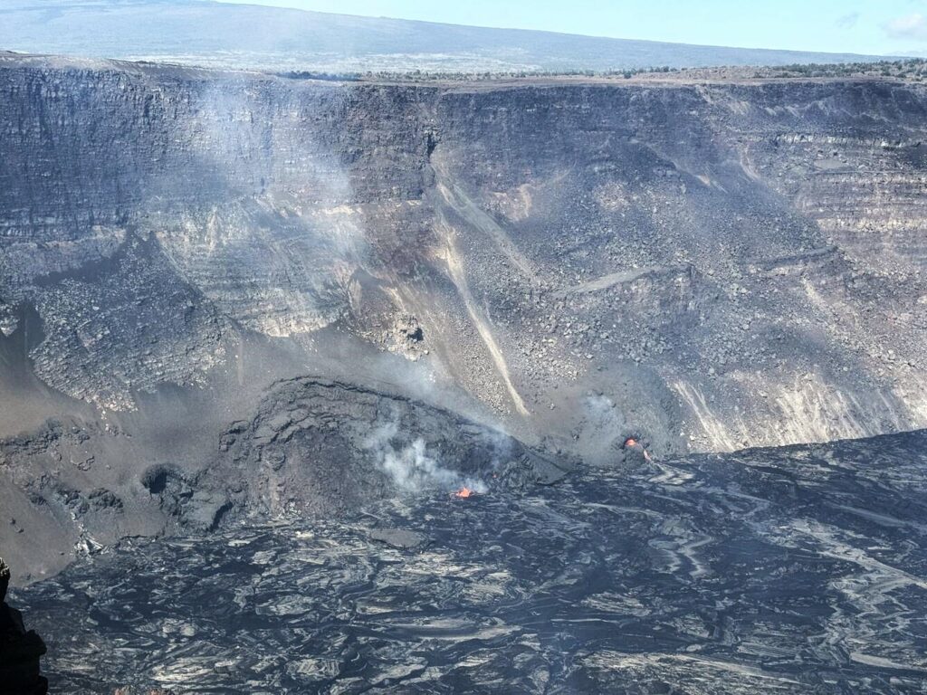
The eruption at the summit of Kīlauea paused again the morning of December 25—resumption of activity as happened yesterday is possible, but not certain. USGS Hawaiian Volcano Observatory geologists arrived at Halema‘uma‘u crater rim just after the eruption pause, observing very weak spattering and drainback of lava into the vent.
The vigorous fountaining from vents in the southwest corner of Halemaʻmaʻu crater rapidly died down over a few minutes just before 11:00 a.m. Lava began draining back into the vent at 11:00 a.m. at the nearly the same time that summit tiltmeters began recording a change from deflation to inflation. Seismic tremor also decreased markedly at the same time. The pattern was similar but more abrupt than the onset of the pause on Monday, December 23, that occurred between 3 and 4 p.m.
Episode 2 lasted a little over 24 hours, which is about twice the duration of the first eruptive episode. Prior summit eruptions have lasted days to weeks and there is a high probability that this eruption will resume if the summit repressurizes over the coming days.
HVO continues to closely monitor Kīlauea and will issue an eruption update tomorrow morning unless there are significant changes overnight. HVO remains in close contact with Hawai‘i Volcanoes National Park and the Hawai‘i County Civil Defense Agency.
Kīlauea Volcano Alert Level/Aviation Color Code remain at WATCH/ORANGE. All current and recent activity is within Hawaiʻi Volcanoes National Park. No changes have been detected in the East Rift Zone or Southwest Rift Zone.
Source : HVO
Photos : USGS , USGS / M. Patrick
Japan , Kirishimayama :
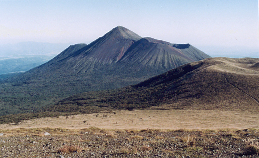
The Japan Meteorological Agency (JMA) reported increasing unrest at Shinmoedake (Shinmoe peak, a stratovolcano of the Kirishimayama volcano group). The Global Navigation Satellite System (GNSS) indicated minor inflation starting in November 2023. The number of earthquakes with epicenters beneath Shinmoedake had been increasing since late October 2023; during 1-11 December 2024 the seismic network detected 284 earthquakes. At 11h00 on 12 December the Alert Level was raised to 2 (on a 5-level scale) and the public was warned to stay 2 km away from Shinmoedake Crater. Sulfur dioxide emissions were below detectable limits on 3 and 9 December.
Kirishimayama is a large group of more than 20 Quaternary volcanoes located north of Kagoshima Bay. The late-Pleistocene to Holocene dominantly andesitic group consists of stratovolcanoes, pyroclastic cones, maars, and underlying shield volcanoes located over an area of 20 x 30 km. The larger stratovolcanoes are scattered throughout the field, with the centrally located Karakunidake being the highest. Onamiike and Miike, the two largest maars, are located SW of Karakunidake and at its far eastern end, respectively. Holocene eruptions have been concentrated along an E-W line of vents from Miike to Ohachi, and at Shinmoedake to the NE. Frequent small-to-moderate explosive eruptions have been recorded since the 8th century.
Sources: Japan Meteorological Agency (JMA) , GVP
Photo : GVP
Tonga Archipelago , Home Reef :
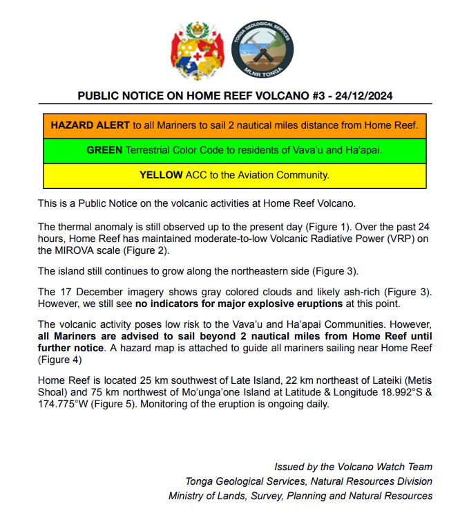
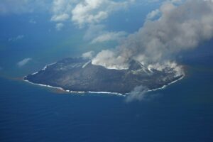
The Tonga Geological Services reported that a thermal anomaly at Home Reef was identified in satellite data at 0115 on 4 December. Thermal anomalies persisted at least through 13 December. The Maritime Alert Level was raised to Orange (the second highest level on a four-color scale) and mariners were advised to stay 4 km away from the island, the Aviation Color Code remained at Green (the lowest color on a four-color scale), and the Alert Level for residents of Vava’u and Ha’apai remained at Green (the lowest color on a four-color scale). A comparison of satellite images from 7 and 12 December showed that a new lobe of lava had flowed to the NE, expanding the coastline. There was also a thermal anomaly over the central part of the island.
Home Reef, a submarine volcano midway between Metis Shoal and Late Island in the central Tonga islands, was first reported active in the mid-19th century, when an ephemeral island formed. An eruption in 1984 produced a 12-km-high eruption plume, large amounts of floating pumice, and an ephemeral 500 x 1,500 m island, with cliffs 30-50 m high that enclosed a water-filled crater. In 2006 an island-forming eruption produced widespread dacitic pumice rafts that drifted as far as Australia. Another island was built during a September-October 2022 eruption.
Sources: Tonga Geological Services, Government of Tonga, Copernicus, GVP
Indonesia , Lewotobi Laki-laki :
Decrease in the activity level of Lewotobi Laki-laki from Level IV (AWAS) to Level III (SIAGA).
The results of the assessment of the activities of G. Lewotobi Laki-laki for the period from 16 to 23 December 2024 are presented below:
Visual observation
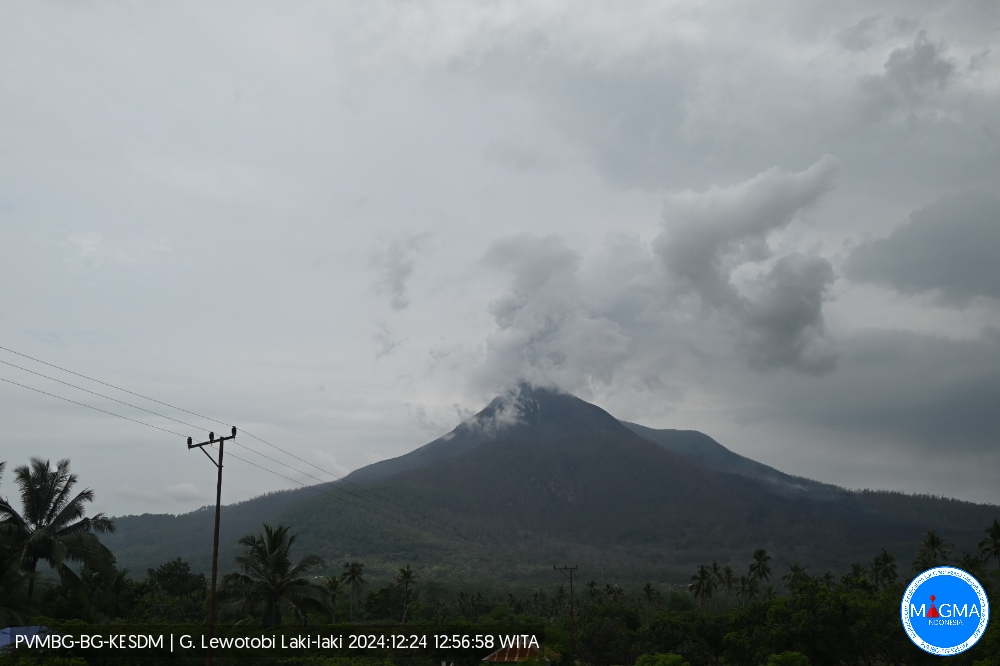
The volcano is clearly visible until it is covered by fog. White and gray smoke is observed from the main crater with fine, medium to thick intensity at a height of about 100-1500 meters above the summit. The weather is sunny to rainy, with weak to moderate winds from the North, North-East, South-West, West and North-West. The average height of the eruption column during this period was between 500 and 1000 meters from the summit, the ash column from the eruption was gray in color.
Instrumental observation
Seismicity recorded during the period from 16 to 23 December 2024:
4 eruption earthquakes.
134 emission earthquakes
83 harmonic tremors,
6 « tornillos » type earthquakes
4 low-frequency earthquakes,
3 shallow volcanic earthquakes
26 deep volcanic earthquakes,
4 local tectonic earthquakes,
48 distant tectonic earthquakes,
1 flood earthquake,
9 continuous tremors with a dominant amplitude of 2.9 mm.
An eruption of Lewotobi Laki-laki occurred on Tuesday, December 24, 2024, at 12:54 WITA. No visual eruption was observed. This eruption was recorded on a seismograph with a maximum amplitude of 7.4 mm and a duration of 111 seconds.
Assessment
Visual observations for the period from December 16 to 23, 2024 show that the volcanic activity of Lewotobi Laki-laki is still fluctuating, the average height of the eruptive column is 500 to 1,000 meters, the same as in the previous period. There are new lava flows descending to the northeast and west-northwest.
During this period, emission earthquakes have increased and weak rumbling sounds have been heard several times from the PGA Lewotobi station.
The length of the lava flows in the northwest and northeast directions is about 3.8 km from the summit, the influence of the slope and the still high temperature of the lava still allow the lava to move.
Harmonic earthquakes have decreased quite significantly, as the movement of fluids or the release of gas from the magma that fills the fractures of Lewotobi Laki-laki decreases.
During this period, the « tornillos » earthquakes decreased, indicating that the flow of shallow fluid to the surface was slowing down.
Low-frequency earthquakes have decreased, indicating a reduction in the flow of magmatic fluid from the interior to the surface.
Shallow volcanic and deep volcanic earthquakes tend to decrease compared to the previous period, indicating that the magma activity in the magma pocket of Lewotobi Laki volcano has decreased slightly due to the reduction of magma activity towards the surface.
Distant tectonic earthquakes and local tectonic earthquakes tend to increase, the recorded local tectonic earthquakes indicate that there is still supply from the interior, where the location is still far from the body of Lewotobi Laki-laki. Local tectonic earthquakes have an influence on the activity of the volcano, so caution should be exercised if there is a sudden increase in the number of local tectonic earthquakes that will affect the height of the eruption or the activity of Lewotobi Laki-laki.
During this period, a flood earthquake was recorded, triggered by heavy rainfall transporting eruption products to a sloping area. The materials released and deposited around Lewotobi Laki-laki could potentially transform into lahars in the event of heavy rainfall.
Recommendation
Based on the results of a comprehensive analysis and assessment of visual and instrumental monitoring, the activity level of Lewotobi Laki-laki has been downgraded from Level IV (AWAS) to Level III (SIAGA) effective 24 December 2024 at 10:00 WITA.
Source : PVMBG
Photo : Magma Indonésie .
Kamchatka , Sheveluch :
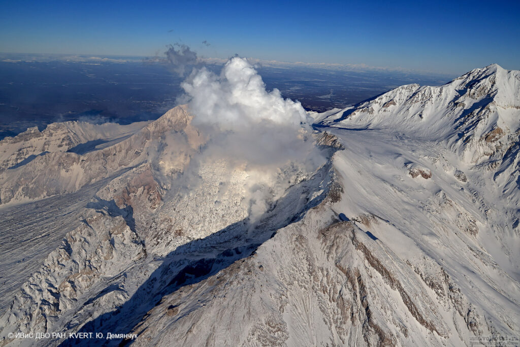
The Kamchatkan Volcanic Eruption Response Team (KVERT) reported that lava extrusion may have continued at Sheveluch’s “300 years of RAS” dome on the SW flank of Old Sheveluch and at the dome at Young Sheveluch during 5-12 December. Daily thermal anomalies over the domes were identified in satellite images. The Aviation Color Code remained at Orange (the second highest level on a four-color scale). Dates are based on UTC times; specific events are in local time where noted.
The high, isolated massif of Sheveluch volcano (also spelled Shiveluch) rises above the lowlands NNE of the Kliuchevskaya volcano group. The 1,300 km3 andesitic volcano is one of Kamchatka’s largest and most active volcanic structures, with at least 60 large eruptions during the Holocene. The summit of roughly 65,000-year-old Stary Shiveluch is truncated by a broad 9-km-wide late-Pleistocene caldera breached to the south. Many lava domes occur on its outer flanks. The Molodoy Shiveluch lava dome complex was constructed during the Holocene within the large open caldera; Holocene lava dome extrusion also took place on the flanks of Stary Shiveluch. Widespread tephra layers from these eruptions have provided valuable time markers for dating volcanic events in Kamchatka. Frequent collapses of dome complexes, most recently in 1964, have produced debris avalanches whose deposits cover much of the floor of the breached caldera.
Sources: Kamchatkan Volcanic Eruption Response Team (KVERT), GVP
Photo : Yu. Demyanchuk. IVS FEB RAS, KVERT (archive 2023).


