December 2 , 2024.
New Zealand , Ruapehu :
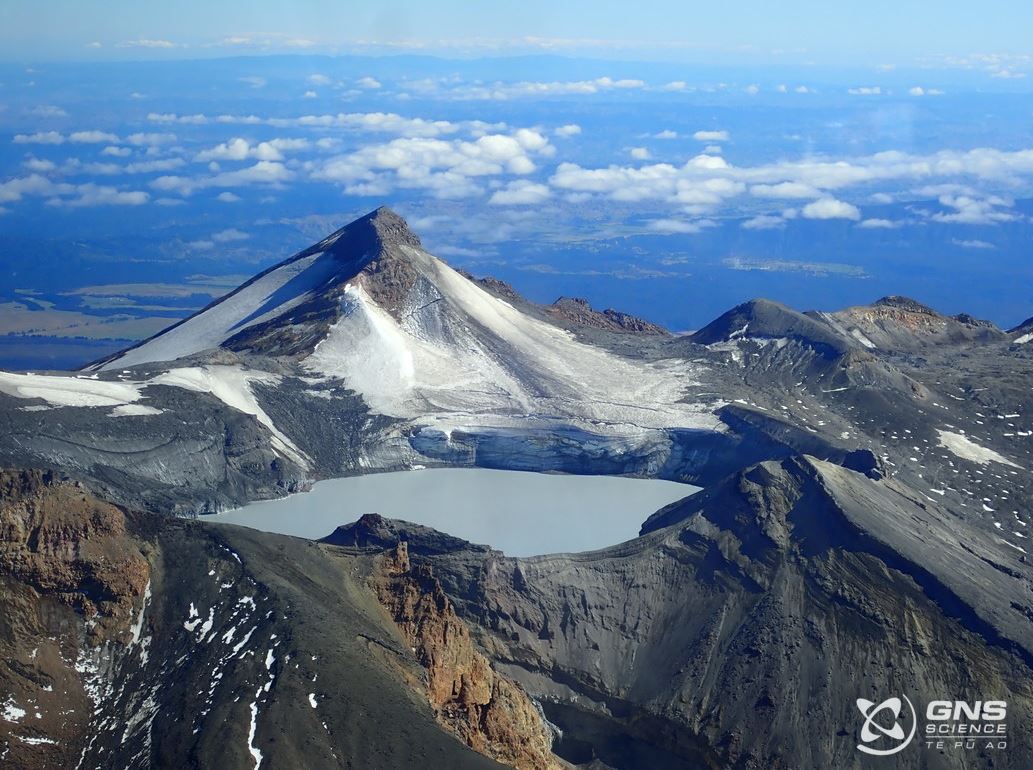
Mt Ruapehu Crater Lake starts heating – minor volcanic unrest continues. Volcanic Alert Level remains at 1. Published: Fri Dec 20 2024 12:15 PM
Since mid-October the temperature of Te Wai ā-moe (Ruapehu Crater Lake) has been slowly heating. The current temperature is now around 18-19 °C, from a low of 8 °C in early October. We continue to measure low–moderate volcanic sulphur dioxide (SO₂) gas emissions, and low level of volcanic tremor. An eruption remains unlikely.
The Volcanic Alert Level remains at 1 and the Aviation Colour Code at Green.
Earlier this year, Te Wai ā-moe was in a cooling phase from February with the lake temperature dropping from about 30 ºC, to a low point of 8 ºC early October. During that cooling episode, the amounts of sulphur dioxide (SO₂) gas coming out through the lake decreased and volcanic tremor also declined, consistent with the cooling of the hydrothermal system beneath the lake.
There are now clear signs of reheating of Te Wai ā-moe (Ruapehu Crater Lake) with an increase in temperature of 10 ºC since early-October. The daily average is currently around 18–19 ºC. Both the increase and the current temperature are well within the expected norms.
The amount of sulphur dioxide (SO₂) gas has also increased since early October 2024, which shows that the vent is now more open than during the earlier cooling episode. That is consistent with observations of weak upwellings in the lake and floating strands of sulphur on the lake surface, and overall, more heat reaching and warming the lake.
Our recent observations are consistent with ongoing, low-level volcanic unrest at Ruapehu. We expect the lake to slowly continue heating up during the coming months as part of a typical Ruapehu heating-cooling episode.
Monitoring indicators remain consistent with a low level of volcanic activity. As a result, the Volcanic Alert Level remains at 1. The Aviation Colour Code remains Green.
Source : Geonet / Agnès Mazot /Duty Volcanologist
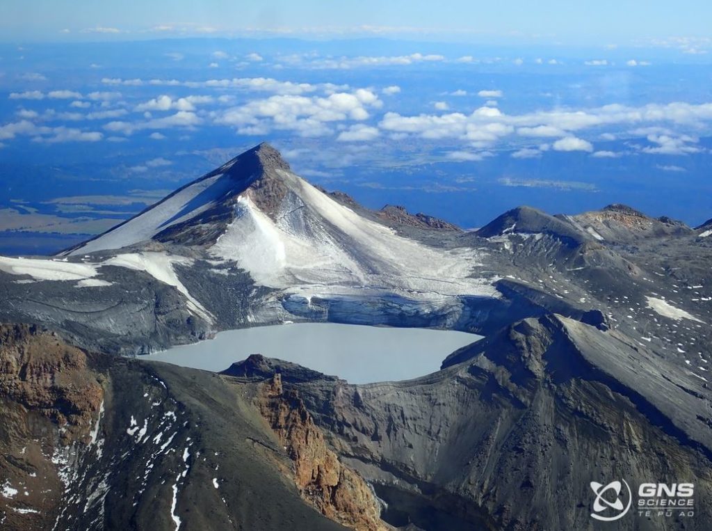
Photo : GNS Science.
Indonesia , Ibu :
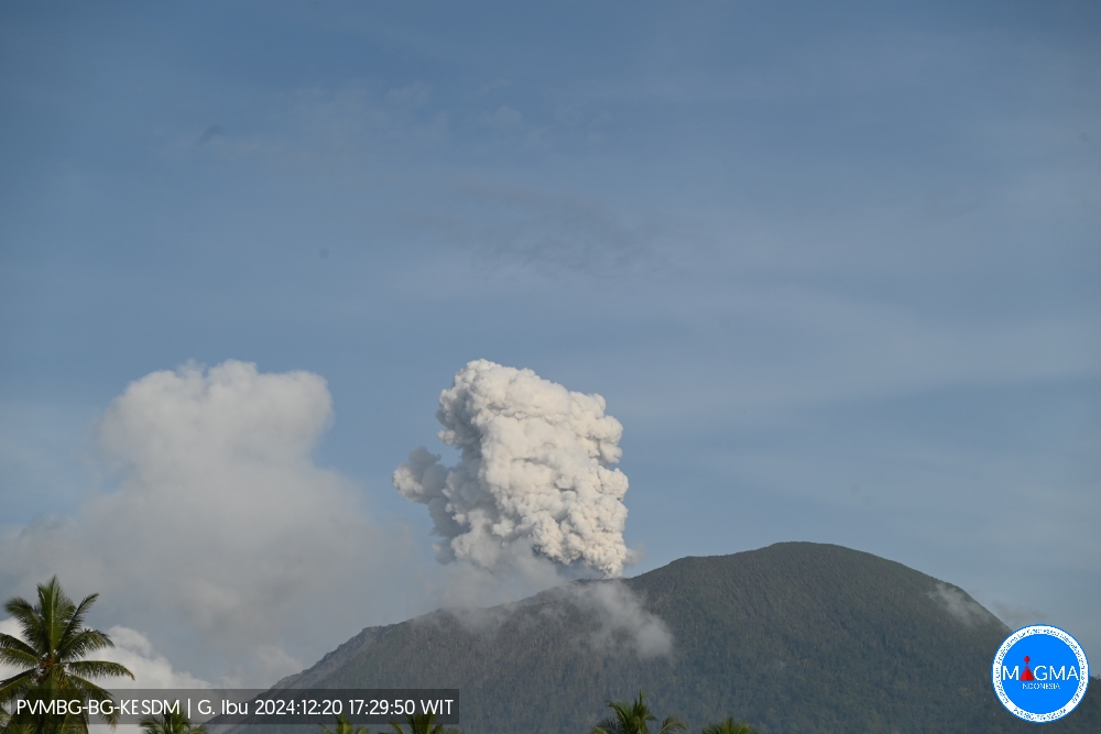
An eruption of Mount Ibu occurred on Friday, 20 December 2024 at 17:29 WIT with the height of the ash column observed at ±400 m above the summit (±1725 m above sea level). The ash column was observed to be white to grey in colour with a thick intensity, oriented towards the North-East. This eruption was recorded on a seismograph with a maximum amplitude of 26 mm and a duration of 45 seconds.
Seismicity observation:
14 eruption/explosion earthquakes with an amplitude of 17 to 28 mm and a seismic duration of 40 to 82 seconds.
26 emission earthquakes with an amplitude of 2 to 17 mm and an earthquake duration of 23 to 51 seconds.
2 harmonic tremors with an amplitude of 2 to 8 mm and an earthquake duration of 76 to 90 seconds.
58 shallow volcanic earthquakes with an amplitude of 2 to 12 mm and a seismic duration of 4 to 18 seconds.
16 deep volcanic earthquakes with an amplitude of 2 to 10 mm, and an earthquake duration of 9 to 17 seconds.
6 distant tectonic earthquakes with an amplitude of 2 to 28 mm, and the duration of the earthquake was 32 to 136 seconds.
Recommendation
1. Communities around Mount Ibu and visitors/tourists should not carry out activities within a radius of 4 km, with a sectoral extension of 5.5 km towards the crater opening in the northern part of the active crater of Mount Ibu.
2. In the event of ash fall, people carrying out activities outside the house are advised to protect their nose, mouth (mask) and eyes (goggles).
Source et photo : Magma Indonésie
Colombia , Nevado del Ruiz :
Manizales, December 17, 2024, 6:00 p.m.
From the monitoring of the activity of the Nevado del Ruiz volcano, the Colombian Geological Survey (SGC), an entity attached to the Ministry of Mines and Energy, reports that:
During the week of December 10 to 16, 2024, the volcano continued to exhibit unstable behavior. Compared to the previous week, the main variations in the monitored parameters were:
– The recording of seismicity related to fluid dynamics inside the volcanic conduits continued, associated with long-duration signals and low energy levels.
However, unlike the previous week, the duration of the signals was shorter.
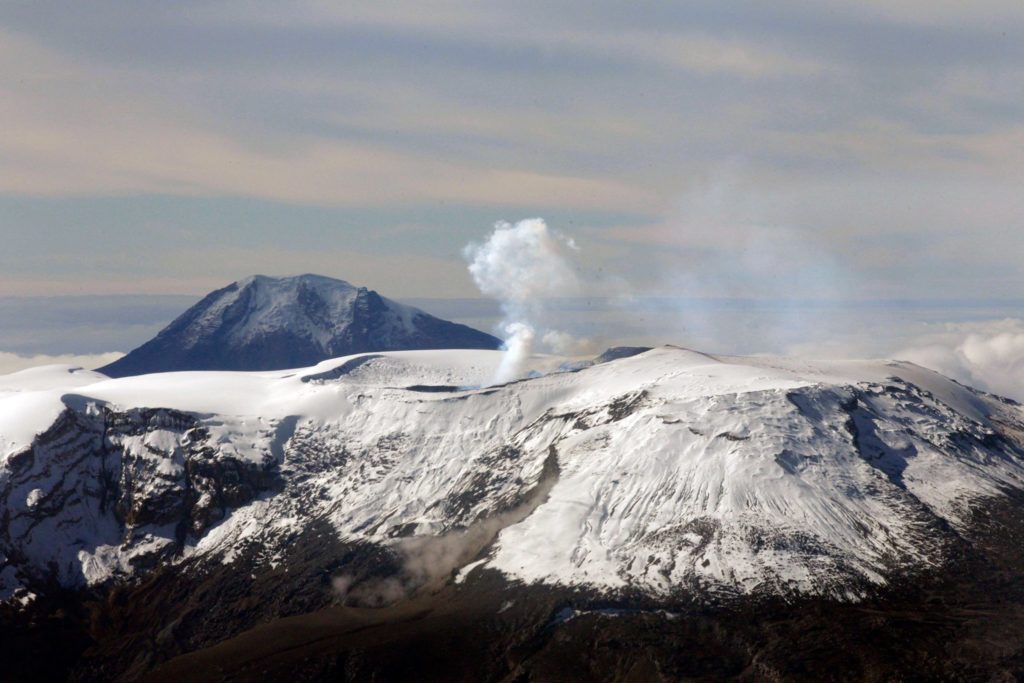
Some of these signals were associated with continuous ash emissions, especially those recorded on December 11, 13 and 14. Regarding the seismic signals associated with the emission of pulsatile ash, these have increased in the number of earthquakes recorded and have slightly decreased in the seismic energy released. Thanks to the cameras (conventional or thermographic) used to monitor the volcano and the reports of the managers of the Los Nevados National Natural Park and the SGC staff during the field work in the area, it has been possible to confirm several ash emissions and changes in the temperature of the emitted material, related to some of these events.
– The seismic activity associated with the rock fracturing processes inside the volcanic edifice decreased in the number of earthquakes recorded and in the seismic energy released. The earthquakes were located mainly in the Arenas crater and, in a scattered manner, on the different flanks of the volcano, at distances of up to 10 km from the crater. The depths of the events varied between 1 km and 8 km from the summit of the volcano. The highest magnitude of the week was 1.6, corresponding to the earthquakes recorded on December 11 at 16:38 and on December 13 at 05:42, located respectively in the Arenas crater (2 km deep) and 6 km east of it (3 km deep). – The emission of water vapor and gases, mainly sulfur dioxide (SO₂), into the atmosphere through the Arenas crater was variable. Daily SO₂ degassing rates were similar to those recorded the previous week. Satellite monitoring, carried out in a complementary manner to assess this parameter, continued to show significant SO₂ releases into the atmosphere.
– The height of the gas column maintained values below 1000 m (measured above the volcanic summit) for most of the week. Vertically and in dispersion, it reached maximum values of 1800 m during some of the recorded pulsatile ash emissions. In relation to the direction of dispersion of the gas column, this was preferentially towards the southwest side of the volcano and, to a lesser extent, towards the west-southwest of it.
– When monitoring thermal anomalies at the bottom of the Arenas crater, from satellite monitoring platforms, a similar number of detections occurred because the atmospheric conditions favored their observation. Energy levels ranged from low to moderate, with peak values slightly higher than those recorded the previous week.
Source : SGC
Photo : Carlos Ortega. ( 2023).
Mexico , Popocatepetl :
December 19, 11:00 (December 19, 17:00 GMT)
Activity of the last 24 hours
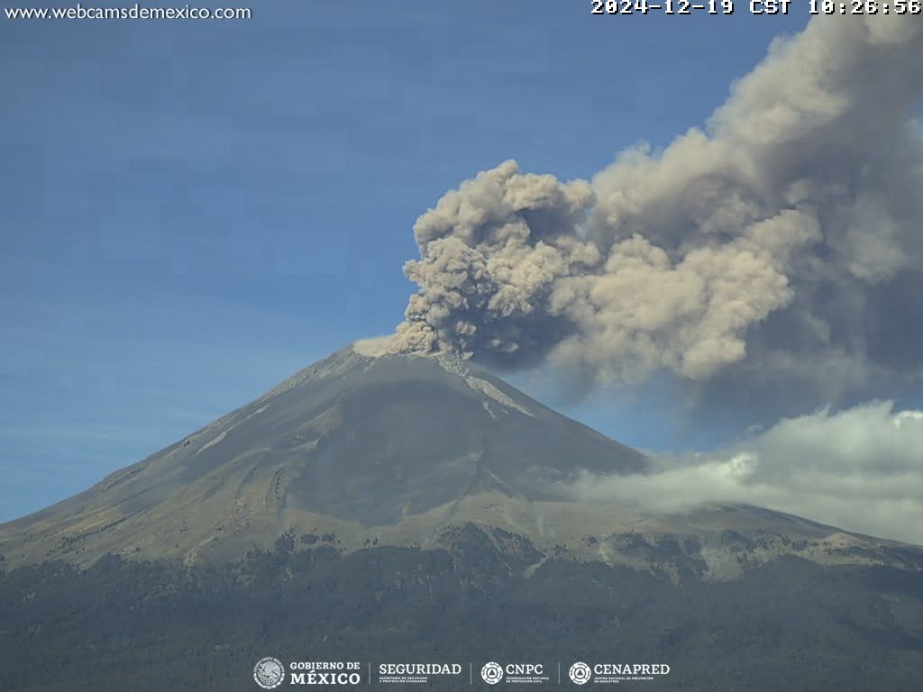
36 low intensity exhalations were detected, accompanied by water vapor, volcanic gases and small amounts of ash. In addition, 767 minutes of high frequency and low amplitude tremors were recorded.
The National Center for Communication and Civil Protection Operations (Cenacom) reported yesterday a slight ash fall in the municipality of Atlatlahucan, state of Morelos.
During the morning and at the time of this report, a continuous emission of water vapor, volcanic gases and ash was observed, with dispersion towards the north-northeast (N-NE).
The Popocatépetl volcanic fire alert is in yellow phase 2.
The scenarios predicted for this phase are:
A few small to moderate explosions
Occurrence of tremors of varying amplitude
Light to moderate ash rains in the surrounding towns and in some more distant towns
Ejection of incandescent fragments within the 12-kilometer exclusion radius
The occurrence of lahars can be expected to descend into the ravines, due to the accumulation of ash on the slopes and its interaction with the rains expected in the coming weeks.
Possibility of pyroclastic flows not reaching the populations
Source et photo : Cenapred.
La Martinique Island , Mount Pelée :
Weekly report, Institut de physique du globe de Paris / Observatoire volcanologique et seismologique de Martinique
Saint-Pierre, December 13, 2024 at 12:15 local time (GMT-4)
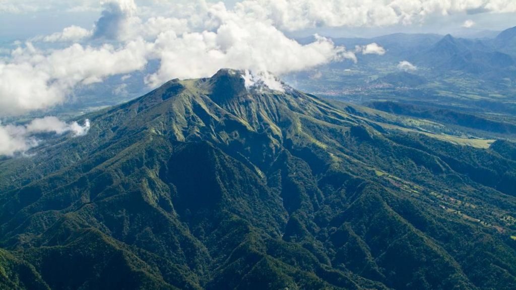
Volcanic activity is slightly increasing this week with 20 earthquakes of volcanic origin observed.
Between December 6, 2024 at 16:00 (UT) and December 13, 2024 at 16:00 (UT), the OVSM recorded 20 low-energy volcano-tectonic earthquakes. These earthquakes were clearly identified as coming from one of the well-known seismically active zones at Mount Pelée, located between 1.0 and 1.4 km deep below the summit of the volcano. The superficial seismicity of the volcano-tectonic type is associated with micro-fracturing in the volcanic edifice in connection with the global reactivation of the volcano observed since the end of 2018.
No earthquake was felt by the population.
The previous week, the OVSM had recorded 2 earthquakes of volcanic origin. As of December 13, 2024 and during the last 4 weeks, the OVSM has therefore observed a total of 87 volcanic earthquakes, or an average of 21 to 22 earthquakes per week.
During the volcanic reactivation phases of volcanoes similar to Mount Pelée, it is usual to observe seismic activity that varies in intensity and frequency.
For more details on observations and interpretations of volcanic activity over the longer term, refer to the OVSM monthly bulletins.
The alert level is currently YELLOW: vigilance.
Source : Direction de l’OVSM-IPGP
Photo : Parc naturel de Martinique .

