December 19 , 2024.
Indonesia , Ibu :
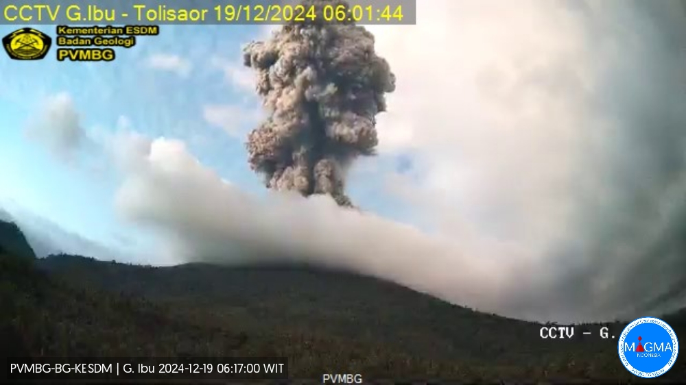
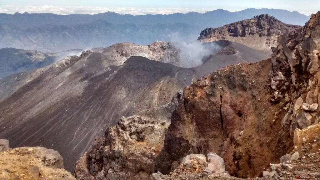
An eruption of Mount Ibu occurred on Thursday, 19 December 2024 at 06:00 WIT with the height of the ash column observed at ±1,500 m above the summit (±2,825 m above sea level). The ash column was observed to be grey with a thick intensity, oriented towards the East. This eruption was recorded on a seismograph with a maximum amplitude of 28 mm and a duration of 129 seconds.
VOLCANO OBSERVATORY NOTICE FOR AVIATION – VONA
Issued : Décember 19 , 2024
Volcano : Ibu (268030)
Current Aviation Colour Code : ORANGE
Previous Aviation Colour Code : orange
Source : Ibu Volcano Observatory
Notice Number : 2024IBU1301
Volcano Location : N 01 deg 29 min 17 sec E 127 deg 37 min 48 sec
Area : North Maluku, Indonesia
Summit Elevation : 4240 FT (1325 M)
Volcanic Activity Summary :
Eruption with volcanic ash cloud at 21h00 UTC (06h00 local).
Volcanic Cloud Height :
Best estimate of ash-cloud top is around 9040 FT (2825 M) above sea level or 4800 FT (1500 M) above summit. May be higher than what can be observed clearly. Source of height data: ground observer.
Other Volcanic Cloud Information :
Ash cloud moving to east. Volcanic ash is observed to be gray. The intensity of volcanic ash is observed to be thick.
Remarks :
Eruption recorded on seismogram with maximum amplitude 28 mm and maximum duration 129 second.
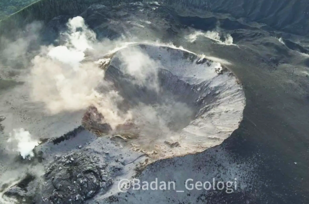
The Pusat Vulkanologi dan Mitigasi Bencana Geologi (PVMBG) reported that the eruption at Ibu continued during 11-17 December. Gray or white-and-gray ash plumes that were often dense rose 0.3-1.2 km above the summit and drifted in multiple directions on most days; emissions were not reported on 15 December likely due to weather clouds. Webcam images posted with 11 December reports showed incandescence at the summit of the inner active cone. The Alert Level remained at 3 (the second highest level on a four-level scale) and the public was advised to stay 4 km away from the active crater and 5.5 km away from the N crater wall opening.
Sources : Magma Indonésie , GVP.
Photos : Magma Indonésie , ANTARA / HO-Agence géologique .
Tonga Archipelago , Home Reef :
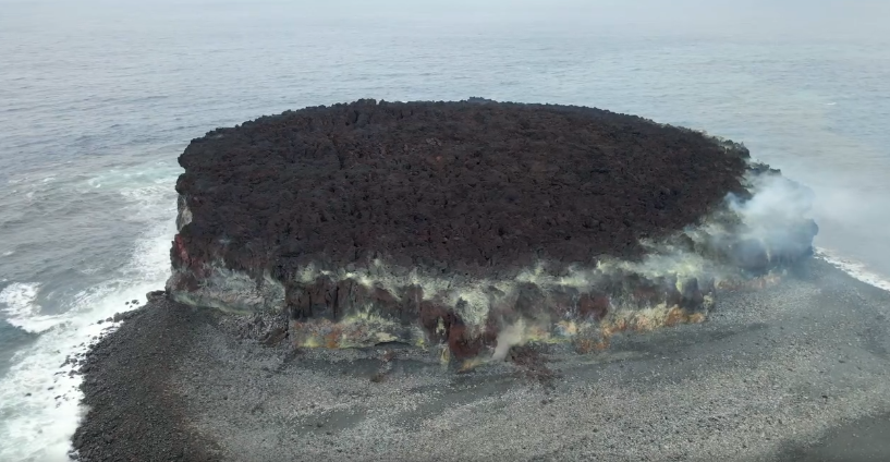
The Tonga Geological Services reported that a thermal anomaly at Home Reef was identified in satellite data at 0115 on 4 December. Thermal anomalies persisted at least through 13 December. The Maritime Alert Level was raised to Orange (the second highest level on a four-color scale) and mariners were advised to stay 4 km away from the island, the Aviation Color Code remained at Green (the lowest color on a four-color scale), and the Alert Level for residents of Vava’u and Ha’apai remained at Green (the lowest color on a four-color scale). A comparison of satellite images from 7 and 12 December showed that a new lobe of lava had flowed to the NE, expanding the coastline. There was also a thermal anomaly over the central part of the island.
Home Reef, a submarine volcano midway between Metis Shoal and Late Island in the central Tonga islands, was first reported active in the mid-19th century, when an ephemeral island formed. An eruption in 1984 produced a 12-km-high eruption plume, large amounts of floating pumice, and an ephemeral 500 x 1,500 m island, with cliffs 30-50 m high that enclosed a water-filled crater. In 2006 an island-forming eruption produced widespread dacitic pumice rafts that drifted as far as Australia. Another island was built during a September-October 2022 eruption.
Sources : Tonga Geological Services, Government of Tonga, Copernicus , GVP.
Photo : Lacelid Productions ( capture d’écran ) 06/2024 .
Japan , Suwanosejima :
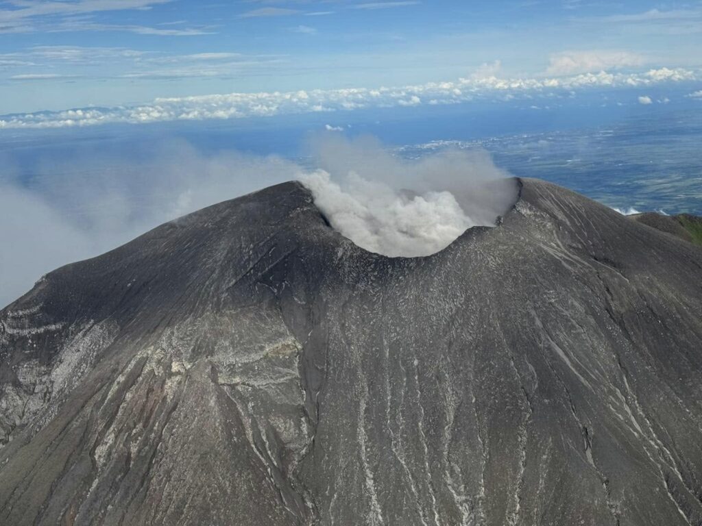
The Japan Meteorological Agency (JMA) reported that eruptive activity at Suwanosejima’s Ontake Crater continued during 9-16 December. Crater incandescence was observed nightly in webcam images. Blocks were ejected as far as 300 m from the center of the crater. Eruptive events at 12h31 on 12 December, at 07h50 on 13 December, at 19h08 on 14 December, and at 03h41 on 15 December produced ash plumes that rose 1-1.2 km above the cater rim and drifted S and SE; the plumes on 12 and 13 December rose into weather clouds. An explosion was recorded at 12h13 on 15 December, though no emissions were reported. Another explosion at 02h21 on 16 December produced an ash plume that rose 800 m above the crater rim and drifted E. The Alert Level remained at 2 (on a 5-level scale) and the public was warned to stay at least 1.5 km away from the crater.
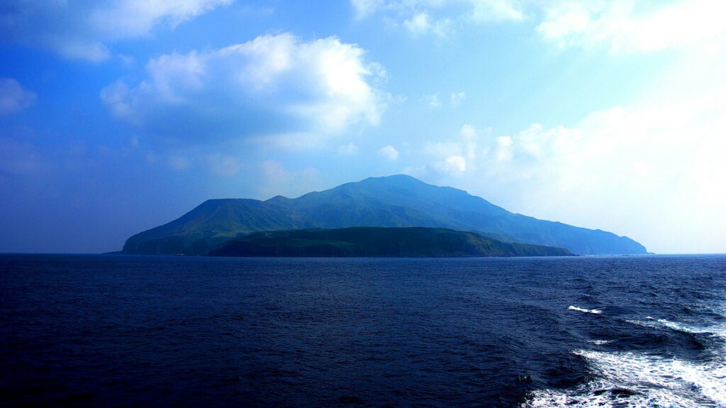
The 8-km-long island of Suwanosejima in the northern Ryukyu Islands consists of an andesitic stratovolcano with two active summit craters. The summit is truncated by a large breached crater extending to the sea on the E flank that was formed by edifice collapse. One of Japan’s most frequently active volcanoes, it was in a state of intermittent Strombolian activity from Otake, the NE summit crater, between 1949 and 1996, after which periods of inactivity lengthened. The largest recorded eruption took place in 1813-14, when thick scoria deposits covered residential areas, and the SW crater produced two lava flows that reached the western coast. At the end of the eruption the summit of Otake collapsed, forming a large debris avalanche and creating an open collapse scarp extending to the eastern coast. The island remained uninhabited for about 70 years after the 1813-1814 eruption. Lava flows reached the eastern coast of the island in 1884. Only about 50 people live on the island.
Sources: Japan Meteorological Agency (JMA) , GVP.
Photo : 名古屋太郎 ( 11/2024)
Colombia , Galeras :
San Juan de Pasto, December 17, 2024, 5:00 p.m.
From the monitoring of the activity of the Galeras volcano, the Colombian Geological Survey (SGC), an entity attached to the Ministry of Mines and Energy, reports that:
In the week of December 10 to 16, 2024, the activity of the volcano showed a decrease in seismicity. Compared to the previous week, the main variations in the monitored parameters were:
• There was a decrease in both the frequency of earthquakes and the seismic energy released. The predominance of fracture seismicity remains. Earthquakes associated with the movement of fluids within volcanic conduits have multiplied.
• The earthquakes related to the fracturing processes were located mainly towards the western sector of the active cone, at distances of up to 1 km from the main crater, at very superficial levels (less than 2 km from the summit of Galeras) and with magnitudes lower than 1.
• Small emissions of white gases were observed from the fumarole fields of Las Chavas, to the West, and El Paisita, to the North of the active cone, with weak columns and variable dispersion due to wind action.
• The other volcanic monitoring parameters showed stability.
Based on the above, the SGC recommends closely monitoring the evolution through the weekly bulletins and other information published through our official channels, as well as the instructions of local and departmental authorities and the National Disaster Risk Management Unit (UNGRD).
Volcanic activity remains in yellow alert status: active volcano with changes in the behavior of the base level of the monitored parameters and other manifestations
Source et photo : SGC (photo sgc , 07/2024 ).
Philippines , Kanlaon :
The Philippine Institute of Volcanology and Seismology (PHIVOLCS) reported continuing eruptive activity at Kanlaon during 11-17 December. The seismic network recorded 2-32 daily volcanic earthquakes, and sulfur dioxide emissions ranged from 3,620 to 8,600 tonnes per day. Gas-and-steam emissions that were continuous rose 50-100 m above the summit and drifted mainly W, WSW, SSW, and SW; weather clouds obscured views on 11 and 13 December. There were 1-6 ash emission events during 3-5 and 7-8 December, with each lasting 3-40 minutes. Periodic ash emissions were recorded during the week: two ash emission events lasting 11-29 minutes occurred on 10 December, 13 ash emission events on 12 December were as short as two minutes and as long as 78 minutes, and four ash emission events on 16 December lasted 6-35 minutes.
The Disaster Response Operations Monitoring and Information Center (DROMIC) report issued at 20h00 on 17 December stated that 15,391 people (4,865 families) were spread across 32 evacuation centers and another 2,711 people (803 families) were staying elsewhere. The report also stated that 40 people involved with farming or fishing were affected, a total of 21.27 hectares of agricultural fields were damaged, and 32 cities had declared a “state of calamity”. The Alert Level remained at 3 (on a scale of 0-5); the public was warned to stay 6 km away from the summit and pilots were warned not to fly close to the volcano.
Sources: Philippine Institute of Volcanology and Seismology (PHIVOLCS), Disaster Response Operations Monitoring and Information Center (DROMIC) , GVP.
Photo : GMA news

