November 24 , 2024 .
Iceland , Reykjanes Peninsula :
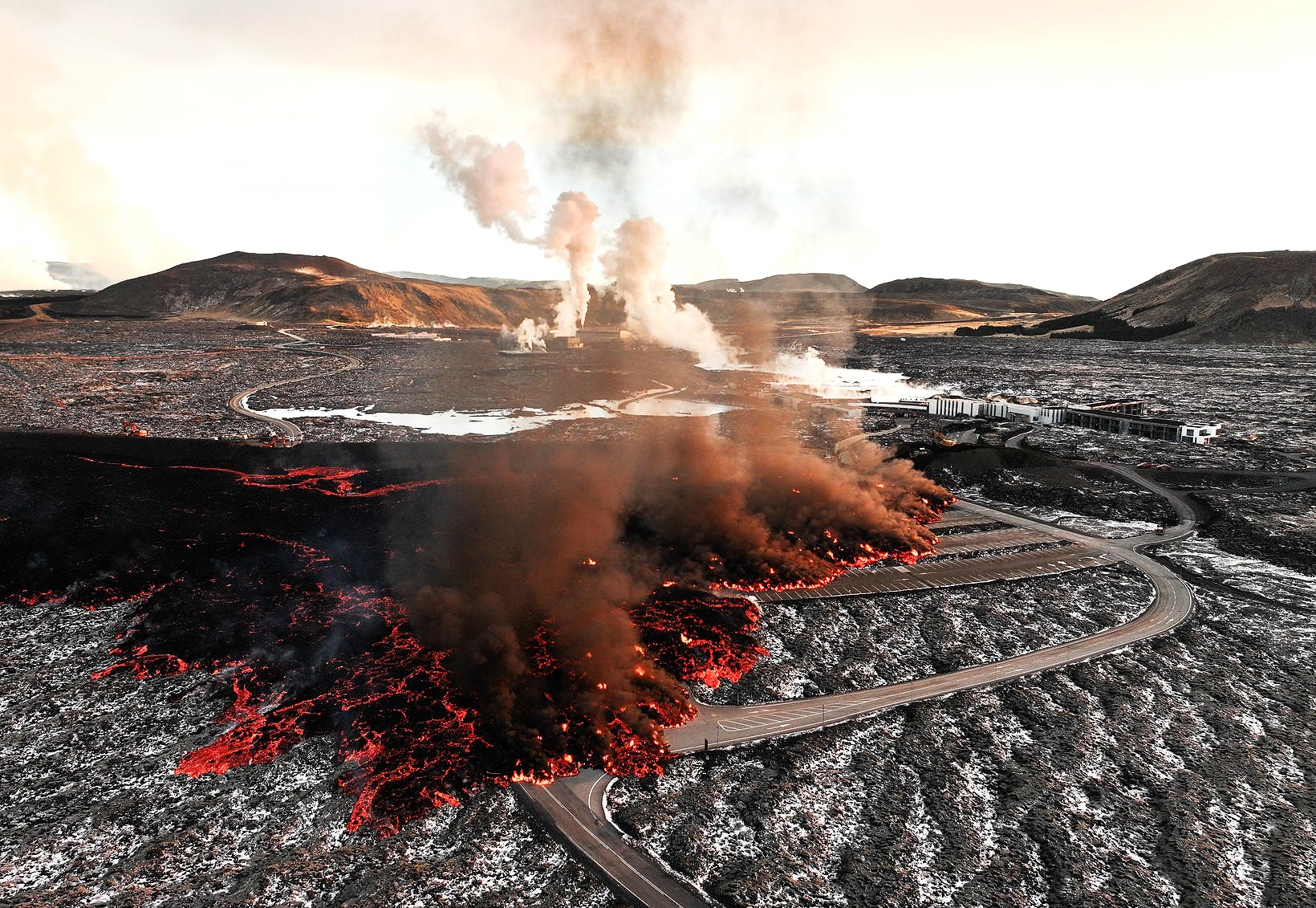
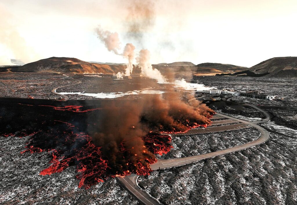
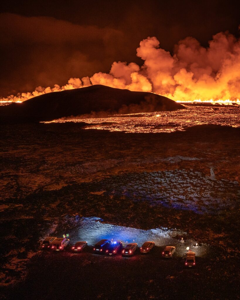
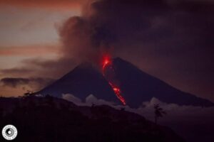
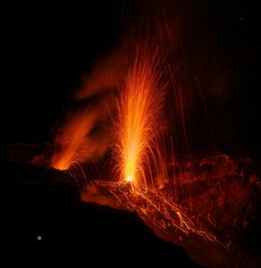
The eruption of Sundhnúksgíga continues. The fissure is still erupting in three defined areas and the most active is around its middle. The activity has remained generally stable since yesterday. The eruption is stable and no earthquakes have been recorded in the area. Land subsidence is measured at nearby GPS stations, as more magma is flowing to the surface than can accumulate in a magma chamber. Lava is still flowing west from the center of the craters and flowing along the dikes of Svartsengi and Bláa Lónið and thickening. Lava is also flowing north and east from the northernmost and southernmost craters. The forecast continues to be quite strict in the area from the northeast, so that gas pollution will mainly reach the southwest, and gas pollution could be observed in Grindavík today Saturday.
According to the lava flow models, the lava will probably continue to spread, but there is no infrastructure there. The defense walls and embankments that were worked on yesterday seem to have held, but work is underway to raise the embankments over the holes in the defense walls.
« The defense walls have held as expected, » Ari Guðmundsson, one of the supervisors of the Reykjanes Peninsula defense walls and a Verkís employee, said in an interview.
No risk of lava breaking through the defense walls
He says the holes on the Bláalónsvegur road and at the lagoon parking lot have been closed. « There is no danger at the moment that the lava flow will penetrate, but we are raising and reinforcing the closure to make sure. »
Activity Remains Stable in Three Vents Along the Eruptive Fissure
Updated 23 November 16:00 UTC
Eruptive activity in three vents has been relatively steady since yesterday
Seismic activity remains low and land continues to subside at Svartsengi,
The progression of lava flow near Svartsengi continues causing strain on the protective barriers
Hazard assessment is valid until November 25th, unless stated otherwise.
Eruptive activity between Stóra-Skógfell and Sýlingarfell continues. Since yesterday, activity in three areas along the eruptive fissure have remained fairly stable.
Seismic activity remains low and land continues to subside at Svartsengi, consistent with significant magma outflow to the eruption.
The lava flow that crossed Grindavíkurvegur and the hot water pipeline to the west has continued travelling westward. The lava flow is causing some strain on the protective barriers around Svartsengi.
Gas dispersion forecast: Northeasterly and northerly wind today (Saturday) and tomorrow. Gas pollution will be advected to the southwest and south towards Grindavík and Svartsengi. Wildfires are not expected.
Source : IMO, MBL . IS , IMO .
Photos : mbl . is/Eggert Jóhannesson , Jakob Vegerfors .
Indonesia , Dempo :
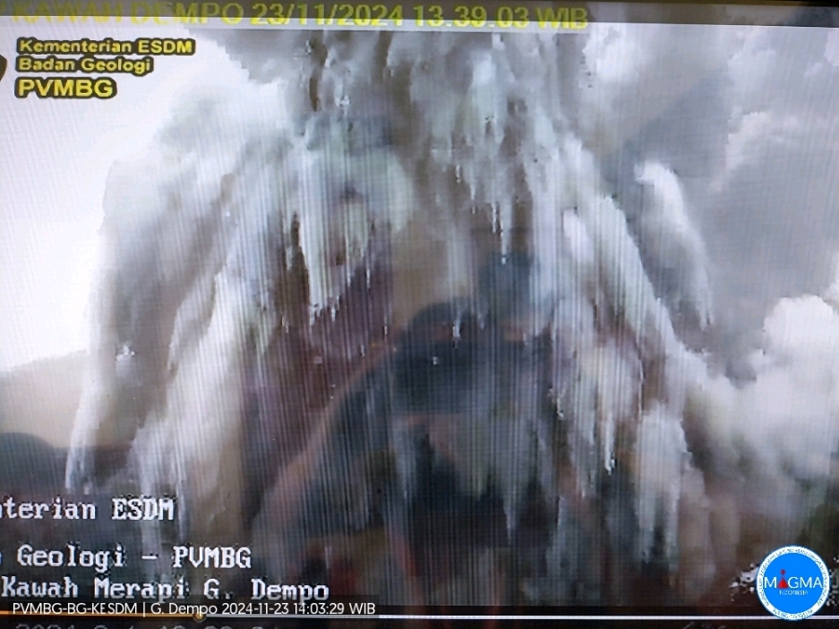
Mount Dempo erupted on Saturday, November 23, 2024 at 1:38 PM WIB with the height of the ash column observed at ± 200 m above the summit (± 3373 m above sea level). The ash column was observed to be gray with a thick intensity, oriented towards the North. This eruption was recorded on a seismograph with a maximum amplitude of 30 mm and a duration of 240 seconds.
VOLCANO OBSERVATORY NOTICE FOR AVIATION – VONA
Issued : November 23 , 2024
Volcano : Dempo (261230)
Current Aviation Colour Code : YELLOW
Previous Aviation Colour Code : yellow
Source : Dempo Volcano Observatory
Notice Number : 2024DEM004
Volcano Location : S 04 deg 01 min 48 sec E 103 deg 07 min 48 sec
Area : South Sumatra, Indonesia
Summit Elevation : 10154 FT (3173 M)
Volcanic Activity Summary :
Increasing in volcanic activity.
Volcanic Cloud Height :
Best estimate of ash-cloud top is around 10794 FT (3373 M) above sea level or 640 FT (200 M) above summit. May be higher than what can be observed clearly. Source of height data: ground observer.
Other Volcanic Cloud Information :
Ash cloud moving to north. Volcanic ash is observed to be gray. The intensity of volcanic ash is observed from medium to thick.
Remarks :
Eruption recorded on seismogram with maximum amplitude 30 mm and maximum duration 240 second. Tremor recorded on seismogram with maximum amplitude 1 mm.
Source et photo : Magma Indonésie.
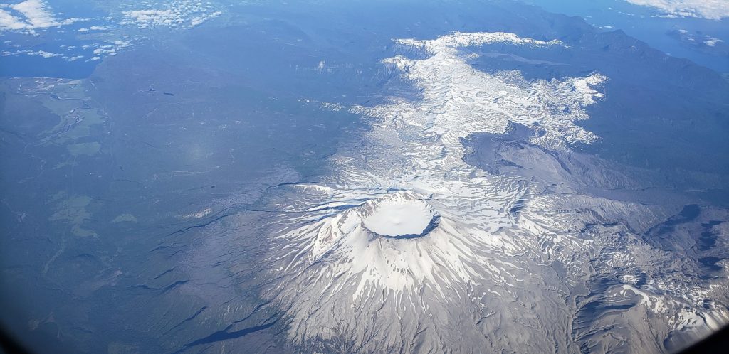
Chile , Puyehue / Cordon Caulle :
Seismology
The seismological activity of the period was characterized by the recording of:
61 VT type seismic events, associated with rock fracturing (Volcano-Tectonic). The most energetic earthquake had a Local Magnitude (ML) value equal to 2.0, located 1.5 km to the East-Southeast and with a depth of 4.7 km in reference to the 2011 crater.
3 LP type seismic events, associated with fluid dynamics within the volcanic system (Long Period). The size of the largest earthquake evaluated from the Reduced Displacement (DR) parameter was equal to 4 cm2.
Fluid Geochemistry
No anomalies were reported in sulfur dioxide (SO2) emissions into the atmosphere in the area near the volcanic complex, according to data published by the Tropopheric Monitoring Instrument (TROPOMI) and the Ozone Monitoring Instrument (OMI) Sulphur Dioxide Group.
Thermal anomalies by satellites
Over the period, 1 thermal alert was recorded on November 14, with a volcanic radiative power (VPR) of 2 MW, according to data processed by the MIROVA site. According to the analytical processing of Sentinel 2-L2A satellite images, in combination with false color bands, no abnormal radiance is observed on the Volcanic Complex. Concerning the processing of Landsat 8-9 images, the results obtained do not represent variations attributable to volcanic activity.
Geodesy
According to the data obtained by the radar interferometry technique (InSar), a deformation pattern similar to that observed in previous periods is observed with a maximum uplift rate of 1.0 cm/month.
Surveillance cameras
The images provided by the fixed camera, installed near the volcanic complex, did not record degassing columns or variations related to surface activity.
Satellite geomorphological analysis
Thanks to the analysis of Sentinel 2 and Planet Scope Scene satellite images, no morphological changes attributable to volcanic activity are detected.
The most notable aspects that led to this change in alert are related to seismicity and deformation. The inflationary deformation process continues with rates similar to those observed in recent months. Seismicity continues to be spatially distributed in nearby sources and with a trend where magnitudes are low.
In conclusion, the continuity in the deformation and the presence of seismicity allows to maintain the volcanic technical alert in: YELLOW TECHNICAL ALERT: Changes in the behavior of volcanic activity.
Source : Sernageomin
Photo : Wikipedia
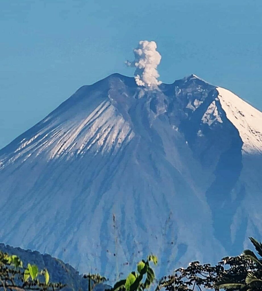
Ecuador , Sangay :
DAILY STATE REPORT OF SANGAY VOLCANO , Saturday, November 23, 2024 .
Information Geophysical Institute – EPN.
Surface Activity Level: Moderate , Surface Trend: No change
Internal Activity Level: High , Internal Trend: No change
Seismicity: From November 22, 2024, 11:00 a.m. to November 23, 2024, 11:00 a.m. :
Seismicity:
Below is the count of seismic events recorded at the reference station
Explosion (EXP): 201
Precipitation / Lahars:
No rain has been recorded in the volcano area. **In the event of heavy rain, it could remobilize the accumulated materials, generating mud and debris flows that would descend the sides of the volcano and flow into adjacent rivers.
Emissions / ash columns:
Since yesterday, due to unfavorable weather conditions, it has not been possible to observe ash columns, with the exception of short episodes that allowed an emission to be visualized, at a height of 900 meters above the crater level, towards the South-Southwest. In relation to this low activity, the W-VAAC agency has not published any activity reports for this volcano either.
Other monitoring parameters:
The FIRMS and MIROVA satellite systems do not record thermal anomalies.
Observation:
Since yesterday, due to unfavorable weather conditions, no incandescence episodes have been observed by surveillance cameras. Similarly, the volcano has remained cloudy most of the time.
Alert level: yellow
Source : IGEPN
Photo : Morona Digital ( 24 / 09/2024)
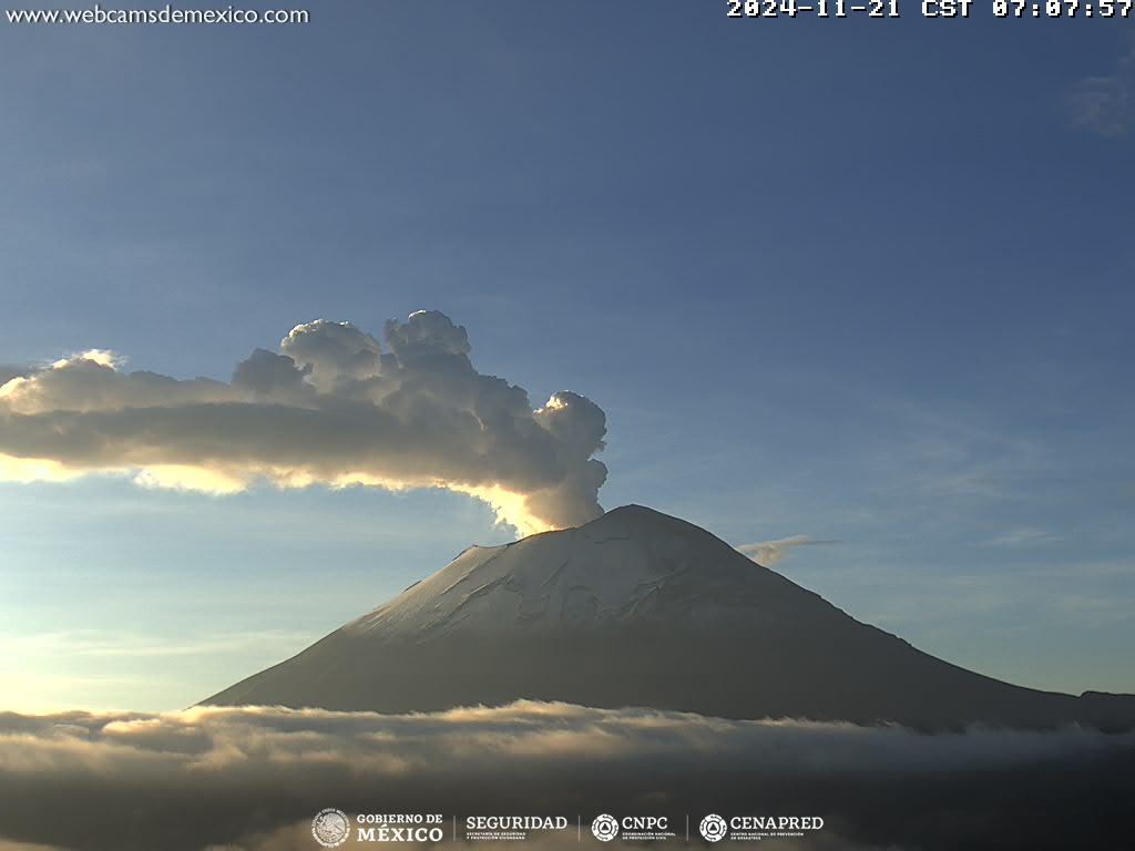
Mexico , Popocatepetl :
November 23, 11:00 (November 23, 17:00 GMT), Activity in the last 24 hours
70 exhalations were detected, accompanied by water vapor, volcanic gases and small amounts of ash. In addition, 111 minutes of very low amplitude tremor were recorded, including 88 minutes at high frequency and 23 harmonic minutes.
During the morning and at the time of this report, a continuous emission of water vapor, volcanic gases and ash was observed, with dispersion towards the South (S) of the crater.
The Popocatépetl volcanic alert fire is in yellow phase 2.
The scenarios anticipated for this phase are:
A few small to moderate explosions
Occurrence of tremors of varying amplitude
Light to moderate ash rains in the surrounding towns and in some more distant towns
Ejection of incandescent fragments within the 12-kilometer exclusion radius
The occurrence of lahars can be expected to descend into the ravines, due to the accumulation of ash on the slopes and its interaction with the rains expected in the coming weeks.
Possibility of pyroclastic flows not reaching the populations.
Source : Cenapred

