November 8 , 2024 .
Indonesia , Lewotobi Laki-laki :
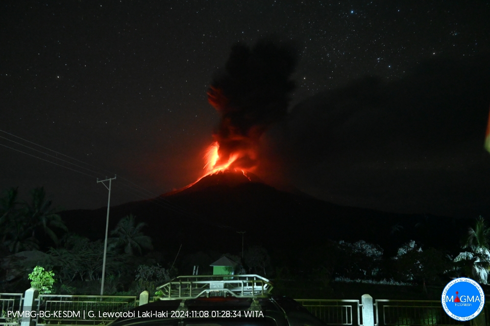
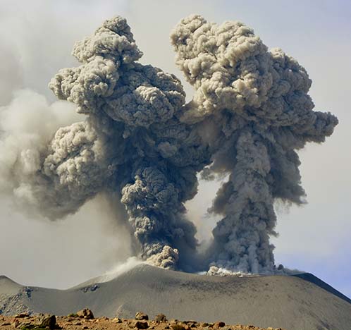
An eruption of Lewotobi Laki-laki occurred on Friday, 8 November 2024 at 01:25 WITA with the height of the ash column observed at ±2000 m above the summit (±3584 m above sea level). The ash column was observed to be grey with thick intensity, oriented towards the north and northwest. At the time of writing this report, the eruption was still ongoing.
VOLCANO OBSERVATORY NOTICE FOR AVIATION – VONA
Issued : November 08 , 2024
Volcano : Lewotobi Laki-laki (264180)
Current Aviation Colour Code : RED
Previous Aviation Colour Code : red
Source : Lewotobi Laki-laki Volcano Observatory
Notice Number : 2024LWK729
Volcano Location : S 08 deg 32 min 20 sec E 122 deg 46 min 06 sec
Area : East Nusa Tenggara, Indonesia
Summit Elevation : 5069 FT (1584 M)
Volcanic Activity Summary :
Eruption with volcanic ash cloud at 17h25 UTC (01h25 local).
Volcanic Cloud Height :
Best estimate of ash-cloud top is around 11469 FT (3584 M) above sea level or 6400 FT (2000 M) above summit. May be higher than what can be observed clearly. Source of height data: ground observer.
Other Volcanic Cloud Information :
Ash cloud moving from north to northwest. Volcanic ash is observed to be gray. The intensity of volcanic ash is observed to be thick.
Remarks :
Eruption recorded on seismogram with maximum amplitude 47.3 mm and maximum duration 162 second.
Source and photo : Magma Indonésie.
Kamchatka , Sheveluch :
VOLCANO OBSERVATORY NOTICE FOR AVIATION (VONA)
Issued: November 07 , 2024
Volcano: Sheveluch (CAVW #300270)
Current aviation colour code: RED
Previous aviation colour code: orange
Source: KVERT
Notice Number: 2024-90
Volcano Location: N 56 deg 38 min E 161 deg 18 min
Area: Kamchatka, Russia
Summit Elevation: 3283 m (10768.24 ft), the dome elevation ~2500 m (8200 ft)
Volcanic Activity Summary:
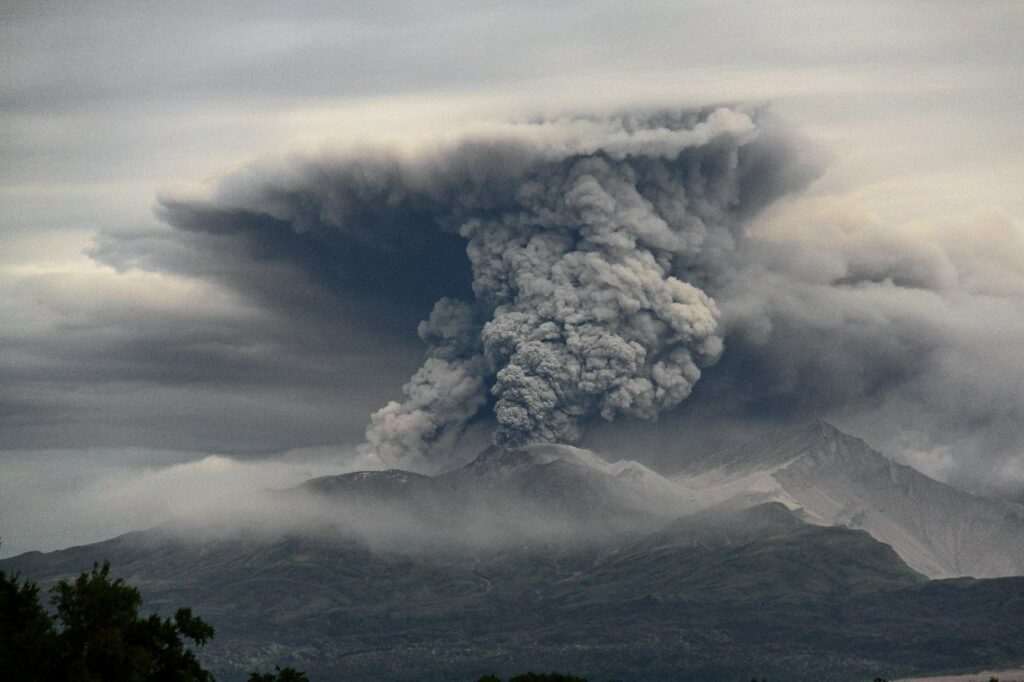
Strong explosive eruption of Sheveluch volcano (near Karan lava dome probably) began about 09:20 UTC November 07. Explosions sent ash up to 10-11 km a.s.l., a large ash cloud is drifting to the east-north-east of the volcano.
An explosive-extrusive eruption of the volcano continues. Ash explosions up to 15 km (49,200 ft) a.s.l. could occur at any time. Ongoing activity could affect international and low-flying aircraft.
Volcanic cloud height:
10000-11000 m (32800-36080 ft) AMSL Time and method of ash plume/cloud height determination: 20241107/0946Z – NOAA-19 4m5
Other volcanic cloud information:
Distance of ash plume/cloud of the volcano: 22 km (14 mi)
Direction of drift of ash plume/cloud of the volcano: ENE / azimuth 58 deg
Time and method of ash plume/cloud determination: 20241107/0946Z – NOAA-19 4m5
Start time of explosion and how determined: 20241107/0920Z – Satellite data
Source : Kvert
Photo : Viktor Frolov ( 08/2024)
Chile , Descabezado Grande :
Special Report on Volcanic Activity (REAV), Del Maule Region, Descabezado Grande Volcanic Complex, November 8, 2024, 02:05 local time (Continental Chile)
The National Geology and Mining Service of Chile (Sernageomin) announces the following PRELIMINARY information, obtained through the monitoring equipment of the National Volcanic Monitoring Network (RNVV), processed and analyzed at the Volcanological Observatory of the Southern Andes (Ovdas):
On Friday, November 8, 2024 at 01:40 local time (04:40 UTC), monitoring stations installed near the Descabezado Grande volcanic complex recorded an earthquake associated with the fracturing of rocks within the volcanic system (VT volcano-tectonic type).
The characteristics of the earthquake after its analysis are as follows:
TIME OF ORIGIN: 01:40 local time (04:40 UTC)
LATITUDE: 35.569° S
LONGITUDE: 70.737° West
DEPTH: 3.7 km
LOCAL MAGNITUDE: 3.4 (ML)
Observations:
No changes in the seismic behavior of the volcano were recorded after the event.
The volcanic technical alert remains at Green level.
Source : Sernageomin.
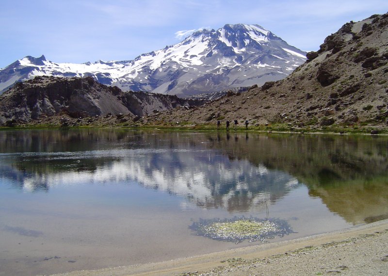
Photo : Wikiheinz
Colombia , Nevado del Ruiz :
Manizales, November 5, 2024, 8:30 p.m.
From the monitoring of the activity of the Nevado del Ruiz volcano, the Colombian Geological Survey (SGC), an entity attached to the Ministry of Mines and Energy, reports that:
During the week of October 29 to November 4, 2024, the volcano continued with unstable behavior. Compared to the previous week, the main variations in the monitored parameters were:
– Seismicity related to the activity of fluids inside volcanic conduits increased in the number of earthquakes recorded and in the seismic energy released. In general, signals associated with pulsatile ash emissions predominated. The energy levels of these events ranged mainly between low and moderate, with several high values occasionally recorded this week. Thanks to the cameras (conventional or thermographic) used to monitor the volcano and the reports received by the inhabitants of the volcanic influence zone, it was possible to confirm the emissions of ash and changes in the temperature of the emitted materials, associated with some of these earthquakes.
– The seismic activity associated with the fracturing of the rocks inside the volcanic edifice increased in the number of earthquakes recorded and in the seismic energy released. The earthquakes were located on the North-Northwest, North-Northeast to Northeast and South-Southeast flanks, as well as in the Arenas crater. The earthquakes were recorded at distances of less than 8 km from the crater and their depths varied between less than 1 km and 9 km from the summit of the volcano. The highest magnitude of the week was 2.5, corresponding to the earthquake recorded on October 30 at 00:55, located 3 km south-southeast of the Arenas crater, at a depth of 4 km. This earthquake occurred during a seismic wave on the same day.
It should be noted that during the week, several seismic increases were recorded, highlighting the one that occurred between November 2 and 4 on the North-Northwest flank, at an average distance of 7 km from the crater. During this increase, four events were recorded with magnitudes greater than 2.0 and a maximum magnitude of 2.4, corresponding to the earthquakes of November 2 at 16:43 and November 3 at 20:13, both at a depth of 8 km. In addition, the seismicity related to the activity of the lava dome (protuberance or mound) located at the bottom of the crater increased in the number of earthquakes and maintained low energy levels.
– The emission of water vapor and gas into the atmosphere continued from the Arenas crater. Sulfur dioxide (SO2) degassing rates were variable and changes could not be determined compared to the previous week, as the wind direction did not favor the location of the measuring stations, however, from satellite monitoring, similar values were observed.
– The maximum height of the vertical and dispersed gas column was 1800 m measured above the volcanic summit. These values were observed during the ash emission on October 30 at 02:20. The direction of dispersion of the column showed a variable tendency towards the northwest and northeast flanks of the volcano and, to a lesser extent, towards the eastern flank. According to this last wind direction, a report of ash fall and sulfur odor was received yesterday, November 4, at noon, from the Lagunilla River sector.
– When monitoring thermal anomalies at the bottom of the Arenas crater, from satellite monitoring platforms and despite the atmospheric conditions of high cloudiness in the area, some reports of low to moderate energy level anomalies were obtained.
Source : SGC
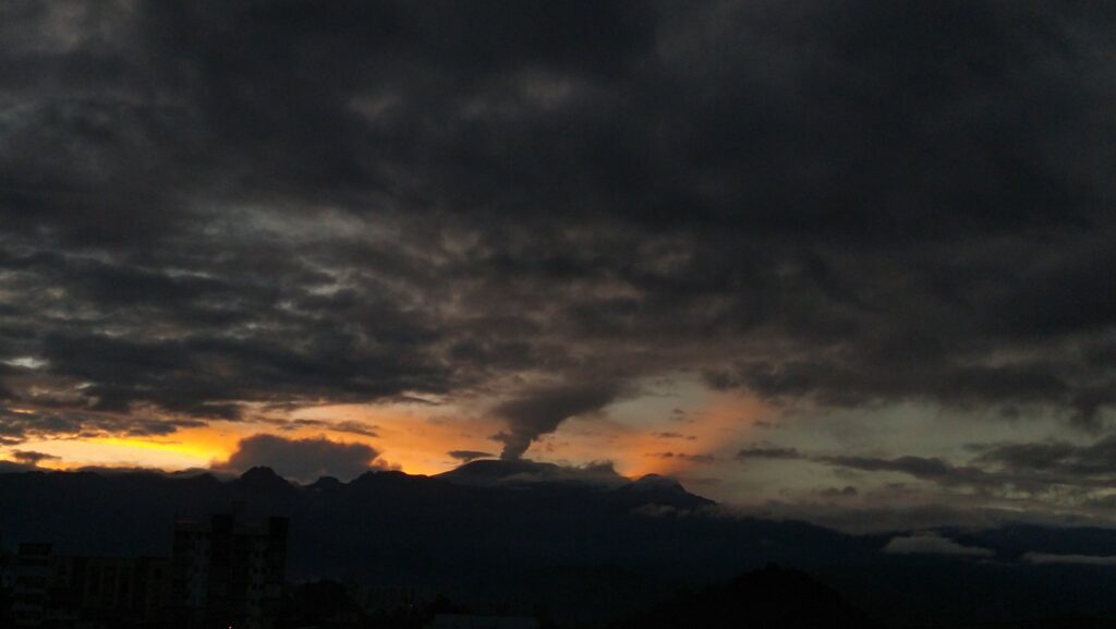
Photo : Julian Fernando Aranzazu Henao ( 01/2024).
Peru , Sabancaya :
Analysis period: from October 28, 2024 to November 03, 2024, Arequipa, November 04, 2024
Alert level: ORANGE
The Geophysical Institute of Peru (IGP) reports that the eruptive activity of the Sabancaya volcano continues. During this period, an average of 7 explosions per day have been recorded, with columns of ash and gas up to 2200 m above sea level above the summit of the volcano. Therefore, the volcanic alert level remains at ORANGE
The IGP has recorded and analyzed the occurrence of 186 earthquakes of volcanic origin, associated with the circulation of magmatic fluids inside the Sabancaya volcano, as well as earthquakes related to rock fracturing. An average of 7 explosions per day have been recorded.
Columns of ash and gas have been observed up to 2200 m above sea level above the summit of the volcano. The predominant direction of these emissions has been towards the northwest, west and southwest sectors of the volcano over a distance of less than 10 km.
A slight inflation process continues to be recorded in the northern sector (around the Hualca Hualca volcano).
Satellite recordings have identified the presence of 24 thermal anomalies, with a maximum value of 4 MW, associated with the presence of a lava body on the surface of the volcano’s crater.
Moderate emissions (745 tons/day) of sulfur dioxide (SO2) have been observed
RECOMMENDATIONS
• Maintain the orange volcanic alert level.
• Do not approach within a radius of less than 12 km of the crater.
Source : Cenvul
Photo : IGP , 04/2021

