November 04 , 2024 .
Alaska , Spurr :
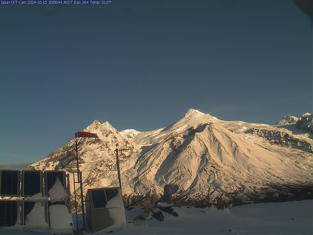
Unrest continues at Mount Spurr. The number of shallow earthquakes underneath the summit region is elevated and unchanged over the past 24 hours compared to the last few days. Clouds blocked most views of the volcano yesterday. Clearer weather today shows nothing of note.
AVO continues to closely monitor activity at Mount Spurr for signals that would indicate that the volcano is moving closer to an eruption .
Based on previous eruptions, changes from current activity in the earthquakes, ground deformation, summit lake, and fumaroles would be expected if magma began to move closer to the surface. Therefore, it is very likely that if an eruption were to occur it would be preceded by additional signals that would allow advance warning.
Local seismic, infrasound, web cameras, and GNSS stations are used to monitor Mount Spurr along with regional infrasound, lightning networks and satellite data.
Source : AVO
Photo : Boyce, Ellie / Alaska Volcano Observatory / University of Alaska Fairbanks, Geophysical Institute ,
Indonesia , Lewotobi Laki-laki :
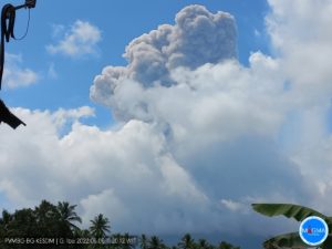
Lewotobi Laki-laki Activity Level Increased from Level III (SIAGA) to Level IV (AWAS)
The results of the assessment of the activities of Lewotobi Laki-laki for the period from October 23 to November 3, 2024 at 18:00 WITA are presented below as follows:
I. Visual Observation
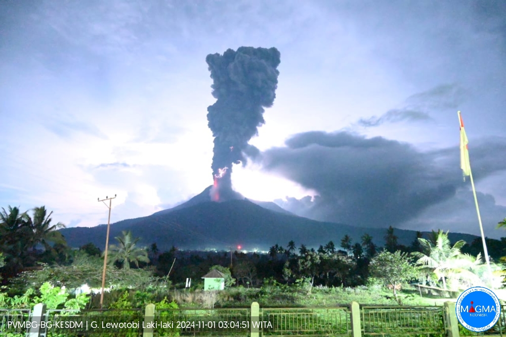
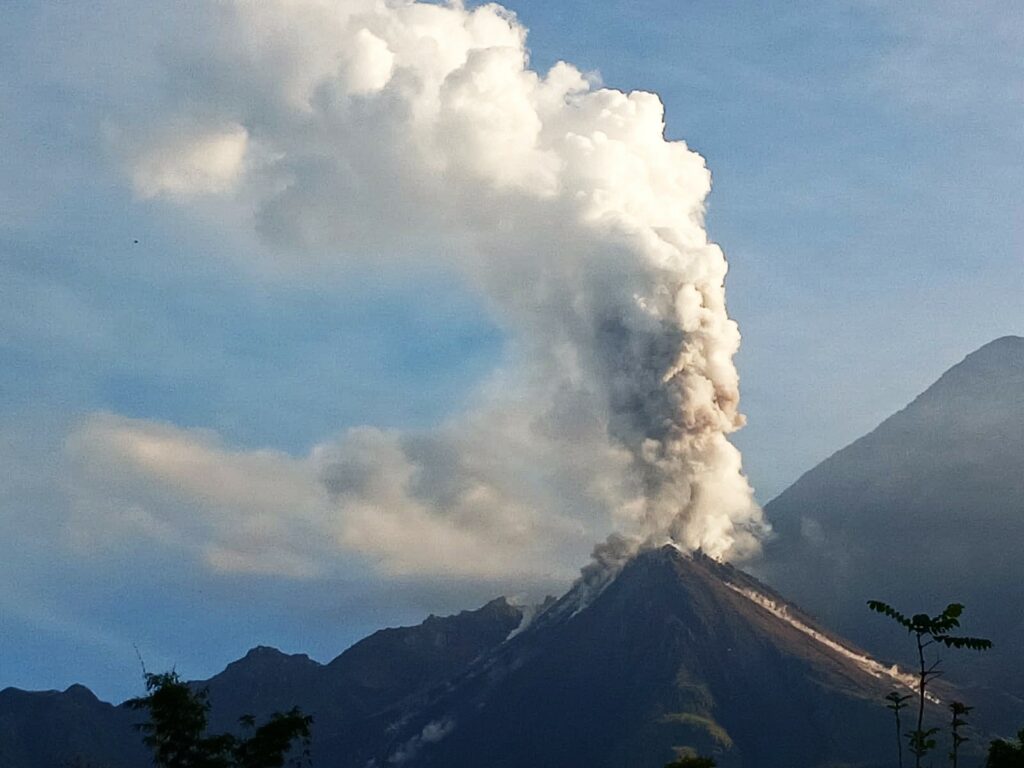
White and gray smoke was observed from the crater with low, medium to thick intensity and a height of about 20 to 2,000 meters above the summit. The average height of the eruption column is 500 to 2,000 meters, the eruption ash column is gray in color. On November 1, a Strombolian eruption occurred with an eruption column height reaching 2,000 meters above the summit and incandescence during the eruption was visible.
II. Instrumental observation
The types of earthquakes recorded during the period from October 23, 2024 to November 3, 2024 at 18:00 WITA are:
43 eruption earthquakes,
28 emission earthquakes,
94 harmonic tremors,
7 low-frequency earthquakes,
133 shallow volcanic earthquakes,
353 deep volcanic earthquakes,
26 local tectonic earthquakes,
68 distant tectonic earthquakes,
3 flood earthquakes.
Assessment
Visual observations for the period from October 23 to November 3, 2024 at 21:00 WITA show that the volcanic activity of Lewotobi Laki-laki has increased quite significantly. In the previous period, the average height of the eruptive column was 100-1,000 meters, currently the average height of the eruptive column is 500-1,000 meters. On November 1, 2024, an eruption occurred, the height of the eruptive column reaching 1,500-2,000 meters above the summit. During this period, earthquakes and flood vibrations were recorded in the Dulipali area. The mass of lava material in the northeastern part is moving very slowly, according to the Sentinel 2 satellite image dated October 29, 2024, material capable of transforming into lahars can be seen in the area to the north and east of the crater. The latest measurements made using a drone showed that the flow distance was about 4,340 meters from the center of the crater. The influence of the slope and the still high temperature of the lava still allow the lava to move, although very slowly.
Visual drone data show that the center of activity is located in two eruption vents, namely the main crater of Mount Lewotobi Laki and the vent located on the northwest side of Lewotobi Laki-laki. Eruptive activity during this period occurred more frequently in the northwest vent. Visually visible in October, the vent was larger compared to the January period. Apart from that, there are several solfatara passages on the northeast side of the crater.
Surface earthquakes have seen an increase. Deep volcanic (VA) and shallow volcanic (VB) earthquakes were recorded as having increased compared to the previous period. On November 1, 2024, between 00:00 and 24:00 WITA, 119 deep volcanic (VA), 19 shallow volcanic (VB) earthquakes and 6 harmonic tremors were recorded. On November 2, 2024, for the period 00:00-24:00 WITA, 70 deep volcanic earthquakes, 34 shallow volcanic earthquakes and 8 harmonic tremors were recorded. This is higher than the previous period when the average number of volcanic eruptions was 10 to 12 times in 1 day. Low-frequency (LF) earthquakes were still recorded during this period, indicating that magma was flowing towards the surface.
The average number of eruptions per day is 6-8 eruptions, but the last eruption earthquake was recorded on November 1, 2024 and no eruption has occurred since. This phenomenon indicates that there is a plug that prevents volcanic material from escaping. This may increase the potential for a larger eruption than in the previous period.
During this period, flood vibrations were recorded that may have occurred in the area around the river in the Dulipali area. This happened because the intensity of the rain was high, so the material accumulated in the area was carried by the current to the lower area.
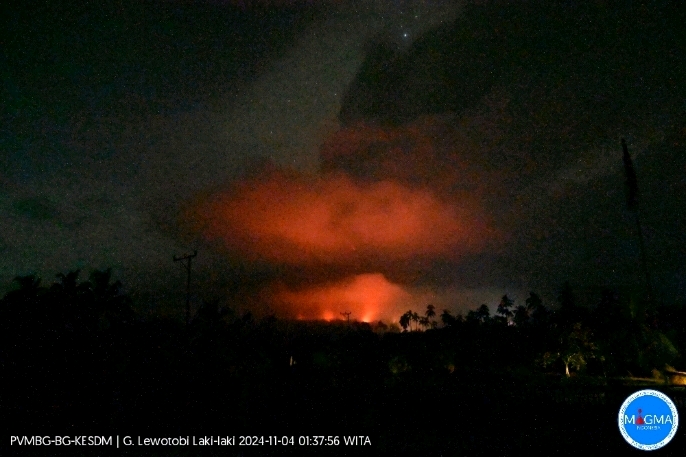
On November 3, 2024 at 23:57 WITA, there was an eruption on Lewotobi Laki-laki with an unobserved smoke column. The eruption was recorded on a seismogram with a maximum amplitude of 47.3 mm and a duration of ± 24 minutes 10 seconds.
As a result of this eruption, fires occurred in residential areas due to the ejection of incandescent materials.
On November 3, 2024 at 01:34 and 02:24 WITA, there was another eruption with an eruption force lower than the eruption at 23:57 WIB.
IV. RECOMMENDATION
Based on the results of visual and instrumental monitoring, there was a significant increase in volcanic activity on Lewotobi Laki-laki, so the activity level was raised from level III (SIAGA) to level IV (AWAS), starting from November 3, 2024 at 24:00 WITA.
Source : PVMBG
Photos : Magma Indonésie.
Italy , Stromboli :
Statement on the activity of Stromboli, 03 November 2024, 11:47 (10:47 UTC).
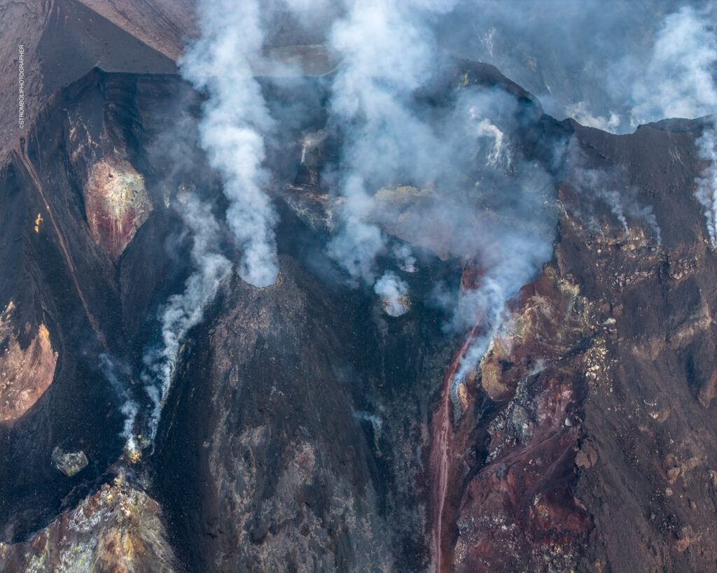
The National Institute of Geophysics and Volcanology, Osservatorio Etneo, communicates that according to the analysis of the images of the surveillance cameras, the effusive activity of the lava overflow from the North crater area reported in the previous statement has gradually dried up since the early hours of the morning. The ordinary explosive activity persists.
From a seismic perspective, since the last report at 17:58 UTC yesterday, the tremor amplitude has decreased from high to medium values around 22:00 UTC where it still remains. No significant changes have been reported in the frequency of occurrence and amplitude of explosion earthquakes.
Regarding deformations, the GNSS and inclinometric monitoring network stations do not show significant variations.
Further updates will be communicated shortly.
Source : INGV
Photo : Stromboli stati d’animo / Sebastiano Cannavo
Ecuador , Sangay :
DAILY STATE REPORT OF SANGAY VOLCANO , Sunday 03 November 2024 .
Information Geophysical Institute – EPN.
Surface Activity Level: High , Surface Trend: No change
Internal Activity Level: High , Internal Trend: No change
Seismicity: From 02 November 2024 , 11:00h to 03 November 2024 , 11:00h :
Seismicity:
Below is the count of seismic events recorded at the reference station
Explosion (EXP): 68
Rainfall/Lahars:
Thanks to surveillance cameras and satellite images, the presence of rain was observed in the area, without lahars being generated. **Heavy rains could remobilize the accumulated materials and generate mudflows with debris (lahars) that could descend on the sides of the volcano, or even flow into adjacent rivers.
Emissions/ash column:
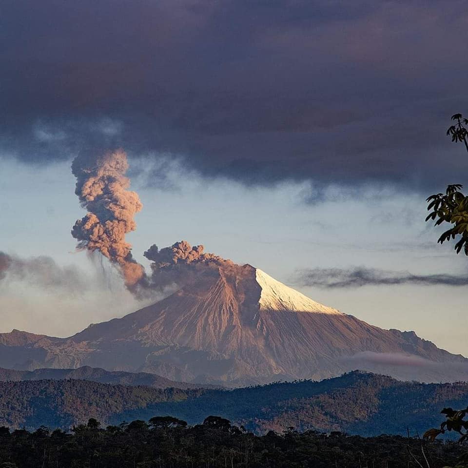
Thanks to cameras, an emission of gas and ash was observed, the column of which reached 1000 meters above the level of the crater, in a southwest direction. In relation to this activity, the VAAC agency in Washington generated an emission report, with a column height equal to 1200 meters above the level of the crater, oriented towards the southwest.
Observation:
The volcano remained cloudy. However, during the night, thanks to the surveillance camera system, several periods of incandescence were observed at the crater.
Alert level: yellow
Source : IGEPN
Photo : Volcan Sangay / FB.
Guatemala , Santiaguito :
Atmospheric conditions: Clear.
Wind: Northeast.
Precipitation: 10.0 mm.
Activity:
The Santa María-Santiaguito Volcanic Complex Observatory reports favorable atmospheric conditions for observing the Caliente Dome. Between 3 and 5 moderate explosions have been recorded that raise columns of grayish gas and ash with heights between 700 and 900 meters above the dome, which move southwest and west in the direction of the wind. These explosions are accompanied by low degassing noises, similar to those of an airplane turbine. Incandescence has been observed above the crater as well as on the lava flows that descend on the southern and western flanks of the volcanic edifice.
Due to the wind direction, a low ash fall is expected in communities such as Loma Linda, San Marcos Palajunoj and their surroundings. During the afternoon and evening, rains could cause lahars to descend into the channels descending from the Domo Caliente. The activity remains at a high level, so there is the possibility that, due to explosions or gravity, some of the accumulated material could collapse and generate pyroclastic flows over long distances towards the southwest, south and southeast.
Source : Insivumeh .
Photo : Conred ( 10/2024).

