October 29 , 2024.
Philippines , Kanlaon :
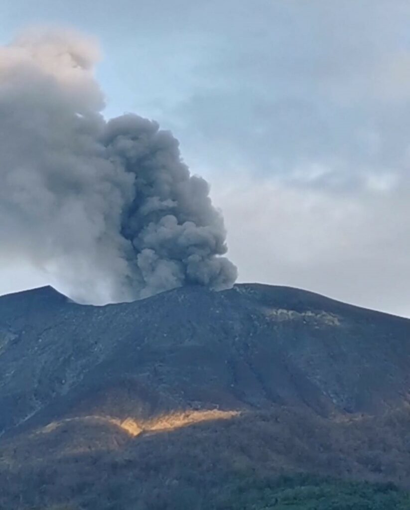
KANLAON VOLCANO ADVISORY , 28 October 2024 , 10:00 PM
Notice of elevated volcanic SO2 gas flux at Kanlaon Volcano.
Volcanic sulfur dioxide (SO2) gas emission from the summit crater of Kanlaon based on campaign Flyspec measurements today, 28 October 2024, averaged 10,074 tonnes/day. This is the 5th highest emission from the volcano recorded since instrumental gas monitoring began. Kanlaon has been degassing increased concentrations of volcanic SO2 this year at an average rate of 1,273 tonnes/day prior to the 3 June 2024 eruption, but emission since then has been particularly elevated at a current average of 4,210 tonnes/day. Sulfuric fumes were reported in Brgy. Masulog and Canlaon City proper and, to a lesser degree, in Brgys. Panubigan and Binalbagan, Canlaon City. Prolonged exposure to volcanic SO2, especially of communities within direct reach of accumulation from plumes during low wind conditions, can cause irritation of the eyes, throat and respiratory tract. People who may be particularly sensitive are those with health conditions such as asthma, lung disease and heart disease, the elderly, pregnant women and children. For communities that can be affected by volcanic SO2, please be mindful of the following.
The public is reminded that Alert Level 2 (increasing unrest) prevails over Kanlaon, but that current activity may lead to eruptive unrest and an increase in the Alert Level. The public is strongly advised to be ready and vigilant, and to avoid entry into the four (4) kilometer-radius Permanent Danger Zone (PDZ) to minimize risks from volcanic hazards such as pyroclastic density currents, ballistic projectiles, rockfall and others. In case of ash fall events that may affect communities downwind of Kanlaon’s crater, people should cover their nose and mouth with a damp, clean cloth or dust mask. Civil aviation authorities must also advise pilots to avoid flying close to the volcano’s summit as ash and ballistic fragments from sudden eruption can be hazardous to aircraft. Communities living beside river systems on the southern and western slopes, especially those that have already experienced lahars and muddy streamflows, are advised to take precautionary measures when heavy rainfall over the volcano has been forecast or has begun.
DOST-PHIVOLCS maintains close monitoring of Kanlaon Volcano and any new development will be immediately communicated to all concerned stakeholders.
Source : DOST-PHIVOLCS
Photo : Norbert Gallosa , 18/10/224
Mexico , Popocatepetl :
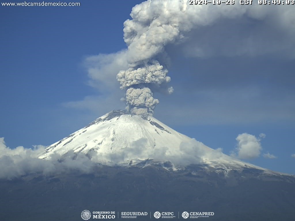
October 28, 11:00 (October 28, 17:00 GMT) , Activity of the last 24 hours
5 exhalations were detected, accompanied by water vapor, volcanic gases and ash. In addition, 1,426 minutes of high-frequency tremors of very low to moderate amplitude were recorded.
The National Center for Communication and Civil Protection Operations (Cenacom) reported yesterday a slight ash fall in the municipality of Tetela del Volcán, Hueyapan and Tlaltizapán, Morelos, as well as in Tlaxcala, Chiautempan and Zacatelco, Tlaxcala.
During the morning and at the time of this report, a continuous emission of water vapor, volcanic gases and ash is observed with dispersion towards the Northeast (NE).
The Popocatépetl volcanic alert fire is in yellow phase 2.
The scenarios anticipated for this phase are:
A few small to moderate explosions
Occurrence of tremors of varying amplitude
Light to moderate ash rains in the surrounding towns and in some more distant towns
Ejection of incandescent fragments within the 12-kilometer exclusion radius
The occurrence of lahars can be expected to descend into the ravines, due to the accumulation of ash on the slopes and its interaction with the rains expected in the coming weeks.
Possibility of pyroclastic flows not reaching the populations
Source et photo : Cenapred
Indonesia , Ibu :
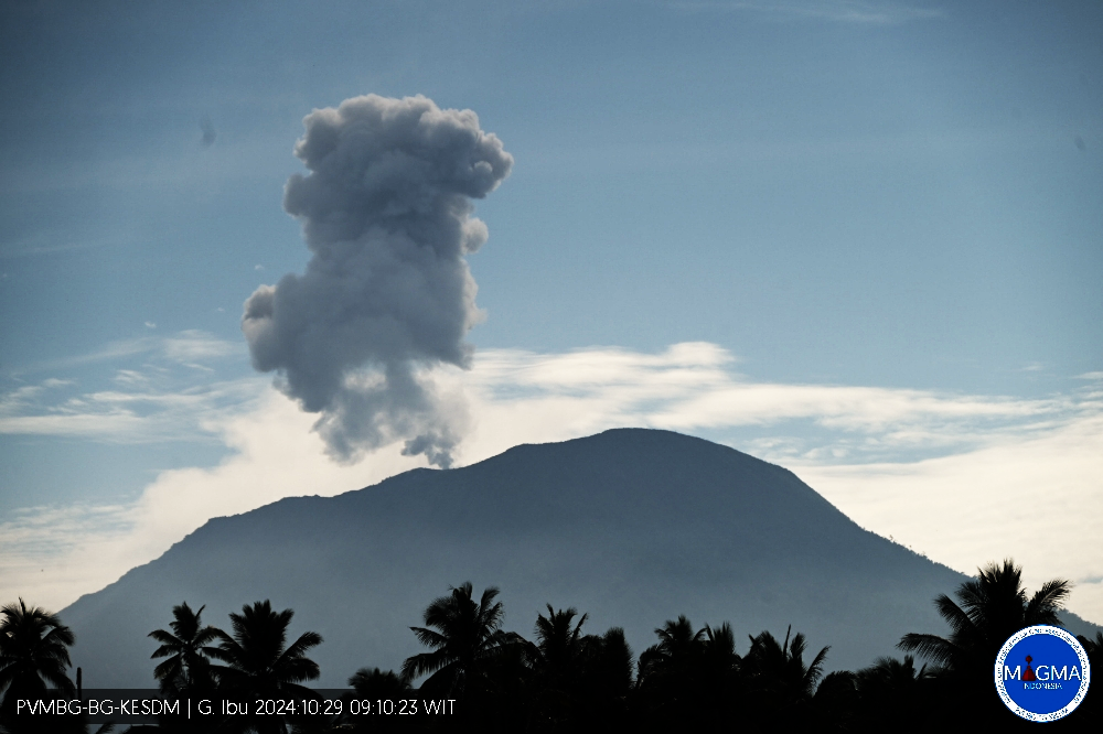
Mount Ibu erupted on Tuesday, 29 October 2024 at 09:08 WIT with the height of the ash column observed at ± 800 m above the summit (± 2,125 m above sea level). The ash column was grey in colour with a thick intensity, oriented towards the North-East. This eruption was recorded on a seismograph with a maximum amplitude of 28 mm and a duration of 63 seconds.
VOLCANO OBSERVATORY NOTICE FOR AVIATION – VONA
Issued : October 29 , 2024
Volcano : Ibu (268030)
Current Aviation Colour Code : ORANGE
Previous Aviation Colour Code : orange
Source : Ibu Volcano Observatory
Notice Number : 2024IBU968
Volcano Location : N 01 deg 29 min 17 sec E 127 deg 37 min 48 sec
Area : North Maluku, Indonesia
Summit Elevation : 4240 FT (1325 M)
Volcanic Activity Summary :
Eruption with volcanic ash cloud at 00h08 UTC (09h08 local).
Volcanic Cloud Height :
Best estimate of ash-cloud top is around 6800 FT (2125 M) above sea level or 2560 FT (800 M) above summit. May be higher than what can be observed clearly. Source of height data: ground observer.
Other Volcanic Cloud Information :
Ash cloud moving to northeast. Volcanic ash is observed to be gray. The intensity of volcanic ash is observed to be thick.
Remarks :
Eruption recorded on seismogram with maximum amplitude 28 mm and maximum duration 63 second.
Source et photo : Magma Indonésie
Colombia , Nevado de Santa Isabel :
Manizales, October 22, 2024, 9:40 p.m.
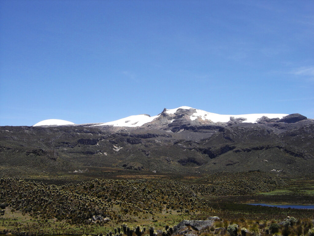
From the monitoring of the activity of the Nevado de Santa Isabel volcano, the Colombian Geological Survey (SGC), an entity attached to the Ministry of Mines and Energy, reports that:
For the week of October 15 to 21, 2024, the recording of seismic activity associated with the fracturing of rocks inside the volcanic edifice continued. This seismicity increased slightly in the number of earthquakes and maintained levels of released seismic energy similar to those of the previous week. The earthquakes recorded were of magnitudes less than 1 (low energy level) and were located mainly in the East-Northeast sector of the volcanic structure, at distances less than 7 km from its central part.
The depths of the earthquakes varied between 3 km and 5 km.
The carbon dioxide (CO2) flows measured in the La Azufrera sector, southwest of the volcano, remained within a stable range.
The other parameters measured and used for the diagnosis of volcanic activity did not present significant changes during the period evaluated.
Based on the above, at the SGC we recommend closely monitoring the evolution through weekly bulletins and other information published through our official channels, as well as the instructions of the local, departmental and governmental authorities of the National Disaster Risk Management Unit (UNGRD).
The status due to volcanic activity remains in yellow alert: active volcano with changes in the behavior of the base level of the monitored parameters and other manifestations.
Source et photo: SGC
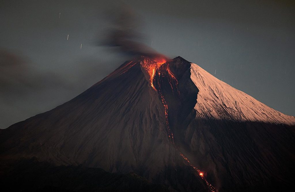
Ecuador , Sangay :
DAILY STATE REPORT OF SANGAY VOLCANO , Monday, October 28, 2024 .
Information Geophysical Institute – EPN.
Surface Activity Level: High , Surface Trend: No change
Internal Activity Level: High , Internal Trend: No change
Seismicity: From October 27, 2024, 11:00 a.m. to October 28, 2024, 11:00 a.m. :
Seismicity:
Below is the count of seismic events recorded at the reference station
Explosion (EXP): 183
Rainfall/Lahars:
In the early morning hours, thanks to surveillance cameras and satellite images, the presence of rain was observed in the area, without lahars being generated. **Heavy rains could remobilize the accumulated materials and generate mudflows with debris (lahars) that could descend on the sides of the volcano, or even flow into adjacent rivers.
Column emissions/ash:
Thanks to the surveillance camera system, an emission of gas and water vapor was observed with a column height equal to 1,500 meters above the crater level, in a southwest direction. On the other hand, due to bad weather conditions, it was not possible to identify gas and ash emissions using satellite images. Similarly, the VAAC agency in Washington has not published any emission reports in the last 24 hours.
Gas:
The Mounts satellite system detected 13.8 tons of sulfur dioxide (SO2), measured yesterday at 13:20 TL.
Observation:
Since yesterday afternoon and until the submission of this report, the volcano has remained completely cloudy.
Alert level: yellow
Source : IGEPN
Photo : Eqphos_fotografía

