October 06 , 2024.
Philippines , Taal :
TAAL VOLCANO ADVISORY , 5 October 2024 , 1:30 PM
Notice for minor phreatomagmatic activity at Taal Volcano.
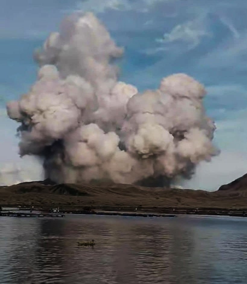
A minor phreatomagmatic eruption at the Taal Main Crater occurred at 11:32 AM today, 05 October 2024, which lasted four (4) minutes based on visual, seismic and infrasound records of the Taal Volcano Network (TVN). The event produced a short black jetted plume followed by a steam-rich plume that rose 2,000 meters above the Main Crater before drifting southwest based on IP camera monitors. Prior to this, a total of five (5) phreatic events were recorded today. Traces of ash were reported in areas of Agoncillo, Batangas. In total, thirty (30) minor eruptive events have been recorded since 22 September 2024.
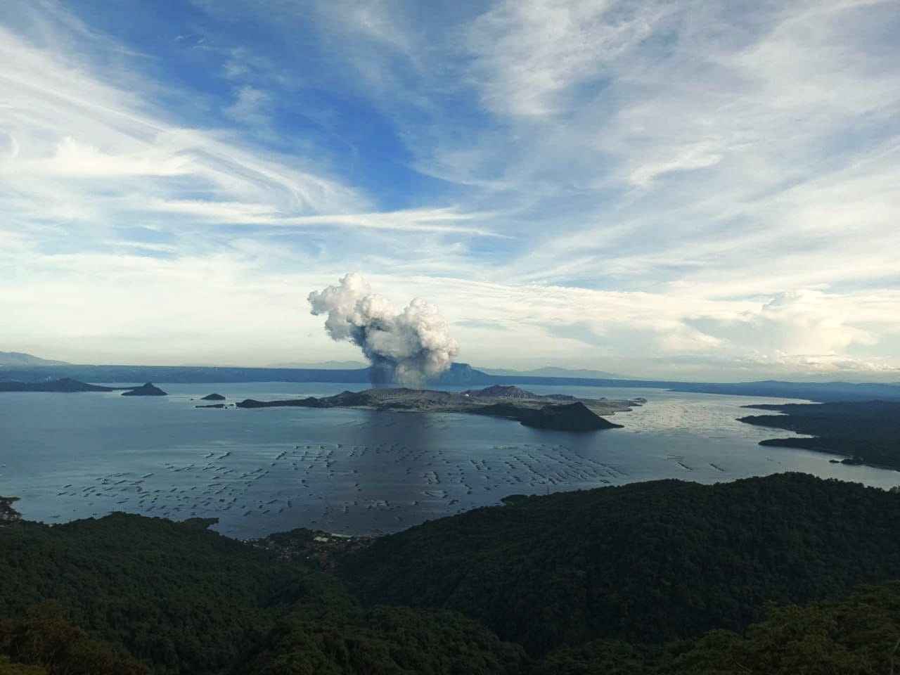
Meanwhile, sulfur dioxide (SO2) emissions yesterday 04 October 2024 averaged 3,276 tonnes/day. Nonetheless, average SO2 emissions since January this year remain high at 6,673 tonnes/day. The phreatomagmatic event was likely driven by sudden contact of water with a small branch of shallow magma that has been in place beneath the Taal Main Crater and that has been degassing sustained levels of SO2 for the past three years. The background levels of volcanic earthquake activity and ground deformation detected at Taal indicate that unrest is unlikely to progress into a major magmatic eruption at this time.
DOST-PHIVOLCS reminds the public that Alert Level 1 prevails over Taal Volcano, which means that it is still in abnormal condition and should not be interpreted to have ceased unrest nor ceased the threat of eruptive activity. At Alert Level 1, sudden steam-driven or phreatic explosions, volcanic earthquakes, minor ashfall and lethal accumulations or expulsions of volcanic gas can occur and threaten areas within the Taal Volcano Island (TVI). Should phreatomagmatic activity at Taal persist or intensify, then the Alert Level may be raised to Alert Level 2. Furthermore, degassing of high concentrations of volcanic SO2 continues to pose the threat of potential long-term health impacts to communities around Taal Caldera that are frequently exposed to volcanic gas.
DOST-PHIVOLCS strongly recommends that entry into TVI, Taal’s Permanent Danger Zone or PDZ, especially the vicinities of the Main Crater and the Daang Kastila fissure, must remain strictly prohibited. Local government units are advised to continuously monitor and assess preparedness of their communities and undertake appropriate response measures to mitigate hazards that could be posed by long-term degassing and related phreatic activity. Civil aviation authorities must advise pilots to avoid flying close to the volcano as airborne ash and ballistic fragments from sudden explosions and wind-remobilized ash may pose hazards to aircrafts.
DOST-PHIVOLCS is closely monitoring Taal Volcano’s activity and any new significant development will be immediately communicated to all stakeholders.
Source : DOST-PHIVOLCS.
Photos : Gmanetwork. Inconnu via Wulkany swiata / FB.
Indonesia , Lewotobi Laki-laki :
An eruption of Lewotobi Laki occurred on Saturday, October 5, 2024 at 15:44 WITA with the height of the ash column observed at ±1000 m above the summit (±2584 m above sea level). The ash column was observed to be gray with thick intensity, oriented towards the West. At the time of writing this report, the eruption was still ongoing.

VOLCANO OBSERVATORY NOTICE FOR AVIATION – VONA
Issued : October 05 , 2024
Volcano : Lewotobi Laki-laki (264180)
Current Aviation Colour Code : ORANGE
Previous Aviation Colour Code : orange
Source : Lewotobi Laki-laki Volcano Observatory
Notice Number : 2024LWK595
Volcano Location : S 08 deg 32 min 20 sec E 122 deg 46 min 06 sec
Area : East Nusa Tenggara, Indonesia
Summit Elevation : 5069 FT (1584 M)
Volcanic Activity Summary :
Eruption with volcanic ash cloud at 07h44 UTC (15h44 local).
Volcanic Cloud Height :
Best estimate of ash-cloud top is around 8269 FT (2584 M) above sea level or 3200 FT (1000 M) above summit. May be higher than what can be observed clearly. Source of height data: ground observer.
Other Volcanic Cloud Information :
Ash cloud moving to west. Volcanic ash is observed to be gray. The intensity of volcanic ash is observed to be thick.
Remarks :
Eruption recorded on seismogram with maximum amplitude 12.5 mm and maximum duration 323 second.
Source et photo : Magma Indonésie.
Colombia , Galeras :
San Juan de Pasto, October 1, 2024, 5:10 p.m.
From the monitoring of the activity of the Galeras volcano, the Colombian Geological Survey (SGC), an entity attached to the Ministry of Mines and Energy, reports that:
During the week of September 24 to 30, 2024, the activity of the volcano maintained a stable behavior. Compared to the previous week, the main variations in the monitored parameters were:
● A significant increase in the frequency of earthquakes was recorded, although the energy released decreased.
● The predominance of seismicity associated with rock fracturing within the volcanic system persists.
● The fracture earthquakes were located mainly in a seismic source to the northeast of the volcano, with distances between 11 and 16 km, depths between 10 and 16 km from the summit of Galeras (4200 m) and a maximum magnitude of 1.6.
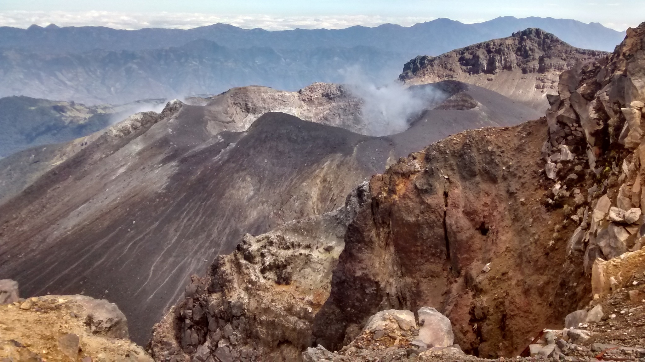
● Gas emissions were observed from the main crater and the fumarole fields of Las Chavas, to the west, and El Paisita, to the north of the active cone, with small white columns of variable height and dispersion due to the action of the winds.
● The other volcanic monitoring parameters showed stability.
Based on the above, the SGC recommends closely monitoring the evolution through the weekly bulletins and other information published through our official channels, as well as the instructions of the local and departmental authorities and the National Disaster Risk Management Unit (UNGRD).
Volcanic activity remains in yellow alert status: active volcano with changes in the behavior of the base level of the monitored parameters and other manifestations.
Source : SGC .
Photo : SGC (07/2024)
Ecuador , Sangay :
DAILY STATE REPORT OF SANGAY VOLCANO , Saturday 05 October 2024 .
Information Geophysical Institute – EPN.
Surface activity level: High , Surface trend: Descending
Internal activity level: High , Internal trend: No change
Seismicity: From 04 October 2024 , 11:00h to 05 October 2024 , 11:00h :
Seismicity:
Below is the count of seismic events recorded at the reference station
Explosion (EXP): 55
Rainfall/Lahars:
In the early morning hours, thanks to surveillance cameras and satellite images, the presence of rain was observed in the area, without lahars being generated. **Heavy rains could remobilize the accumulated materials and generate mudflows with debris (lahars) that could descend on the sides of the volcano, or even flow into adjacent rivers.
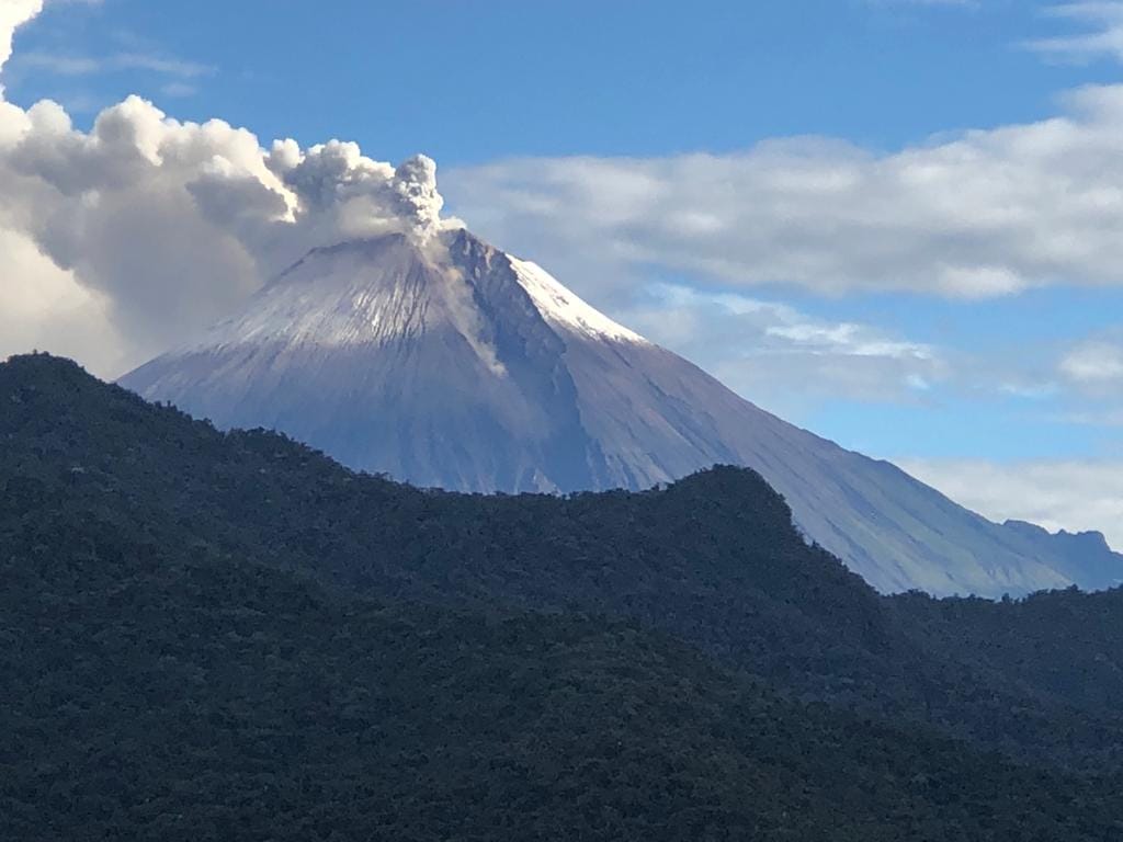
Emission/ash columns:
Since yesterday afternoon, thanks to satellite images and surveillance cameras, several emissions with low ash content have been observed, with heights between 200 and 600 m above the level of the crater, in a West, Northwest and North-Northwest direction. The Washington-VAAC agency has not published any reports related to this activity.
Observation:
Since yesterday afternoon, thanks to surveillance cameras, several episodes of incandescence have been observed at the crater level, with material descending to about 1000 meters below the summit level. On the other hand, since yesterday until the publication of this report, the volcano is partially cloudy
Alert level: yellow
Source : IGEPN
Photo : Carlos Riera.
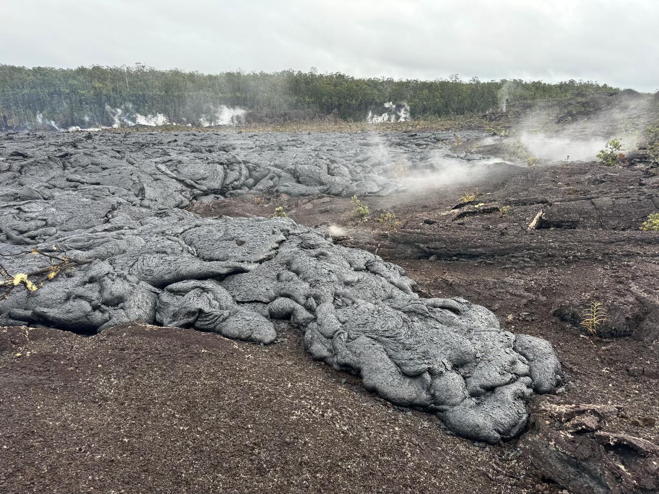
Hawaii , Kilauea :
Saturday, October 5, 2024, 9:00 AM HST (Saturday, October 5, 2024, 19:00 UTC)
19°25’16 » N 155°17’13 » W,
Summit Elevation 4091 ft (1247 m)
Current Volcano Alert Level: ADVISORY
Current Aviation Color Code: YELLOW
Activity Summary:
Kīlauea is not erupting. Weak steaming continues on the inactive September 15-20 flow field within Nāpau Crater on the middle East Rift Zone. No changes have been detected in the lower East Rift Zone or Southwest Rift Zone.
Summit Observations:
There were 11 earthquakes detected beneath the Kīlauea summit region over the past 24 hours. The summit tiltmeters at Uēkahuna and Sandhill show indications of slight inflation over the past few days. The most recent measurement of SO2 emission rate at the summit was 60 tonnes per day on September 17, 2024.
Rift Zone Observations:
The middle East Rift Zone (MERZ) eruption near Nāpau Crater stopped around 10 AM HST on the morning of September 20. Only minor steaming can be seen in webcam imagery from the eruption site at night since that time. No SO2 from the eruption site was detected on Monday, September 23rd, during measurements on Chain of Craters Road, indicating that MERZ SO2 emissions are approaching or at 0 tonnes per day.
Shallow earthquake counts remain low in the MERZ and upper East Rift Zone and tremor is no longer being recorded on seismometers close to the eruption site. Tiltmeters in the MERZ show no significant changes and GPS instruments show low but continuing rates of inflationary deformation.
All recent activity was confined to the middle East Rift Zone between Makaopuhi Crater and Puʻuʻōʻō and there are no indications of any changes further downrift in the MERZ or in the LERZ.
Source : HVO
Photo : USGS / M. Patrick. ( 20/09/2024)