September 29 , 2024 .
Indonesia , Lewotobi Laki-laki :
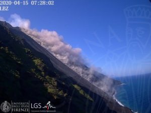
An eruption of Lewotobi Laki Laki occurred on Sunday, September 29, 2024 at 10:15 WITA with the height of the ash column observed at ± 800 m above the summit (± 2384 m above sea level). The ash column was observed to be gray in color with a thick intensity, oriented towards the Southwest. This eruption was recorded on a seismograph with a maximum amplitude of 6.6 mm and a duration of 411 seconds.

VOLCANO OBSERVATORY NOTICE FOR AVIATION – VONA
Issued : September 29 , 2024
Volcano : Lewotobi Laki-laki (264180)
Current Aviation Colour Code : ORANGE
Previous Aviation Colour Code : orange
Source : Lewotobi Laki-laki Volcano Observatory
Notice Number : 2024LWK567
Volcano Location : S 08 deg 32 min 20 sec E 122 deg 46 min 06 sec
Area : East Nusa Tenggara, Indonesia
Summit Elevation : 5069 FT (1584 M)
Volcanic Activity Summary :
Eruption with volcanic ash cloud at 02h15 UTC (10h15 local).
Volcanic Cloud Height :
Best estimate of ash-cloud top is around 7629 FT (2384 M) above sea level or 2560 FT (800 M) above summit. May be higher than what can be observed clearly. Source of height data: ground observer.
Other Volcanic Cloud Information :
Ash cloud moving to southwest. Volcanic ash is observed to be gray. The intensity of volcanic ash is observed to be thick.
Remarks :
Eruption recorded on seismogram with maximum amplitude 6.6 mm and maximum duration 411 second.
Source and photo : Magma Indonésie
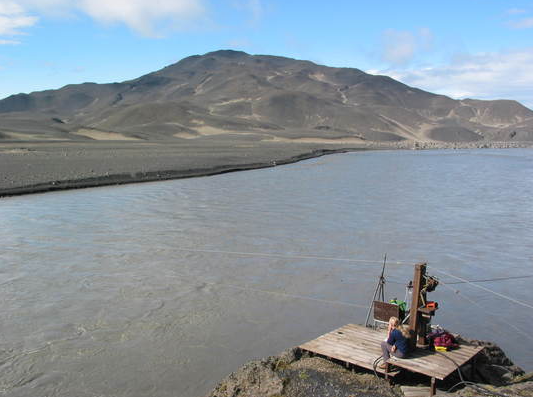
Iceland , Mýrdalsjökull ( Skálm river ) :
A small glacial outburst flood has started in Skálm river, Mýrdalsjökull.
Conductivity increase in Skálm river An increase in conductivity has been detected in Skálm since noon yesterday and is now around 272 µS/cm, water levels have increased slightly. Therefore, we would like to ask people to be careful at the source of the river and near the river channels, as there could be gas pollution in the area. This could be a slow leak of geothermal water from under the glacier. However, it is possible that the flow will increase further. IMO continues to monitor the situation closely.
Riverside measurements
The water level has started to drop, but it is too early to say whether this drop is permanent.
No sulphur smell has been reported yet.
During the major glacial flood of 27 July, the electrical conductivity had increased to almost 1000 µS/cm.
Source et photo : IMO
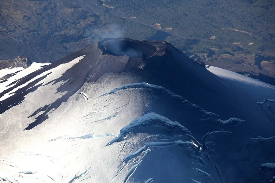
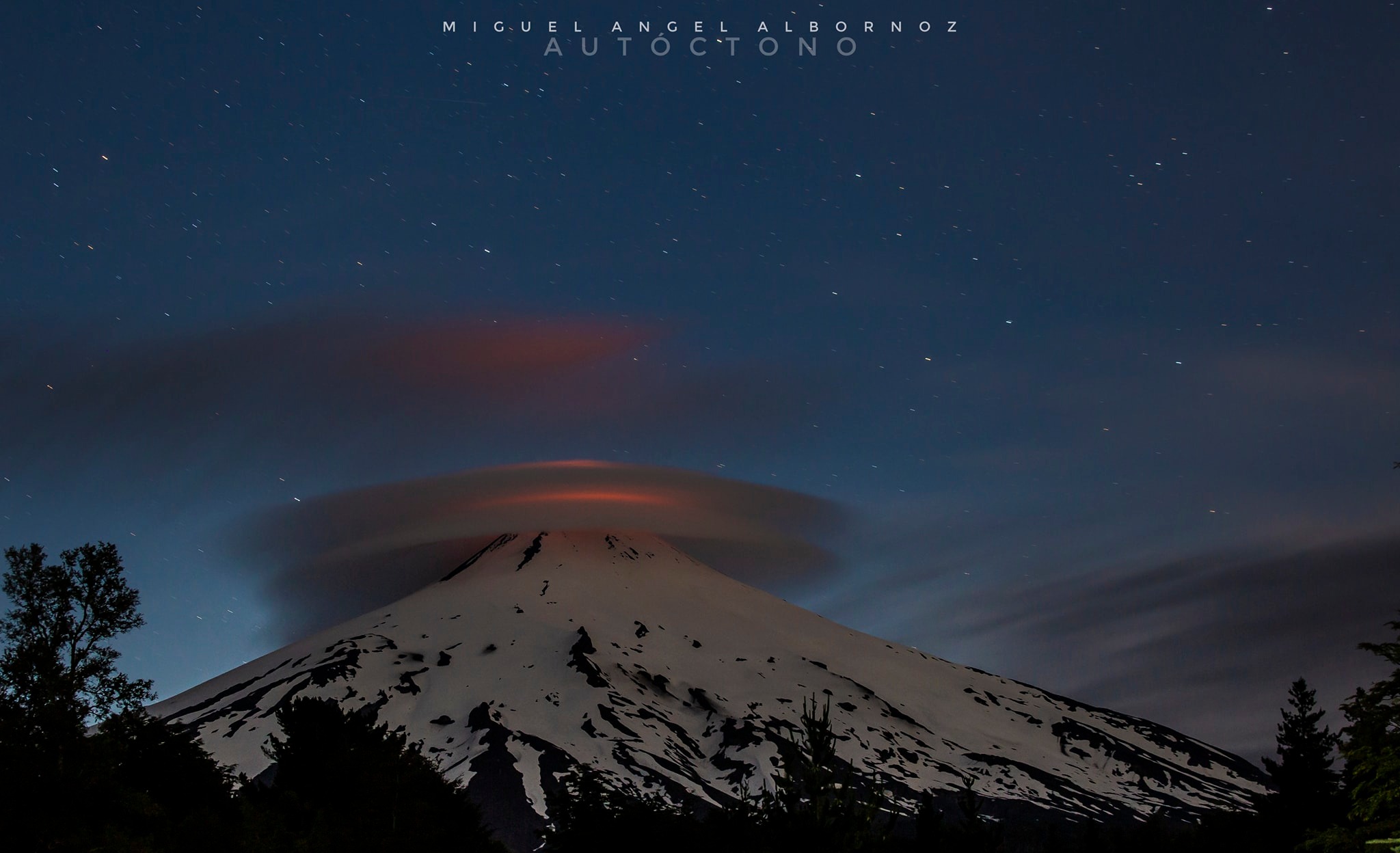
Chile , Villarica :
Seismology
The seismological activity of the period was characterized by the recording of:
A continuous seismic tremor signal associated with the fluid dynamics inside the volcano, which during the period and evaluated with the RSAM parameter, presented energy values between 0.1 and 0.2 μm/s.
28 VT type seismic events, associated with rock fracturing (Volcano-Tectonic). The most energetic earthquake had a Local Magnitude (ML) value equal to 1.3, located 10.8 km to the East-Southeast of the volcanic edifice, at a depth of 7.9 km from the crater.
275 LP type seismic events, associated with the fluid dynamics inside the volcanic system (Long Period). The size of the largest earthquake evaluated from the Reduced Displacement (DR) parameter was equal to 6 cm2.
2 seismic events of type TR, associated with the dynamics maintained over time of the fluids inside the volcanic system (TRemor). The size of the largest earthquake evaluated from the Reduced Displacement (DR) parameter was equal to 1 cm2.
Fluid Geochemistry
The sulfur dioxide (SO2) emissions data obtained by the Differential Optical Absorption Spectroscopy (DOAS) equipment, corresponding to the Los Nevados and Tralco stations, installed respectively 10 km in an East-Northeast direction and 6 km East-Southeast of the active crater, recorded measurements sporadically, presenting a valid average flow rate of 624 t/d, on September 14, consistent with the surface activity of the same period.
No anomalies were reported in sulfur dioxide (SO2) emissions into the atmosphere in the area near the volcano, according to data published by the Tropopheric Monitoring Instrument (TROPOMI) and the Ozone Monitoring Instrument (OMI) Sulphur Dioxide Group.
Geodesy
The analysis of geodetic data, based on data from 5 GNSS stations installed on the volcano, indicates that:
– The horizontal and vertical displacement rates have moderate magnitudes and, in general, are influenced by cyclical variations of an annual nature, data loss and increased dispersion in the time series. For the current period, vertical variation rates close to zero are generally reported, with a maximum calculated at 0.5 cm/month.
– The variation in distance between the different GNSS stations shows slight variations during this period, while maintaining the trend calculated over the last 3 months.
Based on the trends and directions of displacements of the current period, no deformation pattern is observed at the level of the volcanic edifice suggesting changes.
Surveillance cameras
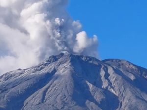
During this fortnight, when weather conditions permitted, predominantly whitish and low-altitude degassing was recorded from the crater, with a maximum height of 120 m. No events were recorded with pyroclast emissions, nocturnal explosions or incandescence.
Satellite geomorphological analysis
Thanks to the analysis of SkySat Collect and Pleiades satellite images, it was possible to observe the crater area, with no trace of a lava lake on the surface.
Volcanic activity has remained at its lowest levels compared to recent months.
In the last fortnight, no explosions with ejection of pyroclastic material outside the crater have been identified, a characteristic consistent with the decrease in other parameters assessed. In particular, seismicity is found with decreased energy values and geodetic data trends are stable. There have been no other satellite anomaly alerts consistent with the absence of a visible lava lake and a decrease in SO2 gas concentration. Overall, indicators from multiparameter data suggest the beginning of a low activity stage. However, the precursor-free explosions that have occurred in recent months indicate that there is still a probability of sudden pyroclastic ejection, which is consistent with the characteristics of an open conduit and the presence of a lava lake. For this reason, the technical alert is maintained at Yellow and the potential impact radius of volcanic hazards is maintained at 1 km measured from the center of the crater.
YELLOW TECHNICAL ALERT: Changes in the behavior of volcanic activity
Source : Sernageomin
Photos : Aton (03/2024) , Miguel Angel Albornoz ( 02/2024).
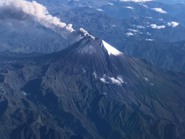
Ecuador , Sangay :
DAILY STATE REPORT OF SANGAY VOLCANO , Saturday, September 28, 2024 .
Information Geophysical Institute – EPN.
Surface Activity Level: High , Surface Trend: No Change
Internal Activity Level: High , Internal Trend: No Change
Seismicity: From September 27, 2024, 11:00 a.m. to September 28, 2024, 11:00 a.m.:
Seismicity:
Below is the count of seismic events recorded at the reference station
Explosion (EXP): 205
Rainfall/Lahars:
As of yesterday, at the time of writing, no rain has been recorded in the areas surrounding the volcano, thanks to the surveillance camera system and satellite images. **In the event of heavy rain, it could remobilize the accumulated materials, generating mud and debris flows that would descend the sides of the volcano and flow into adjacent rivers.
Emissions/Ash Column:
Yesterday afternoon, at the time of writing, thanks to the surveillance camera system and satellite images, several emissions of gas and ash were reported at 500 meters above the crater level in a West and South-West direction. In relation to this activity, the Washington VAAC has issued 2 reports of emissions at heights below 600 meters above the crater level.
Observation:
Since yesterday afternoon, thanks to the surveillance camera system, several episodes of continuous incandescence have been recorded at the crater level and their descent to 1000 meters below the crater level. On the other hand, since yesterday until the closing of this report, the volcano has remained cloudy most of the time.
Alert level: yellow
Source : IGEPN
Photo : volcan sangay FDB / auteur inconnu
La Martinique , Mount Pelée :
Weekly report, Institut de physique du globe de Paris / Observatoire volcanologique et sismologique de Martinique .
Saint-Pierre, September 27, 2024 at 4:30 p.m. local time (GMT-4)
Volcanic activity remains notable this week with 29 earthquakes of volcanic origin observed.
Between September 20, 2024 at 4:00 p.m. (UT) and September 27, 2024 at 4:00 p.m. (UT), the OVSM recorded 29 low-energy volcano-tectonic earthquakes. These earthquakes were clearly identified as coming from one of the well-known seismically active zones at Mount Pelée, located between 1.0 and 1.4 km deep below the summit of the volcano. The superficial seismicity of the volcano-tectonic type is associated with micro-fracturing in the volcanic edifice in connection with the global reactivation of the volcano observed since the end of 2018.
No earthquake was felt by the population.

The previous week, the OVSM had recorded 53 earthquakes of volcanic origin. As of September 27, 2024 and over the past 4 weeks, the OVSM has therefore observed a total of 154 volcanic earthquakes, or an average of 38 to 39 earthquakes per week.
During the volcanic reactivation phases of volcanoes similar to Mount Pelée, it is common to observe seismic activity that varies in intensity and frequency.
For more details on observations and interpretations of volcanic activity over the longer term, refer to the OVSM monthly bulletins.
The alert level is currently YELLOW: vigilance.
Source : Direction de l’OVSM-IPGP. https://www.ipgp.fr/communiques-et-bulletins-de-lobservatoire/?categorie=&domaine=&date=&observatoire-associe=399&motcle=
Photo : Parc naturel Martinique ( 11/2022)