July 21 , 2024.
Alaska , Great Sitkin :
Friday, July 19, 2024, 11:02 AM AKDT (Friday, July 19, 2024, 19:02 UTC)
52°4’35 » N 176°6’39 » W,
Summit Elevation 5709 ft (1740 m)
Current Volcano Alert Level: WATCH
Current Aviation Color Code: ORANGE
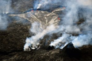
No significant change occurred this week at Great Sitkin, where the ongoing eruption of lava within the summit crater continues. Satellite radar imagery through July 18 showed growth of the active lava flow to the east and south, overtopping older lava erupted in 2022–2024. This activity is causing blocks of lava to fall down the steep flow margins, which has been detected in seismic data. Otherwise, seismic activity was low and unchanged from previous weeks, with occasional small volcanic earthquakes. The volcano was obscured by clouds much of the week, but steaming from the snow-free active lava flow surface was visible in webcam views and elevated surface temperatures were seen in satellite during clear viewing conditions.
The current, prolonged period of lava eruption at Great Sitkin Volcano began in July 2021 and has mainly been observed using satellite radar images that can view the volcano through cloud cover. A single explosive event occurred in May 2021; no other explosions have been detected since that time.
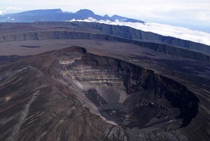
Great Sitkin Volcano on September 3, 2023, during helicopter approach for sampling efforts by AVO geologists. Image is looking west, with Adak and Kanaga Islands visible on the horizon.
Great Sitkin Volcano is a basaltic andesite volcano that occupies most of the northern half of Great Sitkin Island, a member of the Andreanof Islands group in the central Aleutian Islands. It is located 26 miles (43 km) east of the community of Adak. The volcano is a composite structure consisting of an older dissected volcano and a younger parasitic cone with a ~1 mile (1.5 km)-diameter summit crater. A steep-sided lava dome, emplaced during the 1974 eruption, occupies the center of the crater. That eruption produced at least one ash cloud that likely exceeded an altitude of 25,000 ft (7.6 km) above sea level. A poorly documented eruption occurred in 1945, also producing a lava dome that was partially destroyed in the 1974 eruption. Within the past 280 years a large explosive eruption produced pyroclastic flows that partially filled the Glacier Creek valley on the southwest flank.
Source : AVO
Photo : Loewen, Matthew , 3 septembre 2023
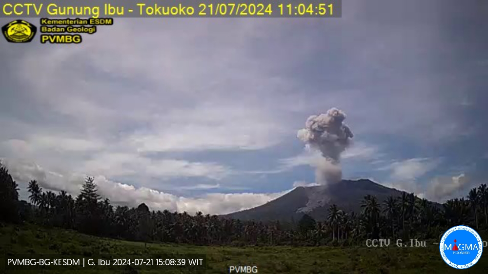
Indonesia , Ibu :
An eruption of Mount Ibu occurred on Sunday 21 July 2024 at 11:00 WIT with the height of the ash column observed at ±1,000 m above the summit (±2,325 m above sea level) . The ash column was observed to be gray with thick intensity, oriented towards the North. This eruption was recorded on a seismograph with a maximum amplitude of 28 mm and a duration of 138 seconds.
SEISMICITY OBSERVATIONS:
6 eruption earthquakes with an amplitude of 10 to 28 mm and a seismic duration of 64 to 96 seconds.
13 emission earthquakes with an amplitude of 2 to 28 mm and earthquake duration of 14 to 54 seconds.
115 Shallow volcanic earthquakes with an amplitude of 2 to 28 mm and an earthquake duration of 4 to 18 seconds.
82 deep volcanic earthquakes with an amplitude of 2 to 28 mm, and an earthquake duration of 9 to 22 seconds.
RECOMMENDATION
Communities around Mount Ibu and visitors/tourists are advised not to carry out activities within a radius of 2.0 km with a sectoral extension of 3.5 km towards the crater opening in the northern part of the crater active Mount Ibu.
In the event of ash falling, people who practice activities outside the home are advised to wear nasal, oral (mask) and eye (glasses) protection.
Source et photo : Magma Indonésie.
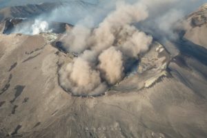
Ecuador , Sangay :
DAILY REPORT ON THE STATE OF THE SANGAY VOLCANO, Saturday July 20, 2024.
Information Geophysical Institute – EPN.
Surface activity level: High, Surface trend: No change
Internal activity level: High, Internal trend: No change
Seismicity: From July 19, 2024, 11:00 a.m. to July 20, 2024, 11:00 a.m.:
Seismicity:
Below is the count of seismic events recorded at the reference station
Explosion (EXP): 1044
Precipitation/Lahars:
Rain fell in the region, without causing lahars. **Heavy rains could remobilize accumulated materials and generate mudflows with debris (lahars). These could descend the sides of the volcano, until they flow into adjacent rivers.
Emissions/ash column:
Since yesterday, thanks to images from the GOES-16 satellite, several episodes of gas and ash emission have been observed, at heights of up to 1,200 meters above the level of the crater, in the West and South direction. West. This activity was also reported by the Washington VAAC agency.
In addition, yesterday afternoon a light ash fall was reported in the cantons of Naranjito (Guayas province), Alausí and Cumandá (Chimborazo province).
Gas:
The MOUNTS satellite system detected 28 tons of sulfur dioxide (SO2) on 07/19/2024, at 12:55 TL.
Other monitoring parameters:
The MIROVA-SENTINEL satellite system detected 1 thermal anomaly.
Observation:
Since yesterday, thanks to the camera system, the area has been observed partly cloudy most of the time. However, during the night, the descent of incandescent material was recorded in the southeast ravine of the volcanic edifice, extending up to 1,800 meters below summit level.
Alert level: yellow
Source : IGEPN
Photo : Eqphos_fotografía ( 12 / 2023 ).
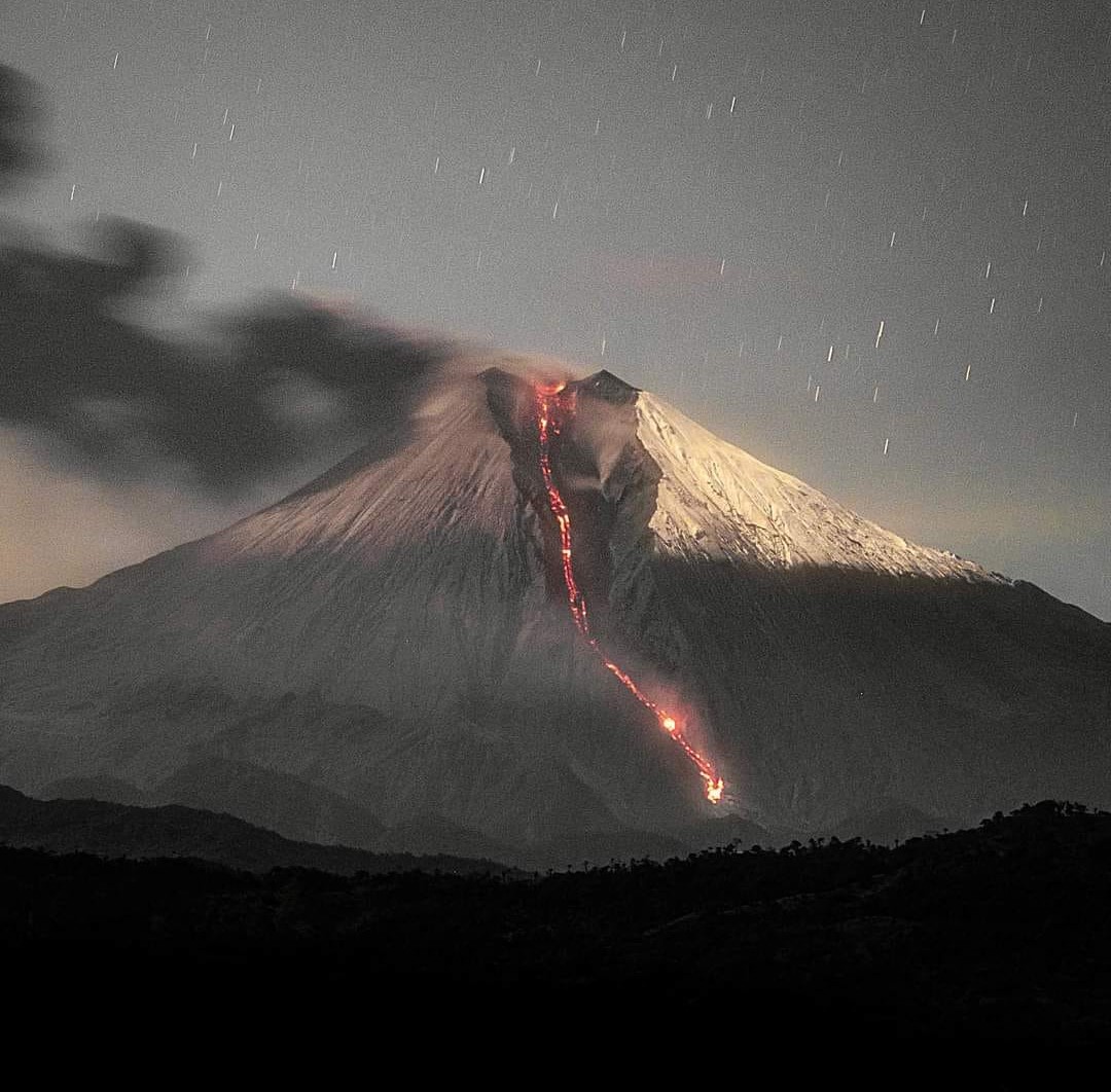
La Martinique , Montagne Pelée :
Weekly report / Paris Institute of Globe Physics / Martinique Volcanological and Seismological Observatory
Saint-Pierre, July 19, 2024 at 4:00 p.m. local time (GMT-4)
Volcanic activity remains low this week with 3 earthquakes of volcanic origin observed.
Between July 12, 2024 at 4:00 p.m. (UT) and July 19, 2024 at 4:00 p.m. (UT), the OVSM recorded 3 volcano-tectonic earthquakes of very low energy and probably coming from one of the well-known seismically active zones at Montagne Pelée, located between 1.0 and 1.4 km deep below the summit of the volcano. Surface seismicity of the volcano-tectonic type is associated with micro-fracturing in the volcanic edifice linked to the global reactivation of the volcano observed since the end of 2018.
These earthquakes were not felt by the population.

The previous week, the OVSM had recorded 2 earthquakes of volcanic origin. As of July 19, 2024 and during the last 4 weeks, the OVSM has therefore observed a total of 6 volcanic earthquakes, or an average of 1 to 2 earthquakes per week.
During phases of volcanic reactivation of volcanoes similar to Montagne Pelée, it is usual to observe seismic activity varying in intensity and frequency.
For more details on observations and interpretations of volcanic activity over the longer term, refer to the OVSM monthly bulletins.
The alert level is currently YELLOW: vigilance.
Source : Direction de l’OVSM-IPGP
Photo : Parc naturel Martinique ( 2022 ?)
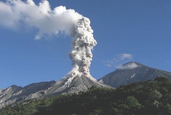
Guatemala , Santiaguito :
Weather conditions: Clear weather
Wind: East
Precipitation: 24.4 mm.
Activity:
The Santiaguito volcano observatory reports degassing above the crater which is dispersing towards the West. Weak and moderate explosions are recorded, expelling columns of gas and ash which reach up to 800 meters above the crater and disperse in a northwest and west direction. At night and early in the morning, incandescence was observed in the Caliente dome and in the upper part of the lava flow in a west-southwest direction. Weak, moderate and some strong block avalanches are recorded on the lava flow, on the southern flank and on the southeastern flank.
The volcano maintains high activity due to the extrusion of blocky lava in a west-southwest direction from the Caliente Dome and due to the unstable nature of the material in the crater, there is a probability of moderate to moderate pyroclastic flows. strong, so one should not stay near or in river beds near the slopes of the volcano. In the afternoon and night, rains could cause lahars in different channels of the volcano.
Source : Insivumeh
Photo : La Hora ( 12/2020 )