July 15 , 2024 .
Italy / Sicily , Etna :
Press release on the activity of Etna, July 14, 2024, 6:20 p.m. (4:20 p.m. UTC).
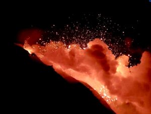
The National Institute of Geophysics and Volcanology, Osservatorio Etneo, communicates that according to the analysis of images from surveillance cameras, from around 1:00 p.m. UTC, a progressive increase in explosive activity was observed in the northern craters East and Voragine, with emission of ashes which quickly dispersed above the summit craters. A slight emission of ash from the Northeast crater persists. The forecast model for the dispersion of any eruptive cloud indicates a South-East direction.
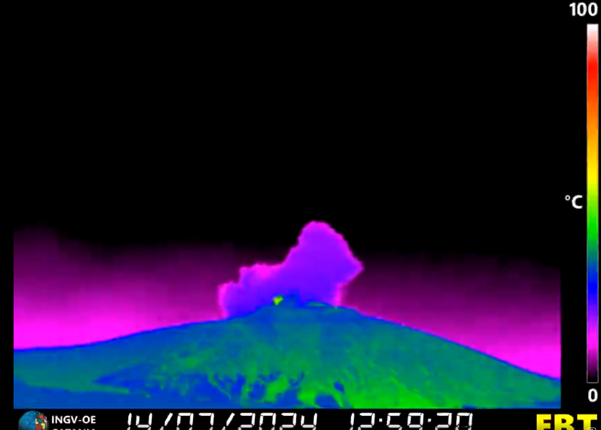
Short explosive sequence recorded today July 14, 2024 on Etna, in double voice from the Voragine crater (already active since yesterday) and from a reanimated crater in the North-East. From the image from the thermal camera located on the northwest side, the activity at both craters is clear, with the northeast crater producing the largest emission on the left and Voragine on its right with little activity Strombolian. All this generated a clear seismic trace and explosions heard from various towns located on the slopes of the volcano. The small cloud of ash dispersed in the summit part of the volcano.
The average amplitude of the volcanic tremor shows large and rapid oscillations in the mid-value range, where it has remained during the last hours. Since 15:00 UTC, it is showing an upward trend that has brought it almost to the high level. The center of gravity of the sources of the volcanic tremor is located at the level of the Northeast crater, at an altitude of approximately 2,800 m above sea level. The infrasound activity from 2:00 p.m. UTC increases and the sources of the events are located at the level of the Northeast crater.
Regarding deformations, update 4:10 p.m. UTC, the signals from the permanent inclinometer and GNSS networks do not detect significant variations.
Further updates will be communicated promptly and in any case within 3 hours of this press release.
Source : INGV.
Photo : INGV ( capture d’écran). 14/07/2024.
Philippines , Kanlaon :
KANLAON VOLCANO ADVISORY , 15 July 2024 , 7:00 AM
Notice of ongoing increased ground deformation changes at Kanlaon Volcano.
Ground deformation monitoring of Kanlaon Volcano has been recording a pronounced increase in the inflation or swelling of the edifice for the past month. Electronic Distance Meter (EDM) measurements by Kanlaon Volcano Observatory tracked an abrupt order of magnitude shortening of campaign EDM lines on the middle and lower southeastern slopes that began on 18 June 2024 and has become sustained since then. Kanlaon has been undergoing slow but sustained inflation or swelling since 2022 based on continuous GPS and electronic tilt measurements, indicating a long-term pressurization within the volcano. Considering that volcanic earthquake activity and elevated volcanic SO2 emission persists, the latest changes in ground deformation parameters could further indicate that magmatic intrusion beneath the edifice may be taking place, warning of increased chances of eruptive activity taking place.

The public is reminded that Alert Level 2 (increasing unrest) prevails over Kanlaon. This means that there is current unrest driven by shallow magmatic processes that could eventually lead to explosive eruptions or even precede hazardous magmatic eruption at the summit crater. The public is strongly advised to be vigilant and avoid entry into the four (4) kilometer-radius Permanent Danger Zone (PDZ) to minimize risks from volcanic hazards such as pyroclastic density currents, ballistic projectiles, rockfall and others. In case of ash fall events that may affect communities downwind of Kanlaon’s crater, people should cover their nose and mouth with a damp, clean cloth or dust mask. Civil aviation authorities must also advise pilots to avoid flying close to the volcano’s summit as ash and ballistic fragments from sudden eruption can be hazardous to aircraft. Communities living beside river systems on the southern and western slopes, especially those that have already experienced lahars and muddy streamflows, are advised to take precautionary measures when heavy rainfall over the volcano has been forecast or has begun.
DOST-PHIVOLCS maintains close monitoring of Kanlaon Volcano and any new development will be immediately communicated to all concerned stakeholders.
Source : Phivolcs
Photo : Phivolcs ( 2017) .
Indonesia , Ibu :
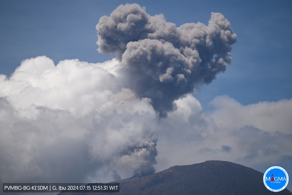
An eruption of Mount Ibu occurred on Monday 15 July 2024 at 11:46 WIT with the height of the ash column observed at ±800 m above the summit (±2,125 m above sea level). The ash column was observed to be gray to black in color with moderate to thick intensity, oriented towards the North and Northeast. This eruption was recorded on a seismograph with a maximum amplitude of 25 mm and a duration of 118 seconds.
VOLCANO OBSERVATORY NOTICE FOR AVIATION – VONA
Issued : July 15 , 2024
Volcano : Ibu (268030)
Current Aviation Colour Code : ORANGE
Previous Aviation Colour Code : orange
Source : Ibu Volcano Observatory
Notice Number : 2024IBU060
Volcano Location : N 01 deg 29 min 17 sec E 127 deg 37 min 48 sec
Area : North Maluku, Indonesia
Summit Elevation : 4240 FT (1325 M)
Volcanic Activity Summary :
Eruption with volcanic ash cloud at 02h46 UTC (11h46 local).
Volcanic Cloud Height :
Best estimate of ash-cloud top is around 6800 FT (2125 M) above sea level or 2560 FT (800 M) above summit. May be higher than what can be observed clearly. Source of height data: ground observer.
Other Volcanic Cloud Information :
Ash cloud moving from northeast to east. Volcanic ash is observed to be gray. The intensity of volcanic ash is observed from medium to thick.
Remarks :
Eruption recorded on seismogram with maximum amplitude 25 mm and maximum duration 118 second.
Source et photo : Magma Indonésie.
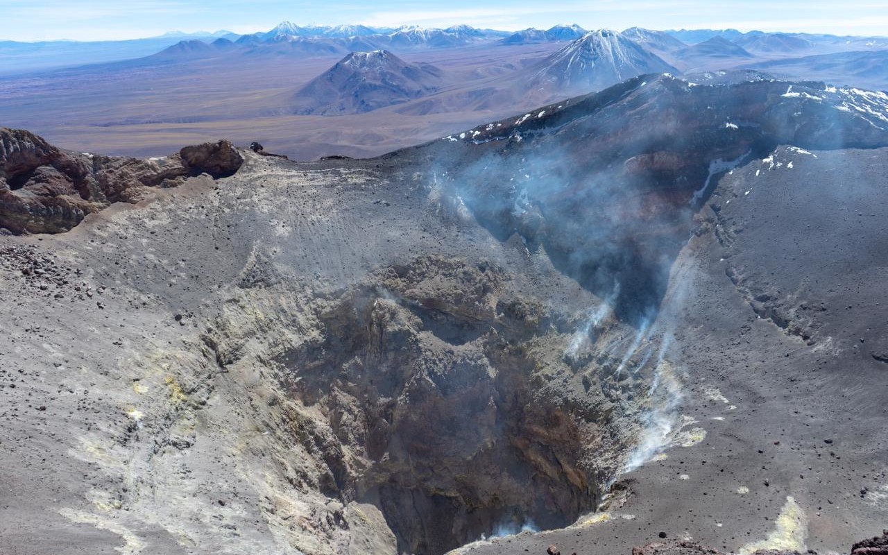
Chile , Lascar :
Seismology
The seismological activity of the period was characterized by the recording of:
22 seismic events of type VT, associated with the fracturing of rocks (Volcano-Tectonics). The most energetic earthquake had a Local Magnitude (ML) value equal to 1.4, located 0.9 km south-southwest of the volcanic edifice, at a depth of 4.1 km from the crater .
124 LP (Long Period) seismic events, associated with fluid dynamics inside the volcanic system. The size of the largest earthquake evaluated from the Reduced Displacement (RD) parameter was equal to 11 cm2.
1 TR type seismic event, associated with the dynamics maintained over time of fluids inside the volcanic system (TRemor). The size of the earthquake evaluated from the Reduced Displacement (RD) parameter was equal to 5 cm2.
Fluid geochemistry
No anomalies have been reported in the emissions of sulfur dioxide (SO2) into the atmosphere in the area near the volcano, according to data published by the Tropospheric Monitoring Instrument (TROPOMI) and the Sulfur Dioxide Group of the Ozone Monitoring Instrument (OMI).
Thermal anomalies by satellites
During the period, no thermal alerts were recorded in the area associated with the volcano, according to the analytical processing of Sentinel 2-L2A satellite images, in combination of false color bands. Likewise, no thermal alert was recorded in the area associated with the volcano according to data processed by Mid-Infrared Volcanic Activity Observation (MODIS-MIROVA).
Geodesy
Geodetic activity during this period was characterized by a low rate of movement in the two monitoring stations installed in the volcanic building, so no significant changes in terms of deformation are evident.
Surveillance cameras
Images provided by surveillance cameras installed near the volcano recorded degassing columns with a maximum height of 300 m on June 3.
Satellite geomorphological analysis
No morphological changes associated with volcanic activity are identified from Planet Scope, Sentinel 2 L2A and LandSat 8 satellite images.
In recent months, volcanic activity has been characterized by a record of LP seismicity with relatively low but stable over time rates of occurrence and energy.
thermal radiation (VRP) remained low, or even zero. Historically, both parameters have shown cyclical behavior, tending to decrease at the end of each cycle and, in some cases, ending with the appearance of minor explosions. Therefore, given the behavior observed in recent years, the Láscar volcano has the potential to generate small untimely explosions without instrumental precursors.
In conclusion, for the current period, activity levels continue to be considered low, suggesting a certain degree of system stability, but it is essential to observe the temporal evolution of monitoring parameters, to exclude possible scenarios involving more energetic activity processes.
Technical alert maintained at:
GREEN TECHNICAL ALERT: Active volcano with stable behavior – There is no immediate risk
Source : Sernageomin
Photo : Vulcanopro.( archive)
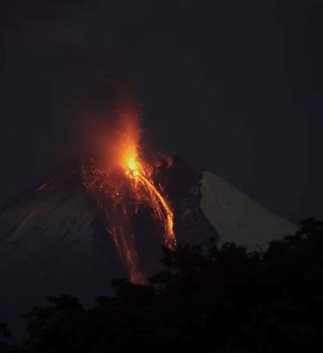
Ecuador , Sangay :
DAILY REPORT ON THE STATE OF THE SANGAY VOLCANO, Sunday July 14, 2024.
Information Geophysical Institute – EPN.
Surface activity level: High, Surface trend: No change
Internal activity level: High, Internal trend: No change
Seismicity: From July 13, 2024, 11:00 a.m. to July 14, 2024, 11:00 a.m.:
Seismicity:
Below is the count of seismic events recorded at the reference station
Explosion (EXP) 622
Precipitation/Lahars:
Rains were recorded in the volcano area. The increase in flow and overflow of the Upano River continues. **In the event of heavy rains, these could remobilize the accumulated materials, generating mud and debris flows which would descend the sides of the volcano and flow into adjacent rivers.**
Emissions/ash column:
Due to weather conditions, it was not possible to observe the broadcasts via the surveillance camera system. On the other hand, thanks to the GOES-16 satellite system, an emission of gas and ash was recorded this morning at a height of 1,200 meters above the level of the crater in the West direction. For its part, the VAAC agency in Washington published 3 reports of emissions with heights between 1,500 and 600 meters above the level of the crater in the west direction, during the last 24 hours.
Gas:
The Mounts satellite system does not show sulfur dioxide (SO2) values.
Observation:
Early in the morning, the descent of incandescent materials could be observed in the South-East ravine up to 2000 meters below the level of the crater. At the time of closing this report, the volcano remains cloudy
Alert level: yellow
Source : IGEPN
Photo : Diego Cardenas ( 11/2022 )