May 11 , 2024.
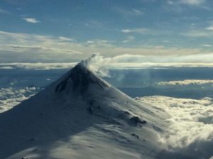
Iceland : Reykjanes Peninsula :
Ongoing magma accumulation and land rise in Svartsengi . Limited activity in the crater
Updated 10. May at 18:00 UTC
There is an increased likelihood of a new dike intrusion and another eruption in the coming days.
The most likely location for a new eruption is the Sundhnúk crater row.
Warning signs preceding an eruption could be very brief.
An updated hazard assessment map has been issued.
The trend of land rise at Svartsengi has remained relatively stable since the most recent volcanic eruption ended, with magma accumulation continuing at a similar rate. As of today, it is estimated that approximately 14 million cubic meters of magma has been added to the magma chamber since the eruption began on March 16th.
In the dike intrusions and eruptions over the past few months, approximately 8 to 13 million cubic meters of magma was added to the chamber beneath Svartsengi before it exited the chamber and travelled towards the Sundhnúk crater row. Now, the amount of magma added has surpassed the previously observed upper limit. Observations from the Krafla eruptions can add context to this behavior, revealing that, as more dike intrusions occur, more pressure is required to initiate them. Therefore, it is likely that the magma chamber beneath Svartsengi will eventually feed another intrusion into the Sundhnúk crater row. However, there is uncertainty about when sufficient pressure will be reached to initiate a new dike intrusion and potentially an eruption if magma reaches the surface.
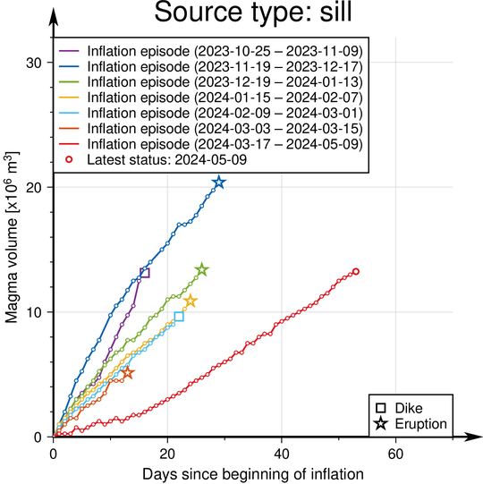
Graph showing the estimated amount of magma that has accumulated beneath Svartsengi between the eruptions and dike intrusions that have occurred on Reykjanes since November 2023.
The Icelandic Meteorological Office continues its 24-hour surveillance of the area to closely monitor the activity. New eruptive fissures could open in the area between Stóra-Skógfell and Hagafell and may resemble the initial phases of other recent eruptions in the area. This could happen with little to no warning. Signs of a new dike intrusion would be similar to those previously observed: localized earthquakes in and around the dike, accelerated deformation, and pressure changes in nearby boreholes.
Increased seismic activity has been recorded at the Sundhnúk crater row in recent days. This increase in seismic activity is likely a sign that stress is being released in and around the recent eruption site on the Sundhnúk crater row due to increased pressure in the magma chamber beneath Svartsengi.
Last night, the Icelandic Meteorological Office’s 24-hour surveillance team detected an increase in localized seismic activity south of Stóra-Skógfell, in a similar location to where previous eruptions have started. Deformation and pressure measurements, which would indicate a dike intrusion, did not exhibit significant changes. The activity persisted for a relatively short duration, but it cannot be ruled out that a small amount of magma may have been injected there.
Caution when traveling near the Sundhnúk crater row
The Icelandic Meteorological Office has issued an updated hazard assessment. The termination of the last eruption has caused updates in several areas, but the current hazard assessment reflects increased chances of a new dike intrusion and possible eruption.
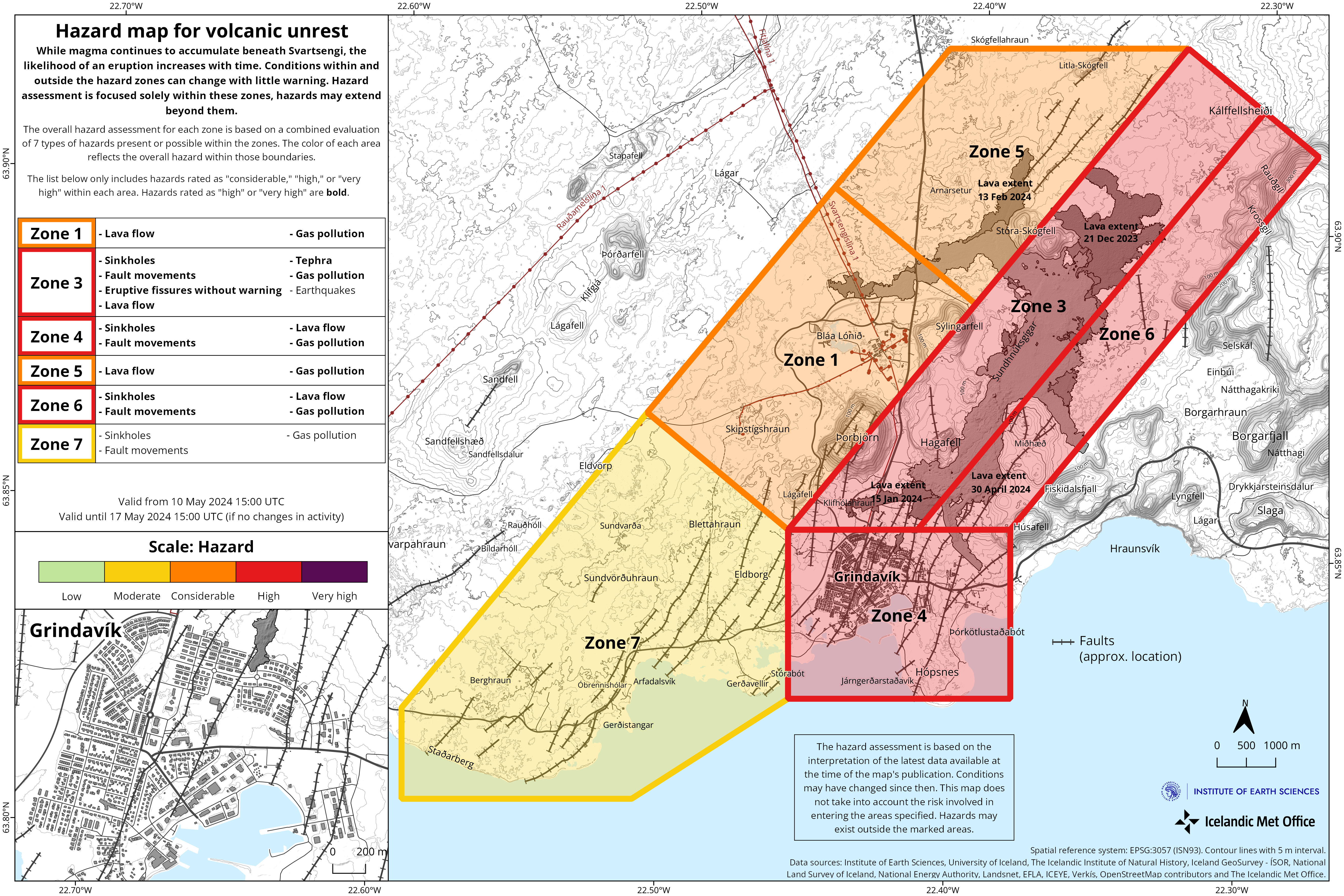
As the crust between Stóra-Skógfell and Hagafell is heavily fractured, magma is likely to find a clear path to the surface without significant resistance, and therefore, substantial seismic activity may not accompany magma migration through the crust. Therefore, warning times before a new eruption could be very brief or nonexistent, so it is important to exercise extreme caution when travelling to area 3, defined on the Icelandic Meteorological Office’s hazard map. The new risk assessment is valid until May 14th, unless the situation changes.
Source : IMO
Photos : Défence civile islandaise , IMO.
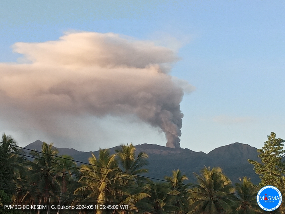
Indonesia , Dukono :
An eruption of Mount Dukono occurred on Saturday May 11, 2024 at 06:25 WIT with the height of the ash column observed at ±1,100 m above the summit (±2,187 m above sea level) . The ash column was observed to be white to gray in color with thick intensity, oriented towards the East. This eruption was recorded on a seismograph with a maximum amplitude of 34 mm and a duration of 65.87 seconds.
Seismicity observation:
4 eruption/explosion earthquakes with an amplitude of 4 to 21 mm and an earthquake duration of 32.25 to 42.02 seconds.
2 local tectonic earthquakes with an amplitude of 4 mm, duration of the earthquake 34.52-36.44 seconds.
2 deep tectonic earthquakes with an amplitude of 5-7 mm, and earthquake duration 56.33-70.03 seconds.
1 Continuous tremor with an amplitude of 0.5 to 2 mm, dominant value of 1 mm.
RECOMMENDATION
(1) People around Mount Dukono and visitors/tourists are advised not to do activities, climb or approach Malupang Warirang Crater within a 3 km radius.
(2) Considering that eruptions with volcanic ash occur periodically and the distribution of ash follows the direction and speed of the wind, so that the landing area of the ash is not fixed, it is recommended that the community around Mount Dukono always equip themselves with masks/nose and mouth coverings to use when necessary to avoid the threat of volcanic ash on the respiratory system.
Source : Magma Indonésie.
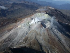
Colombia , Puracé :
Popayan, May 10, 2024, 2:45 p.m.
Concerning the monitoring of the activity of the PURACE VOLCANO – LOS COCONUCOS VOLCANIC RANGE, the COLOMBIAN GEOLOGICAL SERVICE (SGC), an entity attached to the MINISTRY OF MINES AND ENERGY, reports that:
Since yesterday until the time of publication of this bulletin, both the seismic activity associated with the fracturing of rocks inside the volcanic edifice and that linked to the movement of fluids have been characterized by behavior similar to that observed the previous days. Fracture earthquake locations continue to be located beneath the crater of the Puracé volcano and its eastern flank, at depths of up to 3.5 km. The maximum magnitude calculated was 1.4 ML, corresponding to an earthquake recorded yesterday at 6:46 p.m. Seismicity linked to the movement of fluids continues to be concentrated in the crater sector and on its northern flank, at depths less than 2.0 km. No earthquakes associated with the rise, placement, or movement of magma have been recorded.
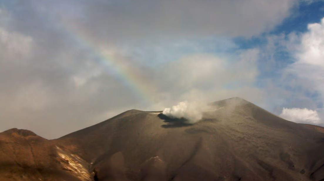
Due to the action of the winds in the upper part of the volcano, it was not possible to measure the height of the gas column, however, in the images obtained, the degassing processes inside the crater and in the lateral fumarole were appreciated, with white emissions. in color which dispersed depending on the wind regime in the region. Ground deformation processes and the concentrations of carbon dioxide (CO2) and sulfur dioxide (SO2) gases maintain the observed trend, with values that remain above the known baselines for this volcano.
The SGC confirms that the alert state of the PURACE VOLCANO continues at ORANGE: volcano with significant changes in the monitored parameters.
Source et photo : SGC
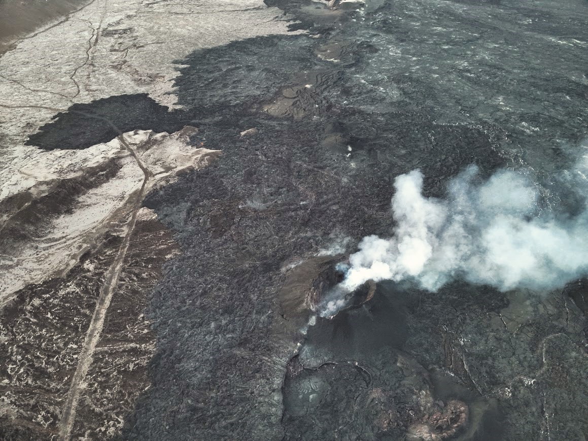
Hawaii , Kilauea :
Friday, May 10, 2024, 8:46 AM HST (Friday, May 10, 2024, 18:46 UTC)
19°25’16 » N 155°17’13 » W,
Summit Elevation 4091 ft (1247 m)
Current Volcano Alert Level: ADVISORY
Current Aviation Color Code: YELLOW
Activity Summary:
Kīlauea volcano is not erupting. Unrest continues beneath the upper East Rift Zone and the summit caldera south of Halemaʻumaʻu.
Summit and upper East Rift Zone Observations:
Earthquake counts remain elevated with approximately 90 earthquakes in the past 24 hours, a decrease over the preceding day. These earthquakes are clustered in the upper East Rift Zone as well as the south caldera region. Earthquake depths have averaged 2-4 km (1.2-3.1 miles) beneath the surface, and magnitudes have been mostly below M2.0.
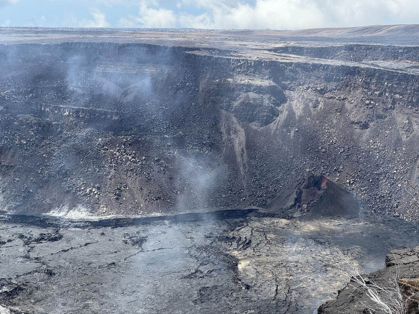
Ground deformation continues beneath Halemaʻumaʻu. The Uēkahuna tiltmeter recorded the onset of deflationary tilt beneath Halemaʻumaʻu yesterday morning. Since that time, the tiltmeter at Sandhill has been flat, showing no significant inflation or deflation in the south caldera region over the past day.
Sulfur dioxide (SO2) gas emission rates remain low. An SO2 emission rate of approximately 62 tonnes per day was recorded on May 2.
Rift Zone Observations:
Elevated seismic activity on the East Rift Zone is confined to the upper East Rift Zone, with no significant earthquakes occurring past the Pauahi Crater. At this time, seismicity in Kīlauea’s Southwest Rift Zone remains relatively low outside of the summit region. Measurements from continuous gas monitoring stations downwind of Puʻuʻōʻō in the middle East Rift Zone—the site of 1983–2018 eruptive activity—continue to be below detection limits for SO2, indicating that SO2 emissions from Puʻuʻōʻō are negligible.
Analysis:
Magma continues to pressurize the system beneath Halemaʻumaʻu and the south caldera region, activating seismicity along faults in the upper East Rift Zone. At this time, it is not possible to say whether this increase in activity will lead to an intrusion or eruption in the near future or simply continue as seismic unrest at depth. Changes in the character and location of unrest can occur quickly, as can the potential for eruption.
Source : HVO
Photo : USGS / M. Patrick
Guatemala , Santiaguito :
Weather conditions: Partly cloudy.
Wind: North-East.
Precipitation: 31.4 mm.
Activity:
The Santiaguito Volcano Observatory is reporting cloudy conditions that make it difficult to observe the activity of the Caliente Dome since yesterday afternoon. During the night and early morning, on the webcam, intermittent incandescence was observed on the dome and its sides due to the constant extrusion of blocky lava. Small and moderate explosions occur at a rate of 1 to 3 per hour, accompanied by low rumbling and degassing noises, raising columns of water vapor and ash to heights of 700 meters above the dome and causing the descent of pyroclastic flows over short distances, mainly towards the northwest, west, southwest, south and southeast flanks of the Caliente dome, piling the material on the promontories of the aforementioned flanks.

The wind blows towards the West and the South-West, so that weak ash falls could occur in the area of San Marcos Palajunoj, Finca Pauwlonias and the surrounding areas. The activity remains at a high level, so it is possible that with the explosions or under the effect of gravity, part of the accumulated material collapses and that pyroclastic flows over long distances are generated towards the South. West, South and South-East.
Source : Insivumeh
Photo : Annie Winson , earthobservatory.sg