March 29 , 2024.
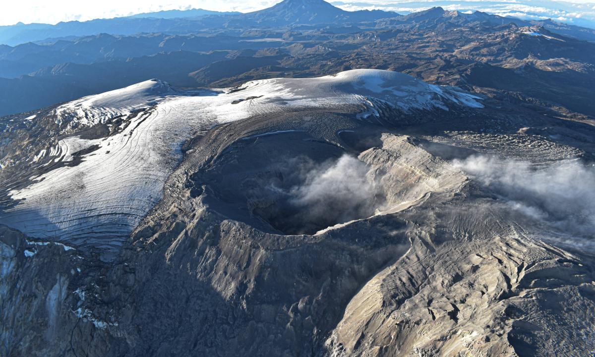
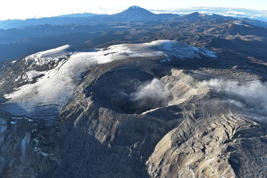
Colombia , Nevado del Ruiz :
Weekly activity bulletin: Nevado del Ruiz Volcano
Regarding the monitoring of the activity of the NEVADO DEL RUIZ VOLCANO, the MINISTRY OF MINES AND ENERGY, through the COLOMBIAN GEOLOGICAL SERVICE (SGC), reports that:
In the week of March 19-25, 2024, the volcano continued with unstable behavior. Compared to the previous week, the main variations in parameters
monitored were:
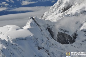
– Seismicity linked to fluid dynamics inside volcanic conduits has decreased in the number of earthquakes recorded and in the seismic energy released. Most seismic signals were associated with pulsatile emissions of ash and gas into the atmosphere. Energy levels were low to moderate and sometimes high. The seismic signal recorded on March 22 at 5:16 a.m. stands out. This is the signal with the highest energy level so far this year, this signal was recorded with ash emission. Thanks to the cameras used to monitor the volcano, several ash emissions and certain changes in the temperature of the emitted materials associated with some of these seismic signals have been confirmed.
– Seismic activity associated with the fracturing of rocks inside the volcanic edifice has decreased in the number of earthquakes recorded and increased in the seismic energy released.
The earthquakes were located mainly on the eastern flank of the volcano, at distances between 3 and 5 km from the Arenas crater and within the crater itself. To a lesser extent, certain earthquakes were located, scattered, on the flanks of the volcano, up to distances less than 10 km from the crater. The depths of the events varied between less than 1 and 6 km from the volcano summit. The highest magnitude of the week was 2.0, corresponding to the March 24 earthquake at 12:17 p.m., located 5 km east of the crater, with a depth of 4 km. During this week, the recording of seismicity linked to the activity of the lava dome (protuberance or mound) located at the bottom of the crater decreased. The energy levels of this type of seismicity were low.
On the volcano, the emission of water vapor and gas into the atmosphere continued. Sulfur dioxide (SO2) outgassing rates were variable and maintained similar values to the previous week.
The maximum height of the gas or ash column was 1,100 m vertical and 1,400 m dispersed. These values were measured at the summit of the volcano on March 22 during the broadcast
of ash recorded at 05:16, which was recorded with the earthquake with the highest energy level mentioned above. The predominant direction of dispersion of the column was variable with a predominance towards the southwest and west flanks of the volcano.
Source et photo : SGC
Russia / Kuril Islands , Ebeko :
VOLCANO OBSERVATORY NOTICE FOR AVIATION (VONA)
Issued: March 29 , 2024 .
Volcano: Ebeko (CAVW #290380)
Current aviation colour code: ORANGE
Previous aviation colour code: orange
Source: KVERT
Notice Number: 2024-15
Volcano Location: N 50 deg 41 min E 156 deg 0 min
Area: Northern Kuriles, Russia
Summit Elevation: 1156 m (3791.68 ft)
Volcanic Activity Summary:
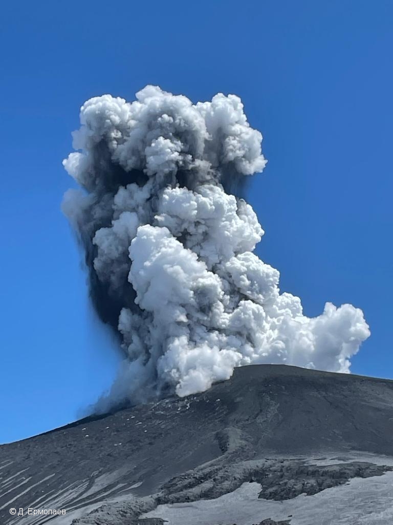
A moderate explosive eruption of the volcano continues. According to visual data from Severo-Kurilsk, explosion sent ash up to 3 km a.s.l., and ash cloud drifted to the south of the volcano.
A moderate explosive eruption of the volcano continues. Ash explosions up to 6 km (19,700 ft) a.s.l. could occur at any time. Ongoing activity could affect low-flying aircraft and airport of Severo-Kurilsk.
Volcanic cloud height:
2500-3000 m (8200-9840 ft) AMSL Time and method of ash plume/cloud height determination: 20240329/0018Z – Video data
Other volcanic cloud information:
Distance of ash plume/cloud of the volcano: 5 km (3 mi)
Direction of drift of ash plume/cloud of the volcano: S
Time and method of ash plume/cloud determination: 20240329/0018Z – Video data
Source : Kvert
Photo : D. Ermolaev ( archive).
Philippines , Taal :
TAAL VOLCANO ADVISORY . 28 Mars 2024 , 4:30 PM
This is a notice of elevated sulfur dioxide degassing from Taal Volcano.
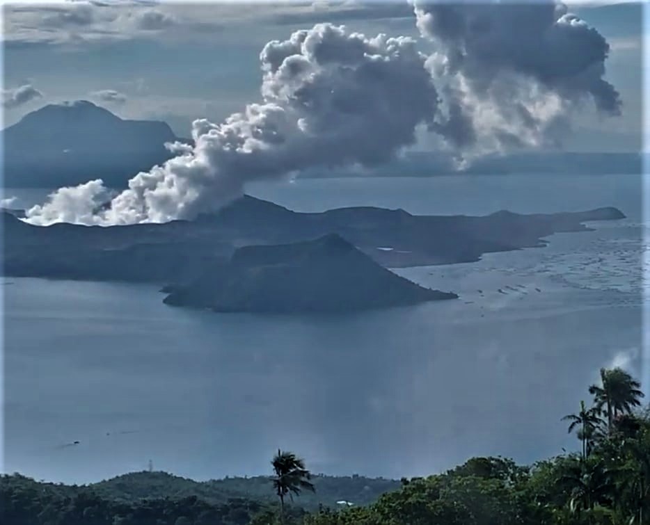
A total of 18,638 tonnes/day of volcanic sulfur dioxide or SO2 gas emission from the Taal Main Crater was measured today, 28 March 2024, the highest flux recorded this year. Taal has averaged approximately 10,331 tonnes/day for the year and has been continuously degassing voluminous concentrations of SO2 since 2021. Moderate winds have prevented the accumulation of SO2 and no volcanic smog or vog over Taal Caldera could be observed by visual monitors throughout the day. However, prolonged exposure to volcanic SO2, especially of communities to the west and southwest of Taal Volcano Island or TVI, can cause irritation of the eyes, throat and respiratory tract. People who may be particularly sensitive are those with health conditions such as asthma, lung disease and heart disease, the elderly, pregnant women and children.
DOST-PHIVOLCS reminds the public that Alert Level 1 prevails over Taal Volcano, which means that it is still in abnormal condition and should not be interpreted to have ceased unrest nor ceased the threat of eruptive activity. At Alert Level 1, sudden steam-driven or phreatic explosions, volcanic earthquakes, minor ashfall and lethal accumulations or expulsions of volcanic gas can occur and threaten areas within TVI. Furthermore, degassing of high concentrations of volcanic SO2 continues to pose the threat of potential long-term health impacts to communities around Taal Caldera that are frequently exposed to volcanic gas. DOST-PHIVOLCS strongly recommends that entry into TVI, Taal’s Permanent Danger Zone or PDZ, especially the vicinities of the Main Crater and the Daang Kastila fissure, must remain strictly prohibited. Local government units are advised to continuously monitor and assess volcanic SO2 exposure of, and potential impacts on, their communities and undertake appropriate response measures to mitigate these hazards.
Source : Phivolcs
Photo : Kyle Aranza
Indonesia , Marapi :
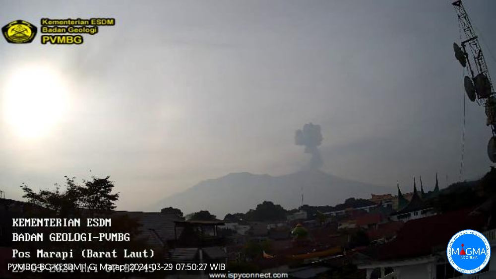
An eruption of Mount Marapi occurred on Friday March 29, 2024 at 07:35 WIB with the height of the ash column observed at ±500 m above the summit (±3391 m above sea level). The ash column was observed to be gray with thick intensity, oriented towards the West. At the time of writing, the eruption was still ongoing.
Observation of seismicity:
2 eruption/explosion earthquakes with an amplitude of 30.4 mm and a seismic duration of 36 to 66 seconds.
2 emission earthquakes with an amplitude of 1.5 to 2.2 mm and a duration of 10 to 16 seconds.
1 Continuous tremor with an amplitude of 0.5 to 1 mm, dominant value of 0.5 mm.
RECOMMENDATION
1. Communities around Mount Marapi and climbers/visitors/tourists should not enter and conduct activities within a 4.5 km radius of the eruption center (Verbeek crater) of Mount Marapi.
2. Communities living around the valleys/streams/river banks that originate at the summit of Mount Marapi should always be aware of the potential threat of lahars that may occur, particularly during the rainy season.
Source et photo : Magma Indonésie.
Mexico , Popocatepetl :
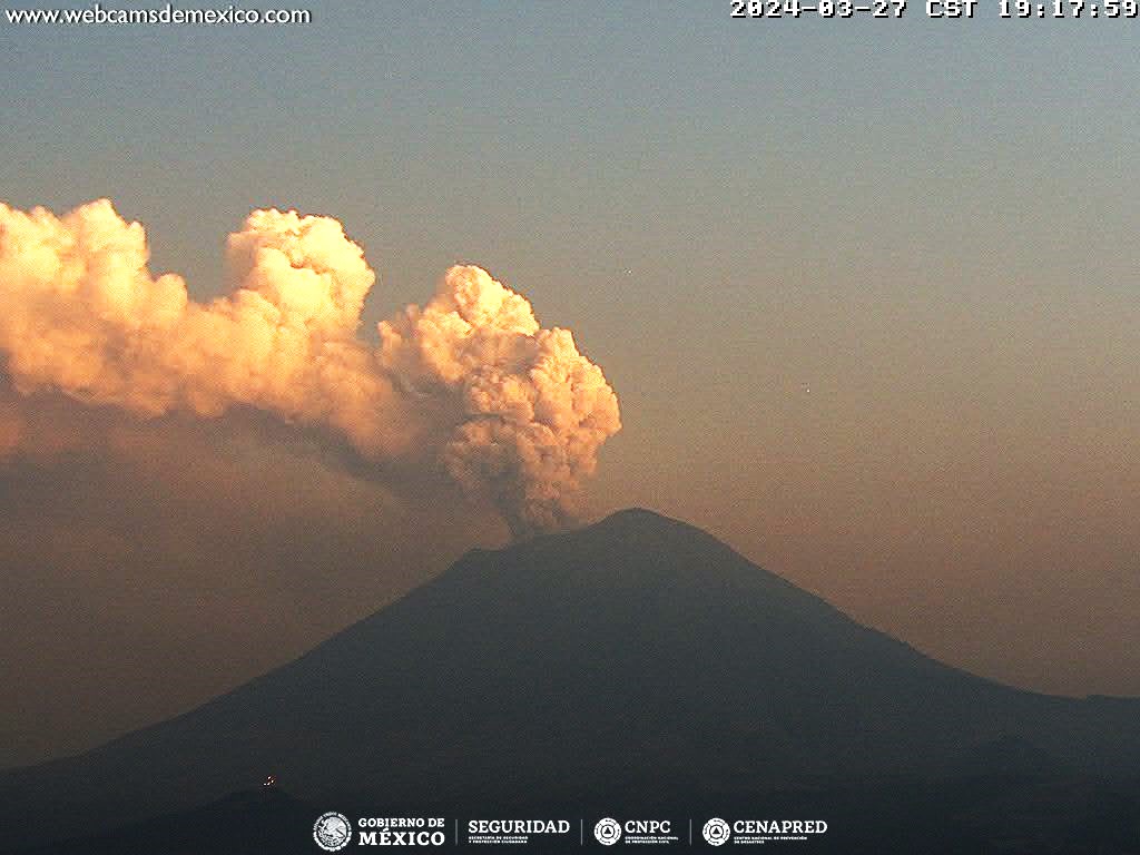
March 28, 11:00 a.m. (March 28, 5:00 p.m. GMT). Activity from the last 24 hours
56 exhalations were detected, accompanied by water vapor, volcanic gases and slight amounts of ash. In addition, 240 minutes of very low to low amplitude tremors were identified; 188 minutes of high frequency and 52 minutes of harmonic tremor.
Today, the National Civil Protection Communications and Operations Center (CENACOM) reported light ash falls in the capital Puebla, San Pedro Cholula, San Andrés Cholula, San Juan Cuautlancingo and Amozoc de Mota, in the State of Puebla.
During the morning and at the time of this report, a continuous emission of water vapor and volcanic gases is observed, in an East-North-East (ENE) direction.
The Popocatépetl volcanic warning fire is in yellow phase 2.
The scenarios planned for this phase are:
A few small to moderate explosions
Appearance of tremors of variable amplitude
Light to moderate ash rain in surrounding towns and some more distant towns
Ejection of incandescent fragments within the exclusion radius of 12 kilometers
Source : Cenapred

