March 04 , 2024.
Ecuador / Galapagos Islands , Fernandina :
Special Volcanic Report – Fernandina. The Fernandina (La Cumbre) volcano, Galapagos Islands, begins a new eruptive period.
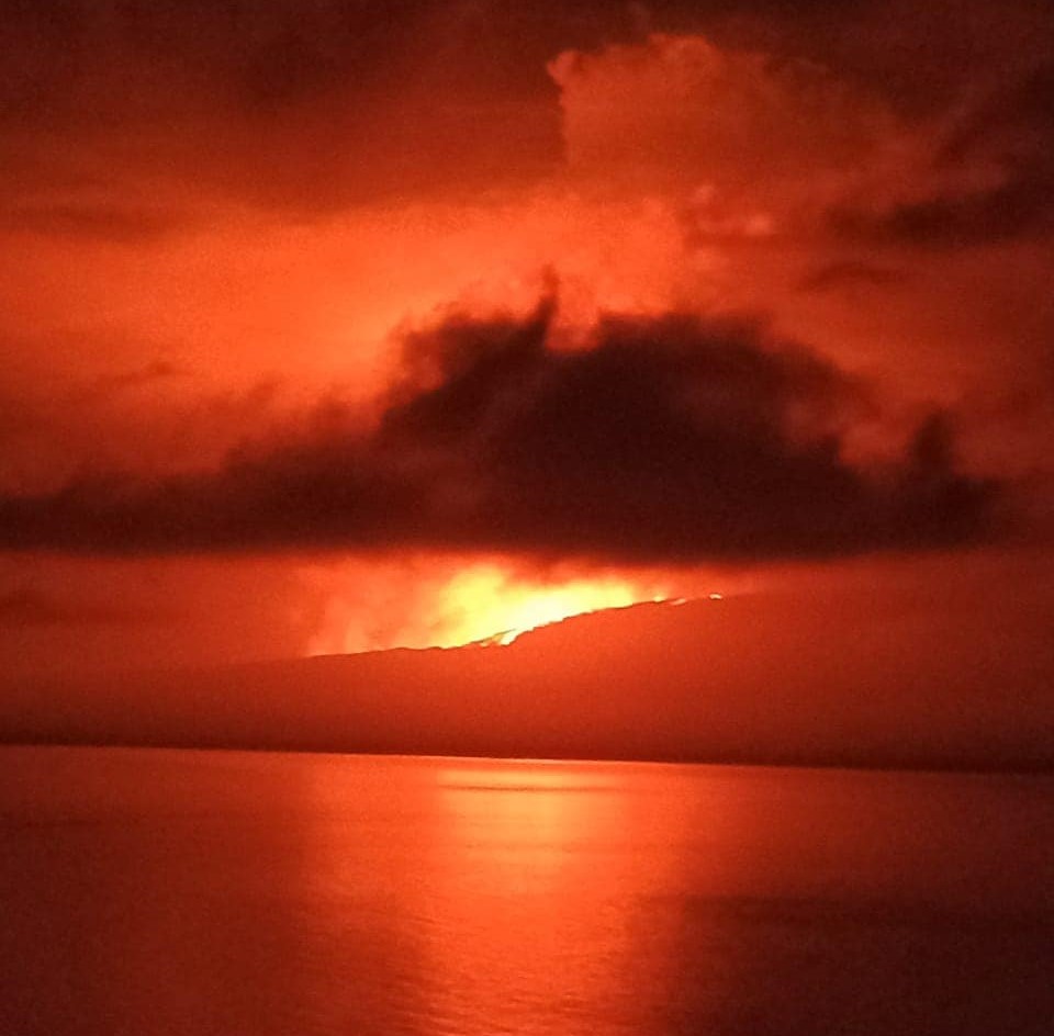
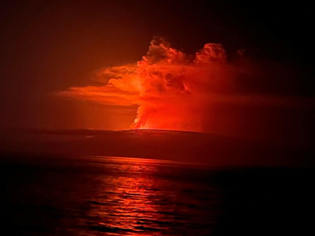
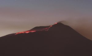
Figure 1. Start of the eruption of the Fernandina volcano (Galapagos). In the image, the gas emission is observed at a height between 2 and 3 km above the summit level towards the West. The incandescence corresponds to lava flows. Photograph retrieved from Facebook authors Doménica Guerrero and Jeff O’Marley Herrera. Published by Radio Santa Cruz.
summary
On Saturday March 2, 2024 at 11:50 p.m. (Galapagos time), the Fernandina volcano (La Cumbre) began a new eruptive process, 4 years after its last eruption (January 2020). Gas emissions and thermal anomalies were detected using the GOES-16 and VIIRS satellite systems. Images shared on social networks confirm the eruption through a circumferential crack located in the upper part of the southeastern flank. In the hours that followed, the gas cloud, without much ash, moved under the influence of the wind towards the West, the North-North-West and the South-South-East. It is important to note that Fernandina Island does not have any human settlements and therefore there is no risk to people. The duration of the eruption cannot be accurately predicted, nor whether it will reach the seashore, but based on volcano deformation data accumulated since the last eruptive period, it is likely that the current eruption will be larger than those observed in 2017, 2018 and 2020. The Institute of Geophysics continues to monitor the phenomenon and will notify in the event of significant changes.
Background
The Fernandina volcano (La Cumbre) presented its last eruptive process on January 12, 2020, which lasted approximately 9 hours and was characterized by the opening of a fissure located under the eastern edge of the caldera, where flows of lava were emitted towards the eastern flank. (IGEPN, 2020a). Additionally, a gas cloud was generated, reaching a maximum height of 3.5 km above sea level. In the weeks following the eruption, an increase in seismicity associated with ground deformation was recorded (IGEPN Report, 2020b; IGEPN, 2021). With between 28 and 30 recorded eruptions since 1800, Fernandina Volcano has the highest eruption recurrence rate in the Galapagos Islands.
Ash and gas clouds:
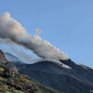
Starting at 11:50 p.m. TL (Galapagos time) on March 2, the geostationary satellite GOES-16 recorded gas emission about 2-3 km above summit level with very low ash content. The broadcast was most intense until around 04:00 TL before fading. The gas cloud moved towards the West, the North-North-West and the South-South-East without going beyond populated areas.
Lava flows
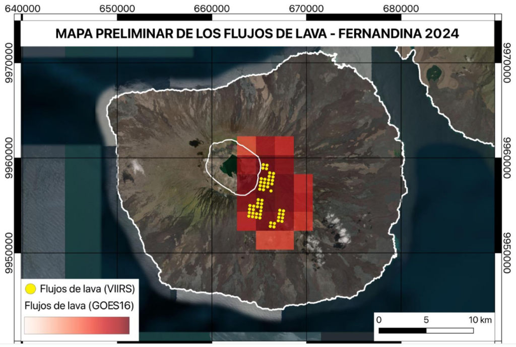
The geostationary satellite GOES-16 recorded thermal anomalies on the southeastern flank of the Fernandina volcano (La Cumbre) from 11:50 p.m. TL (Galapagos) on March 2, corresponding to the descent of lava flows. Additionally, the polar satellites SUOMI-NPP and NOAA-20 recorded more than 1,000 thermal anomalies as they passed over the Galapagos at 00:44 TL and 01:35 TL on March 3, respectively. With this combined information, the first preliminary map of the eruption was prepared using tools developed by the Geophysical Institute (Vasconez et al., 2022). The figure shows that the lava flows come from a circumferential crack located on the southeast flank of the volcano. Previously, the fissure has a length of between 3 and 5 km, while the lava flows have a maximum range of 5 to 6 km, without reaching the sea.
Source : IGEPN
Photos : Doménica Guerrero / JeffO’Marley Herrera, John Garate via Sherine France , IGEPN.
Iceland , Reykjanes Peninsula :
Continued increased likelihood of an eruption. Magma continues to accumulate beneath Svartsengi
Updated 3. March at 12:15 UTC
Likely scenario over the next few days
Magma volume beneath Svartsengi continues to increase, which could lead to another magma propagation and even a volcanic eruption.
A volcanic eruption could start with a very short warning time, event less than 30 minutes.
A volcanic eruption is most likely to occur in the area between mt. Stóra-Skógfell and mt. Hagafell.
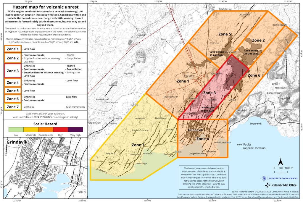
The Icelandic Meteorological Office has updated the hazard assessment map due to the decrease in seismic activity in the Reykjanes peninsula.
Considering the developments in activity since yesterday, the hazard level has been lowered in two zones – Zones 2 and 3. The hazard level remains unchanged in other areas, thus the hazard assessment is now the same as it was prior to yesterday‘s event.
The hazard assessment map is valid from 13:00 UTC today, 3 March, until 15:00 Tuesday 5 March unless development in activity call for a re-evaluation.
Source et photo : IMO
La Réunion , Piton de la Fournaise :
Seismicity
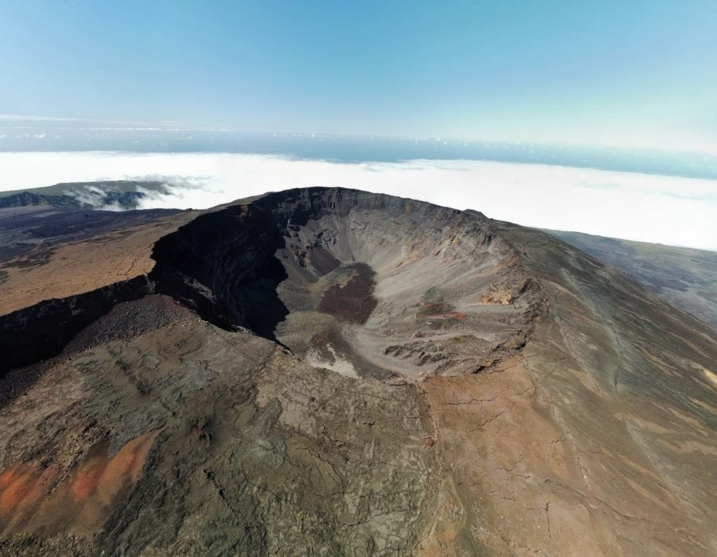
In February 2024, the OVPF-IPGP recorded in total at the Piton de la Fournaise massif:
• 12 superficial volcano-tectonic earthquakes (0 to 2.5 km above sea level) under the summit craters;
• 3 deep earthquakes (below sea level);
• 24 long-period earthquakes;
• 263 landslides.
The month of February 2024 was marked by low seismicity under the Piton de la Fournaise with only 12 superficial volcano-tectonic earthquakes and three deep earthquakes recorded.
Only two deep volcano-tectonic earthquakes could be located, under the Dolomieu crater and under the western part of the Enclos Fouqué. The others – of lower magnitudes – could not be located.
Numerous (263) landslides in the Dolomieu Crater, at the Cassé de la Rivière de l’Est and at the level of recent lava flows were also recorded.
Deformation
In November 2023, a resumption of peak inflation was recorded. This stopped at the end of November and was followed by a period of peak deflation until the end of 2023.
A trend towards a resumption of building inflation seems visible since the second half of February on the baselines located at the base of the terminal cone. This trend will be confirmed with next month’s observations.
Balance sheet
Since December 2023, magma replenishment and pressurization of the surface reservoir have ceased.
In February 2024, seismicity remained low with only 12 volcano-tectonic earthquakes recorded under the summit craters. A trend towards a resumption of building inflation seems visible since the second half of February on the baselines located at the base of the terminal cone. This trend will be confirmed with next month’s observations.
Note that since 2016, the replenishment of the superficial magmatic reservoir under the Piton de la Fournaise has taken place in pulses, thus such phases of calm in deformations and seismicity have already been observed on several occasions between 2016 and 2023 over periods ranging from 15 days to several months.
Indonesia , Ili Lewotolok :
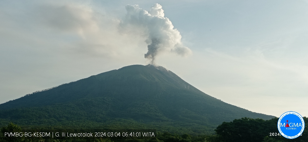
SEISMICITY OBSERVATIONS:
11 eruption/explosion earthquakes with amplitude of 14.7 to 38 mm and duration of 30 to 115 seconds.
103 emission earthquakes with an amplitude of 1.6 to 27.5 mm and earthquake duration of 21 to 107 seconds.
16 non-harmonic tremors with amplitude from 2 to 28.3 mm and earthquake duration from 84 to 334 seconds.
1 local tectonic earthquake with an amplitude of 11.3 mm, and duration of the earthquake of 39 seconds.
RECOMMENDATION
At Level III activity level (SIAGA), it is recommended:
-Communities around Mount Ili Lewotolok as well as visitors/climbers/tourists should not enter or conduct activities within a 2 km radius around the Mount Ili Lewotolok activity center, and residents of the villages of Lamawolo, Lamatokan and Jontona village should always be alert to the potential threat of danger from lava avalanches and hot clouds originating from the eastern part of the summit/crater of Mount Ili Lewotolok.
Chile , Descabezado Grande :
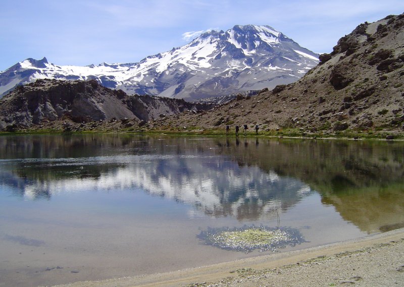
Special Report on Volcanic Activity (REAV), Maule region, Descabezado Grande volcanic complex, March 3, 2024, 4:58 a.m. local time (mainland Chile)
The National Geology and Mining Service of Chile (Sernageomin) announces the following PRELIMINARY information, obtained through the monitoring equipment of the National Volcanic Monitoring Network (RNVV), processed and analyzed at the Andes del Sud Volcanological Observatory ( Ovdas):
On Sunday March 3, 2024 at 4:38 a.m. local time (7:38 a.m. UTC), monitoring stations installed near the Descabezado Grande volcanic complex recorded an earthquake associated with the fracturing of rocks inside the volcanic system (VT volcano-tectonic type) .
The characteristics of the earthquake after its analysis are as follows:
ORIGINAL TIME: 04:38 local time (07:38 UTC)
LATITUDE: 35.580° S
LONGITUDE: 70.752°E
DEPTH: 2.2 km
LOCAL MAGNITUDE: 3 (ML)
Comments:
After the mentioned event, other lower energy volcano-tectonic events were recorded. Images from IP cameras did not show superficial activity.
The technical volcanic alert remains at the Green level.
Source : Sernageomin.
Photo : Wikiheinz

