January 29 , 2024 .
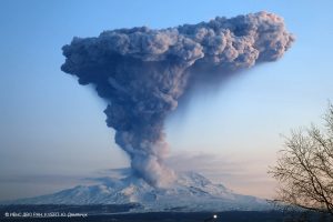
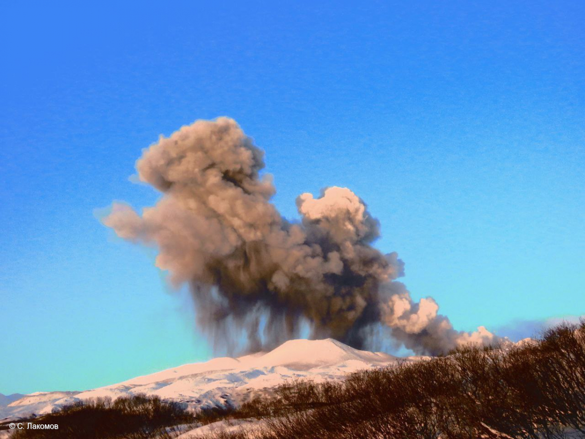
Russia / Northern Kuril Islands , Ebeko :
VOLCANO OBSERVATORY NOTICE FOR AVIATION (VONA)
Issued: January 29 , 2024
Volcano: Ebeko (CAVW #290380)
Current aviation colour code: ORANGE
Previous aviation colour code: orange
Source: KVERT
Notice Number: 2024-06
Volcano Location: N 50 deg 41 min E 156 deg 0 min
Area: Northern Kuriles, Russia
Summit Elevation: 1156 m (3791.68 ft)
Volcanic Activity Summary:
A moderate explosive eruption of the volcano continues. According to visual data from Severo-Kurilsk, explosions sent ash up to 1.5 km a.s.l., and ash cloud drifted to the east of the volcano.
A moderate explosive eruption of the volcano continues. Ash explosions up to 6 km (19,700 ft) a.s.l. could occur at any time. Ongoing activity could affect low-flying aircraft and airport of Severo-Kurilsk.
Volcanic cloud height:
1500 m (4920 ft) AMSL Time and method of ash plume/cloud height determination: 20240129/0540Z – Visual data
Other volcanic cloud information:
Distance of ash plume/cloud of the volcano: 5 km (3 mi)
Direction of drift of ash plume/cloud of the volcano: E
Time and method of ash plume/cloud determination: 20240129/0540Z – Visual data
Source : Kvert
Photo : S. Lakomov
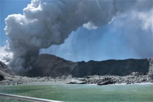
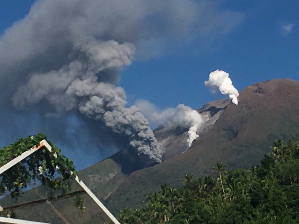
Philippines , Bulusan :
BULUSAN VOLCANO ADVISORY , 28 January 2024 ,09:45 PM
This is a notice of increased seismic activity at Bulusan Volcano.
A total of one hundred twenty-six (126) weak volcano-tectonic (VT) earthquakes has been recorded by the Bulusan Volcano Network (BVN) since 12AM today, 28 January 2024. These VT earthquakes ranged in strength between ML0.3 to ML2.2 and were generated between 1 to 9 kilometers beneath the north to northwestern flank of the volcano edifice. Degassing activity from the summit crater and active vents generated very-weak to moderate volume plumes that drifted southwest to northwest. Sustained seismic unrest for the past month indicates persistent hydrothermal activity that is likely driven by deep-seated magmatic processes and may lead to steam-driven or phreatic eruption.
The public is reminded that Alert Level 1 prevails over Bulusan Volcano, which means it is currently at sustained low-level unrest with increased chances of steam-driven or phreatic eruptions. Local government units and the public are reminded that entry into the 4-kilometer radius Permanent Danger Zone (PDZ) should be prohibited and that vigilance in the 2-kilometer Extended Danger Zone (EDZ) on the southeast sector must be exercised due to the possibilities of sudden and hazardous phreatic eruptions. Civil aviation authorities must also advise pilots to avoid flying close to the volcano’s summit as ash from any sudden phreatic eruption can be hazardous to aircraft. Furthermore, people living within valleys and along river/stream channels should be vigilant against sediment-laden stream flows and lahars in the event of heavy and prolonged rainfall occurring simultaneous with phreatic eruption.
DOST-PHIVOLCS is closely monitoring Bulusan Volcano’s condition and any new development will be relayed to all concerned.
Source : Phivolcs
Photo : Drew Zuñiga
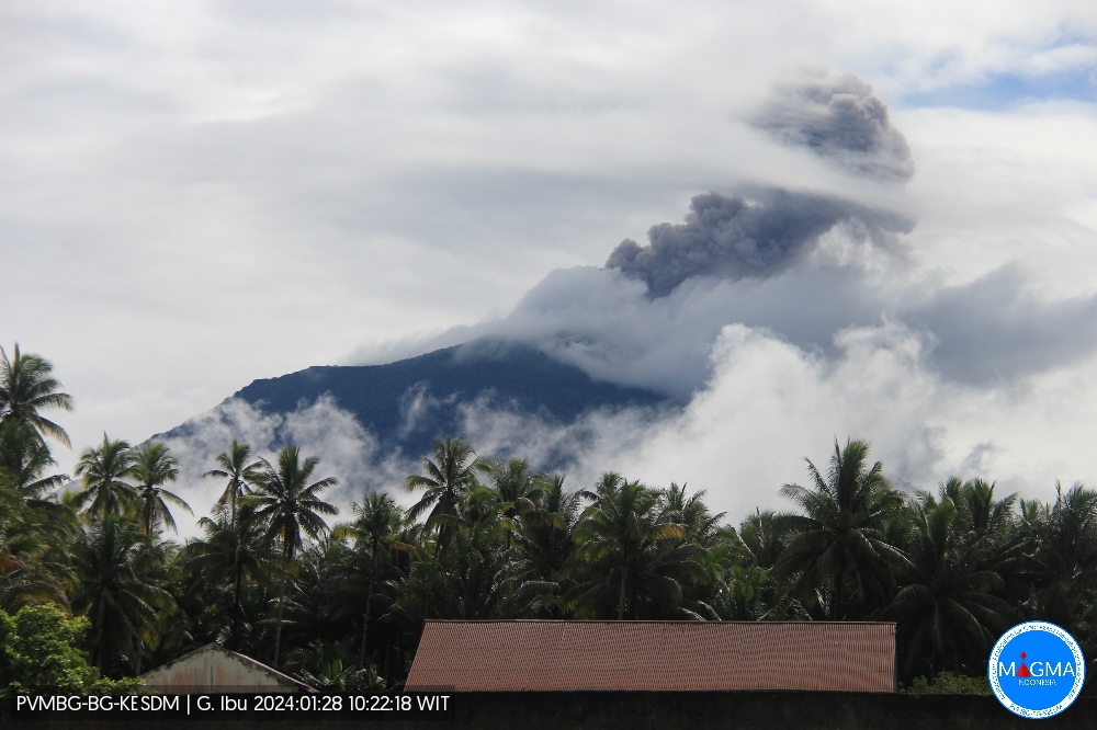
Indonesia , Ibu :
An eruption of Mount Ibu occurred on Sunday 28 January 2024 at 10:10 WIT with the height of the ash column observed at ±600 m above the summit (±1925 m above sea level). The ash column was observed to be gray with thick intensity, oriented towards the South. This eruption was recorded on a seismograph with a maximum amplitude of 26 mm and a duration of 58 seconds.
SEISMICITY OBSERVATIONS
26 eruption earthquakes with an amplitude of 15 to 28 mm and a duration of 23 to 98 seconds.
132 emission earthquakes with an amplitude of 5 to 14 mm and earthquake duration of 15 to 50 seconds.
10 harmonic tremors with an amplitude of 3 to 15 mm and an earthquake duration of 32 to 227 seconds.
235 Shallow volcanic earthquakes with an amplitude of 2 to 14 mm and an earthquake duration of 4 to 14 seconds.
5 deep volcanic earthquakes with an amplitude of 3 to 11 mm, and an earthquake duration of 5 to 8 seconds.
12 distant tectonic earthquakes with an amplitude of 2 to 12 mm, and the duration of the earthquake was 32 to 88 seconds.
RECOMMENDATION
Communities around Mount Ibu and visitors/tourists are advised not to carry out activities within a radius of 2.0 km with a sectoral extension of 3.5 km towards the crater opening in the northern part of the crater active Mount Ibu.
In the event of ash falling, people who practice activities outside the home are advised to wear nasal, oral (mask) and eye (glasses) protection.
Source et photo : Magma Indonésie.
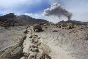
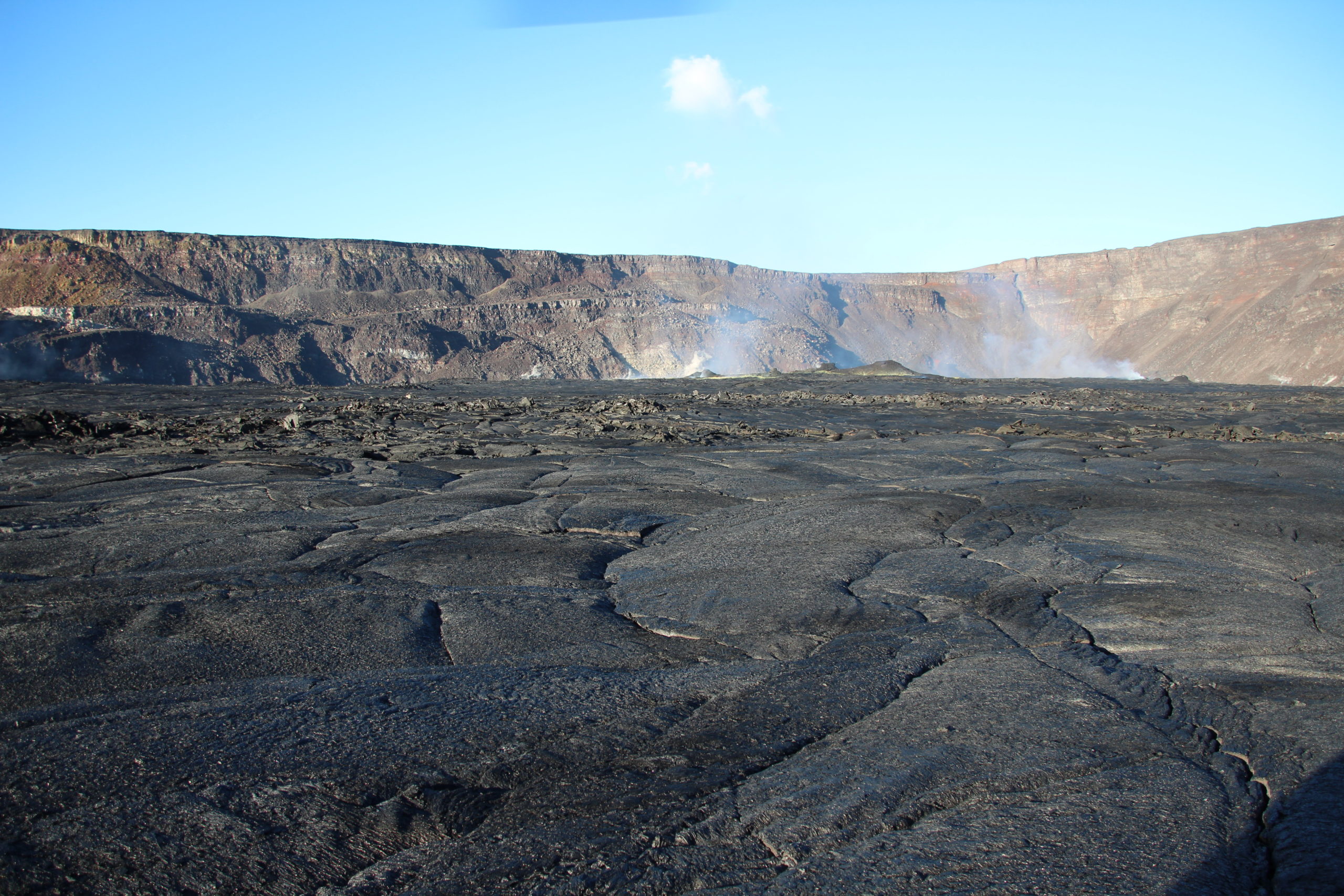
Hawaii , Kilauea :
Sunday, January 28, 2024, 8:59 AM HST (Sunday, January 28, 2024, 18:59 UTC)
19°25’16 » N 155°17’13 » W,
Summit Elevation 4091 ft (1247 m)
Current Volcano Alert Level: ADVISORY
Current Aviation Color Code: YELLOW
Activity Summary:
Kīlauea volcano is not erupting. Over the past day, seismicity picked up in the south caldera region, but has remained steady. Kīlauea summit remains pressurized; in recent months unrest has escalated quickly, and an eruption could occur in the future with little warning.
Summit Observations:
Rates of seismicity in the south caldera area increased yesterday morning, but remained stable through the day. This morning, seismicity is somewhat lower, but a tiltmeter near Sand Hill indicates ongoing inflationary deformation Periods of increased seismicity can be expected to continue during repressurization of the summit magma reservoir, which has been ongoing since the end of the September 2023 eruption.
Kīlauea’s summit region remains at a high level of inflation. Together with the increase in seismicity yesterday morning, a tiltmeter near Sand Hill indicated an increase in inflationary tilt. The tilt rate has remained steady over the past 24 hours (neither increasing nor decreasing). A tiltmeter near Uēkahuna bluff also responded to yesterday’s events, but to a lesser degree, as this instrument is not as sensitive to south caldera changes.
Sulfur dioxide (SO2) gas emission rates remain low. Field measurements indicated an SO2 emission rate of approximately 70 tonnes per day on January 17, which was similar to measurements in October, November, and early December.
Source : HVO
Photo : USGS / N. Deligne.
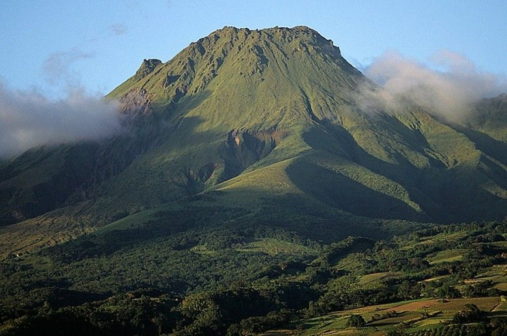
La Martinique , Montagne Pelée :
Weekly report, Paris Institute of Globe Physics, Martinique Volcanological and Seismological Observatory. Saint-Pierre, January 26, 2024 at 12:30 p.m. local time (GMT-4)
Volcanic activity remains low with 1 earthquake of volcanic origin observed this week.
Between January 19, 2024 at 4:00 p.m. (UT) and January 26, 2024 at 4:00 p.m. (UT), the OVSM recorded 1 low-energy deep hybrid earthquake. This earthquake was located approximately 30 km deep southwest of the volcano.
Hybrid type seismic signals contain low frequencies and are associated with the presence of magmatic fluids in the depths of the Montagne Pelée volcanic system.
This earthquake was not felt by the population.
The previous week, the OVSM had recorded 1 earthquake of volcanic origin. As of January 26, 2024 and during the last 4 weeks, the OVSM has therefore observed a total of 10 volcanic earthquakes, or an average of 2 to 3 earthquakes per week.
During phases of volcanic reactivation of volcanoes similar to Montagne Pelée, it is usual to observe seismic activity varying in intensity and frequency.
The alert level is currently YELLOW: vigilance.
Source : Direction de l’OVSM-IPGP
Photo : Photopoesie