January 09 , 2024.
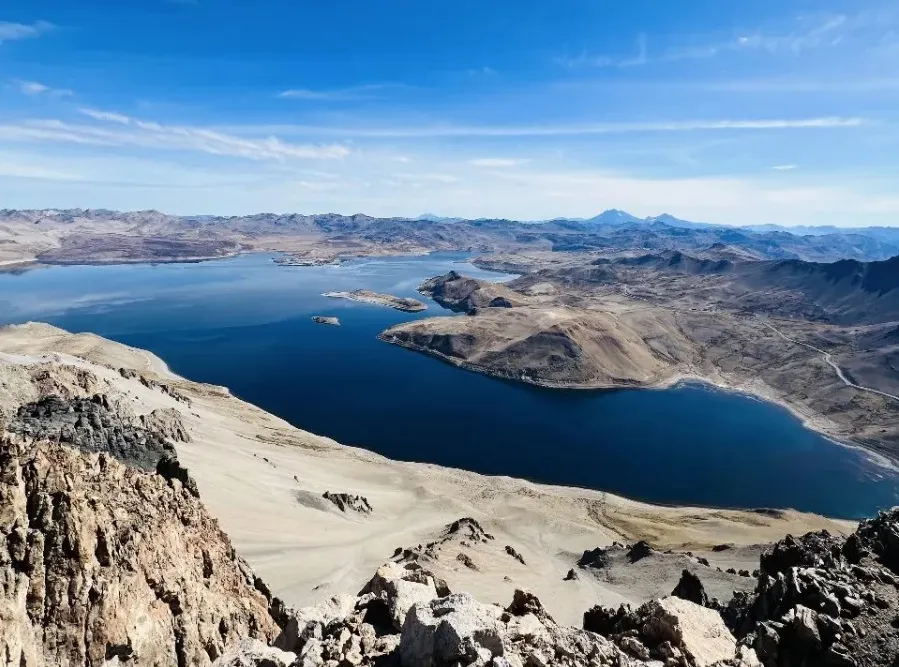
Chile , Laguna del Maule :
Special Report on Volcanic Activity (REAV), Maule region, Laguna del Maule volcanic complex, January 8, 2024, 9:50 p.m. local time (mainland Chile)
The National Geology and Mining Service of Chile (Sernageomin) announces the following PRELIMINARY information, obtained through the monitoring equipment of the National Volcanic Monitoring Network (RNVV), processed and analyzed at the Andes del Sud Volcanological Observatory ( Ovdas):
On Monday January 8, 2024 at 8:43 p.m. local time (11:43 p.m. UTC), monitoring stations installed near the Laguna del Maule volcanic complex recorded a swarm of earthquakes, associated with fracturing of rocks (volcano-tectonic type, VT) . At the time of issuing this report, more than 200 events were recorded, including the highest energy event located 3.6 km east-southeast of the center of the lagoon.
The characteristics of the largest magnitude earthquake recorded so far after its analysis are as follows:
ORIGINAL TIME: 8:43 p.m. local time (11:43 p.m. UTC)
LATITUDE: 36.087°S
LONGITUDE: 70.477°E
DEPTH: 5.7 km
LOCAL MAGNITUDE: 1.6 (ML)
Comments:
Following the main event, volcano-tectonic seismicity continues to be recorded with low energy events (ML< 1.0).
The technical volcanic alert remains at the Yellow level.
Source : Sernageomin.
Photo : OAVV
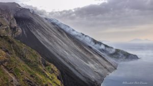
Ecuador , Sangay :
DAILY REPORT ON THE STATE OF THE SANGAY VOLCANO, Monday January 8, 2024.
Information Geophysical Institute – EPN.
Surface Activity Level: High, Surface Trend: Ascending
Internal Activity Level: High, Internal Trend: Ascending
Seismicity: From January 7, 2024, 11:00 a.m. to January 8, 2024, 11:00 a.m.:
The number of seismic events recorded at the reference station over the past 24 hours is shown below. The level of seismic activity of the volcano remains high.
Explosion Event (EXP): 3308
Precipitation/Lahars:
No rain was recorded in the volcano area which could generate mud and debris flows.
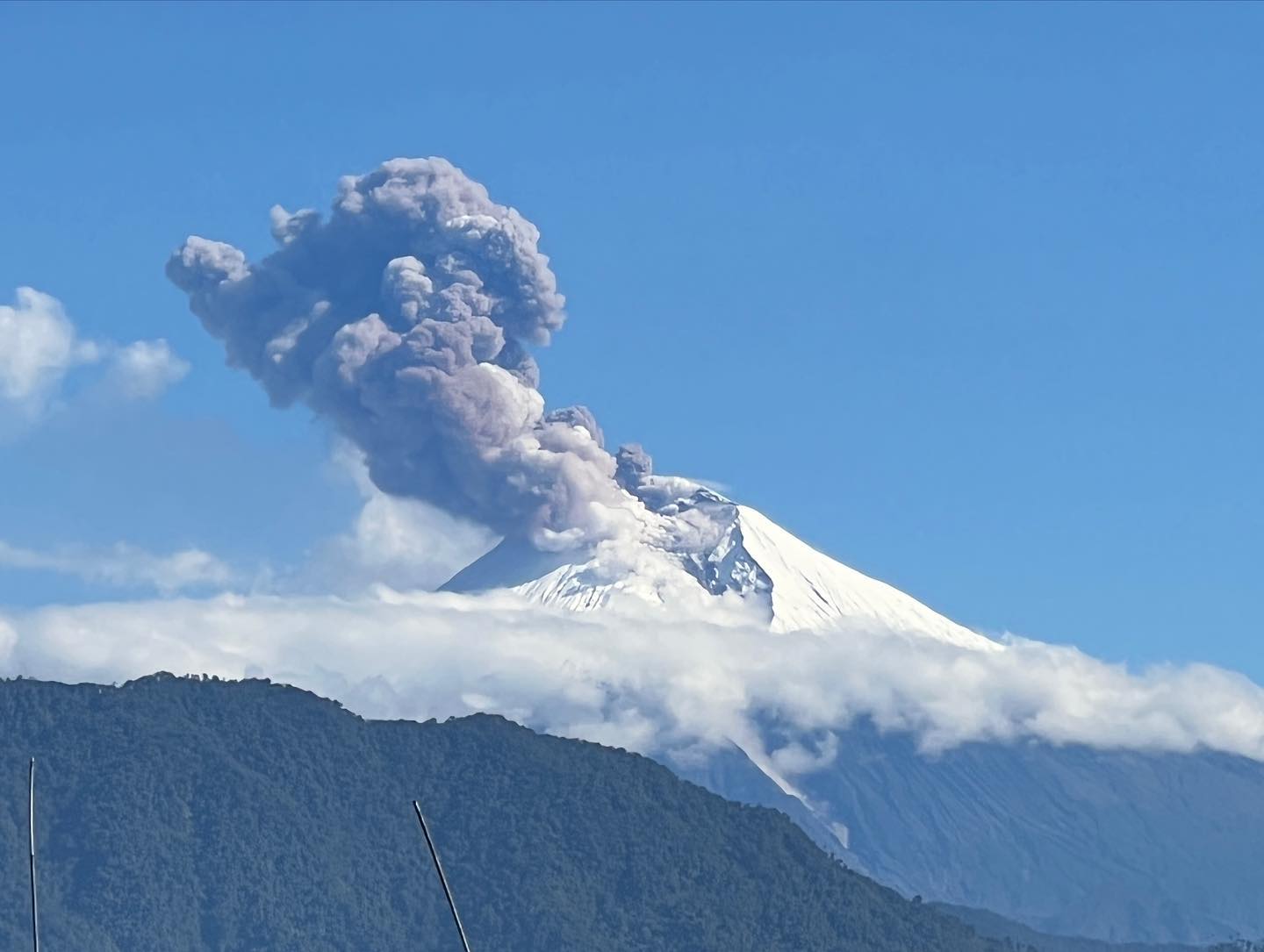
Emissions/ash column:
From yesterday afternoon until today morning, thanks to the surveillance camera system and the GOES – 16 satellite system, several gas and ash emissions were recorded with heights between 400 and 800 meters above sea level. above the level of the crater with West and South-West directions. Likewise, this activity was also reported by the Washington VAAC through 3 reports. In addition, during the morning of today, pyroclastic flows were recorded in the southeast ravine of the volcano, thus announcing the possibility of light ash falls in the province of Chimborazo. Thanks to reports from ROVE and SNGRE, the light ash fall was confirmed in the canton of Guamote-Chimborazo. This phenomenon is recurring throughout the current eruptive period which began in May 2019. It is recommended to take appropriate measures and obtain information from official sources.
Other monitoring parameters:
The MIROVA-MODIS satellite system recorded 1 weak thermal anomaly over the last 24 hours.
Observation:
From yesterday afternoon until today’s morning break, thanks to the surveillance camera system, the volcano remained cloudy most of the time; with the exception of small episodes which allowed the recording of declared emissions and the presence of incandescent material at the level of the crater
Alert level: yellow
Source : IGEPN.
Photo : AdriáLou Garay Véle
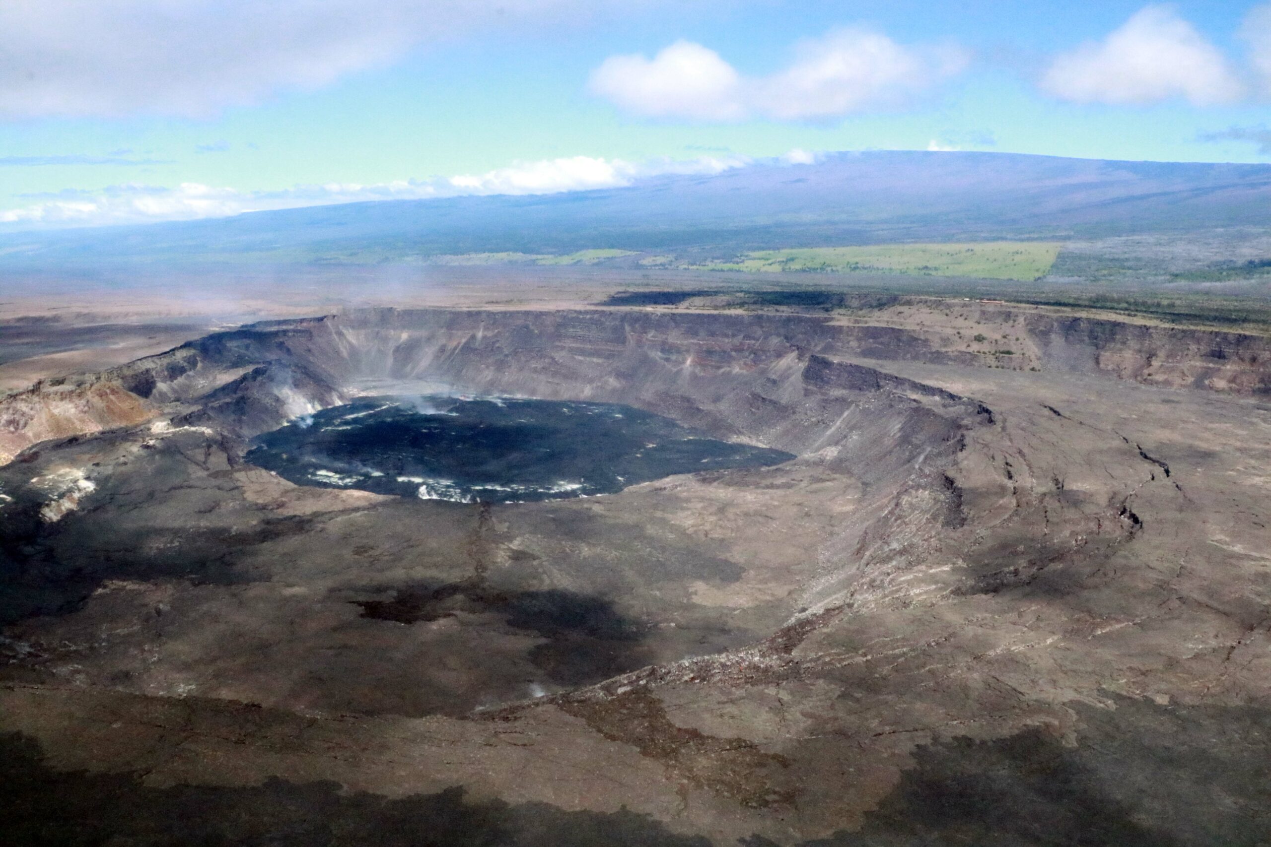
Hawaii , Kilauea :
Monday, January 8, 2024, 8:19 AM HST (Monday, January 8, 2024, 18:19 UTC)
19°25’16 » N 155°17’13 » W,
Summit Elevation 4091 ft (1247 m)
Current Volcano Alert Level: ADVISORY
Current Aviation Color Code: YELLOW
Activity Summary:
Kīlauea volcano is not erupting. Over the past day seismicity has been low in the summit region, upper East Rift Zone, and Southwest Rift Zone. Unrest may continue to wax and wane with fluctuating input of magma to the area, and eruptive activity could occur in the near future with little or no warning. No unusual activity has been noted along the middle and lower sections of Kīlauea’s East Rift Zone.
Summit Observations:
Over the past 24 hours, seismicity has remained low in Kīlauea’s summit region with approximately 5 small-magnitude earthquakes (less than M2) recorded beneath the caldera. The region south and southwest of the caldera remains quiet. Periods of increased shallow seismicity can be expected to continue during repressurization of the summit magma reservoir, which has been ongoing since the end of the September 2023 eruption. Seismicity has not reached the levels that immediately preceded recent summit eruptions at Kīlauea.
Kīlauea’s summit region remains at a high level of inflation; relative tilt is above the level reached prior to the most recent eruption in September 2023, and it is higher than at any time since the 2018 eruption. Over the past 24 hours, summit tilt showed little change and remained relatively flat.
Sulfur dioxide (SO2) gas emission rates remain low. Field measurements indicated an SO2 emission rate of approximately 80 tonnes per day on December 28, which was similar to measurements in October, November, and early December.
Source : HVO
Photo : USGS/ K. Mulliken
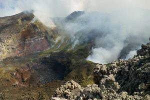
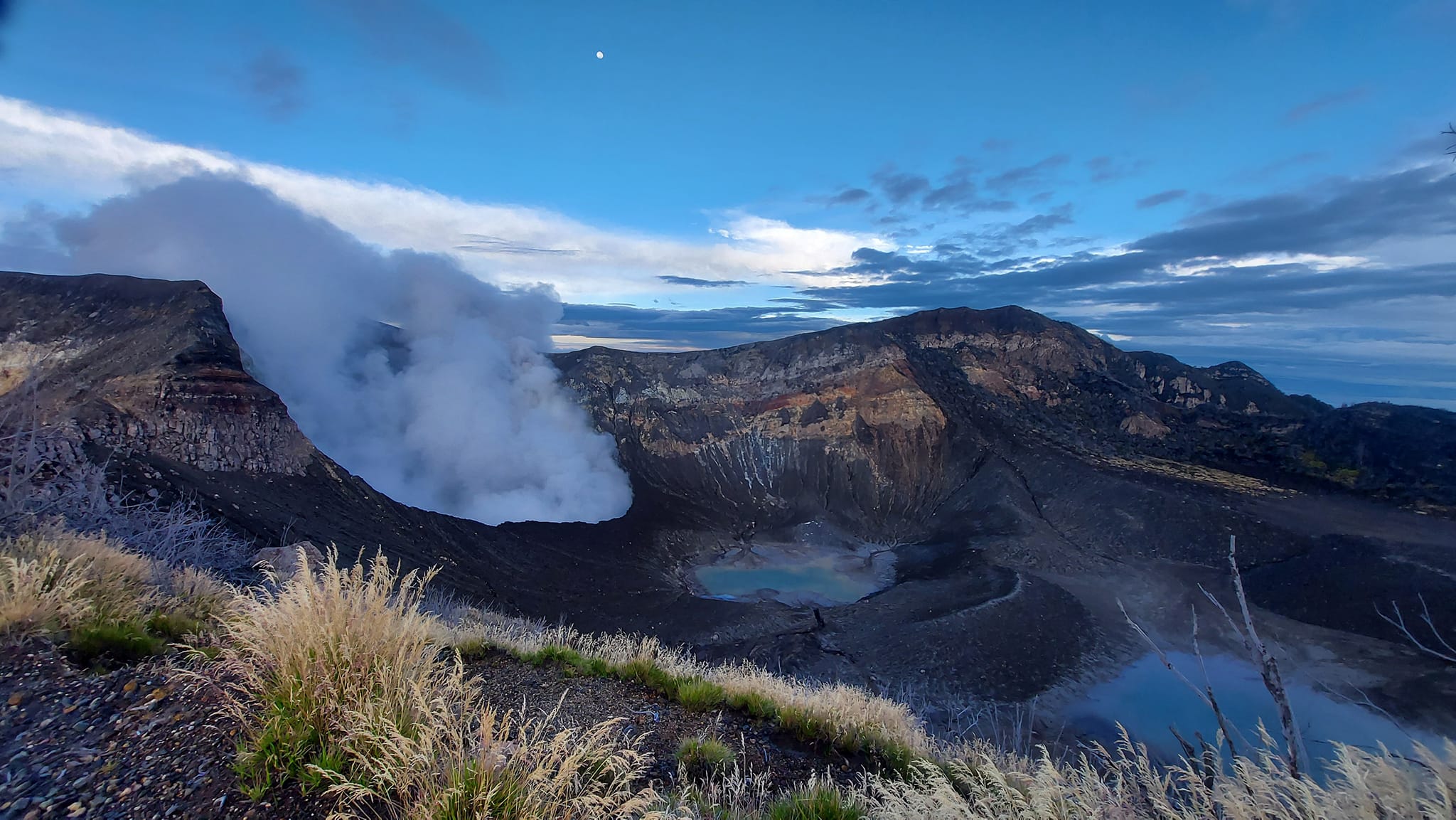
Costa Rica , Rincon de la Vieja / Poas / Turrialba :
Daily report on the state of volcanoes. Date: January 7, 2024. Updated at: 11:26:00.
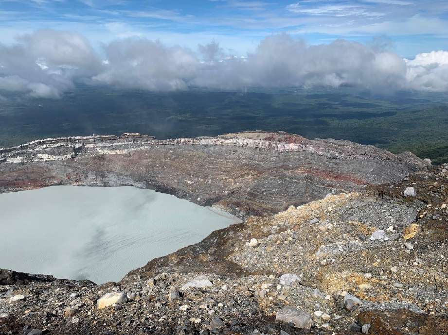
Rincón de la Vieja Volcano
Latitude: 10.83
Longitude:-85.324
Altitude: 1,916 meters above sea level
Activity observed:
The seismograph network recorded approximately 8 small eruptions-exhalations of steam, gas and aerosols in the main crater over the last 24 hours which could not be seen visually as they are low-level events. energy and due to the cloudy conditions prevailing in the crater at the top of the volcano. The continuous and stable volcanic tremor seismic signal is recorded by seismographs with intermediate frequencies between 3 and 4 Hz, as well as intermittent variable tremor with low frequencies between 0.7 and 2.5 Hz. These tremors are associated with the transport of fluids (water, gas). ) in the volcanic building.
Environmental conditions:
Winds are heading southwest at 22 km/h (Windy.com) and the summit of the volcano generally remains cloudy.
Activity Level: Caution (3)
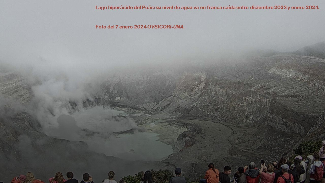
Poas Volcano
Latitude: 10.2
Longitude: -84,233
Altitude: 2,687 meters above sea level
Activity observed:
Seismographs record 1 band of volcanic tremor with frequencies around 2.5 Hz. No phreatic eruptions have been recorded in the last 24 hours. The ExpoGAS gas detection system located south of the active crater, at the visitors’ viewpoint, recorded a maximum SO2 gas concentration of 1 part per million. The MultiGAS gas detection system located on the western rim of the Poás crater recorded stable CO2/SO2 gas ratios, between 0.8 and 1.3, and SO2 concentrations fluctuating between 0.6 and 27 parts per million. .
Environmental conditions:
Winds blow from the South-West at 21 km/h (IMN) and the summit remains frequently cloudy.
Activity Level: Warning (2)
Turrialba Volcano
Latitude: 10,025
Longitude: -83,767
Altitude: 3,325 meters above sea level
Activity observed:
Seismographs record no signs of volcanic eruptions or earthquakes. The seismic activity and fumarolic degassing of the volcano remains generally low, with a relatively low number of low frequency and amplitude LP-type volcanic earthquakes linked to the transport of fluids (water, gas). The MultiGAS gas detection system located around West Crater recorded stable CO2/SO2 gas ratios over the past 24 hours with values around 9 and a low SO2 concentration of 2.5 parts per million. The webcam has been out of service since December 22, 2023.
Environmental conditions:
Winds are blowing westward at 36 km/h (Windy.com) and the summit remains generally cloudy.
Activity Level: Warning (2)
Source : Ovsicori.
Photos : Juan Carlos López del ICE. , Ovsicori , Parque Nacional