December 06 , 2023.
Italy / Sicily , Etna :
WEEKLY BULLETIN, from November 27, 2023 to December 3, 2023. (publication date December 5, 2023)
SUMMARY STATEMENT OF ACTIVITY
In light of the monitoring data, it appears:
VOLCANOLOGICAL OBSERVATIONS: Strombolian type eruptive activity at the South-East crater with lava fountain event and degassing at the Bocca Nuova crater.
2) SEISMOLOGY: Low seismic activity due to fracturing. Average amplitude of medium-high level volcanic tremor.
3) INFRASOUND: Moderate infrasound activity for most of the week, with a clear increase in activity during the paroxysm at the Southeast Crater.
4) GROUND DEFORMATIONS: Over the last week, the ground deformation monitoring networks have not recorded any significant developments, with the exception of the lava fountain episode of December 1, 2023.
5) GEOCHEMISTRY: So2 flux at a medium-high level
Soil CO2 fluxes are at average values
Partial pressure of CO2 dissolved in groundwater shows values within seasonal variability
The helium isotope ratio in peripheral sites is at average values
6) SATELLITE OBSERVATIONS: Thermal activity observed by satellite was generally of a moderate level with high-level anomalies corresponding to the lava fountain event of December 1, 2023.
VOLCANOLOGICAL OBSERVATIONS
During the week, monitoring of the activity of Etna was carried out thanks to the surveillance cameras of the INGV – Osservatorio Etneo (INGV-OE) and an inspection carried out by INGV-OE staff on December 2.
Generally speaking, during the week of observation, the volcanic activity was characterized by explosive activity at variable regime from the Southeast Crater (CSE) with a lava fountain event and by continuous degassing sometimes pulsed at the expense of the Bocca Nuova crater. (BN).
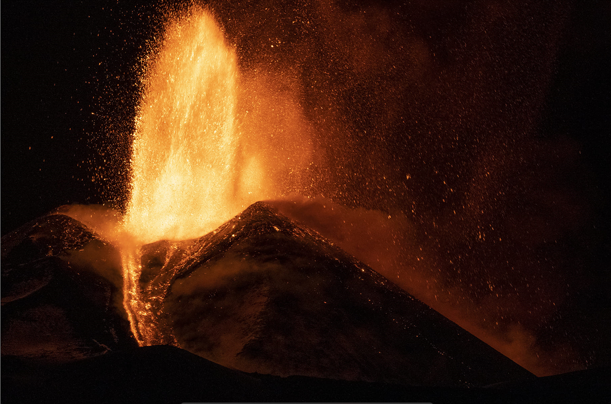
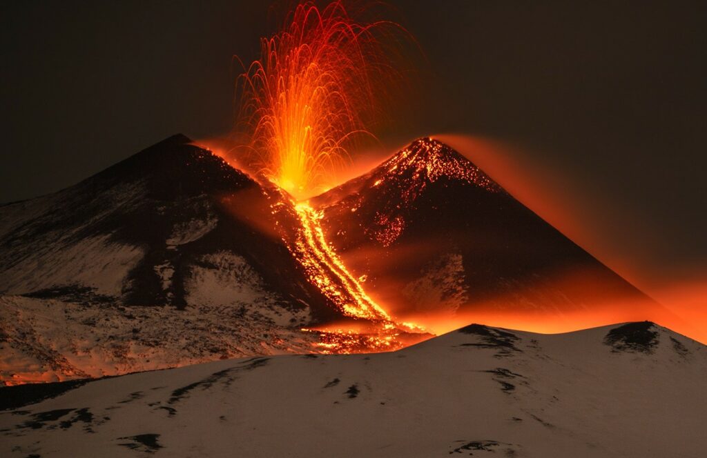
In particular, during the week, the CSE continued to fuel Strombolian-type explosive activity varying both in intensity and in the frequency of occurrence of individual explosions. The eruptive activity only concerned the crater area with fallout of ballistic products along the sides of the cone. Strombolian activity also generated modest emissions of ash which quickly dispersed near the summit area. In general, as we have already observed, explosive activity was characterized by periods of greater vigor with an increase in the number of explosions and periods of lower intensity. This variability occurred on a scale of hours during each day, as already reported in the previous bulletin.
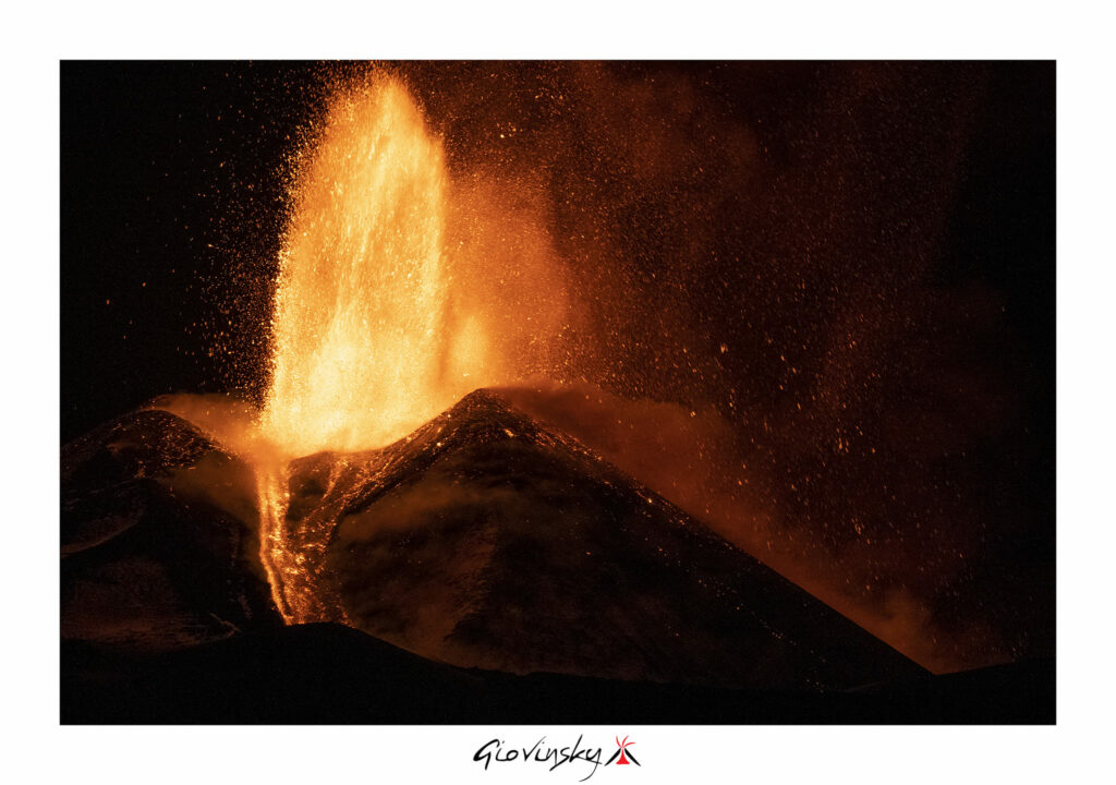
Strombolian activity intensified, becoming continuous from around 16:00 UTC on December 1 with the formation of a lava flow which extended in the South-South-West direction from 16:20 UTC. From 17:00 UTC, Strombolian activity further increased in intensity, gradually transitioning to lava fountains with the formation of a second lava flow, which from around 17:15 UTC developed in the South direction -East. The ash cloud generated by the eruptive column which reached approximately 6000 m altitude, dispersed in a northeast direction with ashes falling on the towns of Fiumefreddo, Calatabiano and Giardini Naxos. The fountain episode ended at 8:35 p.m. UTC. On December 2 and 3, the CSE showed no explosive activity but only degassing and lava flows whose most advanced fronts reached 2860 m altitude towards the South-South-West and 2300 m altitude towards the South-East, and were cooling. The total area covered by the lava flows was 5.6 × 10^5 m2 with an estimated volume of 1.1 × 10^6 m3.
The Bocca Nuova. (BN) produced a pulsed degassing with emission of hot gases whose reverberation was observable at night, while the craters of Voragine (VOR) and Northeast (CNE) continue to show no eruptive activity.
Source : INGV
Photos : Domenico Mazzaglia , Giovinsky Sicilia
Italy , Stromboli :
WEEKLY BULLETIN, from November 27, 2023 to December 3, 2023. (publication date December 5, 2023)
SUMMARY STATEMENT OF ACTIVITY
In light of the monitoring data, it appears:
1) VOLCANOLOGICAL OBSERVATIONS: Normal Strombolian activity was observed during this period. The total hourly frequency was variable but always around average values (11-14 events/h). The intensity of the explosions was low to medium in the areas of the North and South-Central craters.
2) SISMOLOGY: The monitored seismological parameters do not show significant variations, with the exception of the explosion sequence of 11/29, with the strongest energetic event recorded around 8:11 p.m. UTC.
3) GROUND DEFORMATIONS: The island’s ground deformation monitoring networks did not show significant variations over the period examined.
4) GEOCHEMISTRY: SO2 flux at medium level
CO2 flow on average values.
C/S ratio in the plume with medium-high values (last measurement on 11/19/2023)
Helium isotope ratio in the thermal aquifer on medium-high values. (last collection on November 15, 2023)
CO2 flow in Scari: the data is at average values around 115 g/m2day
5) SATELLITE OBSERVATIONS: Thermal activity observed by satellite was generally weak.
VOLCANOLOGICAL OBSERVATIONS
In the observed period, the eruptive activity of Stromboli was characterized through the analysis of images recorded by the INGV-OE surveillance cameras at altitude 190m (SCT-SCV), from
Pizzo (SPT) and Punta dei Corvi (SPCT). The explosive activity was mainly produced by three eruptive vents located in the northern area of the crater and by two vents located in the south central area.
Due to unfavorable weather conditions on November 28, visibility of the crater terrace was insufficient for a correct description of the eruptive activity.
On November 29, an explosive sequence was observed from the Center-South zone.
Observations of explosive activity captured by surveillance cameras
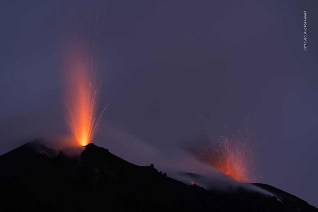
In the area of the North crater (N), with two vents located in sector N1 and one in sector N2, explosive activity of low intensity (less than 80 m in height) and medium intensity (less than 150 m) was observed. The products emitted in the eruption were mainly coarse materials (bombs and lapilli). The average frequency of explosions varied between 4 and 6 events/h. Furthermore, the vents in sector N1 presented sequences of two to three consecutive explosions spaced a few seconds apart.
In the South-Central (CS) zone, sectors S1 and C did not show significant activity. Sector S2 with two vents active even at the same time, and of variable intensity, from low to high (more than 150 m high), produced coarse material mixed with fine materials. Also in sector S2, there were sequences of three to five consecutive explosions within seconds of each other. The average frequency of explosions varied between 6 and 8 events/h.
Explosive event on November 29
On November 29 between 8:11:31 p.m. and 8:15:54 p.m. an explosive sequence hit the south-central area of the crater. In particular, at 8:11:31 p.m., the sequence begins with a high-energy explosive event coming from the South-Central area of sector S2. The duration of this event was approximately 15 s. The plume formed by a mixture of coarse and fine materials exceeded 250 m in height and was directed towards the East, while the ballistic projections were distributed radially with the fall of some blocks also along the upper area of the Sciara del Fuoco.
From 8:12:49 p.m. to 8:15:24 p.m., there were at least 7 medium-low intensity explosions (less than 100 m in height) characterized by coarse material mixed with fine. The total duration of the explosive sequence was approximately 4 minutes, all times are UTC.
Source : INGV
Photo : Stromboli stati d’animo / Sebastiano Cannavo.
Indonesia , Lokon Empung :
Press release on the volcanic activity of Mount Lokon, December 5, 2023.
Lokon Volcano is located in the administrative city of Tomohon, North Sulawesi Province, with a geographical position located at 1021’30 » North latitude and 124047’30 » East longitude with a maximum altitude of approximately 1,579 m above sea level (basic volcano data). . The volcanic activity of Mount Lokon is monitored visually and instrumentally from the Volcano Observation Post (PPGA) located in Kakaskasen Village, North Tomohon Subdistrict, Tomohon City, North Sulawesi.
The last eruption occurred in 2011 as an eruption of ash and ejections of incandescent material that fell around the crater. Mount Lokon’s activity level has been Level II (WASPADA) since August 21, 2023, Crater smoke activity since August 2023 has generally been weak, white, thick, between 25 and 400 meters high. Seismicity is dominated by shallow volcanic earthquakes with an average of 1 to 13 events per day. Phreatic eruptions can potentially occur suddenly if precipitation is significant enough.
The latest developments on Mount Lokon until December 5, 2023 at 06:00 WITA are as follows:
There was an increase in emission activity from the crater between 00:00 and 06:00 (WITA was recorded up to 25 – 150 m above Tompaluan crater, which was followed by an increase in seismicity in the form of 25 shallow volcanic earthquakes, 5 deep volcanic earthquakes, 3 emissions earthquakes and 3 distant tectonic earthquakes.
Based on visual and instrumental data, it is indicated that there was an increase in pressure in the shallow part (surface) after the recording of the shallow volcanic earthquake, associated with the release of gas.
The potential danger threat from Mount Lokon’s activities currently is the sudden occurrence of phreatic eruptions (eruptions caused by contact of magma with hydrothermal water) which may be followed by phreato-magmatic-magmatic eruptions. Eruptions may be accompanied by ejections of incandescent material, emitting lapilli, and thick ash showers with or without a sudden flow of hot eruptive clouds.
Based on the results of observations and analysis of visual and instrumental data until December 5 at 10:00 WITA, the activity level of Mount Lokon is still level II (WASPADA). The recommendations for this level of activity level II (WASPADA) are as follows:
The public and tourists should not approach and carry out activities within a 2.5 km radius of the Tompaluan Crater (activity center).
In the event of an eruption and ash fall, people are advised to stay indoors and, when outside the house, use nose, mouth protection (mask) and eyes (glasses).
Be aware of the potential for lahars in the rivers that originate from the summit of Mon Lokon, particularly during the rainy season.
Source : PVMBG.
Photo : lumbalumba resort , Manado
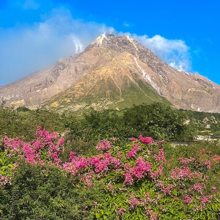
Montserrat , Soufrière Hills :
Soufrière Hills Volcano shows measurable increase in level of unrest
The Montserrat Volcano Observatory reports that activity at the Soufrière Hills Volcano has remained low but has shown measurable increase in the level of unrest in the last year.
This is according to a preliminary report released from the Montserrat Scientific Advisory Committee (SAC) Meeting. The Scientific Advisory Committee (SAC) met for its annual session this week to discuss the status of the Soufrière Hills Volcano.
The report states in particular, the volcano has produced higher rates of volcano-tectonic earthquakes since around 2019, and these have further increased in number over the last 12 months. Monitoring of ground deformation indicates a slow but continuous inflation over the island.
This established long-term trend of inflation is consistent with that observed over the previous 13 years. Measured SO2 fluxes have averaged ~300 tonnes per day over the last six months, a decrease from the previous year but still slightly above the long-term average. Thermal camera images of fumaroles on the dome were last acquired in March and indicate maximum temperature of 522 ℃ which is consistent with the increased temperatures observed since 2018.
The report states: “Overall, the unrest for the past 12 months is the highest observed during the current pause. However, based on previous restarts, we would expect a further increase in unrest prior to the resumption of any significant eruptive activity. The best explanation for this unrest is pressurisation of the magmatic reservoir at depth, possibly driven by a continued supply of magma and gas.”
The volcano, with its large lava dome, is still a potential source of hazards within Zone V, including explosions, pyroclastic flows and lahars.
Resumption of lava extrusion, or explosions, is still possible, however, the chance that explosions or pyroclastic flows will occur within the next year remains low.
It was added that continuous monitoring of the volcano is essential.
Volcanic activity at Soufrière Hills has been ongoing since 1995. An eruption on June 25, 1997, claimed 19 lives and resulted in two-thirds of the island being uninhabitable.
Source :caribbean.loopnews.com/
Photo: 664Connect Media
Colombia , Purace – Los Coconucos Volcanic Range :
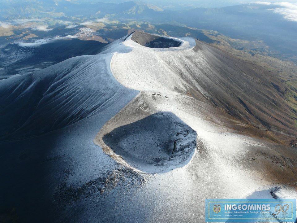
Weekly bulletin of the activity of the Puracé volcano – Los Coconucos volcanic chain.
Monitoring the activity of the VOLCANIC CHAIN PURACE VOLCANO – LOS COCONUCOS, the MINISTRY OF MINES AND ENERGY through the COLOMBIAN GEOLOGICAL SERVICE (SGC)
reports:
During the week of November 28 to December 4, 2023, there was a decrease in the frequency of seismic events and their energy levels. However, variations above the historical average in seismic activity persisted. Likewise, localized deformations continued to be recorded between the Puracé and Curiquinga volcanoes. Regarding the measurement of gases, normal values were recorded in the flow of sulfur dioxide (SO2), while the concentration values of carbon dioxide (CO2) continue to be high, compared to what was recorded over the last year.
The images obtained using the installed cameras show an increase in degassing of the volcanic system, both inside the crater and in the external lateral fumarole (flank
Northwest of the volcanic edifice). The analyzed satellite information does not show significant temperature changes in the lateral zone of the fumaroles or inside the crater.
The other parameters measured and used for the diagnosis of volcanic activity showed no notable changes during the period evaluated.
The alert status for volcanic activity remains at: YELLOW ALERT: ACTIVE VOLCANO WITH CHANGES IN THE BEHAVIOR OF THE BASE LEVEL OF MONITORED PARAMETERS AND OTHER MANIFESTATIONS.
Source et photo : SGC

