November 30 , 2023.
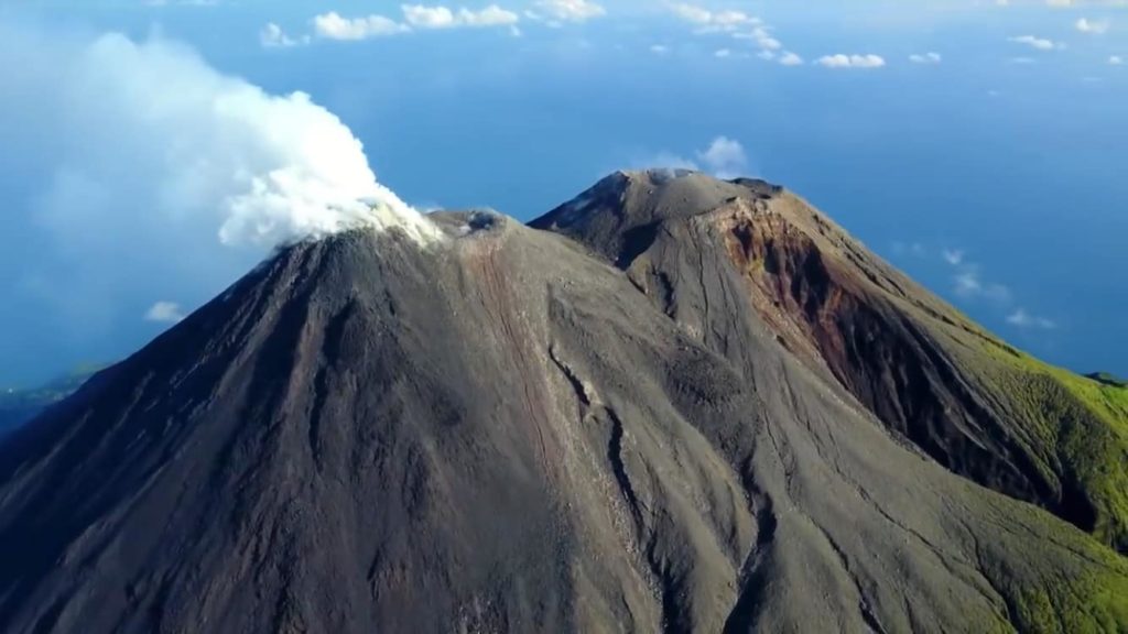
Cape Verde , Brava :
According to the Cape Verde National Institute of Meteorology and Geophysics (INMG), seismicity at Brava increased on 30 October and remained elevated. A M 3.6 earthquake was recorded at 1819 on 30 October and was followed by eight more events of similar magnitudes that were felt by residents. A M 4.8 was recorded at 21h00 and was followed by a 48-hour-long seismic swarm mostly consisting of low-magnitude events that were unable to be located. The Alert Level was raised to 2 (the second level on a five-level scale) on 30 October.
The rate of seismicity was variable, with two events every 1-10 minutes during 30 October-1 November. Most of the events were located at depths of 3-4 km; the hypocenters were initially located in the Praia de Águada area but then they migrated towards the center of the island. Continuous harmonic tremor emerged on 9 November and was interpreted as indicating the movement of magmatic gases. On 15 November seismicity increased and was characterized by more intense periods of volcanic tremor, long-period events, and “burst” events defined as identical events separated by a few seconds. In addition, residents began to feel earthquakes more often. The Alert Level was raised to 3. Three earthquakes all with magnitudes greater than three occurred during 18-19 November, and harmonic tremor again intensified on 19 November.
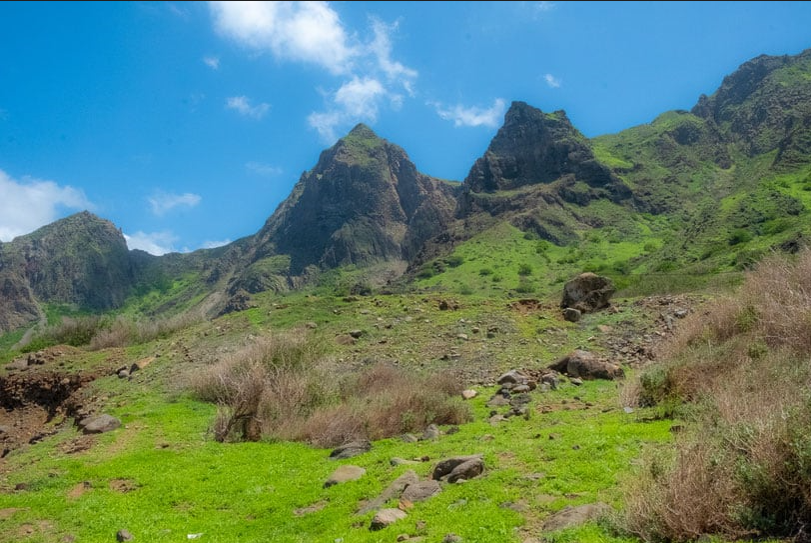
Brava Island, 20 km W of Fogo, is the westernmost of the southern Cape Verde islands. The 10-km-wide island contains 15 morphologically youthful craters located along two or three lineaments intersecting along the crest of the island. The youthfulness of the craters and numerous minor earthquakes in recent years indicate that a significant volcanic hazard still exists (Wolff and Turbeville, 1985). Most of the younger eruptions originated from the interaction of phonolitic magmas with a large groundwater reservoir contained within an older volcanic series characterized by thick welded ignimbrites and block-and-ash flow deposits. Carbonatitic lavas are also found.
Sources: Instituto Nacional de Meteorologia e Geofísica (INMG), Governo de Cabo Verde, GVP.
Photo : paulinaontheroad.
Iceland , Reykjanes Peninsula :
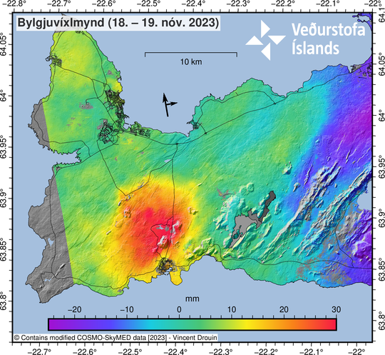
Deformation and seismicity continue to decrease while an eruption remain possible
If there would be an eruption, the most likely place would be east of Sýlingarfell.
Updated 29. November at 17:00 UTC
The seismic activity has continued to slowly decrease over the last two days. Yesterday, about 340 earthquakes were measured near the magma intrusion in the area east of Sýlingarfell, and since midnight today, around 150 earthquakes have been recorded. Most of the earthquakes have been smaller than magnitude 1.0.
The rate of uplift near Svartsengi has been decreasing, but it is still ongoing at a rate of about 1 cm per day. The majority of the displacement in the region is currently attributed to inflow under Svartsengi with a smaller portion flowing into the magmatic intrusion. In other words, the deformation measured and modeled at Svartsengi is now much greater than that seen near the magma intrusion, but all deformation signals are slowly diminishing. Observed signs of inflow into the magmatic intrusion is now limited to the area east of Sýlingarfell. Despite the slowing down of seismic activity and deformation, an eruption is still considered to be possible. If an eruption does occur, the location thought to be most likely is east of Sýlingarfell.
Source : IMO , GVP
Italy / Sicily , Etna :
Press release on the activity of Etna, November 30, 2023, 05:09 (04:09 UTC).
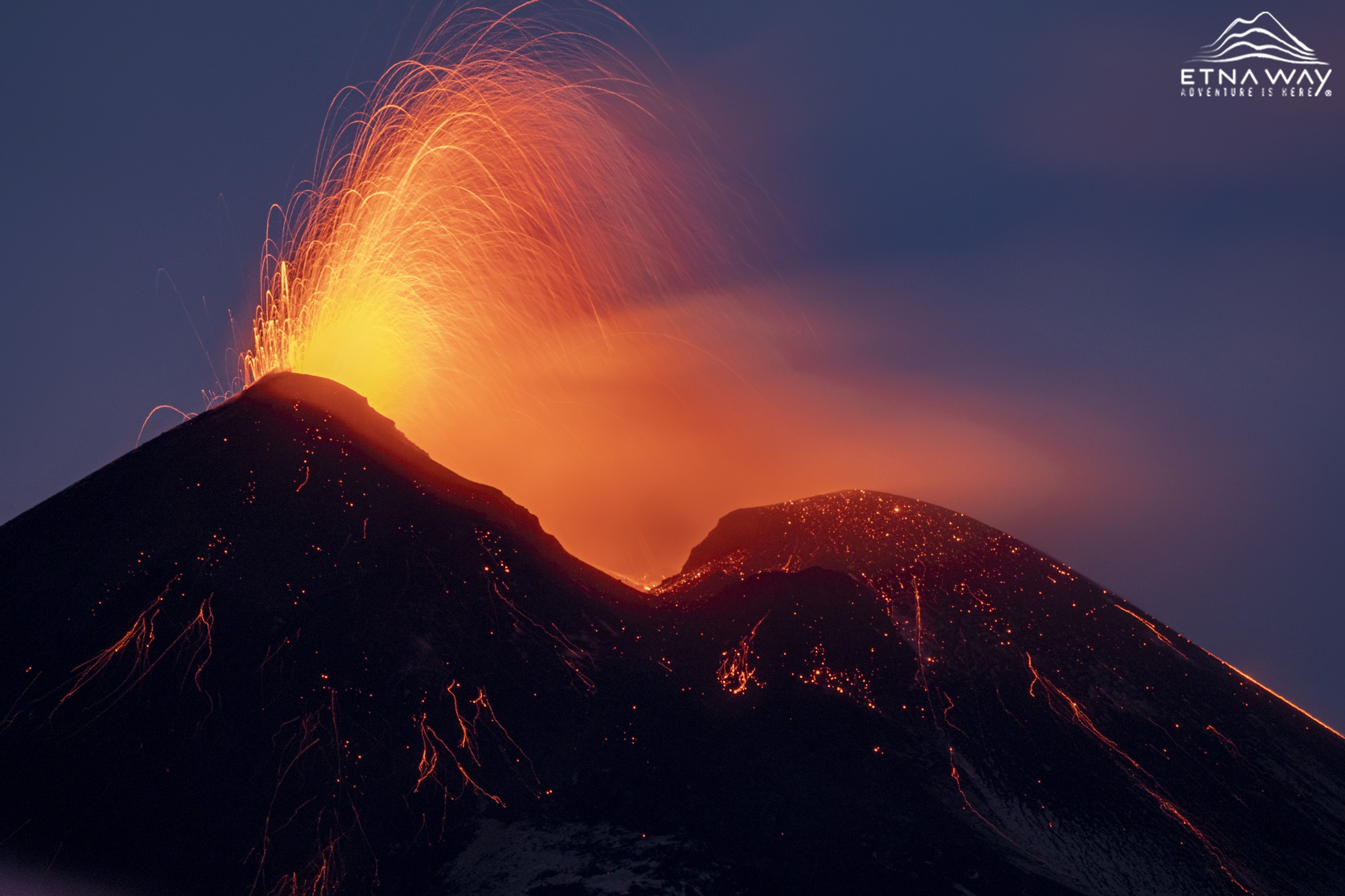
The National Institute of Geophysics and Volcanology, Osservatorio Etneo, communicates that according to the analysis of images from surveillance cameras, we observe that Strombolian activity continues at the level of the Southeast crater. This activity, variable in intensity and frequency of individual explosions, produces modest emissions of ash which, in accordance with the forecast model, disperse quickly in the east direction and in any case near the summit area.
The average amplitude of volcanic tremor continues to show a variable trend over time, with rapid oscillations between medium and high values. The sources remain in the Southeast crater area. Regarding infrasound activity, the sources of the localized events are located in the Southeast crater area and show medium-high intensity. The presence of strong wind does not allow a reliable estimation of the frequency of appearance of infrasound events.
Analysis of the inclinometer network data shows no ground deformation apart from signal oscillations.
Further updates will be communicated shortly.
Source : INGV
Photo : Etnaway
Indonesia , Karangetang :
Reduction of the activity level of Mount Karangetang, North Sulawesi, from level III (SIAGA) to level II (WASPADA).
Visual observation
For the period from November 1 to 28, 2023, the weather is generally clear to cloudy, the mountain is sometimes covered with fog, when it is sunny, smoke from the crater is observed at most 200 m above the summit, the wind is weak to moderate. No visual eruption activity occurred, lava avalanches from the main crater were not observed during the day or night, incandescences were still visible at a maximum of 10 m above the dome. Conditions in the North Crater observed fine to medium white crater smoke with a maximum height of 200 m, at night there was still visible incandescence in the body of the lava dome, no avalanches were observed
Instrumental observation
Seismicity for the period November 1 to 28, 2023 recorded;
5 avalanche earthquakes,
90 emissions earthquakes
68 hybrid/multiple phase earthquakes,
19 deep volcanic earthquakes,
4 local tectonic earthquakes,
2 earthquakes felt on the lI – IV MMI scale
192 deep tectonic earthquakes,
and 1 continuous tremor.
Assessment
Based on visual observation data, the volcanic activity of Mount Karangetang shows a decline. Effusive eruptions identified as lava flows and lava avalanches are no longer observed, however, emissions appear to be increasing, this is due to the release of gas still present. Based on seismicity data, avalanche earthquakes which are an indication of an effusive eruption (lava flow) have decreased. Judging from this fact, the supply of magma has decreased. RSAM data (true seismic amplitude measurement) shows a decrease since November 27, 2023, as well as deformation data (Tiltmeter) seen on the Y axis and the X axis shows deflation, so the activity volcanicity of Mount Karangetang is decreasing. Based on thermal anomaly records detected by Terra and Aqua satellite images on the surface of Karangetang crater, it is shown that the decline has been at a low level since September 2023.
Hot avalanche clouds could occur as the old lava dome is still on top and could collapse/slide at any time with incoming lava. Another feature of the warm clouds that avalanches produce on Mount Karangetang is the accumulation of avalanche lava/landslide material.
Conclusions and Recommendations
Based on the results of the volcanic activity assessment, Mount Karangetang was lowered from Level III (SIAGA) to Level II (WASPADA) effective November 29, 2023 at 4:00 p.m. WITA with recommendations tailored to the threat of potential danger.
Source : PVMBG
Photo : hshdude / esia
Japan , Sakurajima :
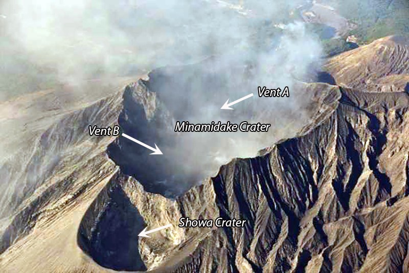
JMA reported ongoing activity at Minamidake Crater (Aira Caldera’s Sakurajima volcano) during 20-27 November, with incandescence at the crater observed nightly. Explosions at 1905 on 20 November and 0226 on 21 November produced ash plumes that rose 1.2 km above the crater rim and drifted SW. Eruptive events on 22 November produced emissions that rose 1 km and drifted N and E. During an overflight of the crater on 24 November plumes obscured views of Minamidake Crater, though observers noted no changes at the geothermal area at Showa Crater. The Alert Level remained at 3 (on a 5-level scale), and the public was warned to stay 2 km away from both craters.
The Aira caldera in the northern half of Kagoshima Bay contains the post-caldera Sakurajima volcano, one of Japan’s most active. Eruption of the voluminous Ito pyroclastic flow accompanied formation of the 17 x 23 km caldera about 22,000 years ago. The smaller Wakamiko caldera was formed during the early Holocene in the NE corner of the caldera, along with several post-caldera cones. The construction of Sakurajima began about 13,000 years ago on the southern rim and built an island that was joined to the Osumi Peninsula during the major explosive and effusive eruption of 1914. Activity at the Kitadake summit cone ended about 4,850 years ago, after which eruptions took place at Minamidake. Frequent eruptions since the 8th century have deposited ash on the city of Kagoshima, located across Kagoshima Bay only 8 km from the summit. The largest recorded eruption took place during 1471-76.
Source : Agence météorologique japonaise (JMA) , GVP
Photo : via INGV.

