November 14 , 2023.
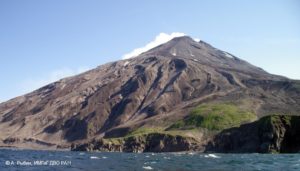
Italy / Sicily , Etna :
Press release on the activity of Etna, November 13, 2023, 11:33 (10:33 UTC).
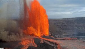
The National Institute of Geophysics and Volcanology, Osservatorio Etneo, communicates that the activity of lava fountains on November 12 at the Southeast crater which began at 5:00 p.m. UTC, ended at 7:30 p.m. UTC, producing an eruptive column at 4500 m altitude. At 7:40 p.m. UTC a pyroclastic flow affected the South-East crater, the latter was positioned in a South-South-East direction. This eruptive activity continued with the establishment of several lava flows in different directions , particularly towards the South, South-East and South-West. At present, the effusive activity has dried up and is gradually cooling. INGV staff carry out field surveys to define the heights of the lava fronts.
After reaching high values between 18:00 and 19:00 UTC yesterday, the average amplitude of the volcanic tremor decreased considerably and around 20:00 UTC it reached the range of average values, positioning itself at a level comparable to that preceding the eruptive activity of ‘yesterday. At present, the tremor amplitude registers modest oscillations, almost always in the range of average values. The location of the centroid of the volcanic tremor sources is consistently located in the Southeast Crater area, at an altitude of approximately 2900 m above sea level.
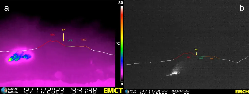
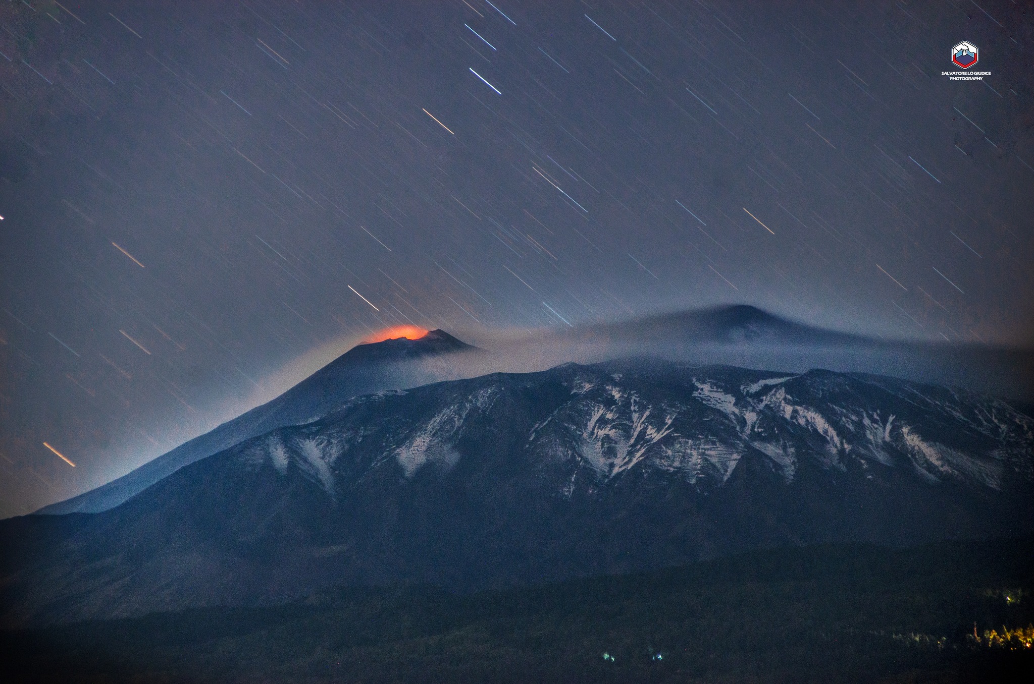
Avalanche of incandescent material on the west wall of the Valle del Bove, taken on the thermal (a) and high-resolution visual (b) cameras of the INGV Etneo Observatory at Monte Cagliato.
Infrasound activity, which also decreased significantly after yesterday’s activity, has returned to low levels.
The PDN summit inclinometer station recorded a clear change in trend from 14:40 UTC on November 12. This variation ended around 19:35 UTC, accumulating sub-microradian values. In the same time interval, other stations in the inclinometer network (PLC, CIT, DAM) also presented minor variations. The high-frequency GNSS network did not record variations above the background noise. At present, the ground deformation network signals have returned to normal.
Further updates will be communicated shortly.
Source : INGV
Photos : Salvatore Lo Giudice , INGV.
Iceland , Reykjanes Peninsula :
Significant likelihood of a volcanic eruption in the coming days
The seismic activity is concentrated on the region of the intrusion, between Sundhnúkur and Grindavík at a depth of about 2–5 km.
Updated 13. November at 13:00 UTC
Seismicity along the magma intrusion continues, although the size and intensity of the activity is decreasing. Since midnight today, 13 November, around 900 earthquakes have been detected. The seismic activity is concentrated on the region of the intrusion, between Sundhnúkur and Grindavík at a depth of about 2–5 km.
Decreasing rates of ground deformation are seen in GPS data from Grindavík. Satellite radar results show a graben-like formation that cuts through part of Grindavík. This feature was first identified by IMO in satellite radar imagery early on 12 November. The imagery shows up to 1-m of vertical ground displacement in the western part of Grindavík, caused by the propagation of the magma intrusion. From geodetical modelling results, we infer that (as of 12 November) the greatest area of magma upwelling is sourced close to Sundhnúkur, 3.5 km north-northeast of Grindavík.
According to our latest estimates, the volcanic hazard assessment in and around Grindavík is unchanged from 12 November. All monitoring systems are being monitored closely in real-time, especially near Grindavík, for any indications of sudden change. The natural hazards monitoring team at IMO is operating at maximum surveillance while the Department of Civil Protection and Emergency Management coordinates short-term, temporary access to Grindavík today, 13 November.
Vertical displacements measured using SAR satellite imagery
Around 900 earthquakes detected since midnight. The seismic activity is concentrated on the region of the intrusion, between Sundhnúkur and Grindavík at a depth of about 2–5 km.
Updated 13. November at 16:20 UTC
Seismicity along the magma intrusion continues, although the size and intensity of the activity is decreasing. Since midnight today, 13 November, around 900 earthquakes have been detected. The seismic activity is concentrated on the region of the intrusion, between Sundhnúkur and Grindavík at a depth of about 2–5 km.
Decreasing rates of ground deformation are seen in GPS data from Grindavík. Satellite radar results show a graben-like formation that cuts through part of Grindavík. This feature was first identified by IMO in satellite radar imagery early on 12 November.
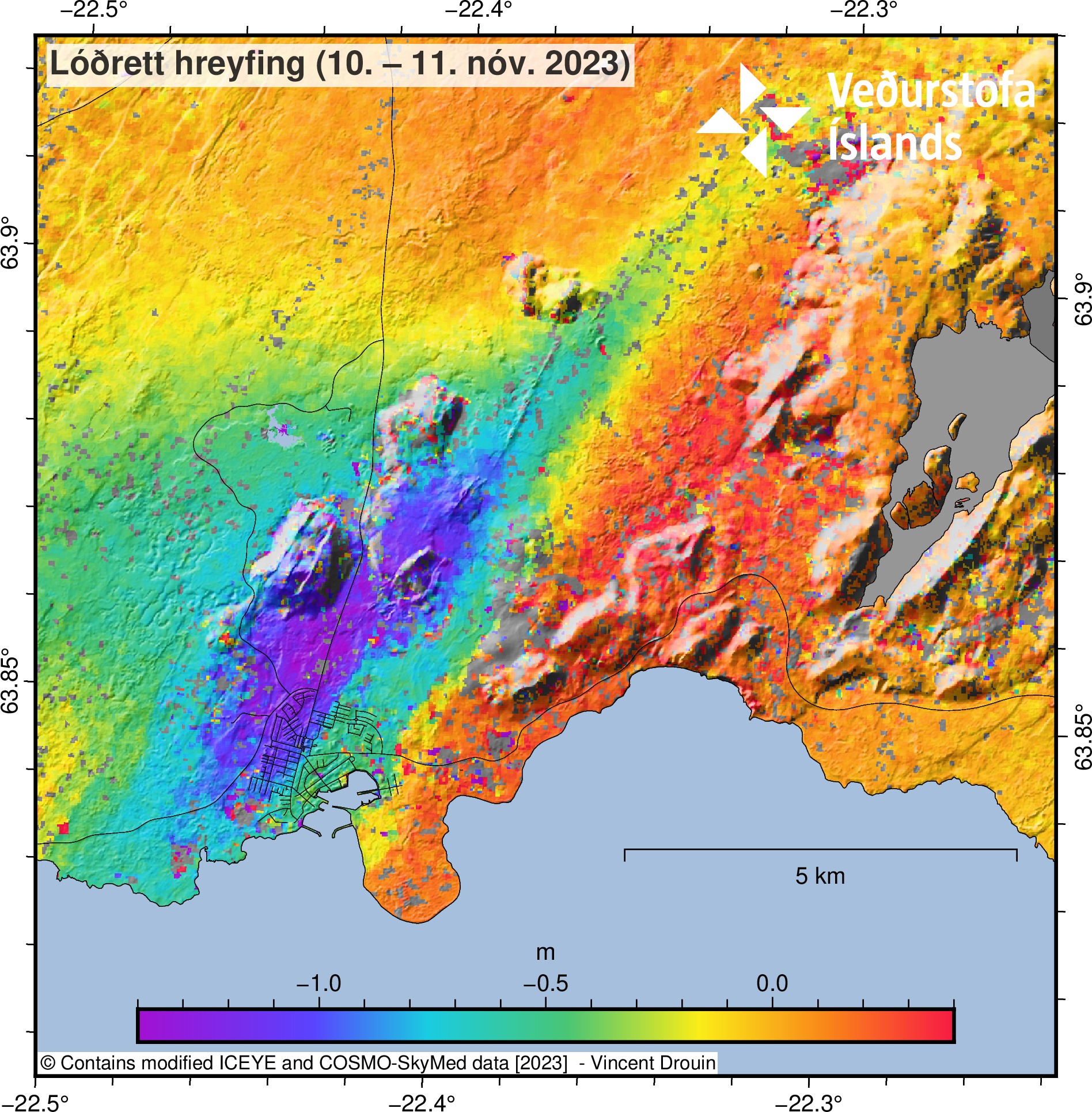
Estimate of the vertical displacements caused by the dike during its initial propagation from Friday afternoon to Saturday morning. The displacements were estimated by combining ICEYE and COSMO-SkyMed pixel offset tracking results.
This ascending COSMO-SkyMed (CSK) interferogram covers the time period 3-11 November and shows an extensive deformation field related to the dike intrusion that began on the afternoon of the 10 November within the Reykjanes-Svartsengi volcanic system. This CSK interferogram and the previous (spanning 2-10 November) supported the difficult decision made by Civil Protection to evacuate the town of Grindavík late Friday evening. It also enabled modelling of the dimensions of the dike intrusion (on the 11 November), which provided a median dike length of 15 km and top depth of less than 1 km below the surface. The imagery shows over 1-m of ground displacement in the western part of Grindavík, caused by the propagation of the magma intrusion. From geodetical modelling results, we infer that (as of 12 November) the greatest area of magma upwelling is sourced close to Sundhnúkur, 3.5 km north-northeast of Grindavík.
New geodetic modelling is currently being undertaken, using an ICEYE interferogram and GNSS observations spanning the last 24-hours, to better assess the ongoing activity and provide an estimate of the current magma inflow rates.
According to our latest estimates, the volcanic hazard assessment in and around Grindavík is unchanged from 12 November. All monitoring systems are being monitored closely in real-time, especially near Grindavík, for any indications of sudden change. The natural hazards monitoring team at IMO is operating at maximum surveillance while the Department of Civil Protection and Emergency Management coordinates short-term, temporary access to Grindavík today, 13 November.
Source : IMO
Photos : RUV , IMO.
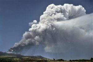
Peru , Sabancaya :
Analysis period: from November 6, 2023 to November 12, 2023, Arequipa, November 13, 2023.
Alert level: ORANGE
The Geophysical Institute of Peru (IGP) reports that the eruptive activity of the Sabancaya volcano remains at moderate levels, that is, with the recording of an average of 10 daily explosions, with columns of ash and of gas up to 2.1 km altitude above the summit of the volcano and their subsequent dispersion. Therefore, for the following days, no significant changes are expected regarding eruptive activity.
The IGP recorded and analyzed the occurrence of 191 earthquakes of volcanic origin, associated with the circulation of magmatic fluids inside the Sabancaya volcano. An average of 10 explosions were recorded daily, in addition to recording of Volcano-Tectonic (VT) type events associated with rock fracturing inside the Sabancaya volcano.
Monitoring the deformation of the volcanic structure using GNSS techniques (processed with fast orbits) does not present significant anomalies. However, in general, a slight inflation process was observed in the northern sector (around the Hualca Hualca volcano). Visual monitoring made it possible to identify columns of gas and ash up to 2.1 km above the summit of the volcano, which were dispersed towards the South and South-East sectors of Sabancaya. Satellite recordings identified the presence of 4 thermal anomalies, with a maximum value of 6 MW, associated with the presence of a lava body on the surface of the volcano crater.
RECOMMENDATIONS
• Keep the volcano alert level in orange.
• Do not approach within a radius of less than 12 km from the crater.
Source : Cenvul.
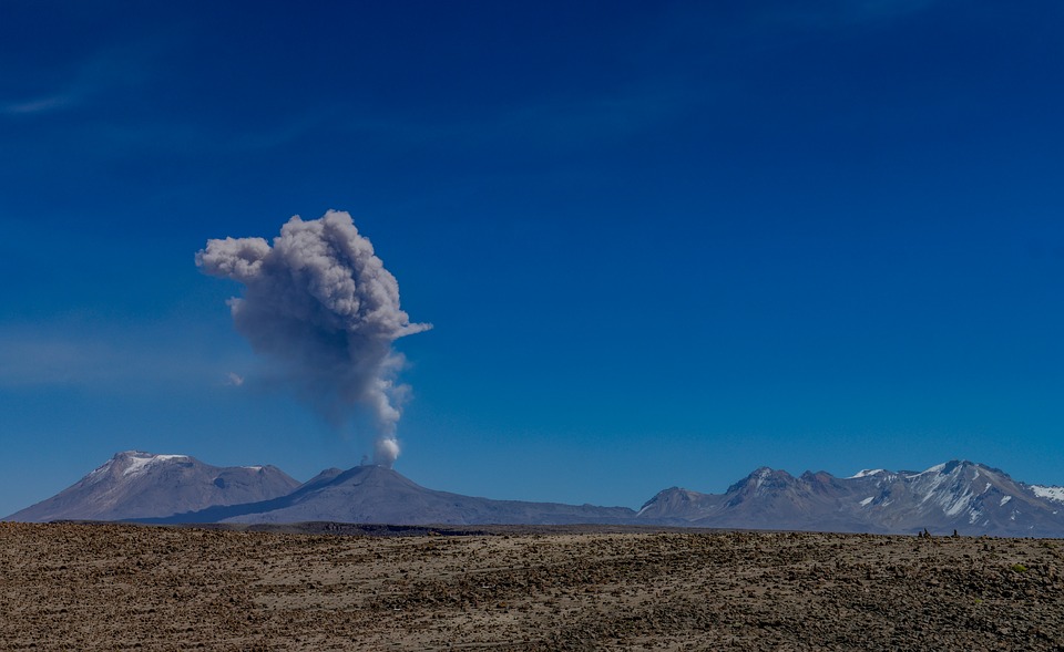
Photo : pixabay
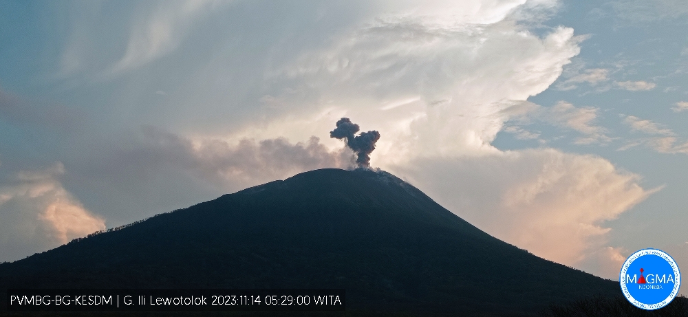
Indonesia , Ili Lewotolok :
Mount Ili Lewotolok erupted on Tuesday, November 14, 2023, at 05:27 WITA. The height of the eruptive column was observed to be ± 400 m above the peak (± 1,823 m above sea level). The ash column was observed to be gray to black in color with thick intensity, oriented towards the North-West. The eruption was recorded on a seismograph with a maximum amplitude of 24.5 mm and a duration of 95 seconds.
VOLCANO OBSERVATORY NOTICE FOR AVIATION – VONA
Issued : November 13 , 2023.
Volcano : Ili Lewotolok (264230)
Current Aviation Colour Code : ORANGE
Previous Aviation Colour Code : orange
Source : Ili Lewotolok Volcano Observatory
Notice Number : 2023LEW091
Volcano Location : S 08 deg 16 min 19 sec E 123 deg 30 min 18 sec
Area : East Nusa Tenggara, Indonesia
Summit Elevation : 4554 FT (1423 M)
Volcanic Activity Summary :
Eruption with volcanic ash cloud at 21h27 UTC (05h27 local).
Volcanic Cloud Height :
Best estimate of ash-cloud top is around 5834 FT (1823 M) above sea level or 1280 FT (400 M) above summit. May be higher than what can be observed clearly. Source of height data: ground observer.
Other Volcanic Cloud Information :
Ash cloud moving to northwest. Volcanic ash is observed to be gray to dark. The intensity of volcanic ash is observed to be thick.
Remarks :
Eruption recorded on seismogram with maximum amplitude 24.5 mm and maximum duration 95 second.
Source et photo : Magma Indonésie.
Mexico , Popocatepetl :
November 13, 11:00 a.m. (November 13, 5:00 p.m. GMT)
Activity from the last 24 hours
22 exhalations were detected, accompanied by emissions of volcanic gases and sometimes ash. Additionally, 1149 minutes of tremor were recorded, identifying high frequency segments of very low to low amplitude that totaled 19.15 hours, as well as a volcano-tectonic earthquake recorded today at 3:39 a.m. of magnitude M1.5.
The National Center for Communications and Civil Protection Operations (Cenacom) reported last night light ash falls in the municipality of Amecameca, Cocotitlán and Tenango del Aire, State of Mexico, and today morning in the municipality of ‘Ocuituco, Morelos.
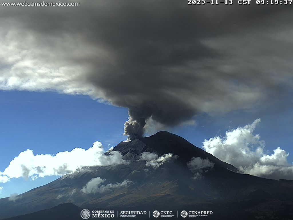
Since this morning and at the time of this report, we have observed a continuous emission of water vapor, volcanic gases and ash, which is dispersing towards the North (N).
The Popocatépetl volcanic warning fire is in yellow phase 2.
The scenarios planned for this phase are:
A few small to moderate explosions
Appearance of tremors of variable amplitude
Light to moderate ash rain in surrounding towns and some more distant towns
Ejection of incandescent fragments within the exclusion radius of 12 kilometers
Source et photo : Cenapred