October 18 , 2023.
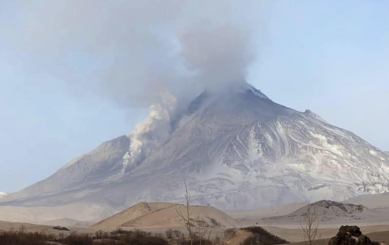
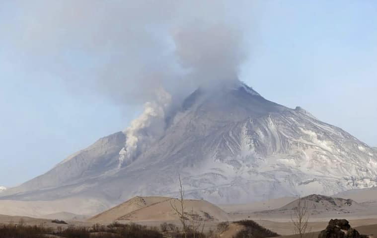
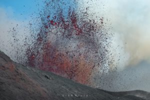
Kamchatka , Bezymianny :
VOLCANO OBSERVATORY NOTICE FOR AVIATION (VONA)
Issued: October 18 , 2023
Volcano: Bezymianny (CAVW #300250)
Current aviation colour code: RED
Previous aviation colour code: orange
Source: KVERT
Notice Number: 2023-117
Volcano Location: N 55 deg 58 min E 160 deg 35 min
Area: Kamchatka, Russia
Summit Elevation: 2882 m (9452.96 ft)
Volcanic Activity Summary:
Large explosions send ash up to 10-11 km a.s.l., and ash plume move to the north-northeast of the volcano.
Ash explosions up to 15 km (49,200 ft) a.s.l. could occur at any time. Ongoing activity could affect international and low-flying aircraft.
Volcanic cloud height:
10000-11000 m (32800-36080 ft) AMSL Time and method of ash plume/cloud height determination: 20231018/0430Z – Himawari-9 14m15
Other volcanic cloud information:
Distance of ash plume/cloud of the volcano: 50 km (31 mi)
Direction of drift of ash plume/cloud of the volcano: NNE / azimuth 31 deg
Time and method of ash plume/cloud determination: 20231018/0430Z – Himawari-9 14m15
Source : Kvert
Photo : Yu.Demyanchuk via Olga Girina
New Zealand , Ruapehu :
Volcanic Activity Bulletin
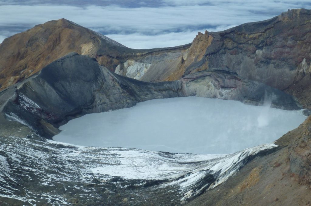
Mt Ruapehu’s Te Wai ā-moe (Crater Lake) is now cooling. Volcanic activity remains low, and the Volcanic Alert Level remains at Level 1.
Published: Wed Oct 18 2023 11:30 AM
After a short heating phase starting mid-July this year, Te Wai ā-moe (Ruapehu Crater Lake) has now cooled back down. Other monitoring indicators are within normal ranges for Mt Ruapehu. Volcanic activity remains low. The Volcanic Alert Level remains at Level 1 and the Aviation Colour Code at Green.
In mid-July 2023 the temperature of Te Wai ā-moe (Crater Lake) started a rising trend, lasting through to early September when a cooling phase started. The lake temperature rose from 11 °C to 26 °C and has now cooled to around 14 °C . The heat flow into the lake is currently around 30-60 MW, typical of a cooler lake.
The lake can experience temporary drops in temperature due to short-lived input of snow melt and heavy rainfall into the lake. These short-term variations did not affect the long-term heating or cooling trends.
Water and gas samples were collected from the lake on October 5, 2023. Chemical analyses of these samples are within the range of recent chemistry samples. Key gas indicators suggest the temperature of the gas deeper in the magmatic system has increased, which has not currently affected the temperature of the lake. Areas of upwelling (discoloured water) and yellow sulphur slicks on the lake surface indicate water and gas flows into the lake from below .
Since installation, our new scanDOAS gas scanning equipment has measured low-to-moderate levels of SO2 gas output most days. Since late September the amount of gas detected has declined, however volcanic gases are still flowing through the volcano.
The level of volcanic tremor recorded by our seismic equipment has remained weak during 2023, and a few earthquakes have been located beneath or near the volcano.
In summary, the falling lake temperature is similar to past cooling phases at Mt Ruapehu. Gas and water chemistry measurements, visual observations of upwelling and sulphur slicks, and low levels of SO2 gas output suggest that the volcanic vents beneath Te Wai ā-moe (Crater Lake) are at least partially open and allow volcanic gases and fluids to enter the lake. This is supported by the currently weak volcanic tremor, and is consistent with a low level of volcanic activity overall. As a result, the Volcanic Alert Level remains at Level 1. The Aviation Colour Code remains Green.
Source et photo : Geonet / Yannik Behr / Duty Volcanologist
Italy , Stromboli :
WEEKLY BULLETIN, from October 9, 2023 to October 15, 2023. (issue date October 17, 2023)
SUMMARY STATEMENT OF ACTIVITY
In light of the monitoring data, it appears:
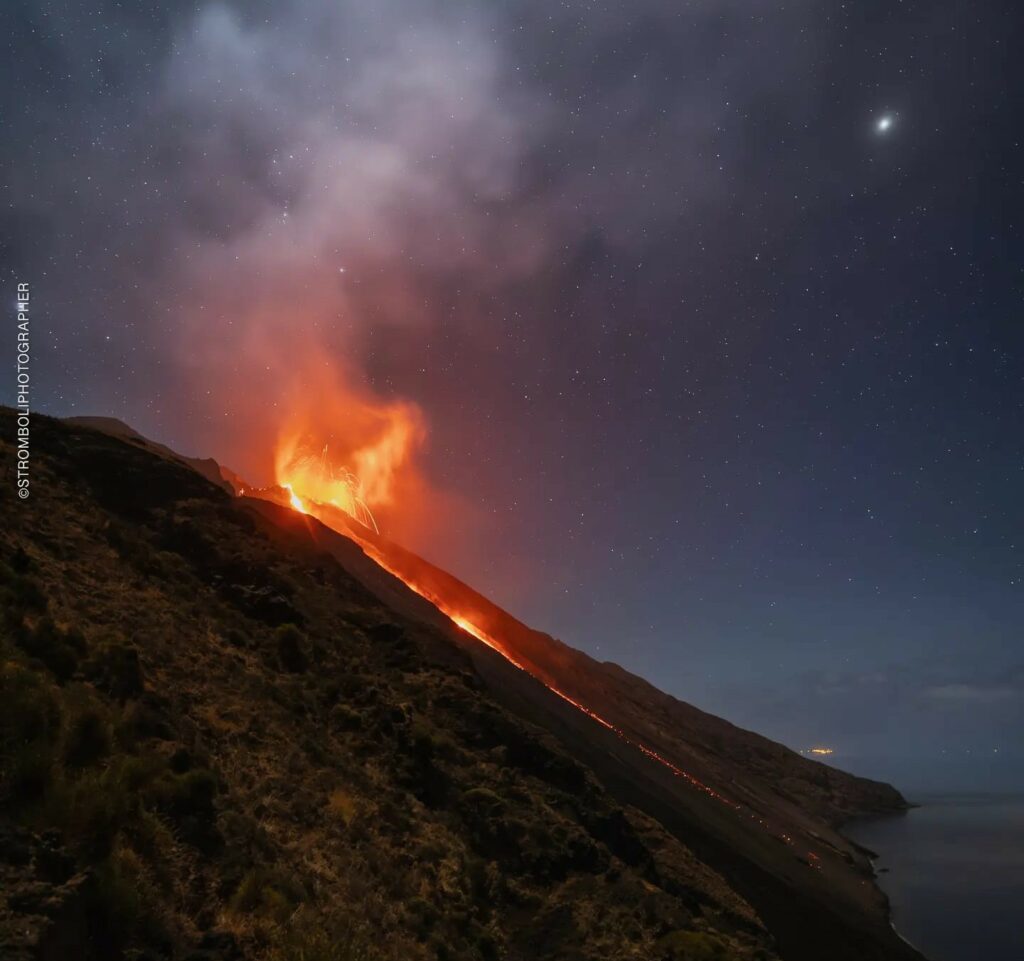
1) VOLCANOLOGICAL OBSERVATIONS: During this period, normal Strombolian activity was observed with splashing in the North crater area. Additionally, on the afternoon of October 9, the lava overflow that had begun on October 8 ceased. The total hourly frequency fluctuated between average values (12-15 events/h). The intensity of the explosions varied from low to medium in the North Crater area and from medium to high in the South-Central area.
2) SISMOLOGY: The monitored seismological parameters do not show significant variations.
3) GROUND DEFORMATIONS: The island’s ground deformation monitoring networks did not show significant variations during the period studied.
4) GEOCHEMISTRY: SO2 flux at an average level and decreasing since the beginning of October.
CO2 flow in the lace zone stable at a medium level, CO2 flow in the Scari zone stable at high values.
There is no update on the CO2/SO2 ratio in the plume.
There is no update on the isotope ratio of helium in groundwater.
5) SATELLITE OBSERVATIONS: Thermal activity observed by satellite has generally been low to moderate.
VOLCANOLOGICAL OBSERVATIONS
In the observed period, the eruptive activity of Stromboli was characterized through the analysis of images recorded by the INGV-OE surveillance cameras at altitude 190m (SCT-SCV),
Pizzo and Punta dei Corvi. The explosive activity was mainly produced by 4 (four) eruptive chimneys located in the northern zone of the crater and by 3 (three) chimneys located in the South Central zone.
Due to a technical problem, as of 9:31 p.m. UTC on October 12, 2023, the 190 m altitude cameras (SCT and SCV) and the Pizzo camera (SPT) did not take images of the terrace of the crater. The only operational camera for the entire period analyzed was that of Punta dei Corvi (SPCT).
Observations of explosive activity captured by surveillance cameras
In the area of the North crater (N), with three vents located in sector N1 and one in sector N2, explosive activity of varying intensity from low (less than 80 m high) to medium (less than 150 m high). top) was observed. The products emitted in the eruption were mainly coarse materials (bombs and lapilli) sometimes mixed with fine materials (ashes). Furthermore, projection activity was observed in sector N1 which was intense from October 9 until the afternoon in conjunction with the lava overflow which began on October 8 and described in the previous weekly report. The average frequency of explosions oscillated between 4 and 8 events/h.
In the Central-South (CS) zone, sectors S1 and C did not show significant activity while sector S2, with three chimneys also active simultaneously, showed explosive activity of varying intensity from low to high (more than 150 m in height) emitting coarse materials mixed with fine materials. The average frequency of explosions fluctuated between 6 and 7 events/h.
Source : INGV.
Photo : Stromboli stati d’animo / sebastiano Cannavo
Italy , Vulcano :
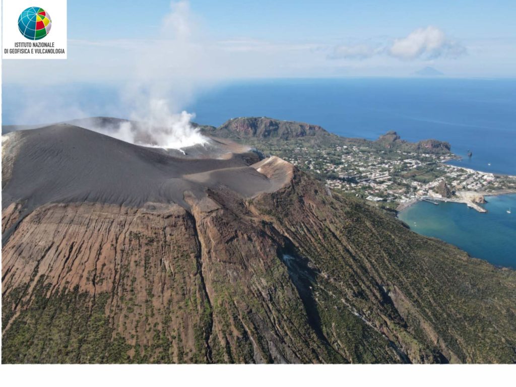
WEEKLY BULLETIN, from October 9, 2023 to October 15, 2023. (issue date October 17, 2023)
SUMMARY STATEMENT OF ACTIVITY
In light of the monitoring data, it appears:
1) Temperature of the crater fumaroles: The temperatures recorded on the edge of the crater remain stable. The maximum temperature recorded is 344°C.
2) CO2 flux in the crater area: The CO2 flux on the eastern rim of the cone showed medium to low outgassing values.
3) SO2 flux in the crater area: Average daily values on an average level
4) Geochemistry of fumarolic gases: No update available.
5) CO2 fluxes at the base of the La Fossa cone and in the Vulcano Porto area: The CO2 fluxes recorded continuously at the base of the cone show stable values, on the respective background levels and no significant variation is obvious.
6) Geochemistry of thermal aquifers: In the Camping Sicilia well, stable and still high temperature values are recorded and do not show variations in conductivity values; in the Bambara well, no significant change was observed in the monitored parameters.
7) Local seismicity: Low rate of occurrence of local micro-seismicity.
8) Regional seismicity: No earthquake of magnitude equal to or greater than 1.0 has been recorded.
9) Deformations – GNSS: The permanent GNSS network did not record any significant variations.
10) Deformations – Inclinometry: The inclinometer network did not record any significant variations.
11) Gravimetry: No significant variation was recorded.
Local seismicity
During the week concerned, the frequency of appearance of micro-shocks with the spectral peak above 1 Hz remained low and with values comparable on average to those of previous weeks. No microshocks with a peak below 1 Hz were recorded.
Source et photo : INGV.
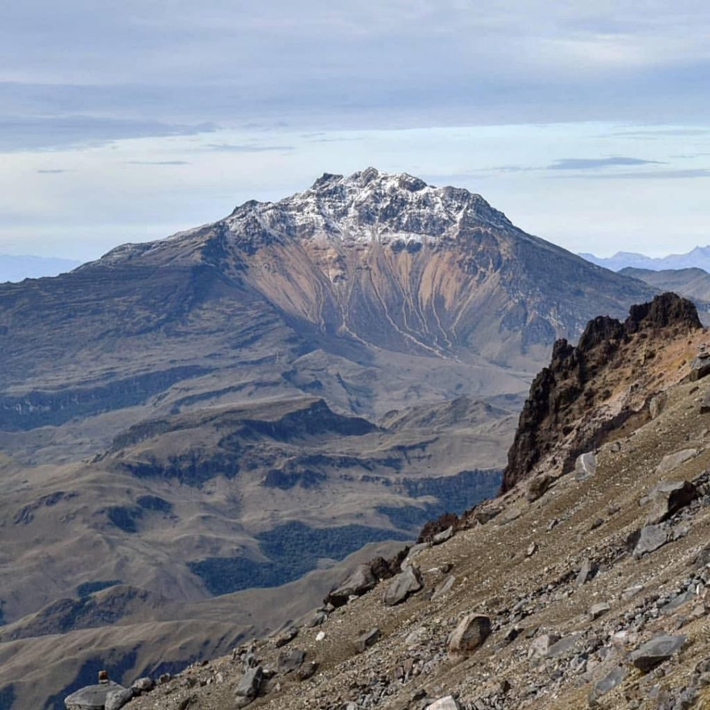
Colombia , Chiles / Cerro Negro :
Weekly activity bulletin of the Chiles and Cerro Negro Volcanic Complex (CVCCN)
Regarding the monitoring of the activity of the CHILES AND CERRO NEGRO VOLCANOES, the MINISTRY OF MINES AND ENERGY, through the COLOMBIAN GEOLOGICAL SERVICE (SGC), reports that:
In the period between October 10 and 16, 2023 and compared to the previous week, a decrease in the values of the number of earthquakes and energy was observed, with the predominance of seismicity associated with the fracturing of the rocks in the volcanic region of Chiles and Cerro Negro. The earthquakes were mainly located to the south of the Chiles volcano, at distances of up to 4 km, at depths between 2 and 6 km compared to the reference height (4,700 m above the level of the sea) and with a maximum magnitude of 1.8. The sensors installed on these volcanoes and the satellites continue to record deformations in different sectors of the volcanic edifice.
The evolution of activity in the CVCCN continues, due to internal processes derived from a complex interaction between the magmatic, hydrothermal system and the geological faults of the area, which is why the probability of occurrence of earthquakes energetic earth that can be felt is maintained by residents of the CVCCN area of influence, in addition to generating instability on slopes, landslides and structural damage to buildings, access roads and bridges. These aspects must be taken into account by the authorities and communities that reside in the zone of influence of these volcanoes.
Volcanic activity remains on YELLOW ALERT Status: Active volcano with changes in baseline behavior of monitored parameters and other manifestations
Source : SGC
Photo : Travelgrafia/Viajes por Colombia .

