August 06 , 2023.
Chile , Chaiten :
Special report on volcanic activity (REAV), Los Lagos region, Chaiten volcano, August 05, 2023, 09:30 a.m. local time (mainland Chile).
The National Service of Geology and Mines of Chile (Sernageomin) publishes the following PRELIMINARY information, obtained through the monitoring equipment of the National Volcanic Monitoring Network (RNVV), processed and analyzed at the Volcanological Observatory of the Southern Andes ( Ovdas):
On Saturday, August 05, 2023, at 09:08 local time (13:08 UTC), monitoring stations installed near the Chaiten volcano recorded an earthquake associated with both rock fracturing and fluid dynamics in the volcanic system (hybrid type). The earthquake was located 05 km from the center of the dome.

The characteristics of earthquakes after their analysis are as follows:
ORIGINAL TIME: 09:08 local time (13:08 UTC)
LATITUDE: 42.844°S
LONGITUDE: 72.651°E
DEPTH: 2.3 km
LOCAL MAGNITUDE: 2.1 ML
REDUCED DISPLACEMENT: 747 cm2
COMMENTS:
Following the event, during the day other similar events of lower magnitude were recorded. No changes in surface activity have been noted from the cameras installed north of the volcano. .
The volcanic technical alert remains at the Green level.
Sources : Sernageomin.
Photo : Christian Brown.
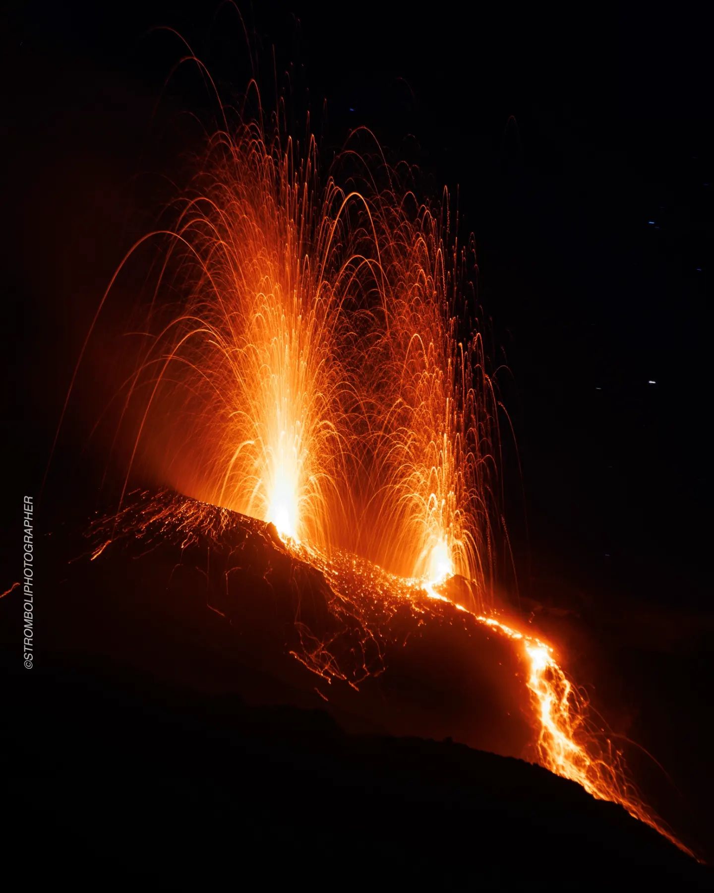
Italy , Stromboli :
Statement on the activity on Stromboli, 06 August 2023, 07:36 (05:36 UTC).
The National Institute of Geophysics and Volcanology, Osservatorio Etneo, communicates that the intensification of the explosive activity (splashing) of the area of the North crater, produced, from about 04:30 UTC, a small overflow of lava which for the moment remains confined to the upper part of the Sciara del Fuoco. The phenomenon was observed by surveillance cameras and is still ongoing at the time of this press release.
From the seismic point of view, the average amplitude of the volcanic tremor is, currently, in the average level. There are no significant variations in the rate of occurrence and in the amplitude of the blast quakes.
There are no significant variations in the signals from the ground deformation monitoring networks.
Further updates will be communicated soon.
Source : INGV.
Photo : Stromboli stati d’animo.
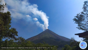
Alaska , Shishaldin :
54°45’19 » N 163°58’16 » W,
Summit Elevation 9373 ft (2857 m)
Current Volcano Alert Level: WATCH
Current Aviation Color Code: ORANGE
The eruption yesterday morning produced an ash cloud the drifted to the northeast at about 26000 ft above sea level. This drifting ash cloud could be seen in satellite data and was observed by pilots. Seismicity remained significantly elevated until 3:00 pm AKDT (23:00 UTC) when the seismic intensity dropped sharply to slightly elevated levels. At this time, a high level meterological cloud obscured satellite views of both the volcano and the drifting ash cloud. Due to the decrease in seismicity, the Alaska Volcano Observatory lowered the Aviation Color Code and Alert Level to ORANGE/WATCH on Aug. 4 at 8:55 pm (Aug. 5 03:55 UTC). Since then, seismicity has decreased in intensity to low levels.
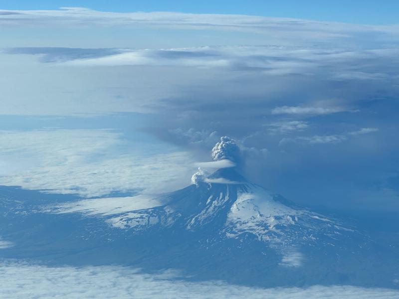
Photo of Shishaldin Volcano on July 18, 2023, as an ash-rich plume is emitted, taken from the air. View from northern Shishaldin, with the ash-rich plume extending to the southeast.
Shishaldin has had six periods of elevated eruptive activity resulting in significant ash emission during the current eruption which started on July 12. It is unknown how long this eruption will last, but previous eruptions of Shishaldin Volcano have lasted weeks to months with repeated cycles of activity similar to those seen in the last two weeks.
Shishaldin Volcano is monitored by local seismic and infrasound sensors, web cameras, and a telemetered geodetic network. In addition to the local monitoring network, AVO uses nearby geophysical networks, regional infrasound and lighting data, and satellite images to detect eruptions.
Source : AVO
Photo : Barnes, Chris
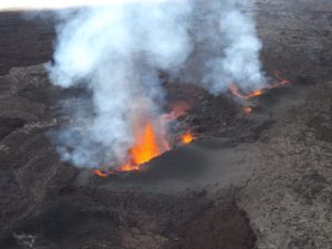
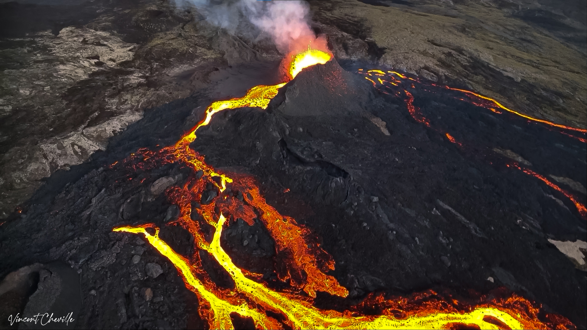
La Réunion , Piton de la Fournaise :
Press release from the Paris Institute of Earth Physics, Piton de la Fournaise Volcanological Observatory, August 06, 2023 – 08:45 – 04:45 UTC.
Ongoing eruption
The eruption started on July 02, 2023, around 08:30 local time continues. The amplitude of the volcanic tremor (indicator of an emission of lava and gas on the surface) remains very low compared to the start of the eruption and has been relatively stable for several days.
Given the poor weather conditions currently on site (65 mm of rain recorded during the day yesterday in the southern part of the Enclos ), no estimate of the lava flows by satellite method could be made on the last 24 hours; No thinning, even partial, allowing visual feedback on the active lava field in the Grandes Pentes, or on the eruptive cone occurred during this period. Only clouds with sometimes a rainbow could be observed.
Given the poor weather conditions currently on site, no estimate of the lava flows by satellite method could be made over the last 24 hours.
The activity most likely continues with weak projections of lava at the level of the eruptive cone as well as a flow of lava in tunnels closest to the eruptive vent.
Low inflation of the summit area has been recorded since mid-July, indicating a re-pressurization of the volcano’s feeding system centered under the summit area with possible transfer of deep magma to the latter, then feeding the eruption.
The seismic activity recorded under the summit zone remains weak. Thus during the last 24 hours, four superficial volcano-tectonic earthquakes have been recorded. This low seismic activity leads to a low risk of the appearance of a new crack and / or collapse in the crater, but does not allow to exclude it as shown by the continuation of the summit inflation and the fluctuations in the amplitude of the tremor which are regularly observed.
Alert level: Alert 2-1 (eruption in the Enclos without any particular threat to the safety of people, property or the environment).
Source : OVPF
Photo : Vincent Cheville / Volcanoexplorer.re Tunnels de lave Réunion / https://www.facebook.com/photo?fbid=250058484559364&set=a.110306641867883
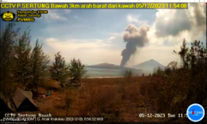
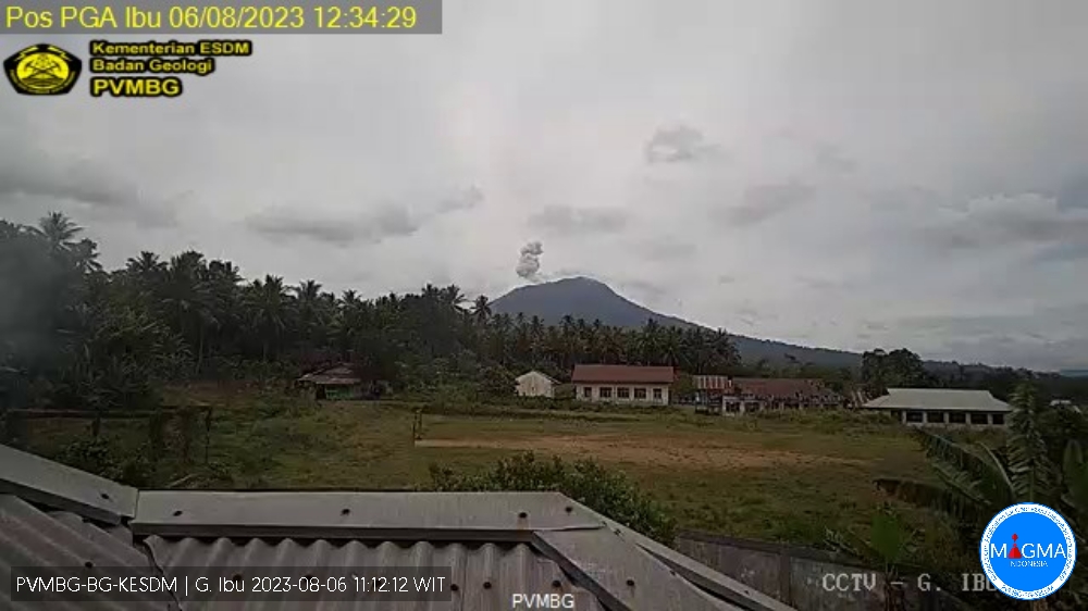
Indonesia , Ibu :
G. Ibu presented an eruption on Sunday August 06, 2023 at 12:44 WIT with an ash column height observed at ± 600 m above the summit (± 1925 m above sea level). The ash column was observed to be gray with thick intensity, oriented northeast. This eruption was recorded on a seismograph with a maximum amplitude of 28 mm and a duration of 78 seconds.
VOLCANO OBSERVATORY NOTICE FOR AVIATION – VONA
Issued : August 06 , 2023
Volcano : Ibu (268030)
Current Aviation Colour Code : ORANGE
Previous Aviation Colour Code : orange
Source : Ibu Volcano Observatory
Notice Number : 2023IBU023
Volcano Location : N 01 deg 29 min 17 sec E 127 deg 37 min 48 sec
Area : North Maluku, Indonesia
Summit Elevation : 4240 FT (1325 M)
Volcanic Activity Summary :
Eruption with volcanic ash cloud at 03h44 UTC (12h44 local).
Volcanic Cloud Height :
Best estimate of ash-cloud top is around 6160 FT (1925 M) above sea level or 1920 FT (600 M) above summit. May be higher than what can be observed clearly. Source of height data: ground observer.
Other Volcanic Cloud Information :
Ash cloud moving to northeast. Volcanic ash is observed to be gray. The intensity of volcanic ash is observed to be thick.
Remarks :
Eruption recorded on seismogram with maximum amplitude 28 mm and maximum duration 78 second.
Source et photo : Magma Indonésie