December 16 , 2022.
Russia / Kuril Islands , Ebeko :
VOLCANO OBSERVATORY NOTICE FOR AVIATION (VONA)
Issued: December 16 , 2022 .
Volcano: Ebeko (CAVW #290380)
Current aviation colour code: ORANGE
Previous aviation colour code: orange
Source: KVERT
Notice Number: 2022-190
Volcano Location: N 50 deg 41 min E 156 deg 0 min
Area: Northern Kuriles, Russia
Summit Elevation: 1156 m (3791.68 ft)
Volcanic Activity Summary:
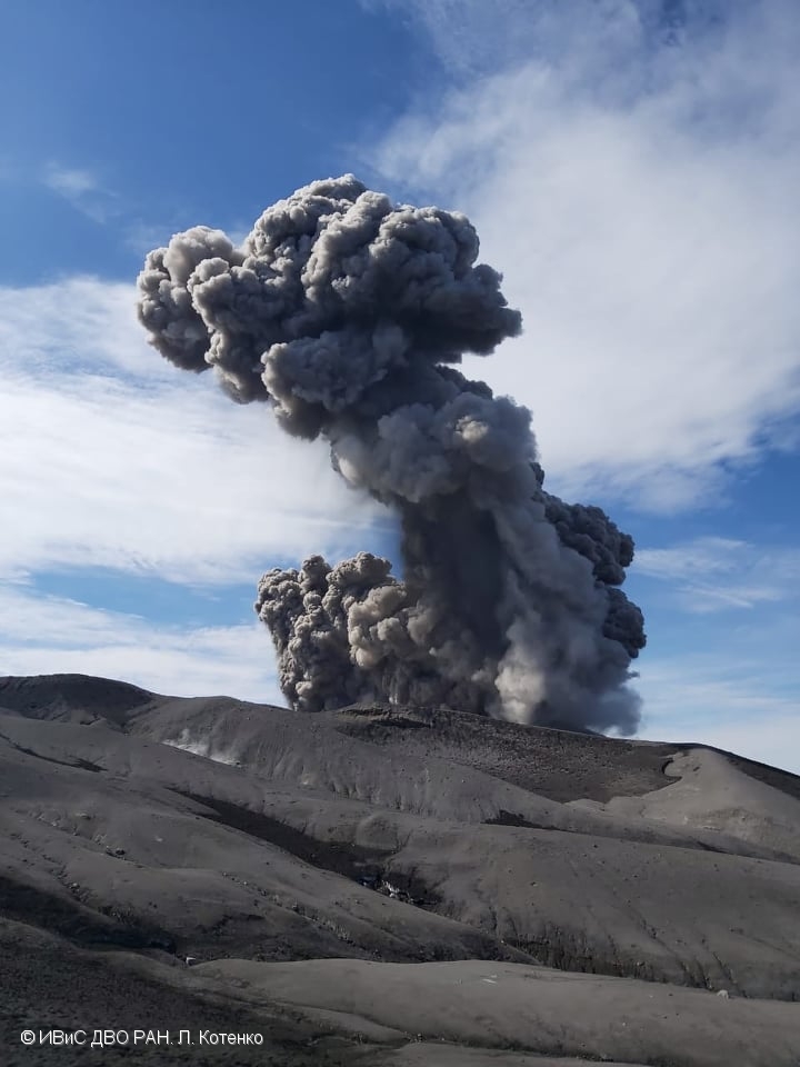
A moderate explosive activity of the volcano continues. According to visual data by volcanologists from Severo-Kurilsk, an explosion sent ash up to 2.4 km a.s.l., an ash cloud is drifting to the north-east of the volcano.
A moderate eruptive activity of the volcano continues. Ash explosions up to 6 km (19,700 ft) a.s.l. could occur at any time. Ongoing activity could affect low-flying aircraft and airport of Severo-Kurilsk.
Volcanic cloud height:
2400 m (7872 ft) AMSL Time and method of ash plume/cloud height determination: 20221216/0403Z – Visual data
Other volcanic cloud information:
Distance of ash plume/cloud of the volcano: 5 km (3 mi)
Direction of drift of ash plume/cloud of the volcano: NE / azimuth 45 deg
Time and method of ash plume/cloud determination: 20221216/0403Z – Visual data
Source : Kvert.
Photo : L. Kotenko. IVS FEB RAS
Colombia , Nevado del Ruiz :
Bulletin of activity level of the Nevado del Ruiz volcano.
The activity level continues at the yellow activity level or (III): changes in the behavior of volcanic activity.
Regarding the monitoring of the activity of the Nevado del Ruiz volcano, the COLOMBIAN GEOLOGICAL SERVICE reports that:
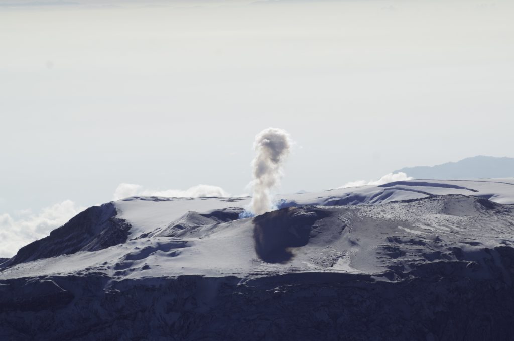
Seismic activity related to fluid dynamics within volcanic conduits maintained similar levels in the number of events recorded compared to the previous week. The permanent record of continuous volcanic tremor with low to moderate energy levels that has been recorded since December 2 stands out. Associated with this signal, there was a continuous emission of ash observed from the cameras installed in the volcano area. Several pulsating emissions of gas and ash associated with some of the seismic signals have also been confirmed.
Seismic activity associated with rock fracturing decreased in number of recorded earthquakes and maintained similar levels in seismic energy released compared to the previous week. The earthquakes were located mainly in the South-East, East-South-East, North-East sectors and in the Arenas crater.
The depth of the earthquakes fluctuated between about 0.6 and 6.5 km. The maximum magnitude observed during the week was 1.3 ML (Local Magnitude) corresponding to the earthquake recorded on December 6 at 12:49 p.m. (local time), located about 7.6 km east-south-east of the crater , at a depth of 4.8 km.
Deformation of the volcanic surface continues to show minor changes.
Source et photo : SGC.
Italy , Stromboli :
Statement on Stromboli activity, December 15, 2022, 16:45 (15:45 UTC).
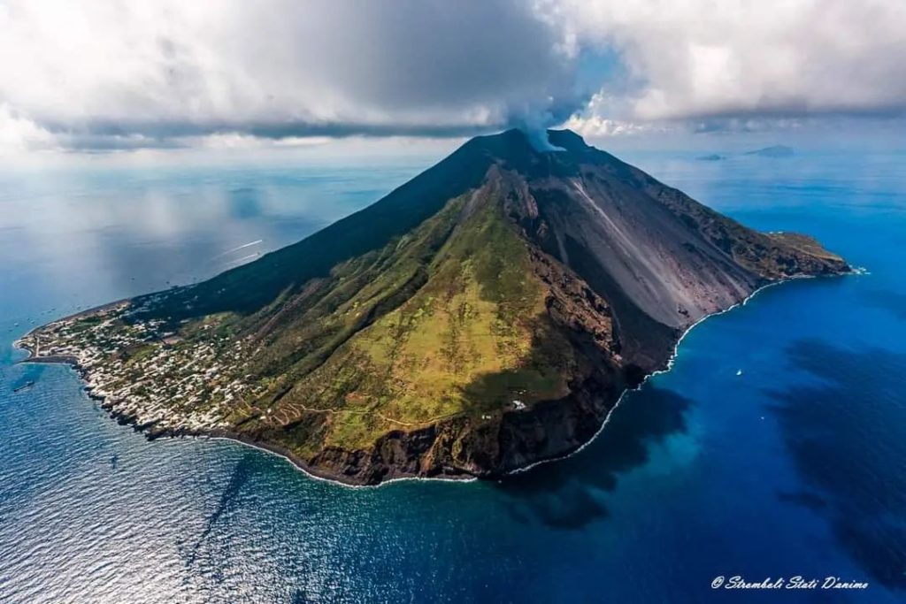
The National Institute of Geophysics and Volcanology, Osservatorio Etneo, communicates that from field surveys carried out by INGV personnel, it has been observed that the lava flow described in previous press releases n is no longer fed and cools. Explosive activity continues.
The temporal trend of the average amplitude of the volcanic tremor from December 10 shows large oscillations which, overall, define a substantially stationary trend which remains mainly in the range of average values, sometimes reaching high values.
Regarding ground deformations, signals from the GNSS network have not shown significant variations over the past 24 hours.
Statement on Stromboli activity, December 15, 2022, 16:49 (15:49 UTC).
The National Institute of Geophysics and Volcanology, Osservatorio Etneo, communicates that the monitoring networks recorded at 4:48 p.m. (15:48 UTC), the return of the parameters to normal activity.
Further updates will be communicated soon
Source : INGV.
Photo : Stromboli stati d’animo.
Indonesia , Semeru :
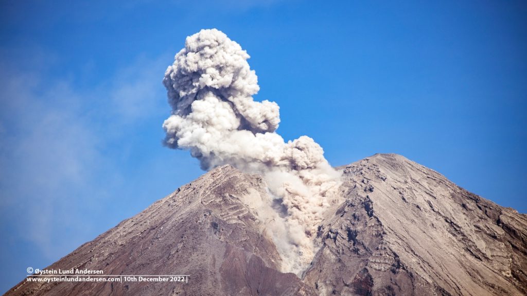
Mount Semeru exhibited an eruption on Friday, December 16, 2022 at 04:55 WIB with the height of the ash column observed at ± 1000 m above the summit (± 4676 m above sea level). The ash column was observed to be white, gray to brown with a thick, north-oriented intensity. This eruption was recorded on a seismograph with a maximum amplitude of 20 mm and a duration of 100 seconds.
VOLCANO OBSERVATORY NOTICE FOR AVIATION – VONA
Issued : December 15 , 2022
Volcano : Semeru (263300)
Current Aviation Colour Code : ORANGE
Previous Aviation Colour Code : orange
Source : Semeru Volcano Observatory
Notice Number : 2022SMR725
Volcano Location : S 08 deg 06 min 29 sec E 112 deg 55 min 12 sec
Area : East java, Indonesia
Summit Elevation : 11763 FT (3676 M)
Volcanic Activity Summary :
Eruption with volcanic ash cloud at 21h55 UTC (04h55 local).
Volcanic Cloud Height :
Best estimate of ash-cloud top is around 14963 FT (4676 M) above sea level or 3200 FT (1000 M) above summit. May be higher than what can be observed clearly. Source of height data: ground observer.
Other Volcanic Cloud Information :
Ash cloud moving to north. Volcanic ash is observed to be white to gray. The intensity of volcanic ash is observed to be thick.
Remarks :
Eruption recorded on seismogram with maximum amplitude 20 mm and maximum duration 100 second.
SEISMICITY OBSERVATION
19 eruption earthquakes with an amplitude of 10 to 23 mm and a duration of 63 to 112 seconds.
7 emission earthquakes with an amplitude of 6-7 mm, and a duration of 49-52 seconds.
Source : Magma Indonésie.
Photo : Oystein Lund Andersen.
Hawaii , Kilauea :
19°25’16 » N 155°17’13 » W,
Summit Elevation 4091 ft (1247 m)
Current Volcano Alert Level: ADVISORY
Current Aviation Color Code: YELLOW
Activity Summary
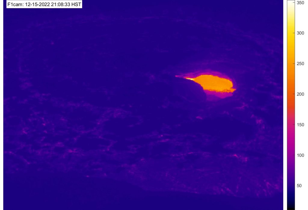
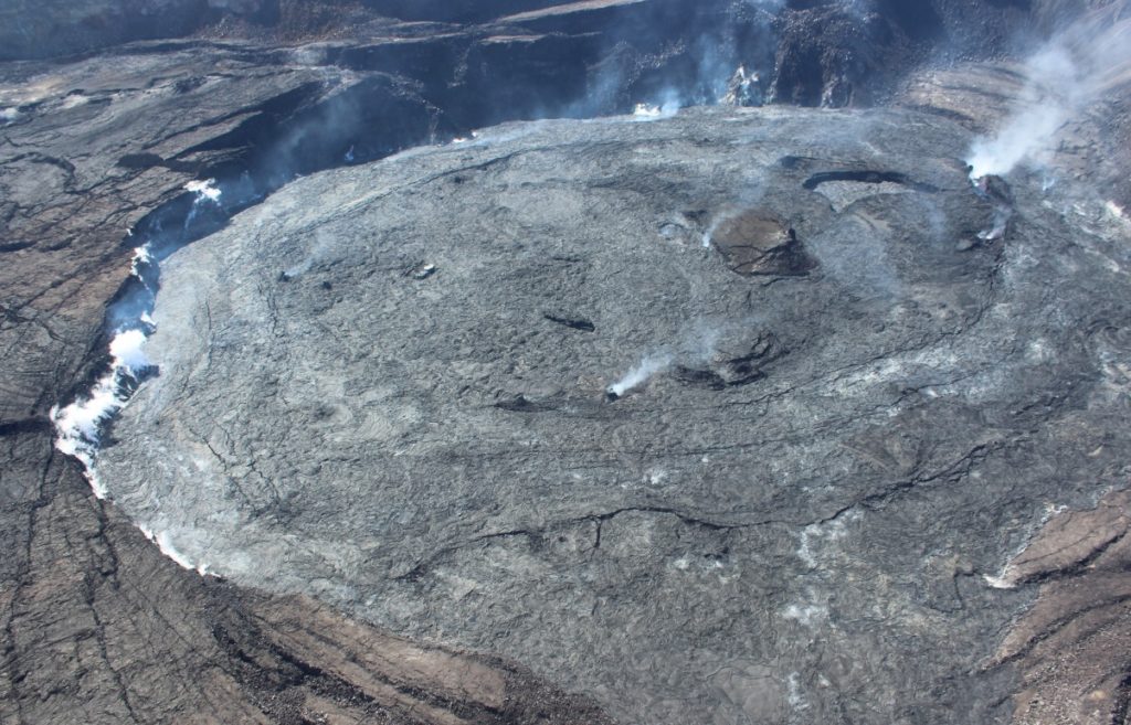
Eruptive activity has not resumed at the summit of Kīlauea; the volcano alert level and aviation color code remains at YELLOW/ADVISORY. A passive overturn of the Halemaʻumaʻu lava lake began just before noon and continued until about 4 p.m. HST today, December 14, exposing new lava at the surface of the lake. There has been no resumption of seismic tremor (indicative of fluid movement), strong degassing, or supply of lava from the west vent that would be associated with re-activation of the eruption. Seismicity and deformation patterns remain low but unsettled. Potential remains for resumption of this eruption or initiation of a new eruption at or near the summit of Kīlauea.
Observations
The lava lake within Halemaʻumaʻu crater began crusting over between December 6th and 9th and the crust was likely less than 3 feet thick. Small pods of lava appeared on the crust in the northeast corner of the formerly active lava lake just before noon today, December 14. The weight of the small lava flows on top of the crust caused the immediate area to founder and overturn exposing the underlying lava within Halemaʻumaʻu crater. Following each overturn, another small flow progressed onto the adjacent crust, causing another 5-10% of the adjacent lake crust to founder and sink. The process repeated itself over the next several hours and by 4 p.m. HST today the entire surface of the small lava lake was resurfaced with new crust. This process is driven by hotter, boyount lava rising below the lakeʻs surface and weighing down the surface crust causing it to sink. Passive overturns are not uncommon in cooling lava lakes and this activity may be repeated during the next several weeks.
Continuing hazards
Levels of volcanic gas (sulfur dioxide and carbon dioxide) can remain locally hazardous even though Kīlauea is no longer erupting. Sulfur dioxide (SO2) gas emissions have greatly decreased; however, local concentrations of sulfur dioxide (SO2) or hydrogen sulfide (H2S) may persist in downwind areas, and residents may notice odors of these gases occasionally. Significant hazards also remain around Halemaʻumaʻu from crater wall instability, ground cracking, and rockfalls that can be enhanced by earthquakes within the area closed to the public.
Source : HVO.
Photo : USGS / J. Bard.

