December 10 , 2022.
Indonesia , Semeru :
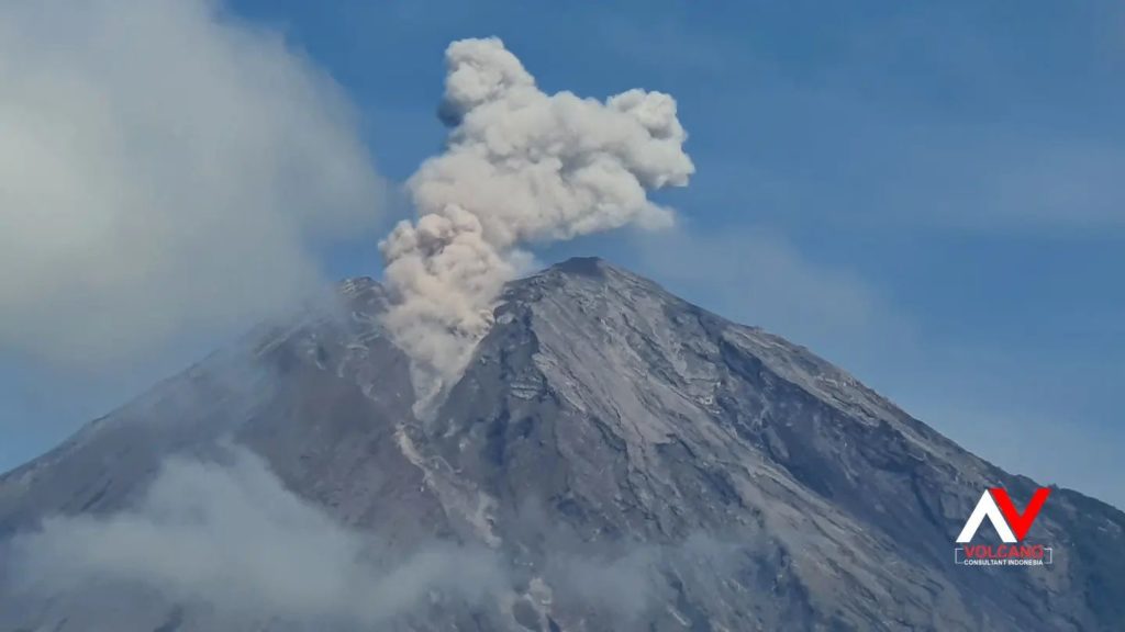
Mount Semeru erupted on Saturday December 10, 2022 at 06:53 WIB with an ash column height observed at ± 700 m above the summit (± 4376 m above sea level). The ash column was observed to be gray with a thick intensity, oriented to the north. At the time of writing this report, the eruption was still ongoing.
VOLCANO OBSERVATORY NOTICE FOR AVIATION – VONA
Issued : December 09 , 2022
Volcano : Semeru (263300)
Current Aviation Colour Code : ORANGE
Previous Aviation Colour Code : orange
Source : Semeru Volcano Observatory
Notice Number : 2022SMR719
Volcano Location : S 08 deg 06 min 29 sec E 112 deg 55 min 12 sec
Area : East java, Indonesia
Summit Elevation : 11763 FT (3676 M)
Volcanic Activity Summary :
Eruption with volcanic ash cloud at 23h53 UTC (06h53 local).
Volcanic Cloud Height :
Best estimate of ash-cloud top is around 13683 FT (4276 M) above sea level or 1920 FT (600 M) above summit. May be higher than what can be observed clearly. Source of height data: ground observer.
Other Volcanic Cloud Information :
Ash cloud moving to north. Volcanic ash is observed to be white to gray. The intensity of volcanic ash is observed to be thick.
Remarks :
Eruption recorded on seismogram with maximum amplitude 23 mm and maximum duration 83 second. –
Source : Magma Indonésie .
Photo : Andi volcanist
Hawaii , Mauna Loa :
Friday, December 9, 2022, 3:30 PM HST (Saturday, December 10, 2022, 01:30 UTC)
19°28’30 » N 155°36’29 » W,
Summit Elevation 13681 ft (4170 m)
Current Volcano Alert Level: WARNING
Current Aviation Color Code: ORANGE
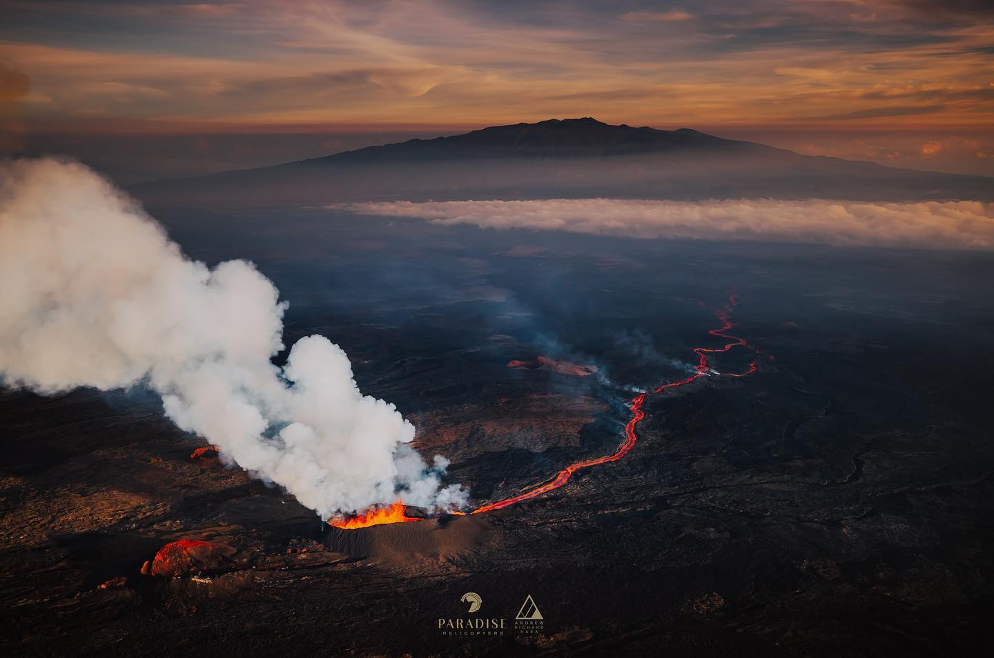
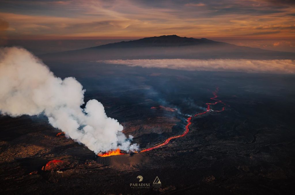
The Northeast Rift Zone eruption of Mauna Loa continues, with reduced lava output and gas emissions at fissure 3 (F3) since this morning.
As of 11:30 a.m. today, December 9, activity at the F3 vent continues to be significantly reduced, with low lava fountains feeding lava flows that extend only 1.65 mi (2.65 km) from the vent in northeast direction. The channels below this point appear drained of lava and probably no longer feed the main flow front.
The inactive main flow front remains stalled about 1.7 mi (2.8 km) from Saddle Road . Yesterday, December 8, the inactive main flow front inched northward very slowly about 7 feet (2 m) per hour as it settled.
Sulfur dioxide (SO2) emission rates were also reduced to approximately 30,000 tonnes per day (t/d) as measured on December 8, 2022.
Tremor ( signal associated with subsurface fluid movement) continues beneath the currently active fissure. This indicates that magma is still being supplied to the fissure, and activity is likely to continue as long as we see this signal.
The significance of the reduced supply of lava is not yet clear; it is common for eruptions to wax and wane or pause completely. A return to high levels of lava discharge could occur and the Hawaiian Volcano Observatory continues to closely monitor this activity.
There is no active lava within Moku’āweoweo caldera nor the Southwest Rift Zone. We do not expect any eruptive activity outside the Northeast Rift Zone.
Source : HVO.
Photo : Andrew Hara / Paradise helicopters / Bruce Omori.
Colombia : Purace / Chaine volcanique Los Coconucos.
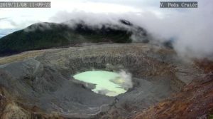
Puracé Volcano Weekly Activity Bulletin – Los Coconucos Volcanic Range
The activity level of the volcano continues at the yellow Activity Level or (III): changes in the behavior of volcanic activity.
From the analysis and evaluation of the information obtained through the monitoring network of the Puracé volcano – Los Coconucos volcanic chain, during the week of November 29 to December 5, 2022, the COLOMBIAN GEOLOGICAL SERVICE – Volcanological and Seismological Observatory de Popayán reports that:
A total of 957 seismic events were recorded, of which 126 were associated with rock fracturing processes (VT type) and 831 with fluid dynamics in volcanic conduits, which recorded a slight increase compared to previous weeks.
The geodetic network of GNSS (Global Navigation Satellite System) stations for monitoring ground deformation continues to record a process associated with inflation.
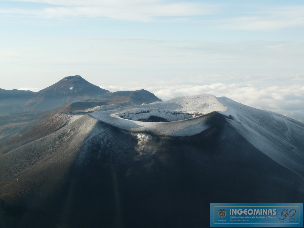
By monitoring the surface activity with the images obtained during the week through the Mina, Lavas Rojas, Cerro Sombrero and Curiquinga web cameras, degassing of the volcanic system was highlighted, with a white column preferentially oriented towards the South East.
Regarding the monitoring of volcanic gases, sulfur dioxide (SO2) measurements continue to show changes with a maximum flow of 1397 t / day for the week evaluated. Other instruments for measuring the concentration of carbon dioxide (CO2) and radon gas (222Rn) continue to record considerably high values in the context of this active volcanic system.
Sensors monitoring electromagnetic fields and infrasonic waves did not record variations associated with changes in volcanic activity.
It is concluded from the above that variations in volcanic activity continue to be recorded, consistent with the behavior expected in a level of activity III (yellow level), which could evolve towards states of greater activity.
Source : SGC.
Photo : Ingeominas.
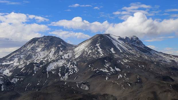
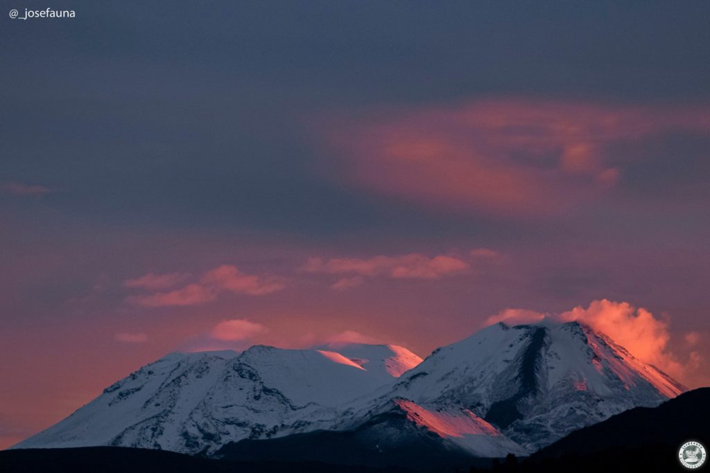
Chile , Nevados de Chillan :
Seismology
The seismological activity of the period was characterized by the recording of:
54 volcano-tectonic (VT) earthquakes associated with brittle rupture processes; the most energetic earthquake had a local magnitude (ML) equal to 1.4, whose location was estimated at a depth of 3.8 km and at an epicentral distance of 1.8 km to the East-South-East of the active crater.
Long-period (LP), explosion (EX) and tremor (TR) seismicities continued to be recorded, associated with fluid dynamics within the volcanic system. Twenty-one LP-type earthquakes were classified, none of which were associated with surface-level explosions due to the presence of acoustic waves and/or gaseous emissions. The size of the largest LP earthquake estimated from the reduced displacement parameter (DR) reached a value equal to 5.9 cm2. No TR-type seismicity was recorded during the evaluated period. Seismic fluid energy showed fluctuations that remain at very low levels, which is consistent with a system with no apparent new magmatic contributions to the surface.
Fluid Geochemistry
Data on sulfur dioxide (SO2) emissions obtained by optical differential absorption spectroscopy (DOAS) equipment, corresponding to the Philippi and Chillán stations, installed 1.5 km to the South-South-East ( SSE) and 2.7 km east-southeast (ESE) of the active crater respectively, presented an average value of 341 ± 97 t / d, with a maximum daily value of 854 t / d, recorded on November 28. Although these values show an increase in SO2 flux compared to the first half of November, this is not a significant increase and they are below the anomalous limit established for this volcano.
Geodesy
According to the data provided by the geodetic monitoring network (GNSS and inclinometers), the most important aspects related to volcanic deformation during the last period have been characterized by:
– A change in trend in the vertical components of all stations, showing a positive vertical adjustment, with rates reaching 0.8 cm / month at the NUBL station, east of the active crater.
– Variations in the trend of horizontal displacements, generally showing displacements towards the North or the North-East, with magnitudes not exceeding 0.4 cm/month and directions not compatible with an inflation record in the complex volcanic.
– The surveillance lines (distance between stations), remain practically constant.
– Variations in electronic inclinometers mainly due to changes in snow conditions around the stations. Recording of point variations
due to explosions is practically nil.
Geodetic data indicate a general change from trends observed for much of the year. The vertical uplift recorded would not correspond to the action of a source of deformation at depth linked to a new intrusion of material, due to the distribution of the direction of these displacements.
The Nevados de Chillán volcanic complex remains in a phase of very low seismic activity and superficial processes, comparable to those observed before the eruptive cycle; although there is a slight trend observed towards inflationary behavior, which needs to be assessed in a longer time window. However, as such behavior has been observed several times during the eruptive cycle (low seismic activity and surface activity), it should be observed that this trend stabilizes temporarily. In general, a decrease in surface processes is observed with occasional emissions of very low degassing power.
Due to the above, its technical alert is maintained at: YELLOW TECHNICAL ALERT: Changes in the behavior of volcanic activity
Source : Sernageomin
Photos : 24 horas , josefauna.
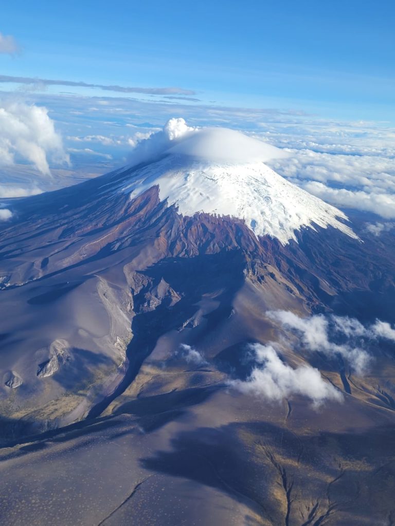
Ecuador , Cotopaxi :
Information on the activity of the COTOPAXI volcano, Quito, Friday, December 9, 2022.
Since 8:32 p.m. TL, the seismic stations of the Cotopaxi volcano have recorded a tremor signal probably linked to gas and ash emission activity. The amplitude of the signal is low compared to the activity of the volcano in 2015, and for the moment it is similar to the events that occurred in the previous days. The volcano remains cloudy and the direction of the winds in the area remains northwest. The IG-EPN is monitoring the event and will timely inform if any changes in the seismic signals are detected. It is recommended to take appropriate measures and receive information from official sources.
Information on the activity of the COTOPAXI volcano, Quito, Saturday, December 10, 2022.
Currently, the seismic network of the Cotopaxi volcano records a decrease in the energy of the tremor. Therefore, surface activity is estimated to have returned to pre-episode levels which began at 8:32 p.m. TL. The ash cloud emitted by the volcano continues to be transported through the atmosphere by the effect of winds to the northwest of the volcano and can generate ash falls in areas located northwest of the volcano. The IG-EPN continues to monitor the event and will inform in a timely manner if any changes in the seismic signals are detected.
The Geophysical Institute is monitoring and any news will be reported.
Source et photo : IGEPN

