November 30 , 2022.
Hawaii , Mauna Loa :
On Tuesday, November 29, at 3:27 a.m. HST, a magnitude-4.0 earthquake occurred 6 mi (9 km) east of Pahala, Island of Hawaiʻi, at a depth of 20 mi (32 km) below sea level. The earthquake is not related to the eruption of Mauna Loa and had no apparent impact on the ongoing eruptions at Mauna Loa and Kīlauea.
This earthquake is part of the seismic swarm under the Pāhala area, which has been going on since 2019.
Tuesday, November 29, 2022, 9:12 AM HST (Tuesday, November 29, 2022, 19:12 UTC)
19°28’30 » N 155°36’29 » W,
Summit Elevation 13681 ft (4170 m)
Current Volcano Alert Level: WARNING
Current Aviation Color Code: RED
Activity Summary:
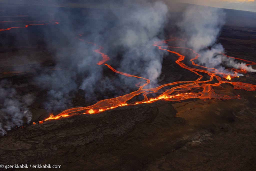
The Northeast Rift Zone eruption of Mauna Loa continues, with several fissures and lava flows active. Several lava flows are traveling in a northeast direction. The longest and largest lava flow is issuing from fissure 3. This lava flow crossed the Mauna Loa Weather Observatory Road at approximately 8 p.m. yesterday evening, November 29, and the flow front was located approximately 6 miles (10 km) from Saddle Road at 7 a.m. HST this morning.
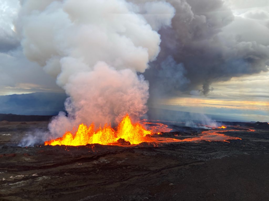
This morning, fountains at fissure 3 are up to 25 m (82 ft) and fountains are fissure 4, which formed at approximately 7:30 p.m. HST last night, were 5-10 m (16-33 ft) tall.
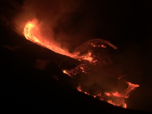
Aerial photograph of the dominant fissure 3 erupting on the Northeast Rift Zone of Mauna Loa, taken at approximately 8 a.m. HST November 29, 2022. Fissure 3 fountains were up to 25 m (82 ft) this morning and the vent was feeding the main lava flow to the northeast.
There is no active lava within Moku’āweoweo caldera, and there is no lava erupting from the Southwest Rift Zone. All lava flows are on the northeast flank of Mauna Loa. We do not expect any eruptive activity outside the Northeast Rift Zone. No property is at risk currently. There is a visible gas plume from the erupting fissure fountains and lava flows, with the plume primarily being blown to the North.
Tuesday, November 29, 2022, 4:23 PM HST (Wednesday, November 30, 2022, 02:23 UTC)
19°28’30 » N 155°36’29 » W,
Summit Elevation 13681 ft (4170 m)
Current Volcano Alert Level: WARNING
Current Aviation Color Code: RED
The Northeast Rift Zone eruption of Mauna Loa continues, with several fissures and lava flows active. Several lava flows are traveling in a northeast direction. The longest and largest lava flow is issuing from fissure 3. This lava flow crossed the Mauna Loa Weather Observatory Road at approximately 8 p.m. yesterday evening, November 29, and the flow front was located approximately 4.5 miles (7.5 km) from Saddle Road at approximately 3:30 p.m. HST this afternoon (straight line distance).
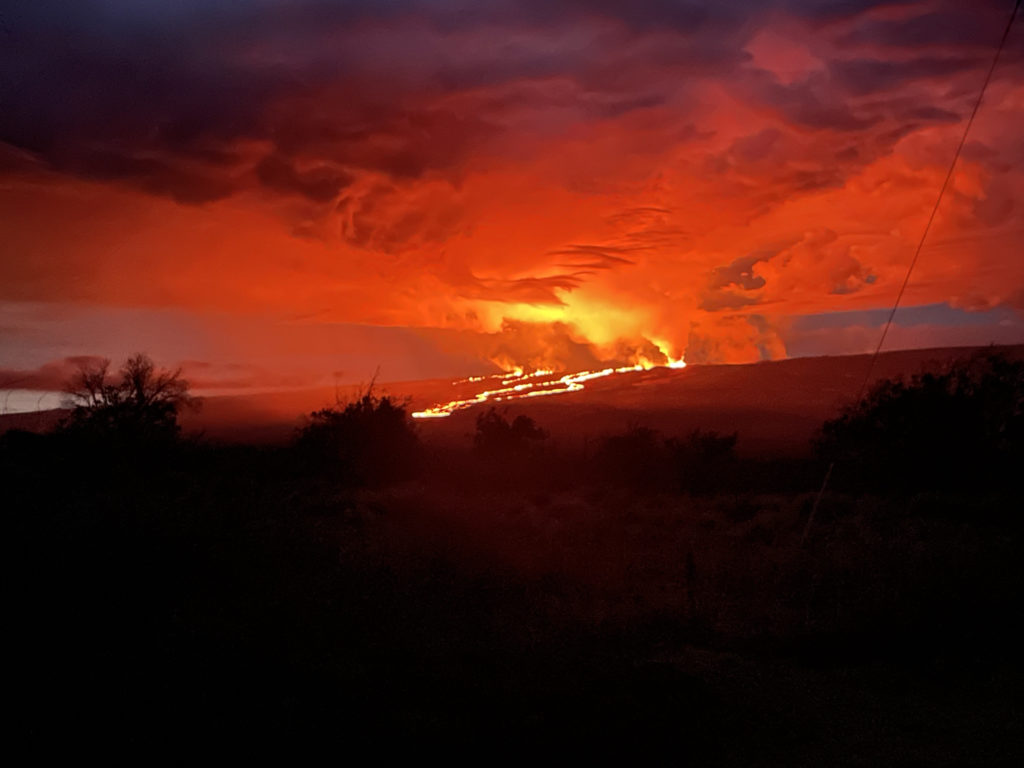
Photograph taken from Saddle Road at 6AM Hawaii time on November 29, 2022 shows lava flows moving northeast downslope of Mauna Loa volcano from the Northeast Rift Zone eruption.
This afternoon, fountains at fissure 3 were consistently 40-50 m (131-164 ft) tall and fountains at fissure 4, which formed at approximately 7:30 p.m. HST on November 28, were 5-10 m (16-33 ft) tall.
There is no active lava within Moku’āweoweo caldera, and there is no lava erupting from the Southwest Rift Zone. We do not expect any eruptive activity outside the Northeast Rift Zone. No property is at risk currently. There is a visible gas plume from the erupting fissure fountains and lava flows, with the plume primarily being blown to the North. Sulfur dioxide (SO2) emission rates of approximately 250,000 tonnes per day (t/d) were measured on November 28, 2022.
Source : HVO.
Photos : Erik Kabik / erikkabik.com , USGS / M. Patrick , USGS .
Italy , Stromboli :
WEEKLY BULLETIN, from November 21, 2022 to November 27, 2022. (issue date 29 November 2022)
ACTIVITY STATUS SUMMARY
In the light of the monitoring data, it is highlighted:
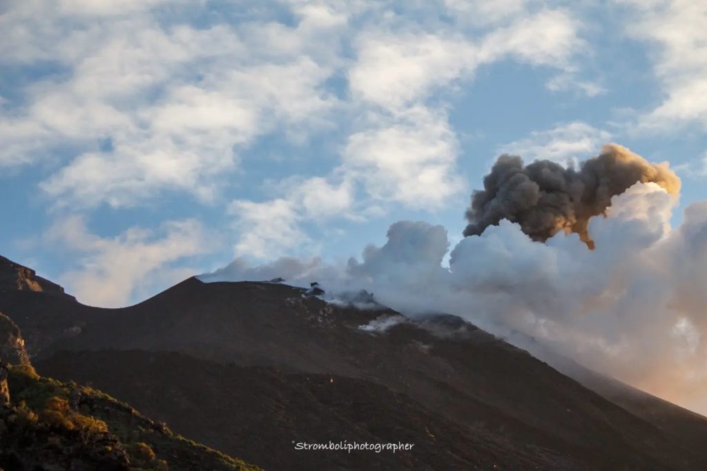
1) VOLCANOLOGICAL OBSERVATIONS: During this period, normal Strombolian-type explosive activity was observed with spattering activity in the North Crater area. The total hourly frequency fluctuated between average values (10-13 events/h). The intensity of the explosions was mainly low in the northern area of the crater and medium to high in the central-southern area of the crater.
2) SEISMOLOGY: The seismological parameters do not show significant variations.
3) SOIL DEFORMATIONS: During the period under consideration, the island’s soil deformation monitoring networks did not record any significant changes.
4) GEOCHEMISTRY: SO2 flux at an average and stable level
CO2 fluxes in the crater area remain at medium-high values.
Stromboli’s weekly average CO2/SO2 ratio shows average values of 12.7.
There are no updates on the isotope ratio of helium in groundwater.
5) SATELLITE OBSERVATIONS: The thermal activity observed by satellite in the summit area was low level.
VOLCANOLOGICAL OBSERVATIONS
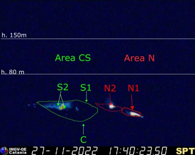
During the observation period, the eruptive activity of Stromboli was characterized by the analysis of the images recorded by the surveillance cameras INGV-OE at 190 m (SCT-SCV), Punta dei Corvi and Pizzo, while the camera at 400 m following problems in acquiring video signals caused by the damage to the fiber optic connection between Punta Labronzo and AOC due to the bad weather that hit the island on August 12, 2022, is not not currently available. The explosive activity was mainly produced by 3 (three) eruptive vents located in the North zone of the crater and by 2 (two) vents located in the Center-South zone. All vents are placed within the depression that occupies the crater terrace.
Due to the unfavorable weather conditions on November 21-22-23, the visibility of the crater terrace was insufficient for a correct description of the eruptive activity. In addition, from 07:56 UTC on November 22, the video signal from the cameras has been restored even if the Pizzo’s camera presents video disturbances.
Observations of explosive activity captured by surveillance cameras
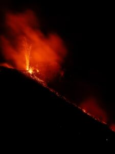
Sector N1 located in the northern zone of the crater produced low intensity explosions (less than 80 m in height) emitting coarse materials (bombs and lapilli). Sector N2, with two emission points, showed mainly low-intensity explosive activity emitting coarse materials and discontinuous low-intensity blasting activity that was intense for short intervals of time. The average frequency of explosions varied from 5 to 7 events/h.
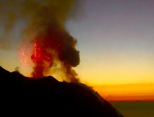
In the Center-South zone, no explosive activity was observed in sectors S1 and C, while in sector S2, with two emission points, explosive activity of variable average intensity (less than 150 m height) to high (more than 250 m high) was observed emitting coarse materials mixed with fine materials (ash). The average frequency of explosions is almost constant around 6 events/h.
Source : INGV.
Photos : INGV , Stromboli Stati d’animo
Chile , Villarica :
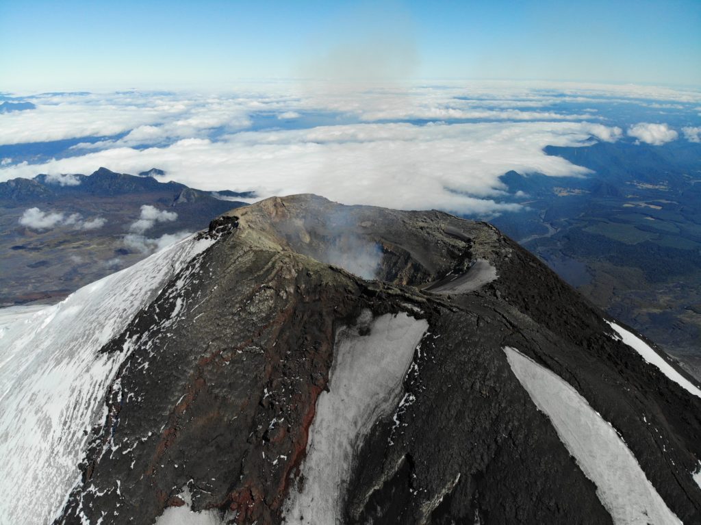
Special Report on Volcanic Activity (REAV), La Araucanía and Los Ríos regions, Villarrica volcano, November 29, 2022, 06:30 a.m. local time (mainland Chile)
The National Geology and Mining Service of Chile (Sernageomin) announces the following PRELIMINARY information, obtained through the monitoring equipment of the National Volcanic Monitoring Network (RNVV), processed and analyzed at the Observatory of Volcanoes of the Southern Andes (Ovdas):
On Tuesday, November 29, from 06:15 local time (09:15 UTC), the monitoring stations installed near the Villarrica volcano recorded an earthquake associated with fluid dynamics inside the volcanic system (Long period).
The characteristics of the earthquake, after its analysis, are as follows:
ORIGINAL TIME: 06:15 local time (09:15 UTC)
REDUCED DISPLACEMENT: 80.29 (cm*cm)
ACOUSTIC SIGNAL: 1.1 Pascals (Pa) reduced to 1 km
The characteristics of the activity associated with the event are as follows:
MAXIMUM COLUMN HEIGHT: Cloudy
SPRAY DIRECTION: Cloudy
COMMENTS:
No superficial activity associated with earthquakes was observed following the weather conditions in the area.
Therefore, the volcanic technical alert is maintained at the Yellow level.
Source : Sernageomin
Photos : Take a Way.
Ecuador , Cotopaxi :
Information on the activity of the COTOPAXI volcano, Quito, Tuesday, November 29, 2022.
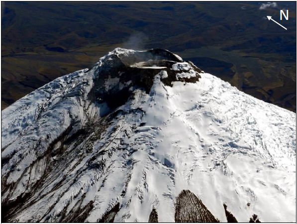
From 06:00 TL, the seismic stations of the Cotopaxi volcano record a tremor signal associated with an emission. The same was confirmed by the surveillance cameras of the IG-EPN, through which a column of gas with a low ash load is observed which reaches 1.6 km above the level of the crater and heads towards the Northeast. There is a probability that ashfall will be recorded in areas near the volcano. It is recommended to take appropriate measures and receive information from official sources.
The Institute of Geophysics of the Ecole Nationale Polytechnique will inform you in good time in the event of a change of activity.
DAILY REPORT OF THE STATE OF COTOPAXI VOLCANO, Tuesday November 29, 2022.
Information Geophysical Institute – EPN.
Surface activity level: Moderate, Surface trend: Ascending.
Internal activity level: Moderate, Internal trend: Ascending.
Seismicity: From November 28, 2022, 11:00 a.m. to November 29, 2022, 11:00 a.m.:
Data transmission from the BREF station is complete for seismic statistics.
Tremor (TRE) 3
Long Period (LP): 67
Rains / Lahars:
Light rains were observed in the area which did not produce lahars or muddy water flows.
Emission / Ash Column:
In the morning, gas emissions with steam could be observed in an easterly direction. Additionally, the Washington VAAC reported a broadcast at 11:03 a.m. in a southeasterly direction.
Other Monitoring Parameters:
FIRMS records 2 thermal anomalies on the Cotopaxi in the last 24 hours. MIROVA records 1 low thermal anomaly over Cotopaxi in the last 24 hours. Slight hot spots are observed on the Cotopaxi during the last 3 hours.
Gas:
The MOUNTS system reported 2062.7 tons of SO2, measured on 2022-11-28 18:31 UTC.
Observation:
In the morning, an emission of gas and water vapor with low ash content was observed. At this time the sector is cloudy.
Alert Level: Yellow
Source et photo : IGEPN.
El Salvador , San Miguel ( Chaparrastique) :
Date and time of publication: November 29, 2022 11:00:00
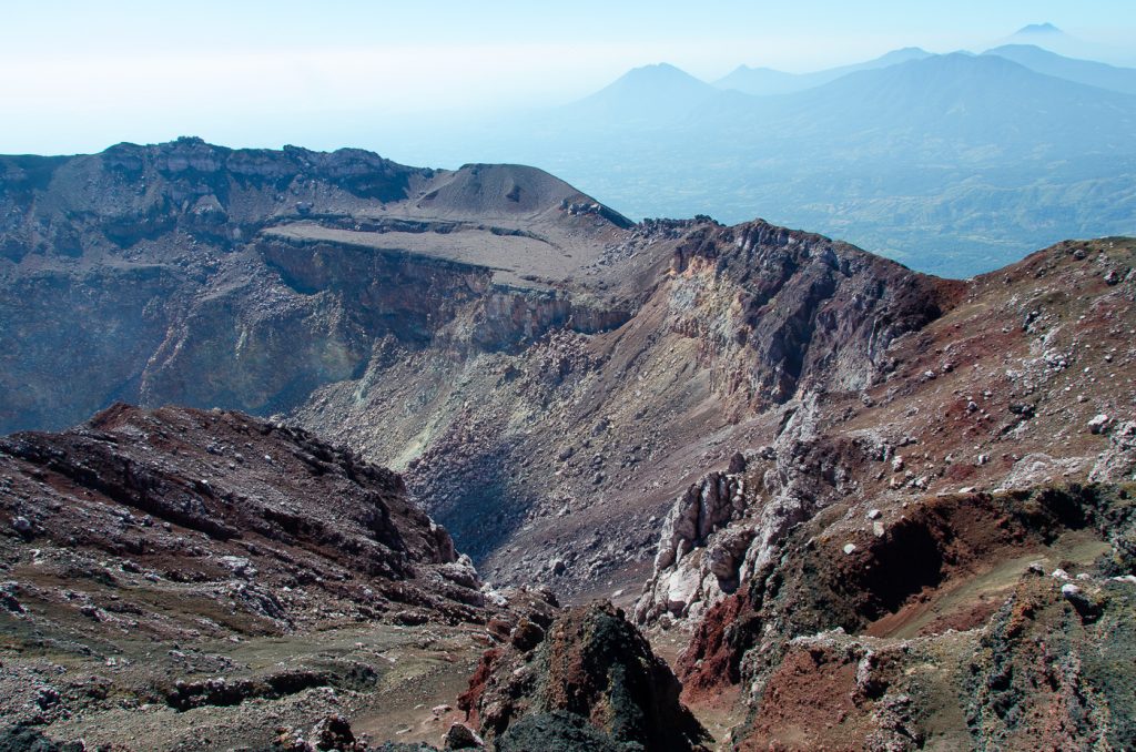
SUMMARY: The San Miguel volcano intensified its activity over the past weekend, generating explosions of greater intensity and height across its central crater, initiating an eruptive phase of intensity 1 (on an explosive index scale of 0 to 8).
Over the past few hours, the frequency of explosions has varied. The time between explosions has increased (longer), the seismicity does not show increasing trends. We monitor this behavior of the volcano, so we will update if the activity of the volcano evolves from a phreatic stage to phreato magmatic or magmatic, that is to say if significant indications of the arrival of new magma are found.
According to the monitoring of seismicity, gas concentration and characteristics of collected ash, this activity was attributed to the contact processes of hot gases coming from the interior of the volcano with rocks saturated with infiltrated water (phreatic activity, mainly), which generate the explosions with emissions of gas, ash, rocks and hot water vapor through the central crater. This behavior may persist for the next few days.
Seismicity:
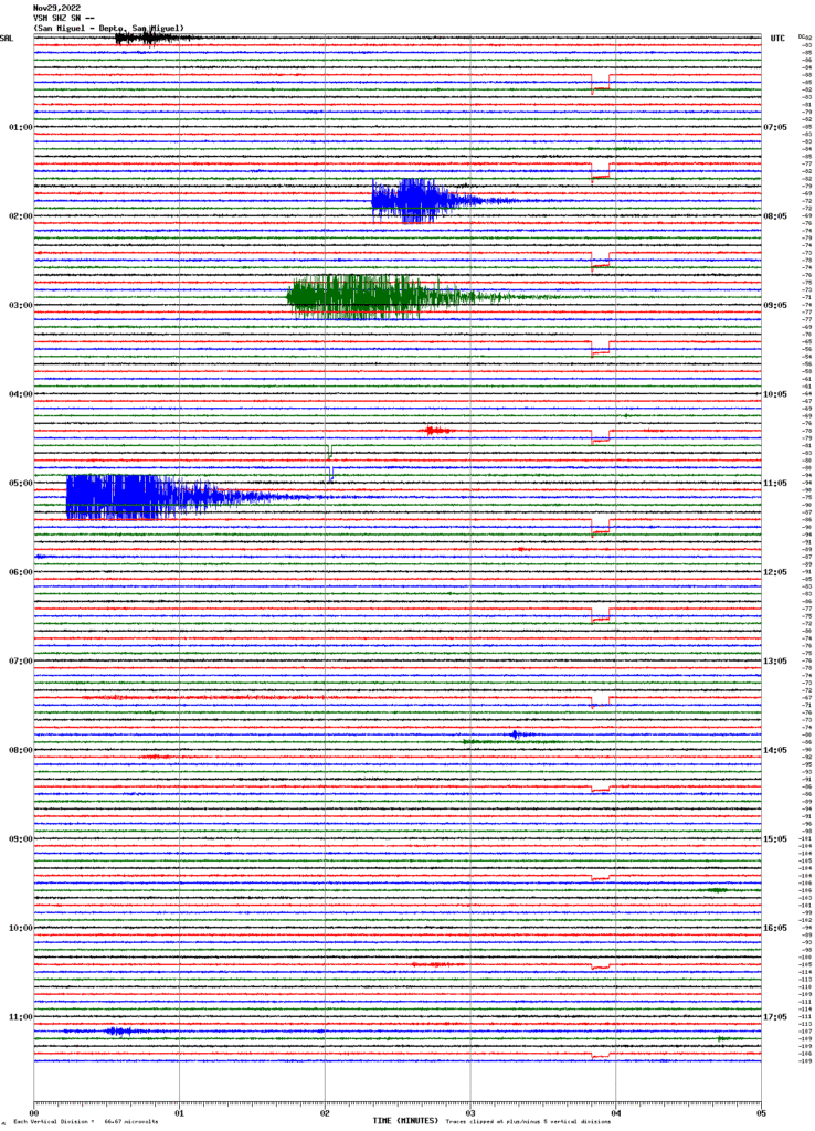
Regarding the seismicity recorded by the San Miguel volcanic station located on the northern flank at 1700m altitude:
Figure 1. Seismic record from the VSM station.
Gas:
Gas measurements taken in the field, with DOAS Mobile equipment, indicate sulfur dioxide values below the historic base threshold of the San Miguel volcano, which is 300 tons per day. Spot measurements were made during the explosions, which reached values of 1200 tons per day, during one of the largest explosions.
Deformation:
The deformation parameters are maintained without significant changes, according to the latest ground deformation measurements.
Source : Marn.
Photos : Auteur inconnu , Marn.


