October 23 , 2022.
Ecuador , Cotopaxi :
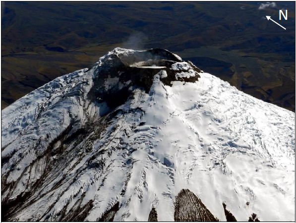
Information on the activity of the COTOPAXI volcano Nº 2022-001, Quito, Friday October 21, 2022.
Since 8:00 p.m. TL, the seismic stations of the Cotopaxi volcano have recorded a tremor signal probably linked to gas and ash emission activity. The amplitude of the signal is low compared to the activity of the volcano in 2015. To date, a slight fall of ash has been reported towards the José Rivas Refuge. The volcano remains cloudy and with light rain such that visual observations cannot be made. The IG-EPN continues to monitor the event and will inform in a timely manner if any changes in the seismic signals are detected. It is recommended to take appropriate measures and receive information from official sources.
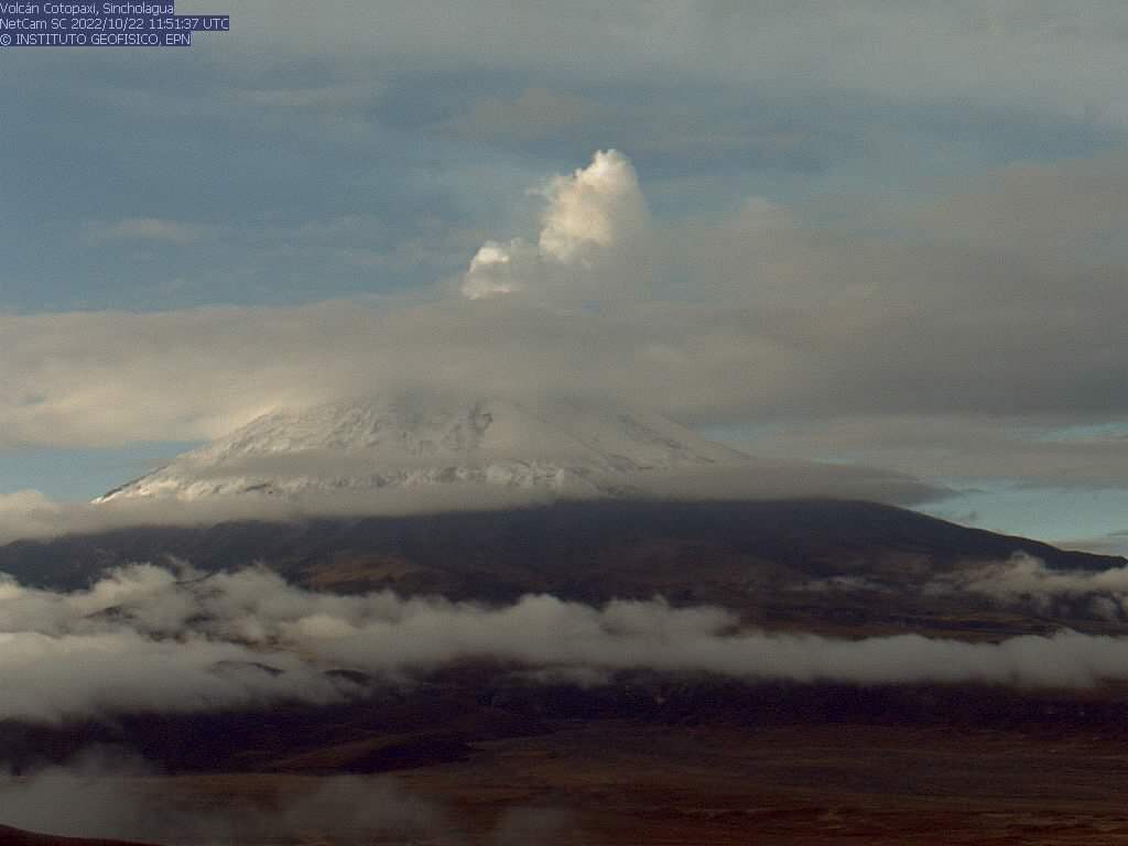
Information on the activity of the COTOPAXI volcano Nº 2022-001, Quito, Saturday October 22, 2022.
After the tremor, which lasted from 7:50 p.m. to 12:40 a.m. today (about 4 hours) and the emission of ash that accompanied this tremor, the level of seismic activity of the volcano has decreased and remains at low levels until here. This morning the Cotopaxi presents an emission mainly of gas and water vapor with a column which reaches 1000 m in height and which due to the winds is directed towards the West. At the moment, technicians from the Institute are carrying out fieldwork in the area of the volcano to learn more about the activity that took place there.
DAILY REPORT OF THE STATE OF COTOPAXI VOLCANO, Saturday October 22, 2022.
Information Geophysical Institute – EPN.
Surface Activity Level: Low, Surface Trend: No change
Internal activity level: Low, Internal trend: No change.
Seismicity: From October 21, 2022, 11:00 a.m. to October 22, 2022, 11:00 a.m.:
The data corresponds to 24 hours of transmission from the BREF reference station. Compared to the seismicity recorded yesterday, there is a slight increase.
Long Periods (LP): 46
Emission Tremors (TREMI): 5
Volcano-tectonics ( VT): 1
Rains / Lahars:
Rains were recorded in the area, which did not generate lahars.
Emission / ash column:
In the early hours of the morning, the volcano cleared up for a moment and a steam emission was observed at 1000 meters in a westerly direction. Then the Washington VAAC reported 2 ash emissions with heights up to 2353 meters above the summit in a northeast and west direction.
Observation:
For the moment, the volcano sector remains cloudy, which is why visual observations cannot be made. Last night, a slight ash fall was reported at the José Rivas refuge.
Alert level: White.
Source et photos : IGEPN.
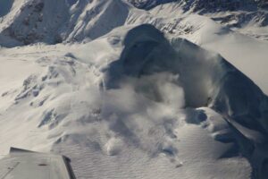
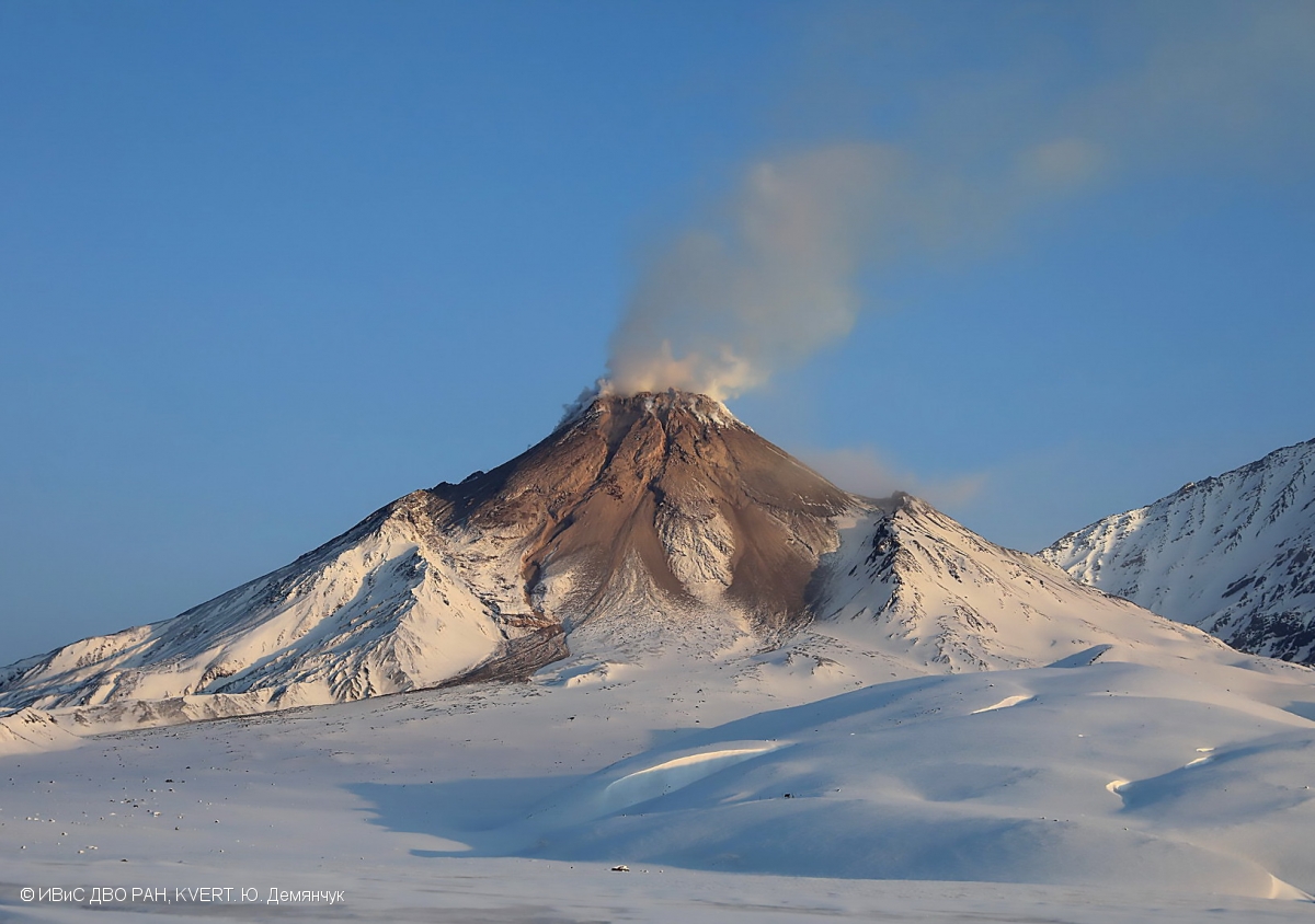
Kamchatka , Bezymianny :
VOLCANO OBSERVATORY NOTICE FOR AVIATION (VONA)
Issued: October 23 , 2022
Volcano: Bezymianny (CAVW #300250)
Current aviation colour code: ORANGE
Previous aviation colour code: yellow
Source: KVERT
Notice Number: 2022-142
Volcano Location: N 55 deg 58 min E 160 deg 35 min
Area: Kamchatka, Russia
Summit Elevation: 2882 m (9452.96 ft)
Volcanic Activity Summary:
Activity of the volcano began to increasing from from October 22. The incandescence of the volcano summit in the night time and sometimes a strong fumarolic activity were obserwing during the last day. The temperature of thermal anomaly gradually increases. KVERT continues to monitor Bezymianny volcano.
Activity of the volcano gradually increases. Strong ash explosions up to 32,800-49,200 ft (10-15 km) a.s.l. could occur at any time. Ongoing activity could affect international and low-flying aircraft.
Volcanic cloud height: NO ASH CLOUD PRODUSED
Other volcanic cloud information: NO ASH CLOUD PRODUSED
Source : Kvert.
Photo :Yu. Demyanchuk, IVS FEB RAS, KVERT
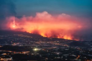
La Martinique , Mount Pelée :
Weekly report on the activity of Mount Pelée for the period from October 14, 2022 to October 21, 2022.
Between October 14, 2022 at 4 p.m. (UTC) and October 21, 2022 at 4 p.m. (UTC), the OVSM recorded at least 31 volcano-tectonic earthquakes of magnitude less than 0.3. Two of these low-energy earthquakes have been located. They are identical to those of the well-known families on Pelee which are located inside the volcanic edifice around 0.4 km depth above sea level or about 1 km depth below the summit. This superficial volcano-tectonic seismicity is associated with the formation of micro-fractures in the volcanic edifice. During the period of this report, the OVSM also recorded 4 hybrid-type earthquakes and 1 long-period type earthquake. These signals containing low frequencies are associated with the presence of fluids (gas, hydrothermal water) in the volcanic edifice.
None of these earthquakes was felt by the population.

During volcanic reactivation phases of volcanoes similar to Mount Pelee, periods of higher seismic activity often alternate with phases of lower seismicity. Since the reactivation of the hydrothermal-magmatic system (end of 2018), several periods of zero or weak seismicity have been recorded by the OVSM, for example May 2019 (5 earthquakes), October 2019 (3 earthquakes), August 2020 (1 earthquake) , and only 8 earthquakes between June 24 and August 8, 2022 (period of 2 months).
The areas of degraded vegetation located between Morne Plumé and the Rivière Chaude were observed during a helicopter flight carried out on February 9 and May 5, with the support of Dragon 972, and confirmed by analysis of satellite and drone images. (overview of May 11) and satellite analysis (June 2022). A new area of degraded vegetation, located just north of the Rivière Chaude, was observed from August 26th.
The alert level remains YELLOW: vigilance.
Source : OVSM-IPGP.
Photo : pinterest
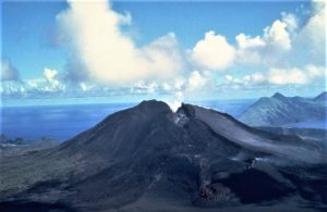
Indonesia , Semeru :
VOLCANO OBSERVATORY NOTICE FOR AVIATION – VONA
Issued : October 22 , 20221022/2337Z
Volcano : Semeru (263300)
Current Aviation Colour Code : ORANGE
Previous Aviation Colour Code : orange
Source : Semeru Volcano Observatory
Notice Number : 2022SMR195
Volcano Location : S 08 deg 06 min 29 sec E 112 deg 55 min 12 sec
Area : East java, Indonesia
Summit Elevation : 11763 FT (3676 M)
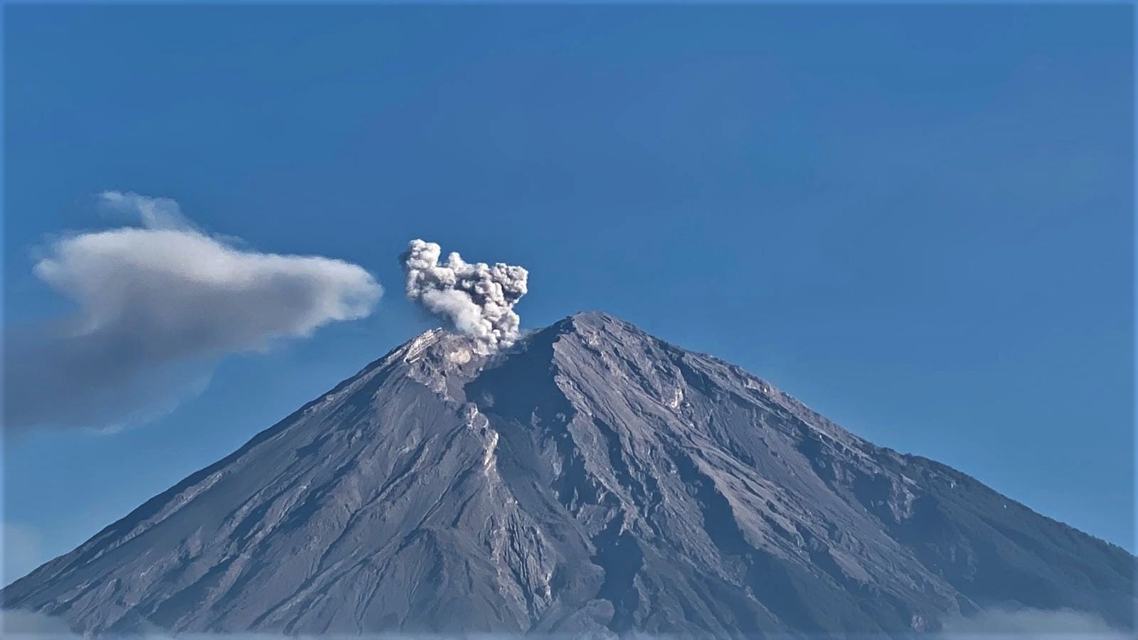
Volcanic Activity Summary :
Eruption with volcanic ash cloud at 22h34 UTC (06h34 local)
Volcanic Cloud Height :
Best estimate of ash-cloud top is around 13363 FT (4176 M) above sea level, may be higher than what can be observed clearly. Source of height data: ground observer.
Other Volcanic Cloud Information :
Ash-cloud moving to south
Observation of seismicity:
24 earthquakes of eruptions/explosions with an amplitude of 10 to 22 mm and a duration of 70 to 120 seconds.
2 emission earthquakes with an amplitude of 5 to 8 mm and an earthquake duration of 35 to 50 seconds.
1 lahar signal with an amplitude of 24 mm and an earthquake duration of 1500 seconds.
Source : Magma Indonésie .
Photo : Andi Volcanist.
Hawaii , Mauna Loa :
19°28’30 » N 155°36’29 » W,
Summit Elevation 13681 ft (4170 m)
Current Volcano Alert Level: ADVISORY
Current Aviation Color Code: YELLOW
Activity Summary:
Mauna Loa is not erupting and there are no signs of an imminent eruption at this time. However, Mauna Loa continues to be in a state of heightened unrest as indicated by increased earthquake activity and inflation of the summit. The current unrest is most likely being driven by renewed input of magma 2–5 miles (3–8 km) beneath Mauna Loa’s summit. Monitoring data show no significant changes in the past day.
Observations:
During the past 24 hours, HVO detected 10 small-magnitude (below M3.0) earthquakes 2–3 miles (3–5 km) below Mokuāʻweoweo caldera and 4–5 miles (6–8 km) beneath the upper-elevation northwest flank of Mauna Loa. Both of these regions have historically been seismically active during periods of unrest on Mauna Loa.
Global Positioning System (GPS) instruments at the summit and on the flanks of Mauna Loa continue to measure inflation at rates elevated since mid-September. However, tiltmeters at the summit are not showing significant surface deformation over the past week.
Concentrations of sulfur dioxide (SO2), hydrogen sulfide (H2S), and carbon dioxide (CO2), as well as fumarole temperatures, remain stable at the summit and at Sulphur Cone on the upper Southwest Rift Zone. Webcam and thermal camera views have shown no changes to the volcanic landscape on Mauna Loa over the past week.
Source : HVO
Photo : USGS/ T. Elias