October 21 , 2022 .
Hawaii , Mauna Loa :
HVO reported continuing unrest at Mauna Loa during 12-18 October. The seismic network detected 22-65 daily small-magnitude (below M 3) earthquakes 3-5 km beneath Mokua?weoweo caldera and 6-8 km beneath the upper NW flank of Mauna Loa. Data from Global Positioning System (GPS) instruments at the summit and flanks showed continuing inflation, though data from tiltmeters at the summit did not show significant surface deformation over the past week. A pair of earthquakes, M 4.6 and M 5, were recorded at 09h07 on 14 October. The first one was located S of Pahala, just offshore, at a depth of about 13 km. The second earthquake followed 24 seconds later and was located S of Pahala (beneath Highway 11) at a depth of 7.4 km. The earthquakes were followed by more than 150 aftershocks in the Pahala region over the next two days. Twenty of the aftershocks were greater than M 2.5 and four were M 3-4. HVO noted that the unrest was likely driven by accumulation of new magma 3-8 km beneath the summit. The Volcano Alert Level remained at Advisory (the second lowest level on a four-level scale) and the Aviation Color Code remained at Yellow (the second lowest level on a four-color scale).
19°28’30 » N 155°36’29 » W,
Summit Elevation 13681 ft (4170 m)
Current Volcano Alert Level: ADVISORY
Current Aviation Color Code: YELLOW
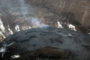
Aerial view of Mauna Loa’s summit caldera, Moku‘āweoweo, captured by Civil Air Patrol on Sunday, October 20, 2019. Lua Poholo is the name of the pit crater in the bottom left corner of the image. Cones that formed during the 1940 and 1949 eruptions of Mauna Loa are visible in the background, as well fissures that extend through the center of the caldera. These fissures formed during the most recent eruption of Mauna Loa, in 1984.
Activity Summary:
Mauna Loa is not erupting and there are no signs of an imminent eruption at this time. However, Mauna Loa continues to be in a state of heightened unrest as indicated by increased earthquake activity and inflation of the summit. The current unrest is most likely being driven by renewed input of magma 2–5 miles (3–8 km) beneath Mauna Loa’s summit. Monitoring data show no significant changes in the past day.
Observations:
During the past 24 hours, HVO detected 18 small-magnitude (below M3.0) earthquakes 2–3 miles (3–5 km) below Mokuāʻweoweo caldera and 4–5 miles (6–8 km) beneath the upper-elevation northwest flank of Mauna Loa. Both of these regions have historically been seismically active during periods of unrest on Mauna Loa.
Global Positioning System (GPS) instruments at the summit and on the flanks of Mauna Loa continue to measure inflation at rates elevated since mid-September. However, tiltmeters at the summit are not showing significant surface deformation over the past week.
Concentrations of sulfur dioxide (SO2), hydrogen sulfide (H2S), and carbon dioxide (CO2), as well as fumarole temperatures, remain stable at the summit and at Sulphur Cone on the upper Southwest Rift Zone. Webcam and thermal camera views have shown no changes to the volcanic landscape on Mauna Loa over the past week.
Source et photo : GVP , HVO.
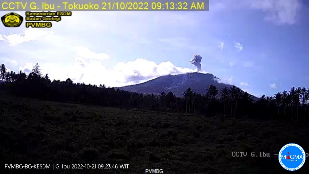
Indonesia , Ibu :
Mount Ibu erupted on Friday, October 21, 2022 at 09:16 WIT with the height of the ash column observed at ± 800 m above the peak (± 2125 m above sea level). It is observed that the ash column is gray in color with a thick intensity towards the northwest. This eruption was recorded on a seismograph with a maximum amplitude of 28 mm and a duration of 70 seconds.
VOLCANO OBSERVATORY NOTICE FOR AVIATION – VONA
Issued : October 21 , 2022
Volcano : Ibu (268030)
Current Aviation Colour Code : ORANGE
Previous Aviation Colour Code : orange
Source : Ibu Volcano Observatory
Notice Number : 2022IBU53
Volcano Location : N 01 deg 29 min 17 sec E 127 deg 37 min 48 sec
Area : North Maluku, Indonesia
Summit Elevation : 4240 FT (1325 M)
Volcanic Activity Summary :
Eruption with volcanic ash cloud at 00h16 UTC (09h16 local).
Volcanic Cloud Height :
Best estimate of ash-cloud top is around 6800 FT (2125 M) above sea level, may be higher than what can be observed clearly. Source of height data: ground observer.
Other Volcanic Cloud Information :
Ash-cloud moving to northwest.
Source et photo : Magma Indonésie .
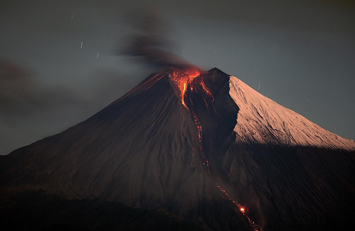
Ecuador , Sangay :
DAILY REPORT OF THE STATE OF SANGAY VOLCANO, Thursday October 20, 2022.
Information Geophysical Institute – EPN.
Surface Activity Level: High, Surface Trend: No change
Internal activity level: High, Internal trend: No change.
Seismicity: From October 19, 2022, 11:00 a.m. to October 20, 2022, 11:00 a.m.:
The data corresponds to 24 hours of transmission from the SAGA reference station
Explosion (EXP) 289
Emission Tremors (TREMI ) 71.
Lahar (HL): 1
Rains / Lahars:
There were rains during the morning today with which a small signal associated with the presence of mudslides was recorded. **In the event of heavy rains, these could remobilize the accumulated materials, generating mudslides and debris that would descend on the flanks of the volcano and flow into the adjacent rivers.**
Emission / ash column:
Yesterday afternoon, several steam and ash emissions were observed with heights up to 1000 m in a northwest direction. Three ash emission reports were issued by the Washington VAAC, with a maximum height of 2070 m above crater level in a northwesterly direction.
Other Monitoring Parameters:
Neither FIRMS nor MIROVA register thermal alerts in the last 24 hours.
Gas:
The Mounts satellite system reported 363.2 tons of sulfur dioxide (SO2) for yesterday at 7:19 p.m. UTC.
Observation:
During yesterday night, an incandescence was observed in the crater with a descent of this incandescent material along the southeastern flank. Since this morning the volcano remains cloudy.
Alert level: Orange.
Source : IGEPN.
Photo : Eqphos fotografía
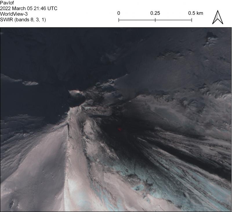
Alaska , Pavlof :
55°25’2″ N 161°53’37 » W,
Summit Elevation 8261 ft (2518 m)
Current Volcano Alert Level: WATCH
Current Aviation Color Code: ORANGE
Low-level eruptive activity continues from a vent on the east flank of Pavlof Volcano, just below the summit. Seismic tremor and several small explosions were detected over the past day. During these explosions, incandescence near the summit could be seen in web camera views. Elevated surface temperatures were observed in satellite views over the past day.
Small explosions associated with the current eruption could happen at any time and may be accompanied by small ash plumes within the immediate vicinity of the volcano. The level of unrest at Pavlof Volcano can change quickly and the progression to more significant eruptive activity can occur with little or no warning.
Pavlof Volcano is monitored by local seismic and infrasound sensors, satellite data, web cameras, and regional infrasound and lightning networks.
Source : AVO.
Photo : Loewen, M. W.
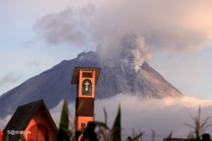
Guatemala , Fuego :
Activity :
The Fuego Volcano Observatory OVFGO reports 6 to 12 weak to moderate explosions per hour, resulting in the generation of ash columns at 4,500 to 4,800 meters (14,764 to 15,748 feet) that spread 15 km towards the East-South-East. Weak and moderate rumblings are reported that have generated weak shock waves that vibrate the roofs and windows of houses near the volcano. Constant avalanches of weak to moderate characteristics have been observed in the direction of the Ceniza ravine, which reach the edges of the vegetation, as well as in the direction of the Seca, Taniluyá and Trinidad ravines.
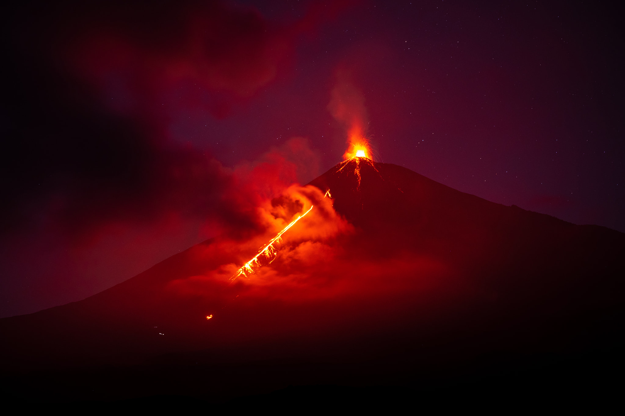
At night and early in the morning, an incandescence was observed reaching a height of 100 to 300 meters. Locomotive-like sounds lasting 2-5 minutes were also heard. Following the explosions of the volcano, fine ash falls are reported at Finca Palo Verde, Sangre de Cristo, Yepocapa, La Rochela, Osuna and others in the Southeast direction.
Source : Insivumeh .
Photo : Diego Rizzo .