October 17 , 2022.
Iceland , Reykjanes Peninsula / Katla :
Yesterday evening (16th of Oct). At around 20:30 an earthquake swarm stated out on the Reykjanes ridge. The largest earthquakes in the swarm were of M4.4 at 22:11, M4.3 at 23:36 and M4,0 at 23:34. About 240 earthquakes have been detected in the swarm since it started.
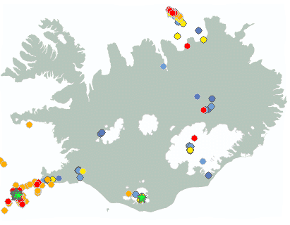
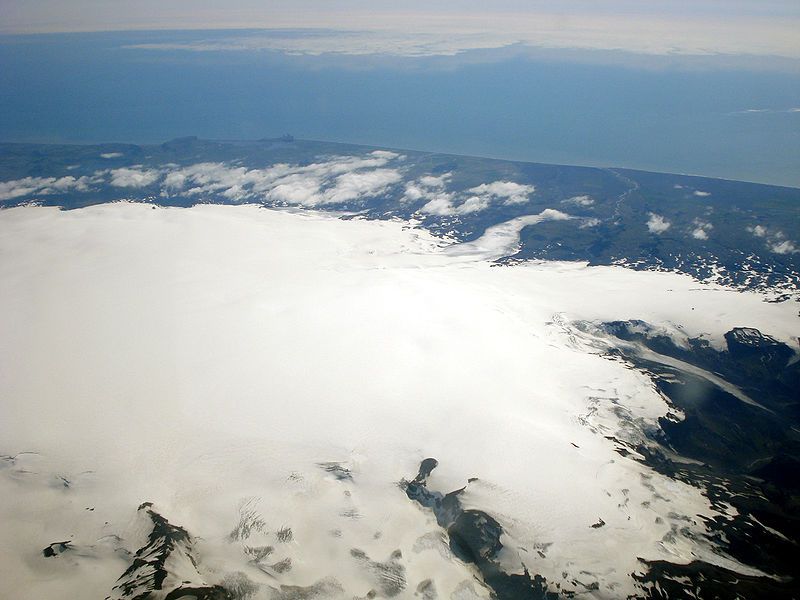
Increased seismic activity has been observed in Mýrdalsjökull since the 15th of October. Yesterday morning at 07:54 there was an earthquake of M3.0 and at at 11:50 there was and earthquake of M3.8 there. The earthquakes are all located close to cauldrons 10 and 11 in the eastern part of Kötluaskja.
Jokulhlaup is likely in Múlakvísl and people are advised to keep distance to the river and especially near the source.
Week overview 3 October – 9 October
Around 420 earthquakes were located last week by the automatic SIL seismic network, it is a similar number of earthquakes in the previous week when they were around 440. The largest earhquake of the week was located east of Grimsey in the Tjörnes fracture zone, of M2.7 at 17:38 on October 7th. More activity was detected in Grimsvötn and on October 5th an earthquake of M2,4 was located there. One eathquake was located in westflanks of Mt. Hekla of M1.2 in early morning on October 5th.
Source : Vedur is
Photos : IMO , tommybee
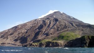
Hawaii , Mauna Loa :
19°28’30 » N 155°36’29 » W,
Summit Elevation 13681 ft (4170 m)
Current Volcano Alert Level: ADVISORY
Current Aviation Color Code: YELLOW
Activity Summary:
Mauna Loa is not erupting and there are no signs of an imminent eruption at this time. However, Mauna Loa continues to be in a state of heightened unrest as indicated by increased earthquake activity and inflation of the summit. The current unrest is most likely being driven by renewed input of magma 2-5 miles (3-8 km) beneath Mauna Loa’s summit. Monitoring data show no significant changes in the past day.
Observations:
During the past 24 hours, HVO detected 35 small-magnitude (below M3.0) earthquakes 2-3 miles (3-5 km) below Mokuāʻweoweo caldera and 4-5 miles (6-8 km) beneath the upper-elevation northwest flank of Mauna Loa. Both of these regions have historically been seismically active during periods of unrest on Mauna Loa.
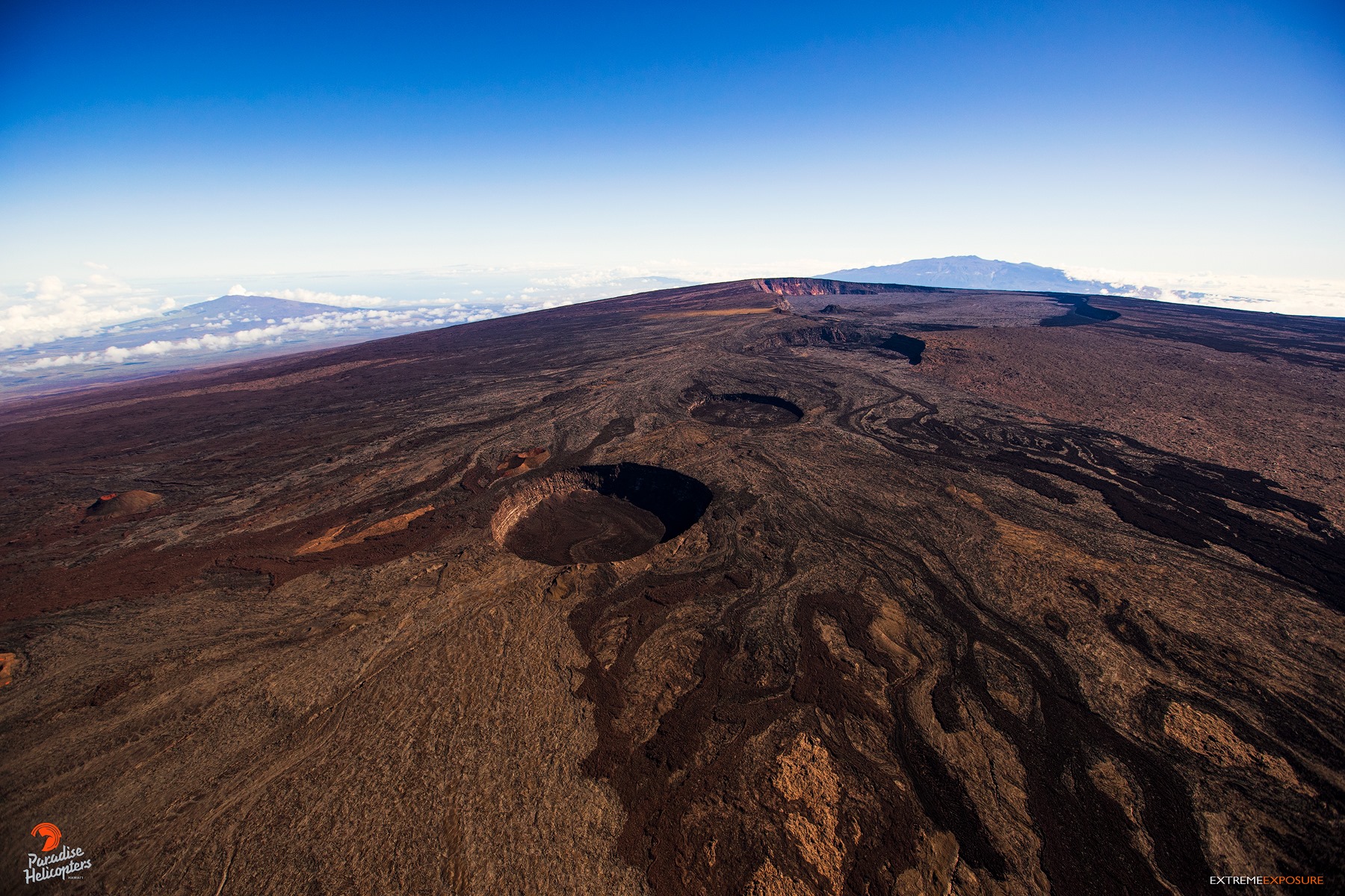
The earthquakes and aftershocks from the morning of October 14, 2022 (HVO Information Statement) have not caused any changes in Mauna Loa monitoring data streams. Over the past 48 hours, there have over 150 aftershocks in the Pahala region. Of these, 20 were greater than M2.5 and 4 have been greater than M3.
Global Positioning System (GPS) instruments at the summit and on the flanks of Mauna Loa continue to measure inflation at rates elevated since mid-September. However, tiltmeters at the summit are not showing significant surface deformation over the past week.
Concentrations of sulfur dioxide (SO2), hydrogen sulfide (H2S), and carbon dioxide (CO2), as well as fumarole temperatures, remain stable at the summit and at Sulphur Cone on the upper Southwest Rift Zone. Webcam and thermal camera views have shown no changes to the volcanic landscape on Mauna Loa over the past week.
Source : HVO.
Photo : Bruce Omori.
Indonesia , Ibu :
Mount Ibu erupted on Monday, October 17, 2022 at 08:58 WIT with the height of the ash column observed at ± 800 m above the peak (± 2125 m above sea level). The ash column is observed to be gray with a thick intensity towards the southwest. This eruption was recorded on a seismograph with a maximum amplitude of 28 mm and a duration of 65 seconds.
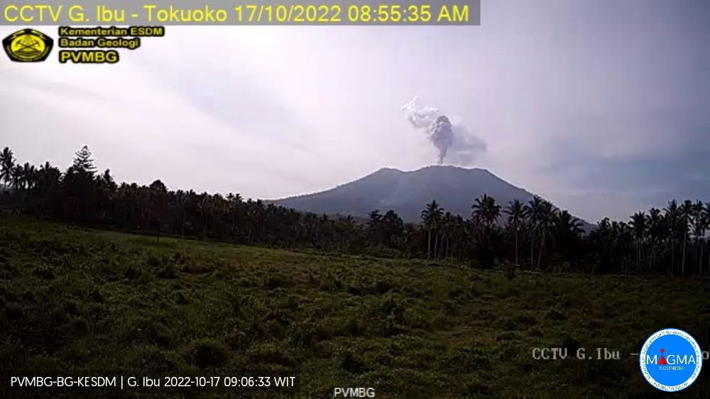
VOLCANO OBSERVATORY NOTICE FOR AVIATION – VONA
Issued : October 17 , 2022
Volcano : Ibu (268030)
Current Aviation Colour Code : ORANGE
Previous Aviation Colour Code : orange
Source : Ibu Volcano Observatory
Notice Number : 2022IBU50
Volcano Location : N 01 deg 29 min 17 sec E 127 deg 37 min 48 sec
Area : North Maluku, Indonesia
Summit Elevation : 4240 FT (1325 M)
Volcanic Activity Summary :
Eruption with volcanic ash cloud at 23h58 UTC (08h58 local).
Volcanic Cloud Height :
Best estimate of ash-cloud top is around 6800 FT (2125 M) above sea level, may be higher than what can be observed clearly. Source of height data: ground observer.
Other Volcanic Cloud Information :
Ash-cloud moving to southwest.
Source et photo : Magma Indonésie.
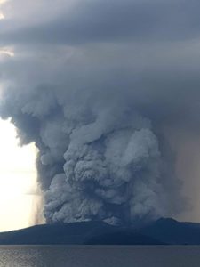
Chile , Nevados de Chillan :
Special Report on Volcanic Activity (REAV), De Nuble region, Nevados de Chillan volcanic complex, October 16, 2022, 5:02 p.m. local time (mainland Chile).
The National Service of Geology and Mines of Chile (Sernageomin) publishes the following PRELIMINARY information, obtained through the monitoring equipment of the National Volcanic Monitoring Network (RNVV), processed and analyzed at the Volcanological Observatory of the Southern Andes ( Ovdas):
Sunday, October 16, 2022, at 4:13 p.m. local time (19.13 UTC), the monitoring stations installed near the Nevados de Chillan volcanic complex recorded an earthquake associated with fluid dynamics (long period type), inside the volcanic system.
The characteristics of earthquakes after their analysis are as follows:
ORIGINAL TIME: 4:13 p.m. local time (7:13 p.m. UTC)
LATITUDE: 36.863°S
LONGITUDE: 71.372° W
DEPTH: 1.6 km
REDUCED DISPLACEMENT: 623 (cm*cm)
ACOUSTIC SIGNAL: 112 Pascals (Pa) reduced to 1 km
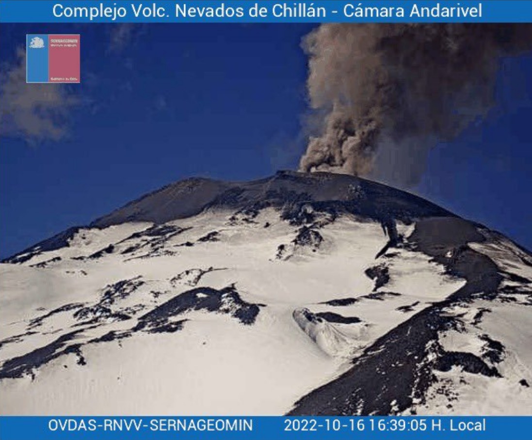
The characteristics of surface activity are as follows:
MAXIMUM COLUMN HEIGHT: Undetermined. More than 400 meters
DIRECTION OF DISPERSION: Southeast (SE)
COMMENTS:
An explosion was observed with a high content of black / gray pyroclasts. In addition, a significant pyroclastic flow was recorded in a preferential direction towards the North-North-East, with a distance greater than 500m from the active crater.
Because of the cloudiness in the area, it was not possible to determine the height of the emission column. But from the Andarivel camera, it could be evaluated at more than 400m, in the direction of dispersion towards the South-East (SE).
The volcanic technical alert remains at the Yellow level.
Sources et photo: Sernageomin.
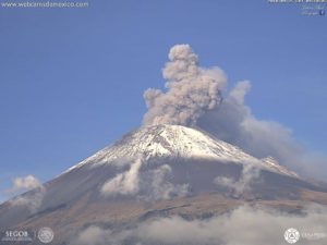
Ecuador , Sangay :
Quito, Sunday October 16, 2022
From 7:00 p.m. TL, through satellite images (GOES-16), an ash cloud is observed which reaches about 1.8 km above the crater and heads northwest. Therefore, there is a probability of ash fall in the provinces of Morona Santiago and Chimborazo. This phenomenon has persisted during the current eruptive period which began in May 2019. IG-EPN continues to monitor the event and will report in a timely manner if changes in seismic signals are detected.
DAILY REPORT OF THE STATE OF SANGAY VOLCANO, Sunday October 16, 2022.
Information Geophysical Institute – EPN.
Surface Activity Level: High, Surface Trend: No change
Internal activity level: High, Internal trend: No change.
Seismicity: From October 15, 2022, 11:00 a.m. to October 16, 2022, 11:00 a.m.:
Due to technical problems at the SAGA reference station, the counting of events was carried out for a period of 8 hours of operation.
Explosion (EXP) 344
Emission Tremors (TREMI ) 22.
Rains / Lahars:
Light showers were recorded via the Windy app. **In the event of heavy rains, these could remobilize the accumulated materials, generating mudslides and debris that would descend on the flanks of the volcano and flow into the adjacent rivers.**

Emission / ash column:
Gas and ash emissions were observed at heights of up to 1,800 meters above crater level in a southwesterly direction. The Washington VAAC reported ash emissions at heights of 1,770 and 1,770 meters above the summit in a southwesterly direction.
Gas:
The MOUNTS system reported 425.1 tons of SO2, measured on 10/15/2022 at 1:54 p.m. TL.
Other Monitoring Parameters:
The FIRMS system reported 38 thermal anomalies and the MIROVA system recorded 1 high thermal anomaly (171 MW), during the last 24 hours.
Observation:
The volcano area has been cleared since yesterday evening until early morning today. During the night and in the early morning, the descent of incandescent materials was observed on the southeast flank. In addition, in the early morning, satellite images showed an ash cloud with a South-West direction. No ashfall report has been received until this report was prepared.
Alert level: Orange.
Source et photo : IGEPN.