May 13 , 2022.
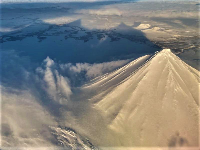
Italy / Sicily , Etna :
Press release on Etna activity.
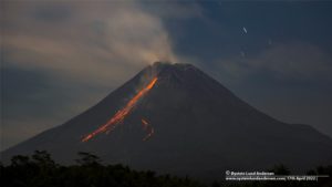
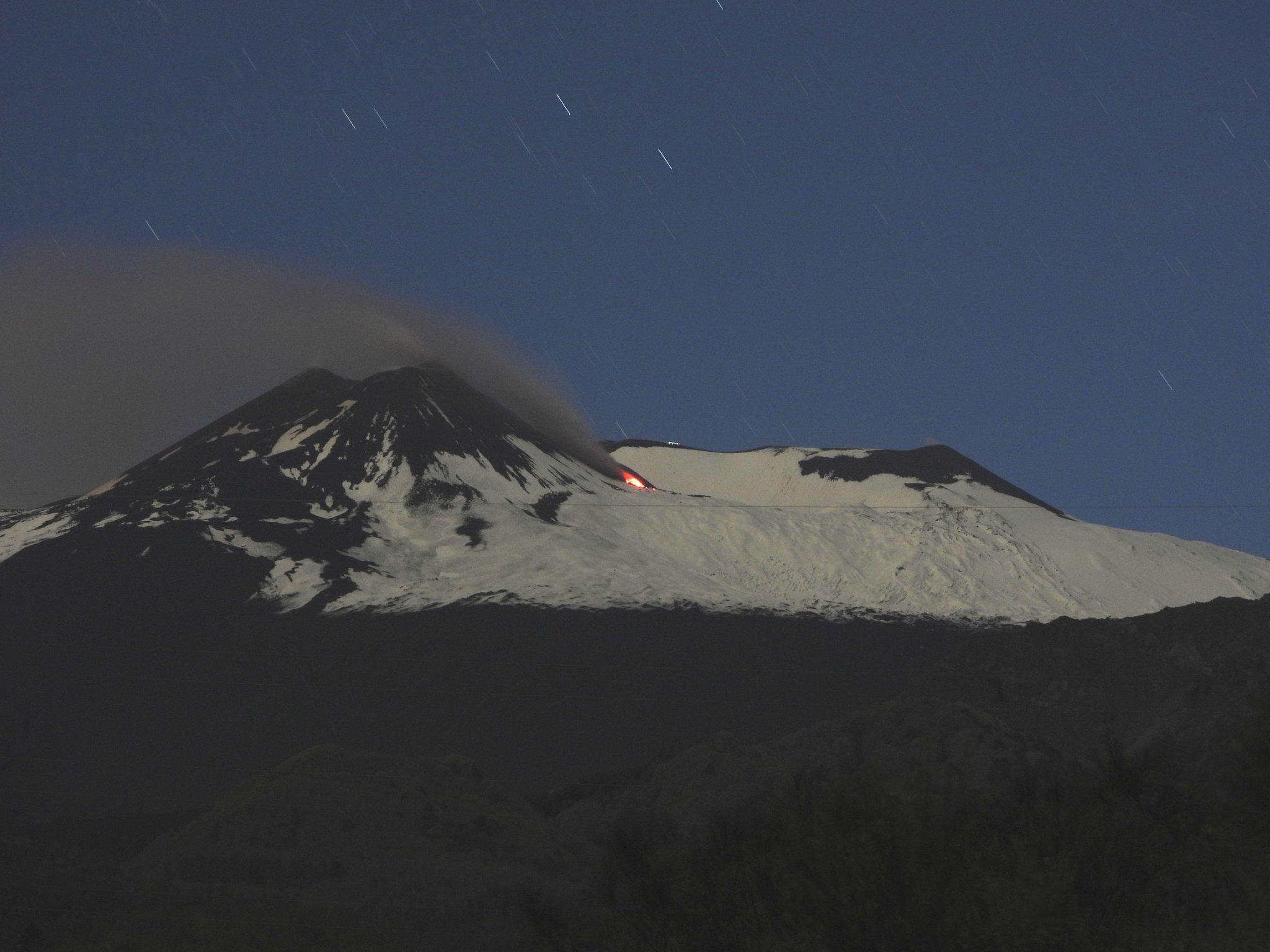
The National Institute of Geophysics and Volcanology Osservatorio Etneo announces that from 7 p.m., an ash program was observed from the southeast crater associated with the opening of one or more mouths along the side North of the south-eastern crater, which produced a small lava flow whose front has reached the northern base of the crater. The panache of ash which has been formed currently reaches a height of approximately 3500 m altitude. The model for forecasting the dispersion of the eruptive cloud indicates the southwest direction.
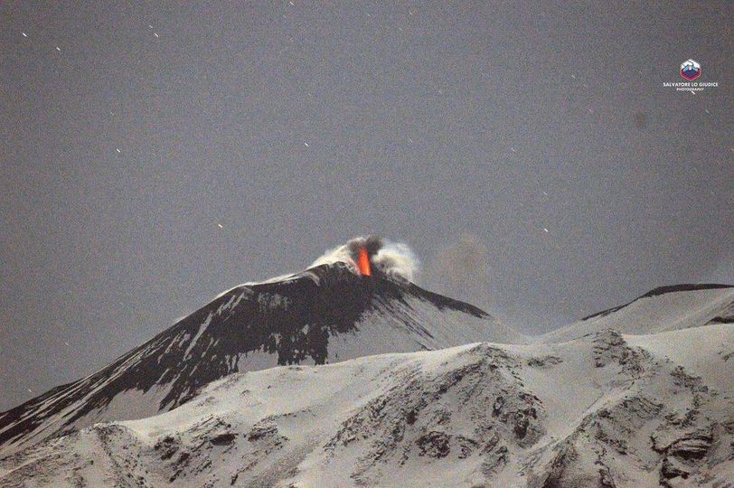
From a seismic point of view, the average amplitude of volcanic tremor, which from 10:00 pm UTC of yesterday is characterized by large fluctuations around medium-high values, at present, remains in the range of values high. The source of the Tremor is located in correspondence with the southeast crater at an altitude of approximately 3000 m above sea level.
The occurrence rate of infrasonor events is low with sources mainly located in the Bocca Nuova crater area.
Analysis of the signals of the soil deformity monitoring networks does not highlight any significant abnormality.
Other updates will be quickly communicated.
Source : INGV
Photo : Salvatore Lo Giudice. INGV.
Indonesia , Awu :
Press release on the increase in the activity of Mount Awu – Sulawesi of the North, May 12, 2022.
Mount Awu (G. AWU) is located in the coordinates of 3,6828460 North latitude, 125,455980 long-east long and at a maximum height of 1320 m above sea level. Administratively, it is located on the island of Sangihe, which is part of the Regency of the Sangihe Islands, in the province of Northern Sulawesi.
The eruption interval of Mount Awu varies from 1 to 101 years. The last eruption occurred in June 2004, in the form of a magmatic eruption producing an eruptive column 3000 m above the summit. The level of activity of Mount Awu is level I (normal) since October 31, 2016, then on December 12, 2021 at 12:00 pm Wita It was noted at level II (waspada) due to the increase in the number of volcanic earthquakes .
On May 9, 2022, there was a significant increase in the number of volcanic earthquakes, namely 88 shallow volcanic earthquakes and 147 deep volcanic earth tremors. On May 10, 2022, the number of volcanic earthquakes increased considerably, namely 90 shallow volcanic earthquakes and 203 deep volcanic earth tremors.
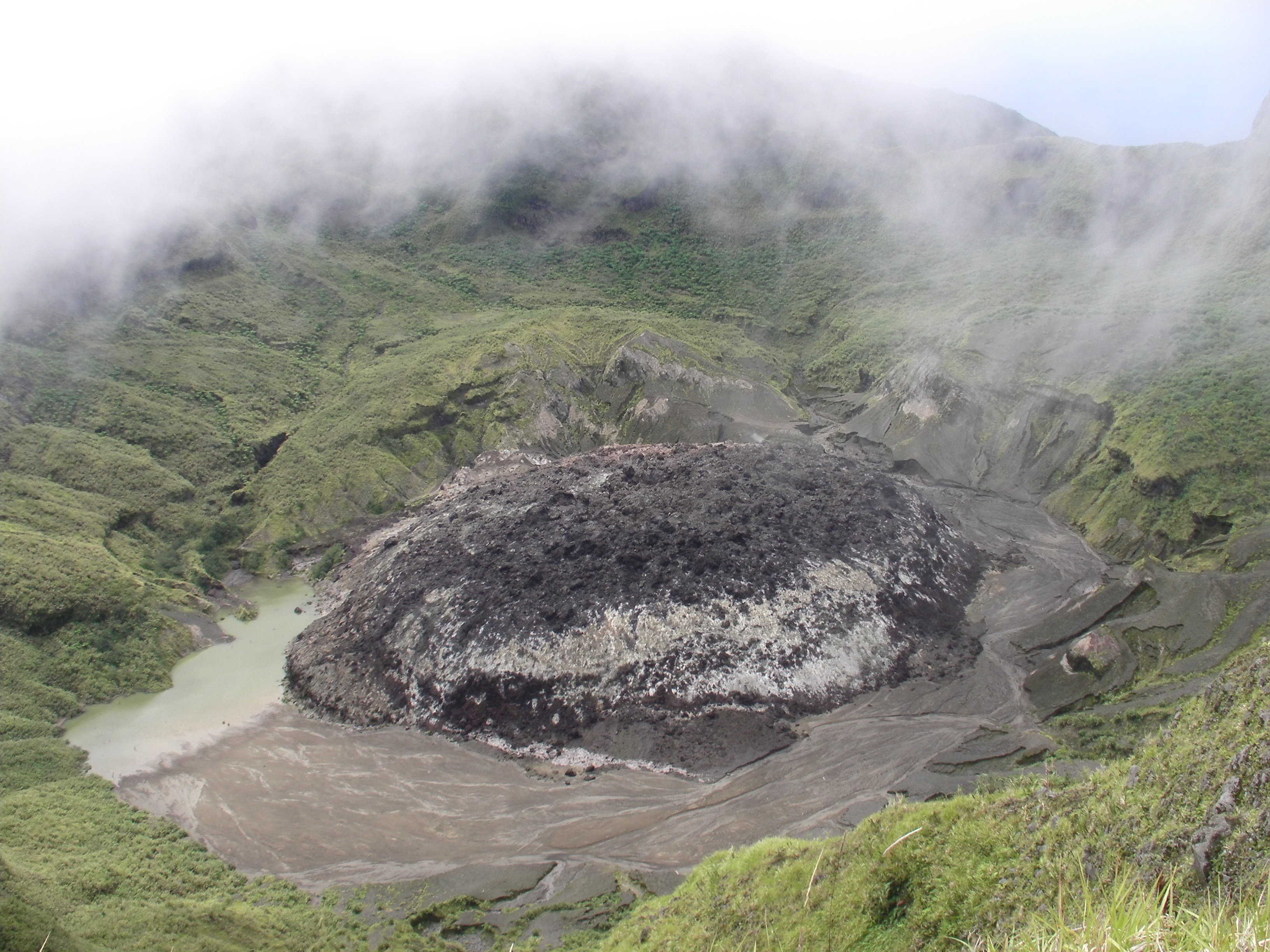
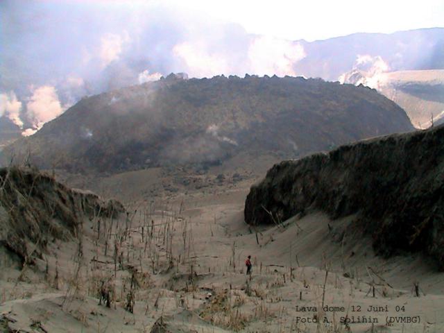
The characteristics of the eruption of Mount AWU can be explosive, efficient or magmatic / phreatic. Its last eruption in June 2004 left a lava dome in its crater which has a diameter of about 370 meters and a height of about 30 meters. The potential danger of Mount Awu which can occur is in the form of a magmatic eruption resulting in the ejection of incandescent materials and/or pyroclastic flows.
Visual observations showed a slight symptom of change in the form of the appearance of smoke from the dome and a very significant increase in the number of volcanic earthquakes, indicating that there is currently a process of rock cracking under the body of Mount Awu followed by a movement of fluids (gas, liquid, rocky solids) towards a shallower surface. The energy values of the earthquakes showed a drastic increase in the period of May 9 and 10, related to the increase in the number of volcanic earthquakes.
Considering the characteristics of the Mount Awu eruption, the potential hazards, the results of seismic monitoring, as well as the anticipation of symptoms of an increase leading to an eruption, the activity level of Mount Awu has passed from Level II (WASPADA) to Level III (SIAGA) from May 11, 2022 at 24:00 WITA.
At Level III Activity Level (SIAGA), the public and visitors/tourists should not approach and move within 3.5 km of the Mount Awu summit crater.
Source : PVMBG.
Photos : Auteur inconnu , A. Solihin, VSI, Directorate of Volcanology and Geological Hazard Mitigation (DVMBG)
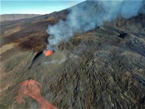
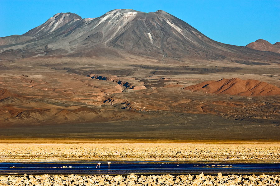
Chile , Lascar :
Seismology
The seismological activity of the period was characterized by the recording of:
7 seismic VT seismic events, associated with the fracturing of rocks (volcano-tectonics). The most energetic earthquake presented a value of local magnitude (ML) equal to 1.2, located 0.8 km south-south-east of the volcanic building, at a depth of 4.9 km in reference to crater.
8 seismic events of the LP type, associated with the dynamics of fluids within the volcanic system (long period type). The size of the largest earthquake evaluated from the reduced displacement parameter (RD) was equal to 3 cm2.
![]()
Fluid geochemistry
Sulfur dioxide emissions (SO2) emissions obtained by means of differential absorption optical spectroscopy equipment (doas), corresponding to the EMU station, located 6 km in the East-Sud-Est (ESE ) Active crater, presented an average value of 837 ± 58 t/d, with a maximum daily value of 1849 T/D on April 13, an increase in SO2 levels is recorded for the period evaluated. However, the values are in low forks for the Láscar volcano.
Three anomalies have been reported in sulfur dioxide emissions (SO2) in the atmosphere in the area close to volcanic building, according to data published by the Tropospheric Monitoring Instrument (Trophomi) and the Ozone Monitoring Instrument (OMI) Sulfur Dioxide Group (http: //so2.gsfc.nasa.gov/). The maximum mass emitted, according to information reported by Mounts (http://mounts-project.com/home) was 60 tonnes on April 23, associated with the dynamics of degassing the Láscar volcano.
Satellite thermal anomalies
15 Thermal alerts were recorded in the area associated with the volcanic building during the period, with a maximum volcanic radiative power (VRP) of 3 MW on April 23, a value considered low according to the data processed by the Infrarouge Middle Observation of volcanic activity (Mirova (http://www.mirovaweb.it/), observing a decrease compared to the previous period. At the same time, according to the analytical treatment of satellite images (Sentinel 2-l2a in combination of combination False colors strips), there were luminance anomalies on days 3, 8, 13, 18, 23 and 24, with a maximum radiation surface estimated at 3600 m2 on April 21.
Geodesy
From the data provided by 2 GNSS stations installed on the volcanic building, which make it possible to measure the deformation of the terrestrial surface, vertical movement rates of around 0.6 cm/month in the deflationary direction are estimated for One of the stations. On the other hand, a slight lengthening of the surveillance line between the two stations is recorded, produced by the movement towards the south of the station located south of the volcanic building. Consequently, slight signs deformation of the volcano which could be associated with volcanic activity.
Surveillance cameras
Thanks to the analysis of the images of the fixed cameras, periods of degassing were observed, with columns composed mainly of gas and water vapor. The maximum height of the column reached 460 m on April 5, 2022.
Regarding incandescent, an increase in incandescent episodes was recorded during the month (03, 04, 06, 07, 12 and 22). The episode that occurred on 07 with an incandescence that lasted a few hours (00:02 – 09:39 UTC) stands out.
The activity has remained at levels considered to be low, suggesting stability of the volcanic system. The volcanic technical alert is maintained at the level:
Green technical alert: active volcano with stable behavior – there is no immediate risk
Observation: It is considered a potential impact zone within a radius of 1 km around the center of the active crater.
Source : Sernageomin.
Photos : Sernageomin / Gabriel Orozco , Gerard Prins .
Alaska , Pavlof :
55°25’2″ N 161°53’37 » W,
Summit Elevation 8261 ft (2518 m)
Current Volcano Alert Level: WATCH
Current Aviation Color Code: ORANGE
Elevated surface temperatures were observed in satellite images over the last day consistent with a continued low-level eruption and effusion of short lava flows on the upper flank. Seismic tremor continues but no explosions or ash emissions were detected over the past day.
Small explosions associated with the current eruption could happen at any time and may be accompanied by small ash plumes within the immediate vicinity of the volcano. The level of unrest at Pavlof can change quickly and the progression to more significant eruptive activity can occur with little or no warning.
Pavlof is monitored by local seismic and infrasound sensors, satellite data, web cameras, and remote infrasound and lightning networks.
Source : AVO.
Photo : Musselwhite, Levi .
Colombia , Nevado del Huila :
Weekly activity bulletin of the Nevado del Huila volcano.
The activity level of the volcano continues at the yellow activity level or (III): changes in the behavior of volcanic activity.
From the analysis and evaluation of the information obtained through the monitoring network of the Nevado del Huila volcano during the week between May 3 and 9, 2022, the Colombian Geological Service – Volcanological and Seismological Observatory of Popayán reports that:
During the evaluated period, a total of 185 seismic events were recorded, of which 68 were related to rock fracturing processes (VT type) and 117 with fluid dynamics in volcanic channels. Of these, 101 were cataloged as long period type events (LP type), one (1) as hybrid (HB type) and 15 as low energy tremor pulses (TR type).
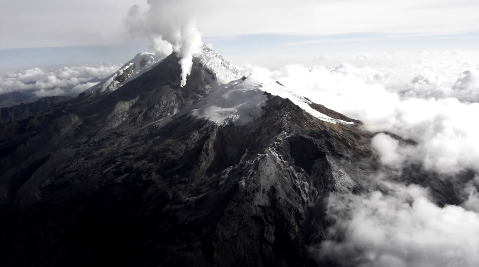
The images obtained during the week via the Tafxnú cameras, Caloto, Wonders and the Palma showed a weak degassing of the volcanic system, with a white column, preferably oriented towards the northwest.
On May 3, 2022, a mobile SO2 flow measure was carried out on the Popayán (Cauca) – Cali (Valle del Cauca) road, in which an area between Mondomo and Villa Rica (Cauca) was detected, with a value of 1522 t / day, which is considered low, for this volcano.
Surveillance sensors of the deformation of the soil, magnetic fields and infrasonore waves have not recorded variations associated with changes in volcanic activity.
Therefore, it is concluded that during the period evaluated, the volcano continued to present stable behavior. The Colombian geological service continues attentive to the evolution of the volcanic phenomenon and will inform about the changes that can occur.
Source : Ingeominas .
Photo : Parque Nacional