April 25 , 2022.
Indonesia , Anak Krakatau :
Visual observation
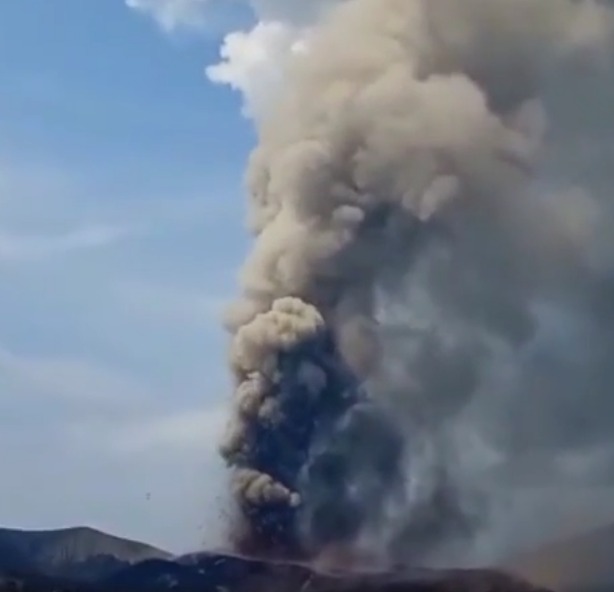
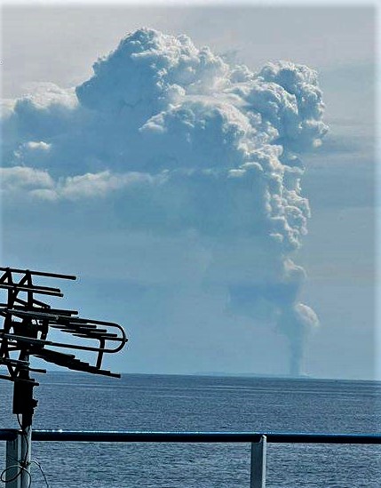
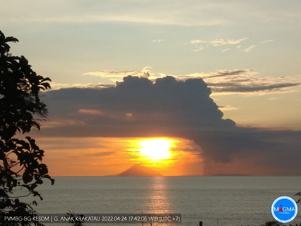
Visually, the height of smoke emissions during the period April 1-24, 2022 from Pasauran and Kalianda PGA stations and CCTV is generally clear until covered in fog. When the weather is clear, the smoke from the crater is observed with low to thick intensity, the height of the emission columns is about 25 to 3000 meters above the summit.
Instrumental observation
The seismicity of Mount Anak Krakatau from April 1 to 24, 2022 was marked by the recording of 21 eruptive earthquakes, 155 emission earthquakes, 14 harmonic tremors, 121 low frequency earthquakes, 17 earthquakes shallow volcanics, 38 deep volcanic earthquakes and continuous tremors with an amplitude of 0.5 to 55 mm (mainly 50 mm). The energy of volcanic activity as reflected in the RSAM value (real-time seismic amplitude measurement) shows a fluctuating pattern with a tendency to increase sharply since April 15, 2022.
Measurement of the deformation using a tilt-meter installed at the Tanjung station shows fluctuations in the X (tangential) and Y (radial) components. Inflation on Anak Krakatau has been observed since April 18, 2022 and has been slightly more intense since April 22, 2022.
Evaluation
Volcanic activity at Mount Anak Krakatau is currently still in a continuous eruptive period with changes in eruption shifting from predominantly ash to Strombolian type producing incandescent lava on April 17, 2022. And on April 23, 2022 at around 12:19 p.m. WIB, lava was observed flowing and entering the sea. It is observed that the current results of the seismic energy estimation increase sharply with the increasing amplitude of the continuous tremors and the increasing intensity of the d events. continuous eruption. This increase was also followed by the results of deformation measurements which showed fluctuations in inflation patterns.
SO2 emissions data based on Sentinel-5 (Tropomi) satellite monitoring show that SO2 emissions began to be observed at
– April 14 with SO2 of 28.4 tonnes/day,
– April 15 68.4 tons/day
– On April 17 increased by 181.1 tonnes/day and
– April 23 made a spectacular jump with 9219 tons/day.
A significant increase in SO2 indicates a new supply of magma and igneous material which rises to the surface in the form of ejection of incandescent material followed by lava flows. The amount of SO2 during the above period reached 9.2 kilotons.
Based on visual and instrumental monitoring data as well as SO2 emission monitoring, the activity of Mount Anak Krakatau has an increasing trend and did not show a decrease in volcanic activity.
Conclusion:
The results of visual and instrumental monitoring show an increasingly significant increase in activity. The activity level of Mount Anak Kraktau changed from WASPADA (Level II) to SIAGA (Level III) from April 24, 2022 at 6:00 p.m. WIB.
VOLCANO OBSERVATION NOTICE FOR AVIATION – VONA
Issued: April 24, 2022
Volcano: Anak Krakatau (262000)
Current Aviation Color Code: ORANGE
Previous Aviation Color Code: orange
Source: Anak Krakatau Volcano Observatory
Notification number: 2022KRA42
Volcano location: S 06 deg 06 min 07 sec E 105 deg 25 min 23 sec
Region: Lampung, Indonesia
Summit elevation: 502 FT (157 M).
Volcanic Activity Summary:
Eruption with cloud of volcanic ash at 05:00 UTC (12:00 local). The eruption and ash emission continue.
Height of volcanic clouds:
Best estimate of ash cloud top is about 10102 FT (3157 M) above sea level, may be higher than can be observed clearly. Source of height data: ground observer.
Other Volcanic Cloud Information:
Visuals directly from CCTV observed eruptions with thick white-gray-black eruption smoke at 3000m above the summit of the volcano, the wind direction is to South-South-West.
Remarks :
The seismic activity is characterized by a continuous volcanic tremor recorded on a seismogram with a maximum amplitude of 55 mm.
Sources : Magma Indonésie , PVMBG
Photos : krakatautours , Abdul Rahman , PVMBG.
Ecuador , Wolf / Sangay :
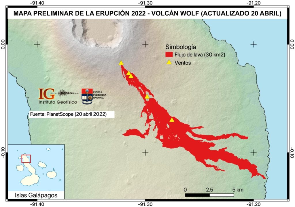
DAILY REPORT OF THE STATE OF WOLF VOLCANO, Sunday April 24, 2022.
Information Geophysical Institute – EPN.
Surface Activity Level: Low, Surface Trend: No change.
Internal activity level: Low, Internal trend: No change.
Seismicity: From April 23, 2022, 11:00 a.m. to April 24, 2022, 11:00 a.m.:
Long Periods (LP) 1
Emission / ash column:
No alerts were generated for the emissions observed by satellites by the Washington VAAC.
Other Monitoring Parameters:
FIRMS and MIROVA systems do not record thermal alerts on Wolf Volcano in the past 24 hours.
Observation:
No news in satellite images.
Alert level: Without alert.
———————————————————————————————————————————————
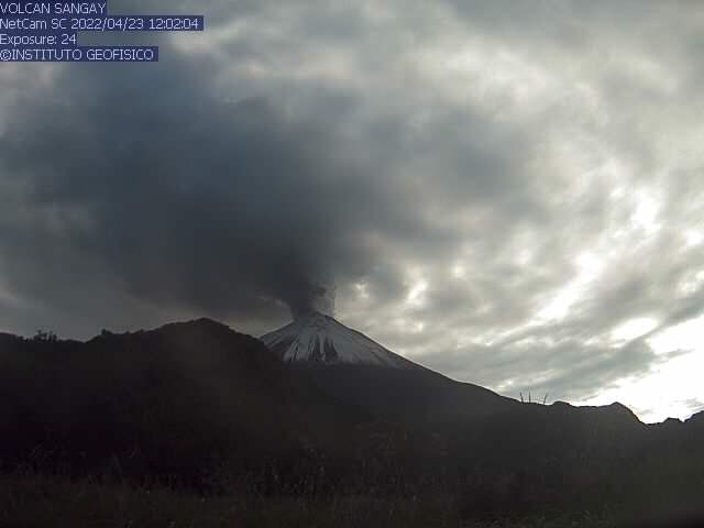
DAILY REPORT OF THE STATE OF SANGAY VOLCANO. Sunday April 24, 2022.
Surface Activity Level: High, Surface Trend: No change.
Internal activity level: High, Internal trend: Ascending.
Seismicity: From April 23, 2022, 11:00 a.m. to April 24, 2022, 11:00 a.m.:
Long Periods (LP): 609
Explosions ( EXP): 13
Emission tremor (TREMI: 6
Rains / Lahars:
Rains were recorded in the volcano area which generated a small mudslide yesterday afternoon. **In case of intense rains in the upper part of the volcano, lahars may occur towards the Volcán and Sangay Norte rivers**
Emission / ash column:
In the morning, an emission of gas and ash was observed which reached 700 meters in height towards the north. The Washington VAAC reported 3 emissions, two emissions from a height of 2070 meters above crater level heading west and one emission from 870 meters above crater level also heading east. West.
Other Monitoring Parameters:
There were 2 moderate alerts on the MIROVA system (46 and 728 MW)
Observation :
In the morning, the area was partially cleared and gas emission to the north was observed. At this hour the sector is troubled and without news.
Alert level: Orange.
Source : IGEPN.
Photos : IGEPN
Philippines , Taal :
TAAL VOLCANO BULLETIN 25 April 2022 8:00 AM
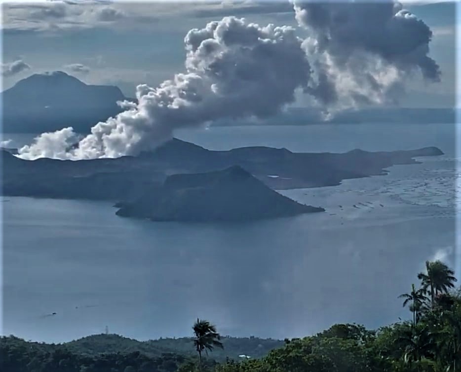
In the past 24-hour period, the Taal Volcano Network recorded one (1) volcanic tremor event having a duration of nine (9) minutes. Activity at the Main Crater was dominated by the generation of plumes 900 meters tall that drifted southwest and west-southwest. Sulfur dioxide (SO2) emission averaged 6,391 tonnes/day on 22 April 2022. Temperature highs of 63.7°C were last measured from the Main Crater Lake on 25 February 2022. Based on ground deformation parameters from electronic tilt, continuous GPS, and InSAR monitoring, Taal Volcano Island and the Taal region has begun deflating in October 2021.
Alert Level 2 (Decreased Unrest) prevails over Taal Volcano. DOST-PHIVOLCS reminds the public that at Alert Level 2, sudden steam-driven or phreatic explosions, volcanic earthquakes, ashfall, and lethal accumulations or bursts of volcanic gas can occur and threaten areas within TVI and along its coast. Entry into TVI, Taal’s Permanent Danger Zone, must therefore be strictly prohibited. Local government units are advised to continually strengthen preparedness, contingency, and communication measures, especially for previously evacuated high-risk barangays in case of renewed unrest. Civil aviation authorities must advise pilots to avoid flying close to the volcano as airborne ash and ballistic fragments from sudden explosions and wind-remobilized ash may pose hazards to aircraft. DOST-PHIVOLCS is closely monitoring Taal Volcano’s activity and any new significant development will be immediately communicated to all stakeholders.
Source : Phivolcs
Photo : Kyle Aranza ( Archive) .
Hawaii , Kilauea :
19°25’16 » N 155°17’13 » W,
Summit Elevation 4091 ft (1247 m)
Current Volcano Alert Level: WATCH
Current Aviation Color Code: ORANGE
Activity Summary:
The summit eruption of Kīlauea Volcano, within Halemaʻumaʻu crater, continued over the past 24 hours. All recent activity has been confined to the crater and current data indicate that this scenario is likely to continue. No significant changes have been noted in the summit or East Rift Zone.
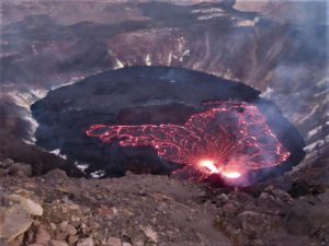
Halemaʻumaʻu crater Lava Lake Observations:
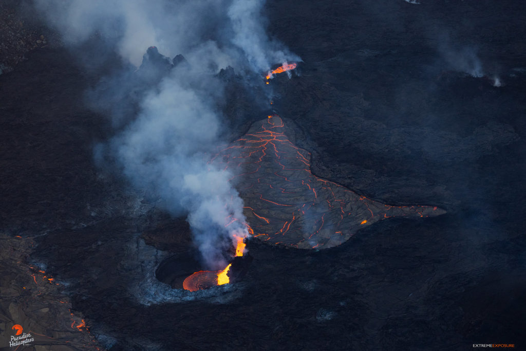
Eruption of lava from the western vent into the active lava lake and onto the crater floor continued over the past 24 hours. The active part of the lava lake showed continuous surface activity. The lake height was high through most of the day, with occasional overflows onto the crater floor. Sporadic breakouts continue along the margins of the crater, particularly to the northeast during the past 24 hours. Since the beginning of this eruption on September 29, 2021, the crater floor has seen a total rise of about 99 meters (325 feet). The volume of lava effused since the beginning of this eruption was approximately 66 million cubic meters (18 billion gallons) as measured on April 6, 2022.
Summit Observations:
Summit tiltmeters have been steady over the past day. Volcanic tremor remains above background levels. A sulfur dioxide (SO2) emission rate of approximately 1,550 tonnes per day (t/d) was measured on April 21, 2022.
Source : HVO.
Photo : Bruce Omori / Paradise Helicopters.
Guatemala , Fuego :
Activity :
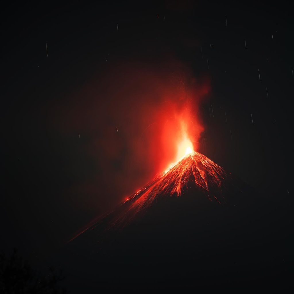
The Fuego Volcano Observatory reports weak fumaroles of light gray color at a height of 4,300 to 4,500 meters above sea level (14,107 to 14,764 feet). 2 to 6 weak and a few moderate explosions per hour are reported, these explosions generate a column with abundant ash of 4,600 to 4,800 masl (15,091 to 15,748 feet) which disperses in a southeast direction due to the wind variable.
The explosive activity generates low rumblings with weak shock waves that vibrate the roofs and windows of houses around the volcano. As a result of the explosive activity, weak and moderate avalanches are generated in the direction of the ravines of Santa Teresa, Ceniza and Trinidad, as well as incandescent pulses 100 meters above the crater. Fine ash falls are reported in communities located to the south, such as Rochela, Ceilán, San Andrés Osuna, El Zapote.
Source : Insivumeh.
Photo : Diego rizzo .

