December 20, 2021.
Spain / La Palma , Cumbre Vieja :
December 19, 2021, 09:00 UTC. Volcanic monitoring continues on La Palma.
Since the last declaration, a total of 10 earthquakes have been located on the island of La Palma, none of them have been felt by the population.
The magnitudes vary between 1.6 and 3.2 (mbLg).
The localization of hypocenters continues under the central area of Cumbre Vieja in the same areas as the previous days. 3 shallow earthquakes were located, 3 earthquakes at depths between 11 and 15 km and 4 earthquakes at depths greater than 30 km.
Likewise, low frequency (LP) events continue to be detected in the recordings of the island’s stations in addition to localized volcano-tectonic earthquakes.
During the past 24 hours, no volcanic tremor has been observed, maintaining the seismic noise at levels close to the pre-eruptive period.
Like the day before, the island’s network of permanent GNSS stations does not show any significant deformations that could be associated with volcanic activity.
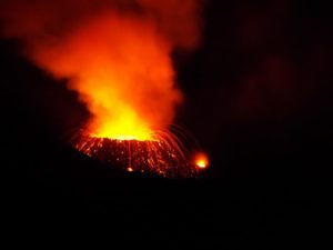
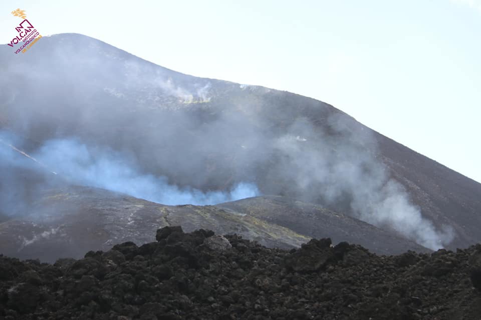
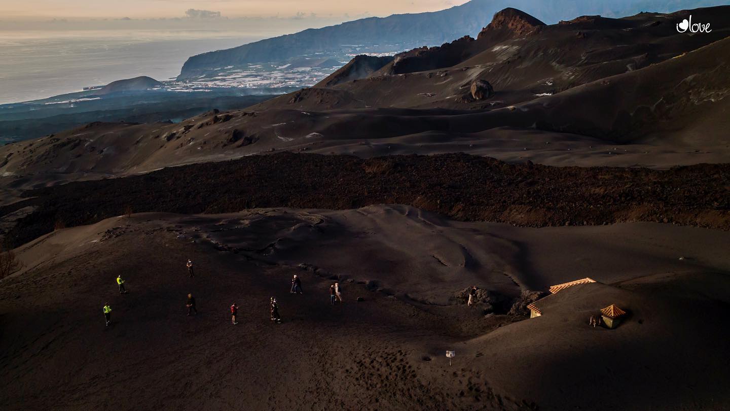
In view of the image calibrated at 08:49 UTC, no type of emission is visible.
The height of the cone is measured by obtaining a value of 1122 m at sea level.
The observations corroborate the signs of exhaustion of the eruptive process, although a further increase in strombolian activity and casting emission cannot be excluded. It has been pointed out that the visible emission of volcanic gases is punctual and sporadic, focusing on eruptive centers and fractures of volcanic tubes. In some fractures and in the region of Las Hoyas, an incandescence is still visible which is linked to the presence of lava in the cooling process.
The tremor signal remains in the category of « background noise » and the seismicity has fallen to « very low levels » at all depths, although at this point the spokesperson for the scientific committee has again put in guard against the possible occurrence of earthquakes felt by the population. Sulfur dioxide emissions in the volcanic plume remain in a low range, between 0.5 and 4.9 kilograms per second, which is the new measurement used by scientists since Saturday due to « the weakness and the intermittence ”of it. Regarding the air quality, the levels are good or reasonably good at all the stations on the island, both by the concentration of SO2 and of microparticles, and there were no exceedances of the levels. daily limit values.
Miguel Ángel Morcuende, warned this evening in an interview with Canary Islands radio television that there are still areas of Los Llanos de Aridane in which noxious gases accumulate, and warned that this Sunday that he prevented the passage to these areas to neighbors and irrigators. “There are some neighborhoods that are affected, especially the southern area, where there is a serious problem of noxious gases accumulating in low-lying areas such as parking lots and warehouses, etc. You have to be very careful with this ”
Sources : IGNes , El Pais .
Photos : Involcan , I love the world.
Hawaii , Kilauea :
19°25’16 » N 155°17’13 » W,
Summit Elevation 4091 ft (1247 m)
Current Volcano Alert Level: WATCH
Current Aviation Color Code: ORANGE
Activity Summary:
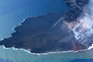
Kīlauea volcano is erupting from a single vent in the western wall of Halemaʻumaʻu crater. The vent is supplying lava to a lava lake in the western portion of the crater. All recent lava activity remains confined within Halemaʻumaʻu crater in Hawai‘i Volcanoes National Park.
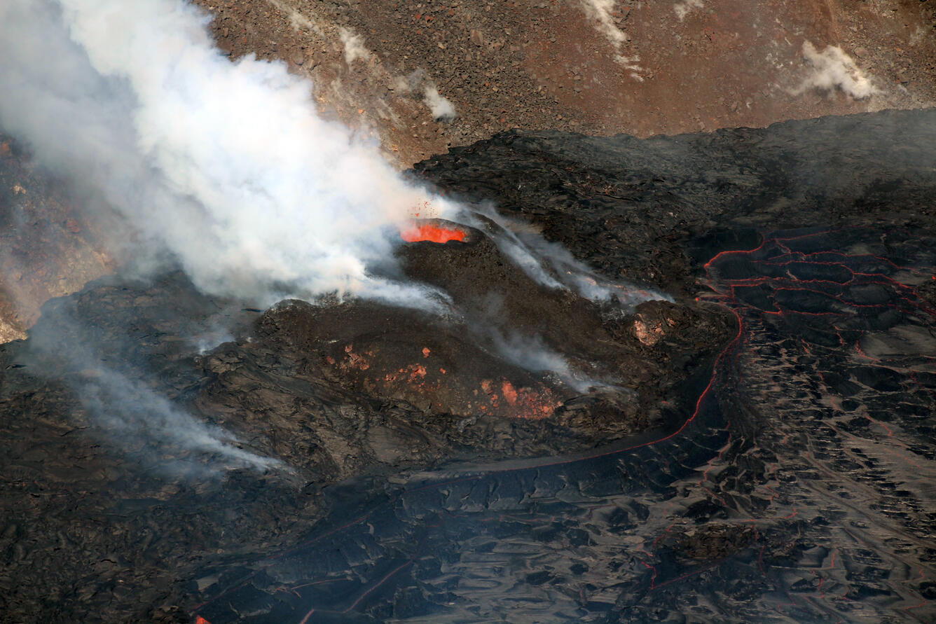
In this photo, spatter is seen above a perched pond at the top of the cone. The volcanic plume originating at the cone is mostly white in color with a blue tinge, indicative of water vapor and sulfur dioxide, respectively.
Summit Observations:
Tilt was inflationary yesterday morning, December 17, 2021, and became deflationary midday. Tilt flattened overnight and remains flat this morning. Earthquake activity remains below background. The most recent measurement of sulfur dioxide (SO2) emission rate on December 16, 2021, was approximately 1,400 tonnes per day.
Halemaʻumaʻu Lava Lake Observations:
Lava is erupting from the same western vent, refilling the former lake area with fresh lava this morning. The lake has seen a total increase of about 69 meters (226 ft) since lava emerged on September 29. The total erupted volume since the beginning of the eruption was estimated to be about 30 million cubic meters (7.8 billion gallons) on November 16.
Source : HVO.
Photo : USGS/ N. Deligne.
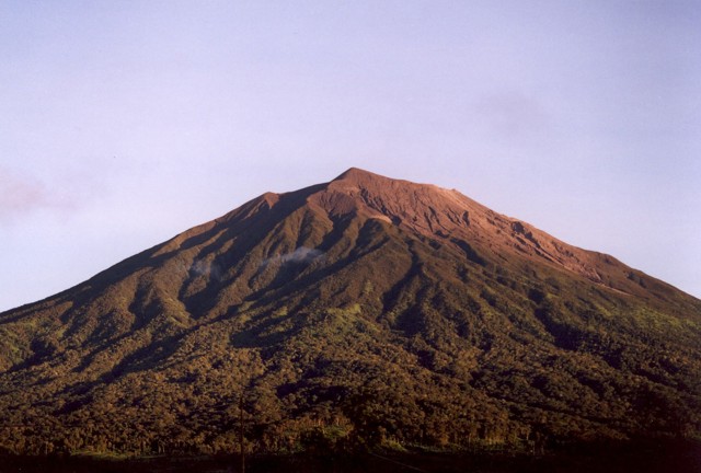
Indonesia , Kerinci :
VOLCANO OBSERVATORY NOTICE FOR AVIATION – VONA.
Issued : Décember 20 , 2021
Volcano : Kerinci (261170)
Current Aviation Colour Code : YELLOW
Previous Aviation Colour Code : yellow
Source : Kerinci Volcano Observatory
Notice Number : 2021KER07
Volcano Location : S 01 deg 41 min 49 sec E 101 deg 15 min 50 sec
Area : Jambi, West Sumatra, Indonesia
Summit Elevation : 12176 FT (3805 M)
Volcanic Activity Summary :
Gas emission detected at 00h10 UTC (07h10 local).
Volcanic Cloud Height :
Best estimate of ash-cloud top is around 14416 FT (4505 M) above sea level, may be higher than what can be observed clearly. Source of height data: ground observer.
Other Volcanic Cloud Information :
No ash detected.
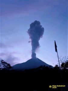
The volcano was clear before it was covered in fog. The smoke from the crater is weak to medium, white in color, 50-100 meters above sea level above the summit.
Seismicity is linked to magma movements and tectonic activity
– 53 earthquakes of emissions
Sources : Magma Indonésie , PVMBG.
Photo : Umar Rosadi, 2005 (Centre of Volcanology & Geological Hazard Mitigation, Volcanological Survey of Indonesia).
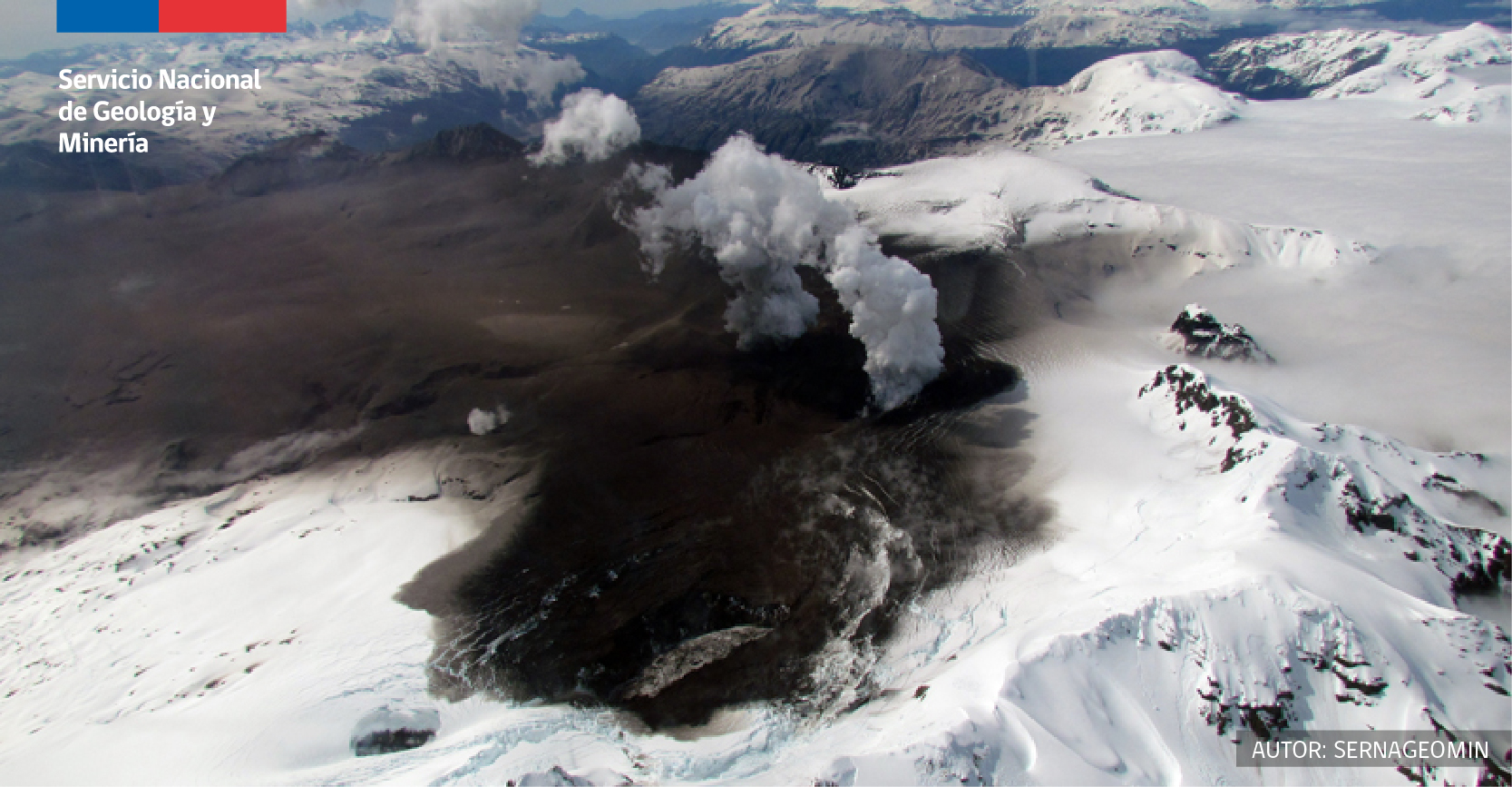
Chile , Hudson :
Special Report on Volcanic Activity (REAV), De Aysén Del General Carlos Ibanez Del Campo region, Hudson volcano, December 12, 2021, 5:45 p.m. local time (Continental Chile).
The National Service of Geology and Mines of Chile (Sernageomin) publishes the following PRELIMINARY information, obtained thanks to the monitoring equipment of the National Volcanic Monitoring Network (RNVV), processed and analyzed at the Volcanological Observatory of the Southern Andes ( Ovdas):
On Saturday, December 12, 2021, at 04:00 local time (07:00 UTC), the monitoring stations installed near the Hudson volcano recorded an earthquake associated with both rock fracturing and fluid dynamics (hybrid type) in the volcanic system.
The characteristics of earthquakes after their analysis are as follows:
ORIGINAL TIME: 04:00 local time (07:00 UTC)
LATITUDE: 45.967 ° S
LONGITUDE: 72.987 ° W
DEPTH: 3.8 km
LOCAL MAGNITUDE: 2.2 (Ml)
REDUCED DISPLACEMENT: 505 cm2
OBSERVATIONS:
No superficial activity was observed following the occurrence of this event.
The volcanic technical alert remains at Green level.
Source et photo : Sernageomin.
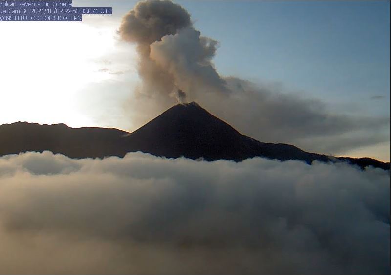
Ecuador , Reventador / Sangay :
DAILY REPORT OF THE STATE OF THE REVENTADOR VOLCANO, Sunday December 19, 2021.
Information Geophysical Institute – EPN.
Surface activity level: High, Surface trend: No change.
Internal activity level: Moderate, Internal trend: No change.
Seismicity: From December 18, 2021, 11:00 a.m. to December 19, 2021, 11:00 a.m.
The seismic statistics correspond to 14 hours of intermittent data transmissions.
Explosion (EXP) 36
Long periods (LP) 32
Emission Tremors (TREMI) 3.
Rains / Lahars:
Light rains were recorded, without causing lahars.
Emission / ash column:
Gas emissions were observed at a height of about 800 m at summit level in a northwest and west direction. 2 VAAC alerts were recorded in a westerly direction with a height of 988 m above the crater level
Other monitoring parameters:
No thermal anomalies have been reported in the past 24 hours.
Observation:
From this morning until now, the area is totally cloudy; An incandescence was observed in the crater last night. The lava flow on the northeast flank continues to be active.
Alert level: Orange.
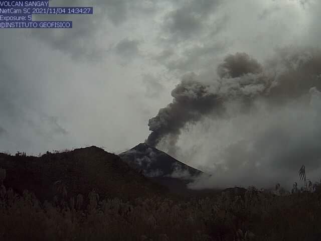
DAILY REPORT ON THE STATE OF SANGAY VOLCANO. December 19, 2021.
Surface activity level: High, Surface trend: No changes.
Internal activity level: High, Internal trend: No changes.
Seismicity: From December 18, 2021, 11:00 a.m. to December 19, 2021, 11:00 a.m .:
Long Periods (LP) type events 32
Explosions (EXP) 80
Tremors of emissions (TREMI) 4
Lahars: 1
Rains / Lahars:
Rains have been recorded in the area and signals associated with the generation of mudslides that descend through the volcano’s drainages where volcanic material continues to accumulate. No issues with these feeds have been reported. ** In the event of heavy rains, they could re-mobilize the material accumulated in the gullies, generating mudslides and debris that would descend through the drains of the volcano and flow into adjacent rivers. **
Emission / ash column:
The area remained cloudy most of the time, however the Washington VAAC reported 3 emissions of 870 meters to the west.
Other monitoring parameters:
MIROVA records 1 low thermal anomaly in the last 24 hours.
Observation:
From this morning until now, the area remains cloudy.
Alert level: yellow.
Source : IG-EPN.
Photos : Archives igepn.