November 21 , 2021
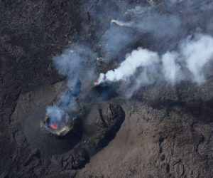
Italy / Sicily , Etna :
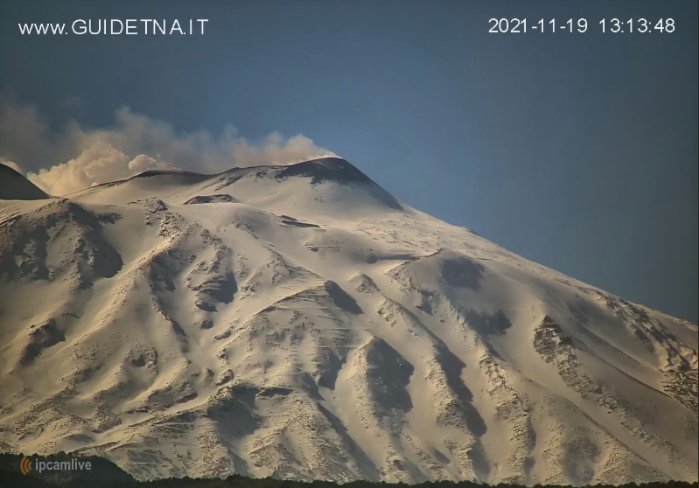
20 November 2021. 12:23 (11:23 UTC). COMMUNICATION ON ETNA’S ACTIVITY.
The National Institute of Geophysics and Volcanology, Osservatorio Etneo announces that from 10:16 UTC, sporadic explosions are observed at the level of the Northeast Crater with emissions of diluted ash which immediately disperse in the summit area. The phenomenon is still ongoing. There are no significant variations in the mean amplitude of the volcanic tremor which shows medium and medium-low values.
The source is located in the area of the craters of Bocca Nuova and Voragine at an altitude of about 2800 m above sea level. GNSS and inclinometric monitoring networks for soil deformation do not show significant variations.
Further updates will be communicated shortly.
Source : INGV.
Photo : Guide Alpine Vulcanologiche Etna
Spain / La Palma , Cumbre Vieja :
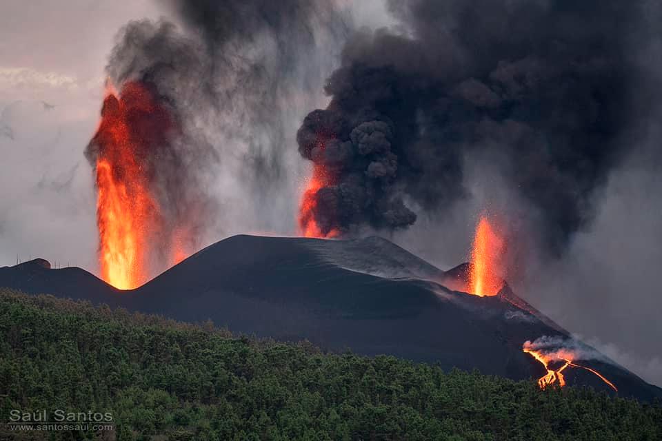
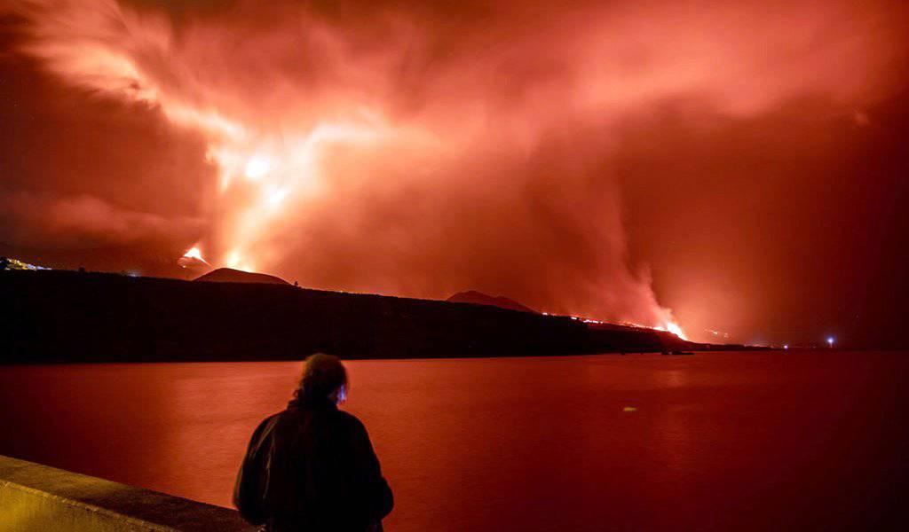
November 20, 2021 09:00 UTC. Eruptive activity continues on La Palma.
Since the last declaration, 69 earthquakes have been located in the southern part of the island of La Palma, near the ongoing volcanic eruption. Four of these earthquakes were felt by the population.
The number of earthquakes has increased compared to the previous day and they are distributed in both intermediate (10-15km) and deep (30-40km) depths.
At 03:07 UTC, an earthquake with a magnitude of 4.6 mbLg was recorded at a depth of 37 km and felt by the population with a maximum intensity of IV (EMS).
The tremor signal continues at a low level with slight fluctuations over the last few hours.
The island’s network of permanent GNSS stations shows an elevation of about 6 cm between November 17 and 19, as well as a deformation to the southwest at station LP03, which is closest to the eruptive centers.
In the rest of the stations, the slight deflation possibly linked to the deep seismicity has stabilized.
In view of the image calibrated at 08:45 UTC, a column height of 3200 m is estimated, and an ash cloud diffuses in the east direction.
La Palma airport was inoperative this Saturday morning due to the build-up of ash from the volcano, AENA reported, while the rest of the airports in the Canary Islands remain open.
The airline Binter has already announced the temporary cancellation of its connections with La Palma at least until one flight in the afternoon inclusive, while continuing to assess the situation.
This closure of the airport coincides with a deterioration in air quality in the southern zone of Las Manchas, which has resulted in the closure of access via the Fuencaliente road, Cabildo de La Palma reported. Access to the coast, where the air quality is good, will be by navy boats.
The Pevolca panel of experts increased the volcano’s explosive index from 2 to 3 due to the large volume of pyroclasts emitted since the start of the eruption, which has exceeded 10 million cubic meters. The Canary Islands Volcanological Institute shared on its official Twitter account that, in recent days, « the large volume of fallen ash clearly indicated the passage at this level ». Experts note that this change « does not indicate that the rash will worsen or change his behavior. »
Seismicity continues at the intermediate level. The most intense earthquake in recent hours reached a magnitude of 4.6 and was located 37 kilometers deep.
The tremor remains at a low level.
Sulfur dioxide emissions are lower than in previous days and range between 10,000 and 17,000 tonnes per day.
Sources : IGN es , El Pais .
Photos : Saul Santos , Patrice Zwenger .
Italy , Vulcano :
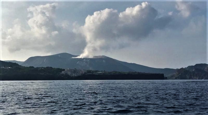
Alert on Vulcano, Civil Protection has requested an increase in the operational phase level from the current « attention » (yellow) to « early warning » (orange) level.
On the Aeolian Island, there is the « yellow » alert level, declared by the National Civil Protection Department. The mayor of Lipari, Marco Giorgianni, announced an ordinance prohibiting citizens from spending the night and staying in the port area of the island of Vulcano and adjacent areas, due to the levels of gas produced.
The President of the Sicilian region, Nello Musumeci, follows closely and is constantly informed by the Regional Civil Protection of the situation, which has been evolving for a few hours and which seems completely unprecedented, requiring the search for alternative accommodation for around 250 people. .
“The new increase in toxic gas emissions recorded in recent days by the National Institute of Geophysics and Volcanology – declares President Musumeci – indeed requires the adoption of urgent precautionary measures to protect public safety and private, including the monitoring of phenomena and gases, the prohibition of risk areas and the possible evacuation of the population from their homes. Our government is close to the community and is committed to working with the mayor and all national structures in managing the emergency ”.
The highest national and regional institutions, the Ingv, the Arpa guarantee the monitoring of the situation which is confirmed in a strong evolution.
The Regional Department of Civil Protection, headed by Salvo Cocina, has requested that the level of the operational phase be raised from the current phase of « attention » (yellow) to « early warning » (orange) with the reinforcement deadly gas monitoring.
Source et photo : Sicilialive.
Iceland , Reykjanes Peninsula :
Strong swarm of earthquakes under Reykjanes Peninsula
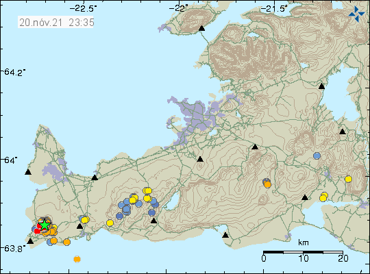
Yesterday (20-Nov-2021) a large swarm of earthquakes started under the Reykjanes volcano. This swarm of earthquakes is quite large, with 217 earthquakes recorded to date. The largest earthquake had a magnitude of Mw3.5 but other earthquakes were smaller in magnitude.
Earthquake swarm at the edge of the Reykjanes Peninsula illustrated by a cluster of orange dots and a green star that shows seismic activity.
The copyright of this image is owned by Icelandic Met Office.
This seismic activity suggests that magmatic pressures in the region are increasing rapidly since the eruption of Fagradalsfjall Mountain stopped three months ago. Inflation that has been measured so far is around or above 2cm at the time of writing. As the seismic activity increases, it is clear that over the next few weeks or months, the seismic activity will increase on the Reykjanes Peninsula until the next eruption. The biggest earthquakes are felt in neighboring towns.
Source : Icelandgeology.net / JÓN FRÍMANN
Photo : Icelandic Met Office.
Colombia , Nevado del Ruiz :
Manizales, November 18, 2021 (7:40 p.m. local time).
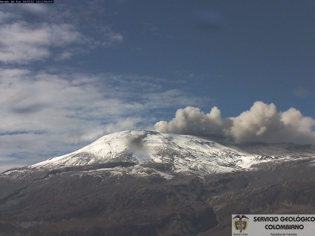
Subject: Activity of the Nevado del Ruiz volcano. The yellow level of activity is maintained at level (III): changes in the behavior of volcanic activity.
Regarding the monitoring of the activity of the Nevado del Ruiz volcano, the MINISTRY OF MINES AND ENERGY through the COLOMBIAN GEOLOGICAL SERVICE, informs that:
Due to the changes in the activity of the Nevado del Ruiz volcano and its unstable behavior, on October 14, 2021, a Unified Command Post (PMU) was organized, during which not only the activity of the Nevado del Ruiz volcano was discussed but also prevention and mitigation actions to reduce vulnerability and reduce the threat of a possible increase in volcanic activity.
During this time the Nevado del Ruiz volcano continued to show unstable behavior. The seismic activity continued to be intense, mainly related to the movement of fluids inside the volcanic conduits. This seismicity was characterized by the appearance of continuous volcanic tremors of low to moderate energy level, tremor pulses, long and very long period earthquakes with variable energy levels located in the Arenas crater. In addition, there was a slight increase in seismicity generated by fracturing of rocks, generally of low to moderate energy, located in the Arenas crater at depths less than 2 km, and in sources proximal and distal of the crater. , at depths between 2 and 5 km, and between 4 and 7 km, respectively.
The deformation of the volcanic surface, measured from GNSS (Global Navigation Satellite System) stations and electronic inclinometers, continues to show minor changes.
In recent weeks, the MOUNTS, NASA FIRMS and Mirova portals have reported low-energy thermal anomalies over the volcano.
Compared to the surface activity, the volcano continues to present permanently small ash emissions, which dispersed according to the direction of the wind, which showed a very variable trend. In recent weeks, reports of volcanic ash fall have been received in the municipalities of Líbano, Herveo, Casabianca and Villahermosa (department of Tolima), Arménia and Filandia (department of Quindío), Pereira and Santa Rosa de Cabal (department of Risaralda) ) and Manizales, Villamaría and Chinchiná (Caldas department).
Source : Ingeominas.
Photo : Archive SGC
Ecuador , Reventador :
DAILY REPORT OF THE STATE OF THE REVENTADOR VOLCANO, Saturday 20 November 2021.
Information Geophysical Institute – EPN.
Surface activity level: High, Surface trend: No change.
Internal activity level: Moderate, Internal trend: No change.
Seismicity: From November 19, 2021, 11:00 a.m. to November 20, 2021, 11:00 a.m.
The reference station exhibited data transmission problems, which is why the seismic statistics are not complete.
Explosion (EXP) 30
Long Periods (LP) 30
Emission tremor (TREMI) 7
Harmonic Tremor (TRARM) 1.
Rains / Lahars:
Rains were recorded which did not generate lahars.
Emission column / ash:
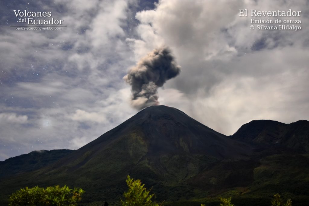
Gas and ash emissions were observed up to 1000 meters above crater level in a northwest direction. The VAAC reported 4 emission alerts observed by satellites at altitudes up to 988 meters above crater level dispersing in a west, southwest and southeast direction.
Other monitoring parameters:
The FIRMS satellite system records 1 thermal alert in the last 24 hours.
Observation:
At night, an incandescence was observed in the upper part, in addition to the rolling of incandescent blocks up to 500 meters below the level of the crater on all sides of the volcano. At the moment the volcano sector is cloudy
Alert level: Orange.
Source : IG-EPN.
Photo : Silvana Hidalgo /volcanes del ecuador .

