July 28 , 2021.
Italy , Stromboli :
Weekly Bulletin, from July 19, 2021 to July 25, 2021 (issue date July 27, 2021)
SUMMARY STATEMENT OF ACTIVITY:
In view of the monitoring data, it is highlighted:
1) VOLCANOLOGICAL OBSERVATIONS: Strombolian explosive activity of ordinary type with total hourly frequency of explosions between medium-low and medium values (2-9 events / h) and intensity of explosions between low and medium in the North zone and low in the North zone Center – South.
2) SEISMOLOGY: The seismological parameters monitored do not show significant variations.
3) DEFORMATIONS: The island’s soil deformation monitoring networks did not show any significant changes during the period under review.
4) GEOCHEMISTRY: SO2 flux at a medium-low level
The average weekly C / S value is 11.0 and is at medium-high values.
The isotopic ratio of Helium dissolved in the thermal aquifer compared to the last sample of 07/05/2021 is at high values.
5) SATELLITE OBSERVATIONS: The thermal activity in the summit area is low to moderate.
VOLCANOLOGICAL OBSERVATIONS
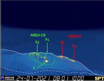
During the observation period, the eruptive activity of Stromboli was characterized by the analysis of the images recorded by the surveillance cameras of the INGV-OE located at 190, Punta Corvi, 400 and at Pizzo and by inspections carried out July 23 and 25. The explosive activity was mainly produced by 3 (three) eruptive chimneys located in the North crater area and 5 (five) eruptive chimneys located in the Center-South crater area. All the vents are located inside the depression which occupies the terrace of the crater.
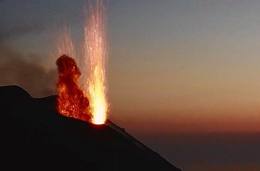
In detail, the area of the North crater (N) with the two sub-areas of the crater N1 and N2, produced explosions with an average frequency between 1 and 6 explosions / hour and an intensity that varied from low to high up to ‘at a height of ~ 130 m, with products of the explosive activity of coarse materials (lapilli and bombs) with radial fallout. In the Center-South zone, explosive activity was observed with an average frequency of between 2 and 9 events / hour and an intensity confined to a low level. Among the areas of the sub-crater CS1, CS2 and the central sector C, the main activity was at CS1 from the cone placed near the Sciara del Fuoco, this cone produced explosions mixed with coarse materials but dominated by fine materials. While sectors CS2 and CS3 were characterized respectively by explosions with a predominance of fine material, puffs and sometimes intense degassing.
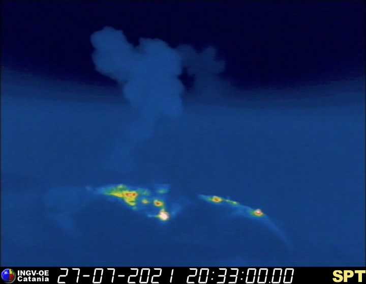
INGV, Osservatorio Etnéo, said that analysis of surveillance images and geophysical parameters at 19:04 UTC (21:04 local time) on 07/27 showed an ordinary explosion in the North Center area which has dumped the products along the Sciara del Fuoco. No significant variation was observed in the distortion signals of the GPS and inclinometric networks of Stromboli. At 22:06 hours (local time), the monitoring networks therefore recorded the resumption of the parameters to normal activity.
On July 23 and 25, observations of the crater area were carried out as part of the activities carried out within the framework of Project ONE. The analysis of the data made it possible to characterize the morpho-structural arrangement of the zones of the North and Center-South crater. In detail, in the North area, the N1 crater was characterized by the presence of two active vents with simultaneous ash explosions (south vent) and projections (north vent), while the N2 crater showed four active vents, one characterized by gas explosions with a few bombs and three in degassing. In the Center-South zone, and in particular at CS1, five active vents were observed, two of which were characterized by an abundant emission of ash, mostly, sometimes active simultaneously, and three degassing vents located in the East sector. The active vent in CS2 was characterized by degassing only and the active vent in CS3 was characterized by sporadic explosions with mainly ash emission.
Source : INGV.
Italy / Sicily , Etna :
Weekly Bulletin, from July 19, 2021 to July 25, 2021 (issue date July 27, 2021)
SUMMARY STATEMENT OF ACTIVITY
In view of the monitoring data, it is highlighted:
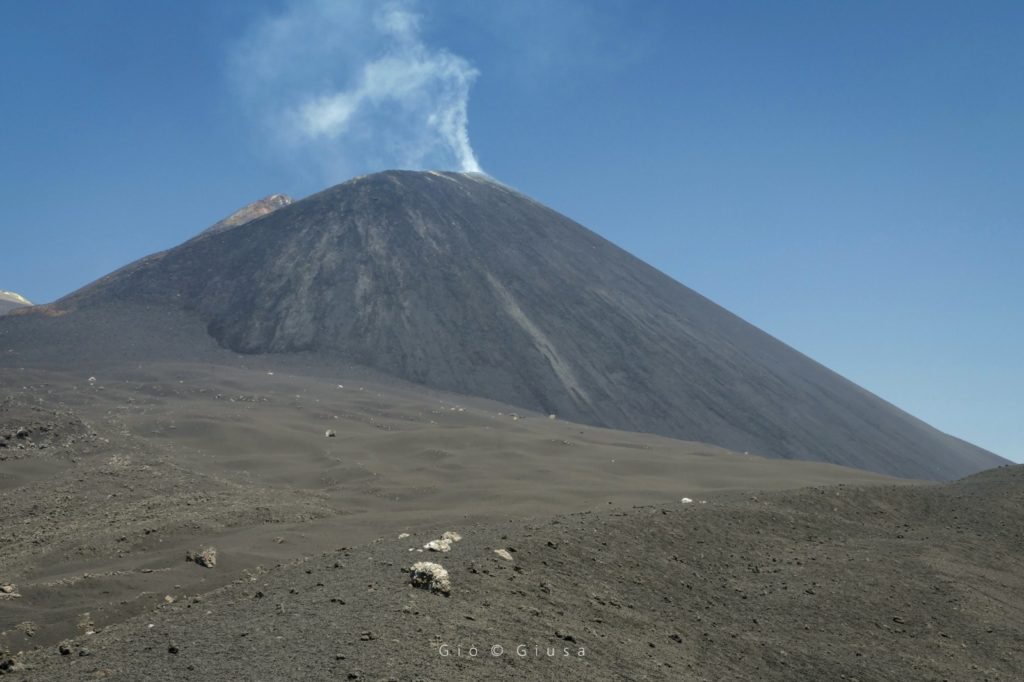
1) VOLCANOLOGICAL OBSERVATIONS: A paroxysmal episode at the Southeast Crater; degassing activities at the other summit craters, sporadic explosions at the Northeast Crater.
2) SEISMOLOGY: Very weak seismic activity of fracturing. The mean amplitude of the volcanic tremor reached very high values during the lava fountain on July 20 and remained at low or medium levels for the remainder of the week.
3) INFRASON: high infrasound activity coinciding with the episode of the lava fountain at the Southeast Crater, low in the remaining period.
The South-East flank of the South-East Crater, the youngest of the 4 craters present on the summit area of the Sicilian volcano. It has produced 47 paroxysms (in two series) since February 16, aiming to become, if it is not already the case, the new highest peak of Etna.
The data: 17 paroxysms from February 16 to April 1, 30 more paroxysms from May 19 to July 20.
4) DEFORMATIONS: The signals from the inclinometric network showed variations during the lava fountain of 20 us. The greatest variations were recorded at the summit station of Cratere del Piano (ECP), with values of the order of 2 microradians on both components.
5) GEOCHEMISTRY: SO2 flux at an average level, with high values during eruptive phases
HCl flux: Data not available, the latest measurements are at a low level
The flow of CO2 emitted by the soil is at average values.
The partial pressure of dissolved CO2 in water does not show significant variations.
There are no updates for the C / S report.
The helium isotope ratio decreases slightly but is still at medium-high values (latest data from 07/08/2021).
6) SATELLITE OBSERVATIONS: The thermal activity in the summit area was of a high level only in correspondence with the lava fountain of July 20.
VOLCANOLOGICAL OBSERVATIONS
During the week, the monitoring of the volcanic activity of Etna was carried out by analyzing the images of the surveillance cameras of the INGV, Osservatorio Etneo (INGV-OE).
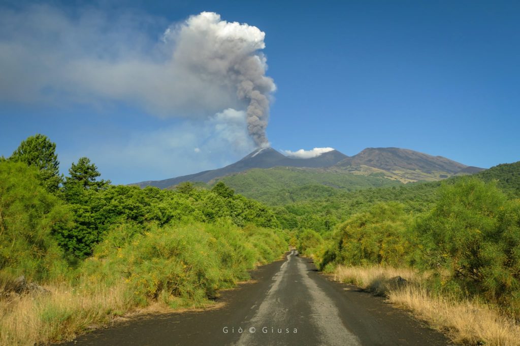
During the week, on July 20, a lava fountain episode occurred in the Southeast Crater. The evolutionary phenomenology of the aforementioned event has been common to all the fountain events observed so far, and consists of the resumption of Strombolian activity at the Southeast Crater, followed by a gradual intensification up to the stage of lava fountain. This phenomenon was accompanied by an overflow of lava towards the southwest.
From July 19 at around 11:50 p.m., there was a resumption of Strombolian activity at the South-East Crater with the emission of ash which dispersed towards the South-South-East. At 4:50 a.m., coinciding with the increase in volcanic tremor, an intensification of explosive activity was observed until it turned into a lava fountain around 7:20 a.m. At the same time, an overflow of lava was observed along the flank of the Southeast Crater heading southwest. The products emitted were dispersed in the area between the southern and eastern slopes of the volcano.
By 10:45 a.m., the SEC lava fountain had ceased and weak Strombolian activity was observed with low emissions of rapidly dispersing ash.
At around 2:20 p.m., thanks to observations made by INGV personnel on the ground, Strombolian activity ended and the flow heading towards the southwest was no longer supplied.
During the remainder of the week, sporadic explosions were observed with ash emissions rapidly dispersing in the summit area.
The other summit craters, during the week, were mainly affected by degassing activities with the exception of the Northeast Crater which was also affected by isolated explosive events.
Source : INGV.
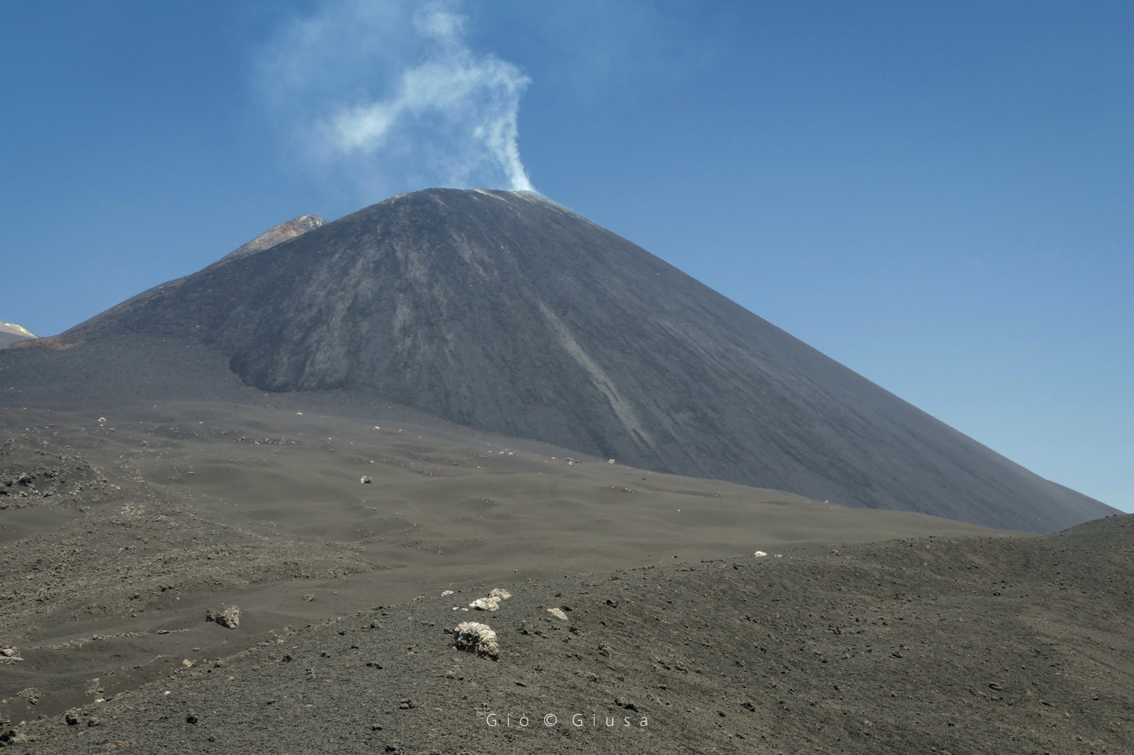
Photos : Gio Giusa
Indonesia , Ili Lewotolok :
VOLCANO OBSERVATORY NOTICE FOR AVIATION – VONA.
Issued : July 27 , 2021
Volcano : Ili Lewotolok (264230)
Current Aviation Colour Code : ORANGE
Previous Aviation Colour Code : orange
Source : Ili Lewotolok Volcano Observatory
Notice Number : 2021LEW29
Volcano Location : S 08 deg 16 min 19 sec E 123 deg 30 min 18 sec
Area : East Nusa Tenggara, Indonesia
Summit Elevation : 4554 FT (1423 M)
Volcanic Activity Summary :
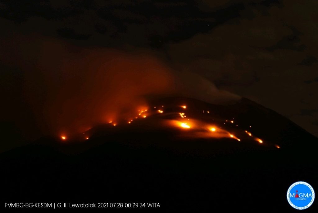
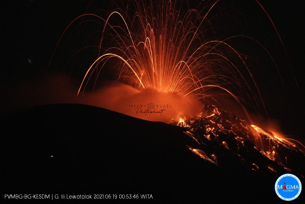
Eruption with volcanic ash cloud at 23h22 UTC (07h22 local). Eruption and ash emission is not continuing.
Volcanic Cloud Height :
Best estimate of ash-cloud top is around 7114 FT (2223 M) above sea level, may be higher than what can be observed clearly. Source of height data: ground observer.
Other Volcanic Cloud Information :
Ash-cloud moving to West
Remarks :
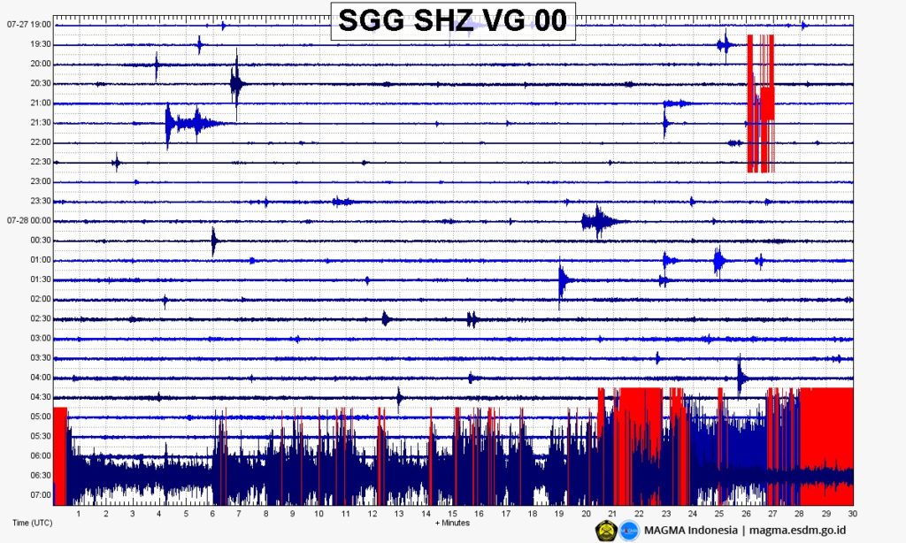
Seismic activity is characterized by continuous volcanic tectonic Earthquake.
Niveau d’activité Niveau III (Siaga) depuis le 29 novembre 2020 à 13h00 WITA. Des éruptions se produisent encore aujourd’hui.
Le volcan était clairement visible jusqu’à ce qu’il soit recouvert par le brouillard. De la fumée blanche, grise et noire , issue du cratère principal a été observée avec une intensité faible, moyenne à épaisse, à environ 50-400 mètres au dessus du sommet. Le temps est ensoleillé à nuageux, le vent est faible à fort au Nord-Est, Est, Ouest et Nord-Ouest. La température de l’air est d’environ 21,3-33,9°C. Humidité 57,1-73,9%.
Selon les sismographes du 27 juillet 2021, il a été enregistré :
5 tremblements de terre d’éruptions/explosions
3 tremblements de terre d’émissions
1 tremor non harmonique
2 tremblements de terre volcaniques profonds
Source : Magma Indonésie , PVMBG.
Photo : Rizal M / PVMBG – Magma Indonesia , Jeffry Pugel /PVMBG – Magma Indonesia.
Indonesia , Sinabung :
VOLCANO OBSERVATORY NOTICE FOR AVIATION – VONA
Issued : July 28 , 2021
Volcano : Sinabung (261080)
Current Aviation Colour Code : RED
Previous Aviation Colour Code : orange
Source : Sinabung Volcano Observatory
Notice Number : 2021SIN79
Volcano Location : N 03 deg 10 min 12 sec E 98 deg 23 min 31 sec
Area : North Sumatra, Indonesia
Summit Elevation : 7872 FT (2460 M)
Volcanic Activity Summary :
Eruption with ash clouds at 06h20 UTC (13h20 local time). The eruption lasted for 742 seconds.
Volcanic Cloud Height :
Best estimate of ash-cloud top is around 22272 FT (6960 M) above sea level, may be higher than what can be observed clearly. Source of height data: ground observer.
Other Volcanic Cloud Information :
Ash cloud is moving to E – S.
Remarks :
Seismic activity is characterized by the Deep Volcanic Earthquake, Low Frequency Earthquake, and Hybrid Earthquake. Pyroclastic flow is observed through the East-Southeast slope and reaches a distance of 1000 meters from the summit.
Level of activity at level III (SIAGA) since May 20, 2019 at 10:00 a.m. WIB. The Sinabung volcano (2,460 m above sea level) has been erupting since 2013.
The volcano is clearly visible until it is covered by fog. White smoke from the main crater was observed with weak, medium to thick intensity about 50-300 meters above the summit. The weather is sunny to cloudy, the wind is weak to the east and south-east. The air temperature is around 16-36 ° C.
According to the seismographs of July 27, 2021, it was recorded:
3 earthquakes of emissions
1 low frequency earthquake
49 hybrid / multi-phase earthquakes
1 deep volcanic earthquake
1 distant tectonic earthquake
Source : Magma Indonésie , PVMBG.
Video : Rizal M.

