April 21 , 2021 .
Italy / Sicily , Etna :
Weekly bulletin from April 12, 2021 to April 18, 2021 (issue date April 20, 2021)
SUMMARY OF THE STATE OF ACTIVITY
In the light of surveillance data, it is highlighted:
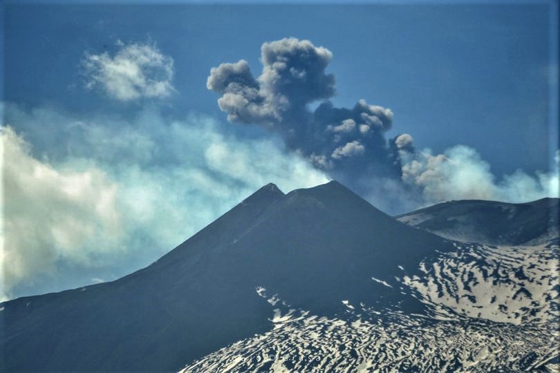
1) VOLCANOLOGICAL OBSERVATIONS: Strombolian activity within the crater at the Northeast Crater. Thermal anomalies visualized by satellite, probably attributable to deep explosive activity in the Bocca Nuova Crater and to hot fumaroles in the area of the summit of the Southeast Crater. Degassing activity at the Voragine Crater.
2) SEISMOLOGY: very low seismic fracturing activity; amplitude of the tremor at a low level.
3) INFRASOUND: low infrasound activity
4) DEFORMATIONS: There are no significant variations in the time series of soil deformation monitoring networks.
5) GEOCHEMISTRY: The flow of SO2 at an average level
HCl flux is at a low level.
The CO2 flux from the soil remains at medium-low values.
The partial pressure of dissolved CO2 in groundwater is at low values.
No new data from the C / S ratio is available.
Helium isotopic ratio values, while remaining at high levels, show a slight decrease in the last sample of 04/01/2021.
6) SATELLITE OBSERVATIONS: The thermal activity in the summit area is at a low level.
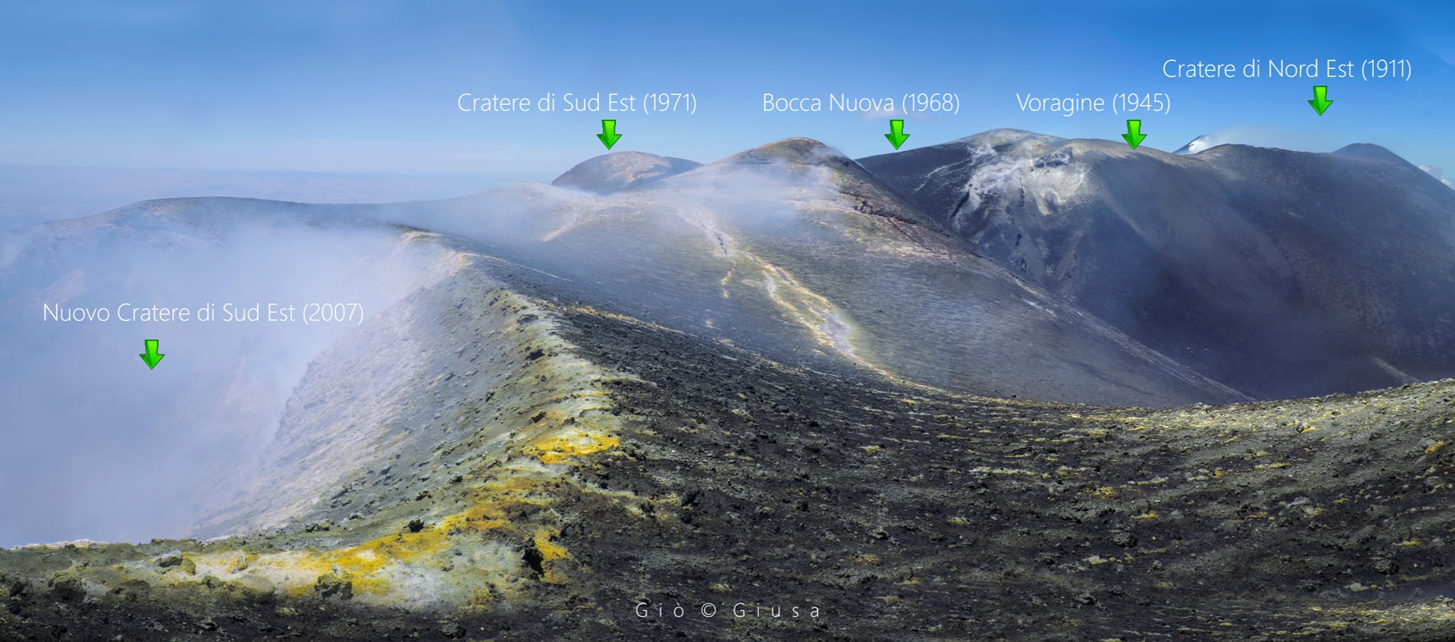
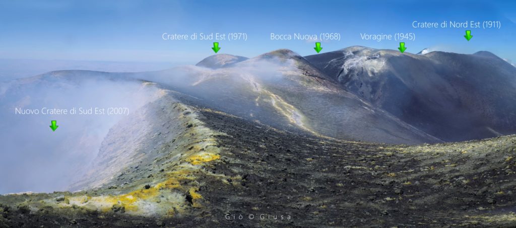
Here is a panoramic shot which shows us how the Summit Crater Zone looked in June 2016. The photo was taken from what was called ′ ′ ′ New South East Crater « , today totally changed after the last paroxysmal events which As we can see, the ′ ′ Selle ′ ′ also shows us very clearly between the two cones of the South East, the absence of the Crater of the Saddle, which then formed with the first eruptive episodes between February and April 2017. There was already a mouth in its place unfortunately not visible from this angle.
VOLCANOLOGICAL OBSERVATIONS
During the week, the monitoring of the volcanic activity at the level of the summit craters of Etna was carried out by analyzing the images of the network of surveillance cameras of the INGV section of Catania, Osservatorio Etneo (INGV-OE). An inspection was also carried out in the summit area by INGV-OE staff on April 13. Finally, the images acquired by the Sentinel 2 satellite on April 12, 14 and 17 provided additional support for the observations.
The alternating weather conditions during the week made the observation of volcanic activity discontinuous through the network of surveillance cameras, due to the presence of cloud cover.
During the period considered, the activity of the Etna volcano followed the behavior observed the previous week, characterized by thermal anomalies detectable by satellite observations, attributable to a deep explosive activity at the crater of Bocca Nuova, an intra Strombolian activity. -crater at the Northeast Crater and in the fumarole areas of the summit area of the Southeast Crater. The Voragine crater showed degassing activity.
In particular, the Southeast Crater (SEC) no longer produces explosive activity visible through the surveillance camera network, with the exception of a single event posted at 03:31 GMT on April 14. The images acquired on April 12, 14 and 17 by the Sentinel 2 satellite, highlight a large area of high thermal anomaly affecting the summit area, attributable to a large area of fumaroles located around the active vents during the last paroxysm and whose intense activity is also clearly visible through the images of the cameras. Even during the inspection carried out on April 13, no explosive activity was detected in progress, only fumarolic activity.
During the period under review, the Northeast Crater (NEC) produced an activity mainly characterized by degassing and intracrater strombolian activity, detected by the images.
of the Sentinel 2 satellite acquired on April 12, 14 and 17, but not visible to the cameras of the CCTV network.
The Bocca Nuova Crater (BN) was also affected by intense impulsive degassing.
During the inspection carried out on April 13, it was found that this activity is mainly attributable to the westernmost of the two cones present inside the crater, already described in previous press releases, which produces launches of fresh material accompanied by light emissions of reddish ash diluted and rapidly dispersed into the atmosphere.
Also in this case, the images acquired by the Sentinel 2 satellite showed two zones of high thermal anomaly in correspondence with these cones. Such anomalies are likely
attributable to a deep Strombolian activity, which is however not observable through the images of the cameras of the surveillance system.
Finally, the Voragine Crater (VOR) was only affected by a modest degassing activity, accompanied by sporadic emissions of diluted ash, quickly dispersed in the atmosphere by the prevailing winds..
Source : INGV.
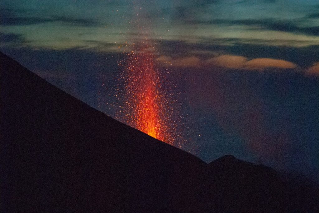
Photos : Gio Giusa .
La Réunion , Piton de la Fournaise :
Press release of April 20, 2021 – 4:00 p.m.
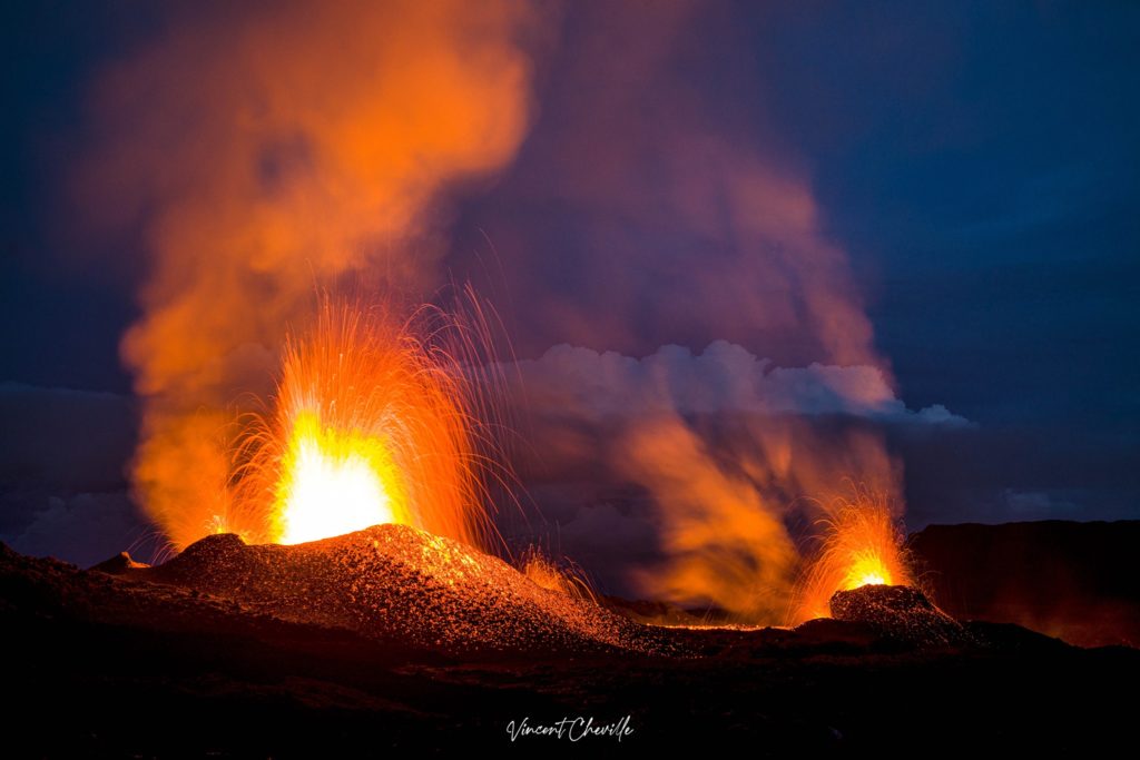
The eruption that started on 04/09/2021 at 7 p.m. (appearance of the tremor) continues. The intensity of the volcanic tremor (indicator of a surface lava emission) over the last 24 hours has remained relatively stable and comparable to that observed the previous days.
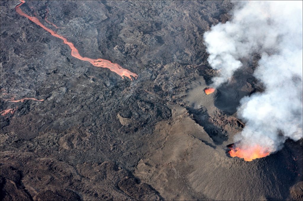
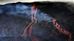
Observations of the eruptive site made during an overflight aboard a microlight this morning still show:
. a main eruptive cone and a secondary eruptive cone about a hundred meters downstream (resulting from the merger of the two secondary mouths which were still visible at the end of last week),
each presenting an activity of lava fountains and degassing.
. a flow activity focusing on the plateau downstream of the eruptive site, with a regime of lava tunnels showing this morning a main resurgence about a hundred meters from the secondary cone.
. the absence of active flow at the level of the Grandes Pentes with a front which therefore remains frozen just upstream of Piton le Bonnet.
Shooting of the eruptive site during the day of 04/20/2021 taken around 8:00 a.m. local time (© OVPF-IPGP).
Over the last 24 hours, 12 superficial volcano-tectonic earthquakes (between sea level and the surface) have been recorded under the summit craters.
– CO2 fluxes in the soil are still increasing both in the far field (Plaine des Cafres and Plaine des Palmistes) and in the near field (Gîte du volcan).
– The deflation of the building has stopped and a slight inflation of the top seems to be emerging. This parameter will be followed over the next few days because it may correspond to the arrival of deep magma,
highlighted by the flow of CO2 in the soil for several days, in the superficial magmatic reservoir that feeds the current eruption.
It should be noted that during the eruptions of January and July 2017 and of April and September 2018 of long duration (> 3 weeks) such a refeeding during the eruption had been observed allowing feeding of the eruptive site over time, and that arrivals of deep magma have often been associated with changes in eruptive activity (explosiveness in 2016 and 2020; increased flow rates; opening of new cracks, etc.).
– The SO2 fluxes measured by the DOAS « NOVAC » network make it possible to estimate lava flows. Considering a partially degassed magma during the first days of the eruption, the maximum lava flow probably did not exceed 20 m3 / sec on April 9 and 10; the proportions of less degassed magma then probably increased over time, making it possible to estimate an average flow rate of around 24 m3 / sec for the day of 03/13 (with peaks of up to 59 m3 / sec). Since a fairly stable average flow, between 6.5 and 8.3 m3 / sec, is estimated for the period from 16 to 19/04. It should be noted that bad weather conditions can affect the accuracy of the measurements.
– The surface flows estimated from satellite data via the HOTVOLC platform (OPGC – Clermont Auvergne University) could not be estimated with precision in recent days given the bad weather conditions on the eruptive site.
– The flow estimates, made from the SO2 flows measured by the DOAS “NOVAC” network, make it possible to propose a first estimate of the total volumes (lava flows + cones
pyroclastics) emitted during the eruption as well as their evolution over time. Thus, since the start of the eruption, the total volume emitted would be around 7 million m3.
Source : OVPF.
Read the article : https://www.ipgp.fr/sites/default/files/ovpf_20210420_16h00_communique_eruption.pdf
Photos : OVPF , Vincent Tunneldelave Réunion ( https://rando-volcan.com ).
Saint Vincent , Soufrière Saint Vincent :
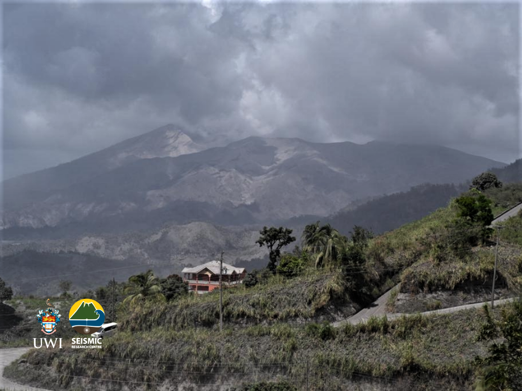
La Soufriere, St Vincent SCIENTIFIC UPDATE 20/04/21 6PM
– Seismic activity at La Soufrière continued the pattern established after the explosive activity on 18 April.
– Small long-period and hybrid earthquakes continued to be recorded. The network also recorded a few rockfalls and volcano-tectonic earthquakes.
– No seismic tremor has been recorded in the last 12 hours.
– Measurements of sulphur dioxide flux SO2 (mass) at La Soufriere volcano was again undertaken along the west coast today with the assistance of the coastguard.
– Measurements yielded an average SO2 flux of 350 tons per day.
– Since the initial depressurization noted immediately following the April 9 explosive phase, the continuous GPS network has recorded a decrease in the overall rates of horizontal and vertical
movement.
– The volcano continues to erupt.
– Its pattern of seismic activity over the last few days is typical of the growth and destruction of lava domes.
– Explosions with accompanying ashfall, of similar or larger magnitude, can occur with little or no warning impacting St. Vincent and neighbouring islands.
– The volcano is at alert level Red.
The seismic station at Bamboo Range recorded the signal from a lahar (mudflow) at 4 am, which lasted for about 30 minutes and may have flowed along a valley on the south- eastern side of the volcano.
Source et photo : UWI.
Indonesia , Semeru :
VOLCANO OBSERVATORY NOTICE FOR AVIATION – VONA.
Issued : April 21 , 2021
Volcano : Semeru (263300)
Current Aviation Colour Code : ORANGE
Previous Aviation Colour Code : orange
Source : Semeru Volcano Observatory
Notice Number : 2021SMR12
Volcano Location : S 08 deg 06 min 29 sec E 112 deg 55 min 12 sec
Area : East java, Indonesia
Summit Elevation : 11763 FT (3676 M)
Volcanic Activity Summary :
Eruption with volcanic ash cloud at 01h03 UTC (08h03 local).
Volcanic Cloud Height :
Best estimate of ash-cloud top is around 14003 FT (4376 M) above sea level, may be higher than what can be observed clearly. Source of height data: ground observer.
Other Volcanic Cloud Information :
Ash cloud moving to southwest
Remarks :
Seismic activity is characterized by eruption, avalanche and gas emission earthquakes
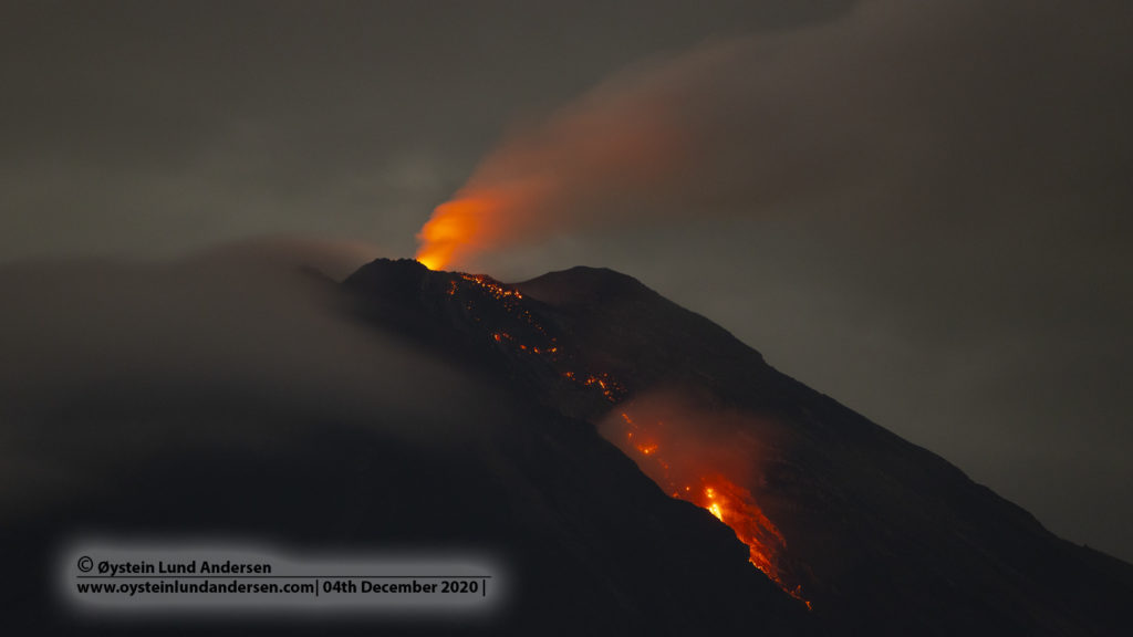
Level of activity level II (WASPADA). The Semeru volcano (3676 m above sea level) is continuously erupting. Explosive and effusive eruptions have been recorded, causing lava flows towards the southern and southeastern slopes, as well as an explosion of incandescent rocks around the summit crater.
The volcano is clearly visible. Smoke from the crater was not observed. The weather is sunny, the winds weak to the north, northeast and east.
According to the seismographs of April 20, 2021, it was recorded:
35 eruption / explosion earthquakes
6 emissions earthquakes
6 distant tectonic earthquakes.
Source : Magma Indonésie , PVMBG.
Photo : Oystein Lund Andersen .
Italy , Stromboli :
Weekly bulletin from April 12, 2021 to April 18, 2021 (issue date April 20, 2021)
SUMMARY OF THE STATE OF ACTIVITY.
In the light of surveillance data, it is highlighted:
VOLCANOLOGICAL REMARKS: Normal explosive volcanic activity of Strombolian type accompanied by sometimes intense projection activity in zone N2. The total frequency of events showed values between medium-low levels (8 events / h) and medium-high values (18 events / h). The intensity of the explosions varied from low to medium-high in the North crater area and medium-high in the Center-South area.
2) SEISMOLOGY: The monitored seismological parameters do not show significant variations.
3) DEFORMATIONS: There are no significant changes to report
4) GEOCHEMISTRY: SO2 flux: medium level
C / S ratio: values are on average levels
He isotope ratio: the values still show a slight decrease, while remaining on average values.
5) SATELLITE OBSERVATIONS: The thermal activity in the summit area is at a medium-low level.
VOLCANOLOGICAL OBSERVATIONS
In the period under observation, the eruptive activity of Stromboli was characterized by the analysis of the images recorded by the surveillance cameras INGV-OE located at an altitude of 190 m, Punta Corvi and an altitude of 400 m.
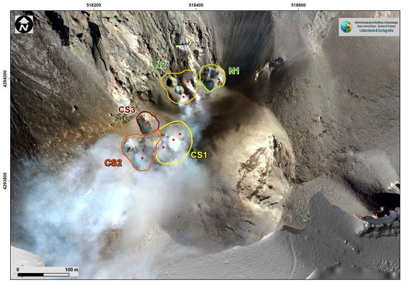
In the area of the North crater, the N1 crater, with two emission points, produced explosions of varying intensity from low to medium-high (sometimes the products reached 250 m in height) emitting coarse materials (lapilli and bombs ) mixed fine materials (ash). After the first day of the period analyzed (April 12), the intensity of the explosions and the coarse part decreased to the advantage of the cinerite part. The N2 vent showed until April 15 an explosive activity of low intensity emitting fine materials. This activity became, in the remainder of the period, mainly emitting coarse materials with a weak projection activity which reached its peak on April 17 with an intense projection activity at times. The average frequency of explosions varied from 5 to 13 events / h.
In the Center-South zone, there were at least three emission points with explosions, emitting mainly coarse materials, with medium and sometimes high intensity (the products exceeded 250 m in height). The explosive activity showed average hourly frequency values ranging from 3 to 5 events / h.
Source : INGV.

