November 09 , 2019.
Hawaii , Mauna Loa :
19°28’30 » N 155°36’29 » W,
Summit Elevation 13681 ft (4170 m)
Current Volcano Alert Level: ADVISORY
Current Aviation Color Code: YELLOW
Activity Summary:
Mauna Loa Volcano is not erupting. Rates of deformation and seismicity have not changed significantly over the past week and remain above long-term background levels.
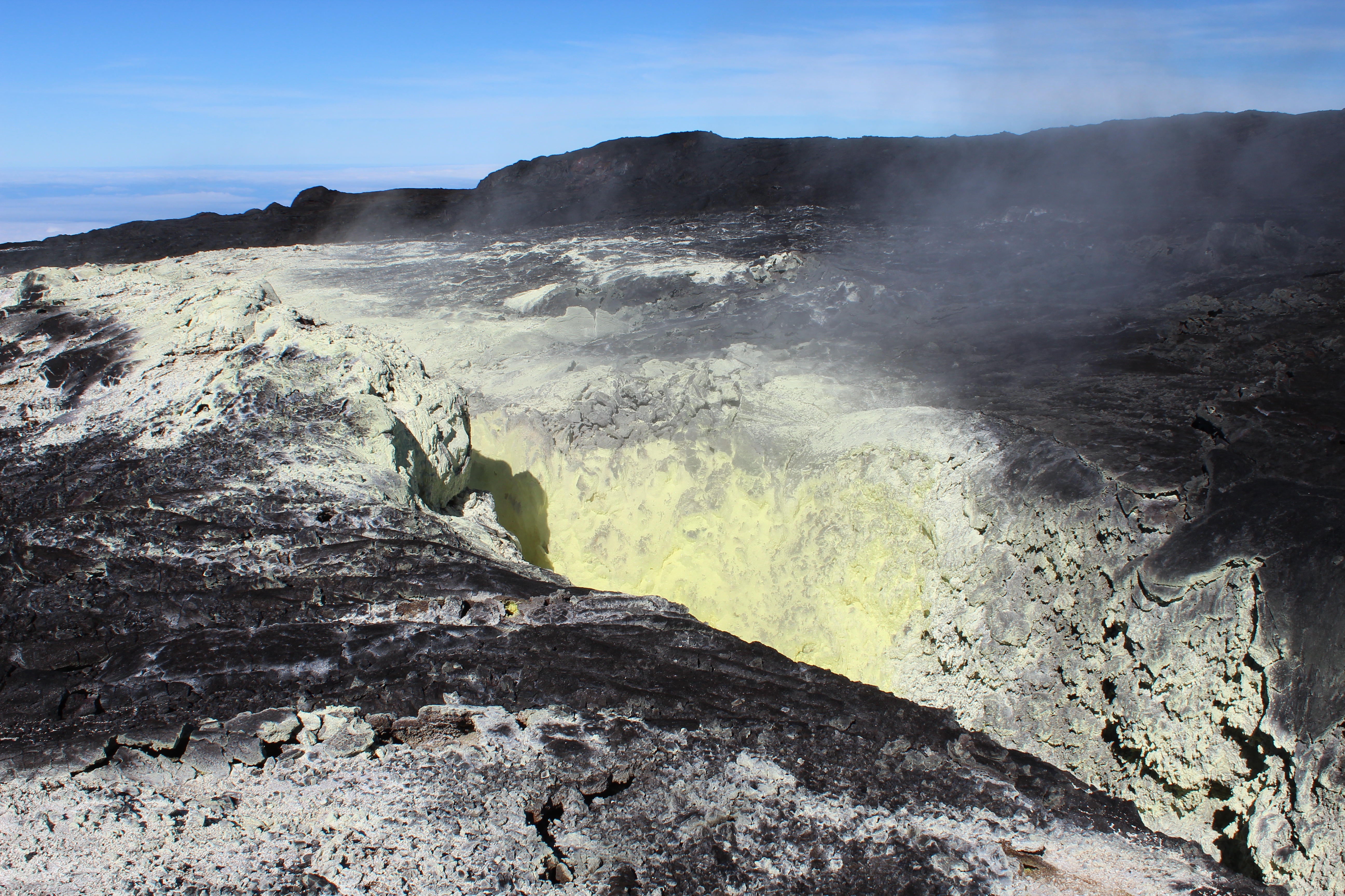
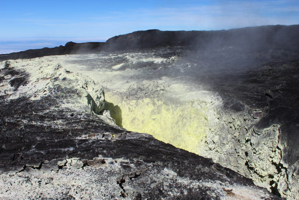
Native sulfur crystals often form through the reaction of sulfur dioxide and hydrogen sulfide gases, both of which are degassing from this old fissure on Mauna Loa, making it an ideal site for volcanic gas monitoring. As a result of the degassing, the fissure is lined with yellow sulfur crystals. USGS photo by P. Nadeau, 09-17-2019.
Observations:
During the past week, approximately 147 small-magnitude earthquakes (nearly all smaller than M2.0) were detected beneath the upper elevations of Mauna Loa. Most of the earthquakes occurred at shallow depths of less than 5 km (~3 mi) below ground level, but a couple were as deep as 12 km (~7.5 mi).
Global Positioning System (GPS) and Interferometric Synthetic Aperture Radar (InSAR) measurements show continued summit inflation, consistent with magma supply to the volcano’s shallow storage system.
Readings of fumarole temperature and gas concentrations at the Sulphur Cone monitoring site on the Southwest Rift Zone remain stable.
Source : HVO.
Italy , Stromboli :
Daily bulletin of 08/11/2019.
SUMMARY OF THE STATUS OF ACTIVITY
In light of the surveillance data, we highlight:
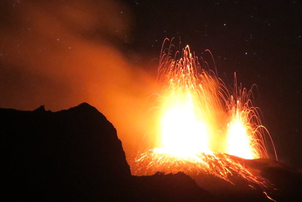
1) VOLCANOLOGICAL OBSERVATIONS: Normal explosive activity of Strombolian type accompanied by degassing activities
2) SISMOLOGY: The seismological parameters do not show any significant changes.
3) DEFORMATIONS: The deformation monitoring networks of the island did not show any significant variation in communication during the last 24 hours.
4) GEOCHEMISTRY: The flow of SO2 is at an average level. The isotopic ratios of helium dissolved in the thermal layer remain unchanged for the mean-low values (data of 23/10/2019). There is no measure of CO2 / SO2 ratio available. The last value for the day of 7/11/2019 was at average levels.
VOLCANOLOGICAL OBSERVATIONS:
At 1200 UTC, analysis of the images recorded by surveillance cameras at 400 m altitude (SQV and SQT) showed ordinary Strombolian activity from the most active mouths in the North and Center-South crater areas.
The daily average hourly frequency of the number of explosions produced by the two areas of the crater was 21 events / h (high frequency). In detail in the North Zone, the explosive activity consisted of 9 events of low intensity / h (less than 80 m high) emitting coarse materials (lapilli and bombs) sometimes covering the slopes of the cone facing the Sciara del Fuoco . In the Center-South zone, an average explosions frequency of 12 events / ha was observed, emitting fine materials (ash) mixed with coarse materials, with an average intensity (less than 150 m) and sporadically high (the products have reached a height of 250 m). The raw products also fell in the direction of Sciara del Fuoco.
Seismology:
The bulletin is established with data acquired from a maximum of 8 stations. The seismic activity recorded during the last 24 hours has the following characteristics: A seismic signal has been recorded that can be associated with a small landslide, mainly visible at the STRE station. The VLP seismicity rate is 20 events / hour.
The amplitude of the VPLs type events was generally low, with some medium-low events. The amplitude of the explosion earthquakes was generally low, with some events of medium to low amplitude and a medium-high amplitude event recorded between 17:30 (UTC) on 07 October and 01:00 (UTC) on 08 October … / …
Source : INGV.
Read the article : file:///C:/Users/Utilisateur/AppData/Local/Packages/Microsoft.MicrosoftEdge_8wekyb3d8bbwe/TempState/Downloads/BollettinoGiornalieroStromboli20191108%20(1).pdf
Photo : Andrey Nikiforov , webcam.
Japan , Sakurajima :
Sakurajima volcano (Kyushu Island, Japan): increasing activity, ash to 22,000 ft altitude.
The activity at the volcano has been increasing during the past few weeks, in particular since the end of October.
Vulcanian-type explosions have been occurring at rates of 4-6 per day on average, mainly (or exclusively?) from the Minamidake summit crater and producing ash plumes that often reach 10,000 ft or more.
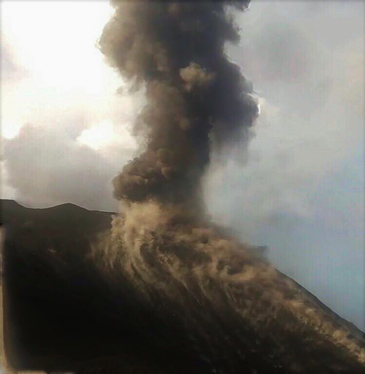
This morning, a particularly strong eruption occurred, causing a noticeable shaking in Kagoshima city and generating an ash plume that rose to approx. 22,000 ft (6.7 km).
Eruption of Sakurajima volcano this morning (image: @volcanohull / public domain).
KAGOSHIMA, Japan (Kyodo) — Mt. Sakurajima in Kagoshima Prefecture, southwestern Japan, erupted Friday, the Japan Meteorological Agency said.
A plume of ash spewed from the volcano’s 1,040-meter Minamidake summit crater in the 5:24 p.m. eruption, reaching about 5.5 kilometers into the sky, the agency said, warning that volcanic activity may continue for some time.
https://www.facebook.com/100192234769964/videos/687240361801644/
No major property damage has been reported, according to the Kagoshima prefectural government.
An eruption on a similar scale at the volcano last occurred in July 2016.
The agency said eruptions at the crater have occurred repeatedly this year, with ash reaching 3 km above the summit on two occasions.
If the eruptions continue, large rocks could be ejected and small pyroclastic flows could occur within around a 1-km radius of the crater, according to the agency.
Source : Volcanodiscovery / Tom Pfeiffer , mainichi.jp.
Photo : @volcanohull / public domain / Volcanodiscovery .
Vidéo : Fenómenos Naturales.
Alaska , Cleveland :
AVO/USGS Volcanic Activity Notice .
Current Volcano Alert Level: WATCH
Previous Volcano Alert Level: ADVISORY
Current Aviation Color Code: ORANGE
Previous Aviation Color Code: YELLOW
Issued: Friday, November 8, 2019, 11:33 AM AKST
Source: Alaska Volcano Observatory
Location: N 52 deg 49 min W 169 deg 56 min
Elevation: 5676 ft (1730 m)
Area: Aleutians
Volcanic Activity Summary:
Satellite data from the past day suggest that slow effusion of lava may have begun in the summit crater. Thus, AVO is increasing the Aviation Color Code to ORANGE and the Volcano Alert Level to WATCH. Highly elevated surface temperatures consistent with lava at the surface have been observed over the past day and robust steaming was seen in web camera and satellite data yesterday. No evidence of explosive, ash-producing activity observed.
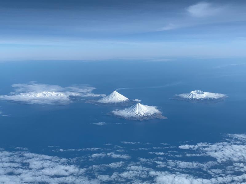
Photo, April 27, 2019, looking south at some of the Islands of Four Mountains volcanoes. Volcanoes from left to right: Kagamil, Cleveland, Carlile, Herbert. Photo courtesy of Dave Clum.
Future explosions at Cleveland are likely and the presence of a lava dome in the summit crater may increase the possibility of this type of activity. They occur without warning and typically produce relatively small volcanic ash clouds that dissipate within hours; however, more significant ash emissions are possible.
Recent Observations:
[Volcanic cloud height] None
[Other volcanic cloud information] n/a
[Lava flow/dome] Possible lava
Remarks:
Cleveland volcano is monitored by only two seismic stations, which restricts AVO’s ability to detect precursory unrest that may lead to an explosive eruption. Rapid detection of an ash-producing eruption may be possible using a combination of seismic, infrasound, lightning, and satellite data.
Source : AVO.
Photo : Dave Clum.
Indonesia , Merapi :
VOLCANO OBSERVATORY NOTICE FOR AVIATION – VONA.
Issued: 20191108/2343Z
Volcano: Merapi (263250)
Current Aviation Colour Code: ORANGE
Previous Aviation Colour Code: orange
Source: Merapi Volcano Observatory
Notice Number: 2019MER03
Volcano Location: S 07 deg 32 min 31 sec E 110 deg 26 min 31 sec
Area: Special Region of Yogyakarta, Indonesia
Summit Elevation: 9498 FT (2968 M)
Volcanic Activity Summary:
Eruption with ash cloud at 23h21 UTC (06h21 local), lasted for 3 minutes. Eruption has stopped.
Volcanic Cloud Height:
Best estimate of ash-cloud top is around 14298 FT (4468 M) above sea level, may be higher than what can be observed clearly. Source of height data: ground observer.
Other Volcanic Cloud Information:
Ash-cloud moving to west.
Remarks:
Eruption was recorded in seismograph for 160 s and amplitude 65 mm.
Source : Magma indonésia .
Vidéo : webcam frekom.

