July 06 , 2019.
Italy , Stromboli :
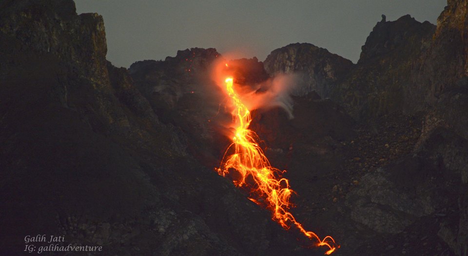
COMMUNICATION on the VOLCANIC ACTIVITY of July 05, 2019 at 08:45:37 (UTC) – STROMBOLI.
The National Institute of Geophysics and Volcanology, Osservatorio Etneo, reports that after observations made by the INGV field staff around 5 am on 5 July, a persistent explosive activity on the Stromboli crater terrace was produced at the time of inspection, by two active mouths in the south-central region. These mouths, spatially close to each other, produced an intense activity of splashing and formed a small cone of slag. The northern zone of the crater terrace was characterized by sporadic, low intensity explosions. As for the lava flow fed by the South-South Crater Zone, it came on the afternoon of July 4th, with the four lava flows that had reached the coast in recent days. cool down.
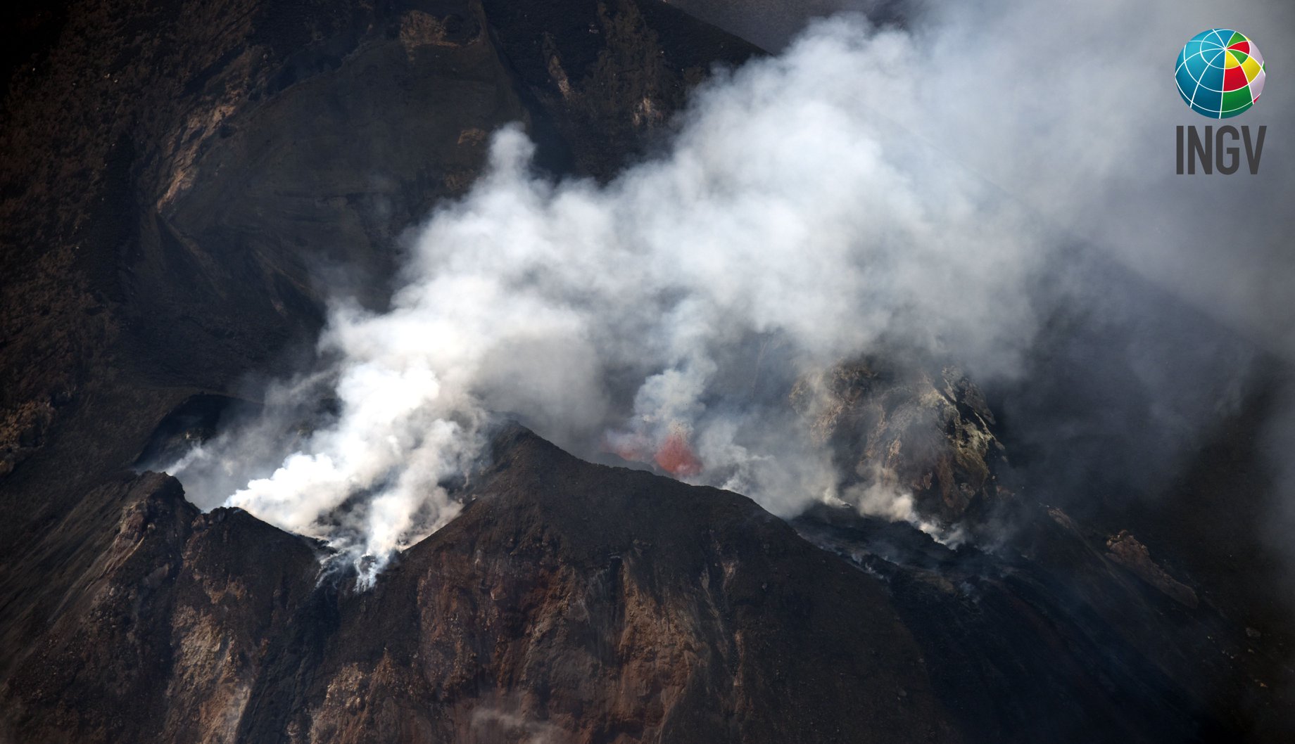
The area of the summit of Stromboli taken by S. Branca (INGV) on the morning of 4 July 2019, from the helicopter of 2 ° Nucleo Aereo of the coastguard of Catania.
The active lava fronts were in the middle of the Sciara del Fuoco. During this morning’s observations, from the Pizzo Sopra La Fossa, the lava overflow is no longer fed, other updates will be announced after the helicopter overflight scheduled for this afternoon. On July 4, the seismic signal was characterized by moderate intensity explosions and a volcanic tremor width fluctuating between low and intermediate values. The recording remained almost motionless this morning, both with regard to the tremors and the intensity and frequency of the signals relating to the explosive events. Since yesterday, ground deformations, both GPS and inclinometer data, have not shown significant changes. Finally, the flow of SO2 measured by the FLAME network on July 4th indicates an increase with values higher than ordinary degassing (~ 250-300 t / d). The daily average was about 180 t / d, which puts the degassing regime at an average level.
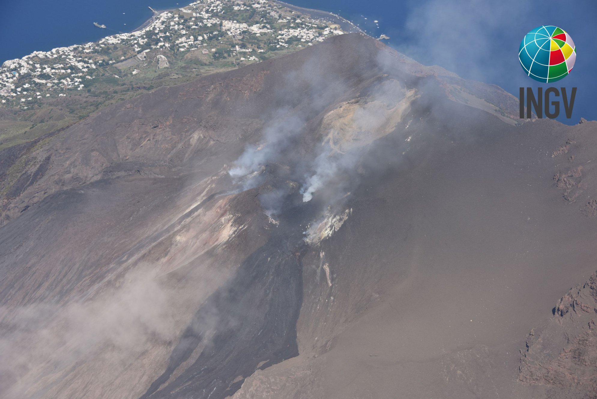
The area of the summit of Stromboli taken by S. Branca (INGV), the afternoon of July 5, 2019, from the helicopter of the 2nd Nucleo Aereo of the coastguard of Catania.
COMMUNICATION ON THE VOLCANIC ACTIVITY of July 05, 2019 16:38:00 (UTC) – STROMBOLI.
The National Institute of Geophysics and Volcanology, Osservatorio Etneo, announces that the data acquired during this day’s survey, carried out between 14:40 and 15:30, by the helicopter provided by the 2nd Coast Guard Unit from Catania, have shown that eruptive activity at the two active mouths in the South Central Crater has changed from intense splashing described in the previous version to intense Strombolian activity. The explosions reach heights of up to 150 m with products that settle occasionally on the Sciara del Fuoco, generating rock rollings along the slope that reach the coastline. Sporadic explosive activity persists north of the crater terrace. In addition, during overflights, it was established that the effusive activity ceased and that the lava overflow from the South-Central crater and its lava flows in the Sciara del Fuoco were no longer supplied and therefore cooling.
Source : INGV Vulcani.
Photo : S. Branca (INGV)
Alaska , Semisopochnoi :
AVO/USGS Volcanic Activity Notice
Current Volcano Alert Level: ADVISORY
Previous Volcano Alert Level: UNASSIGNED
Current Aviation Color Code: YELLOW
Previous Aviation Color Code: UNASSIGNED
Issued: Thursday, July 4, 2019, 10:51 PM AKDT
Source: Alaska Volcano Observatory
Location: N 51 deg 55 min E 179 deg 35 min
Elevation: 2625 ft (800 m)
Area: Aleutians
Volcanic Activity Summary:
Due to an increase in seismicity above background levels over at least the last 8 hours AVO is raising the Aviation Color Code to YELLOW and Alert Level to ADVISORY at Semisopochnoi. No explosive activity has been detected on the Adak infrasound array and clouds currently obscure satellite views of the volcano.
AVO will continue to monitor the volcano using satellite, infrasound and seismic data.
Recent Observations:
[Volcanic cloud height] No cloud observed
[Other volcanic cloud information] No cloud observed
Next Notice:
A new VAN will be issued if conditions change significantly or alert levels are modified.
Remote Semisopochnoi volcano occupies the largest, young volcanic island in the western Aleutians. The volcano is dominated by an 8-km (5-mile) diameter caldera that contains a small lake and a number of post-caldera cones and craters. The age of the caldera is not known with certainty but is likely early Holocene. The last known eruption of Semisopochnoi occurred in 1987, probably from Sugarloaf Peak on the south coast of the island, but details are lacking. Another prominent, young post-caldera landform is Mount Cerberus, a three-peaked cone cluster in the southwest part of the caldera. The island is uninhabited and part of the Alaska Maritime National Wildlife Refuge. It is located 65 km (40 mi) northeast of Amchitka Island and 200 km (130 mi) west of Adak.
Source : AVO Alaska .
Photo : Kim F.
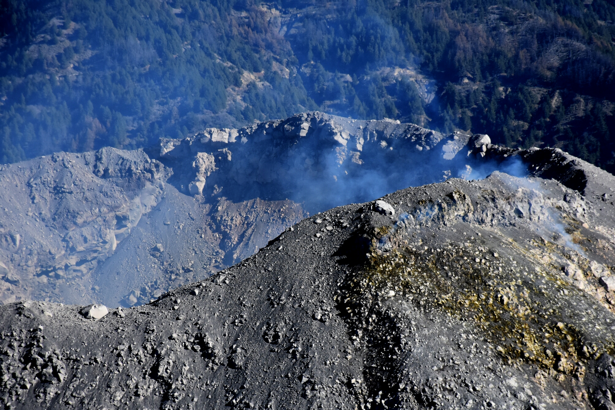
Mexico , Colima :
Weekly technical bulletin of the activity of Volcán de Colima. Date: 5 July 2019 Bulletin No. 128
Seismic activity:
Last week, 3 low-intensity explosions, 34 high-frequency (HF) events, 4 long-period (LP) events, 5 landslides and 14.23 min of low-amplitude trenches were automatically recorded.
Visual observations:
During the reporting period, small explosions and intermittent releases of steam and gas mainly from the northeast side of the crater continue to be recorded. When visibility allowed, the fixed thermal camera located south of the volcano recorded thermal anomalies associated with the emissions produced.
Geochemistry:
No measurements of SO2 flow during the week were made.
Remote perception:
No thermal anomalies detected by the MIROVA satellite system were observed during the last week.
Diagnostic:
The volcano maintains an explosive activity of low intensity. The occurrence of these events indicates that the gas associated with the moving magma has reached superficial levels. This activity can continue and increase in intensity over the next few days or weeks. The staff in charge of monitoring the volcano is attentive to possible changes and changes in activity.
Source : UCOL
Photos : Protección Civil Jalisco Uepcbj.
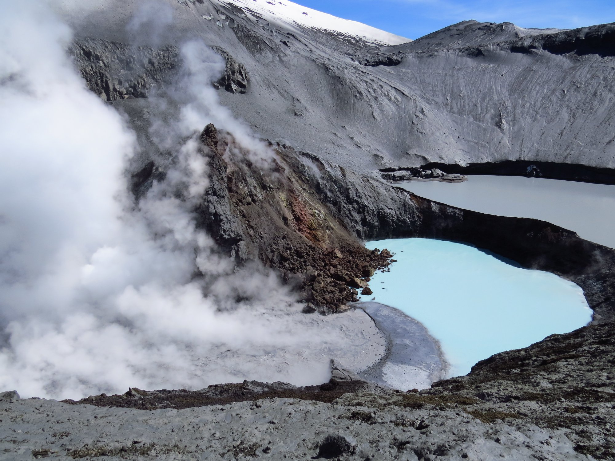
Chile , Copahue :
During this period, 86 seismic events classified as volcano-tectonic (VT) were recorded, associated with fracturing processes of rigid materials. The event with the greatest energy obtained a local magnitude equal to M 2.1 and was located 3.5 km west (O) of the active crater El Agrio, 3.6 km deep.
Similarly, 9 earthquakes associated with fluid dynamics were recorded under the volcanic building, classified as long period type events (LP), with a maximum displacement value (DRC) of 1.5 cm2. In addition, six tremor seismic events (TR) were recorded, with a maximum reduced displacement value of 1.9 cm2.
The continuous tremor signal showed oscillations in its amplitude between low and medium intensity values with dominant frequencies between 0.6 and 3.5 Hz mainly.
IP cameras installed near the volcano when weather conditions allowed to observe the volcano have allowed to observe occasional episodes of low-level whitish degassing of the active crater (El Agrio). On June 17, 2019, was observed the highest column of emission, reaching 400 m above the edge of the crater. Satellite images showed a slight increase in crater lake level, suggesting a recharge of the hydrothermal system.
According to the analysis of the data obtained by four geodetic monitoring stations, small amplitude variations are observed, maintaining the trend observed since February, which does not suggest any significant destabilization of the volcanic system.
Sulfur Dioxide (SO2) emissions recorded by DAS equipment corresponding to Mellizas Station, located 5 km east-northeast of the active crater had an average value of 1027 + / – 384 t / day, with a maximum value of 2805 t / day reported on June 18th. SO2 emissions are considered moderate if we look at the current state of the volcano.
No thermal warning was reported in the area associated with the volcanic building during the reporting period, according to data processed by the mean infrared observation. volcanic activity (MIROVA) (http://www.mirovaweb.it/) and near-real-time thermal monitoring of global hot spots (MODVOLC) (http://modis.higp.hawaii.edu/) .

Although the seismicity displays values considered as low, this one presents a slight increase compared to the previous period, from which a seismic swarm is detached with a localization close to the active crater. In addition, the seismic parameters show in their spectral recording, a displacement of the seismic energy towards the crater.
According to the characteristics shown during the previous and recent volcanic process by the volcano, it does not rule out the occurrence of an imbalance of the magmatic system, implying the possibility of occurrence of minor explosions that would affect the surroundings of the crater and a increase in surface activity.
Therefore, the alert level is maintained at the level:
YELLOW LEVEL: Changes in the behavior of volcanic activity – Probable time for an eruption: WEEKS / MONTH.
Observation: A 500m radius around the crater is considered as a zone of assignment.
Source : Sernageomin.
Photos : Auteur Inconnu.
Indonesia , Merapi :
ACTIVITY REPORT OF MERAPI FROM 28 JUNE TO 4 JULY 2019.
OBSERVATION RESULTS
Visual:
The climate around Mount Merapi is generally sunny in the morning and the evening is cloudy and foggy. The smoke from the crater is white, thin to thick with low pressure. The maximum height of the column is 200 m, dissipating eastwards from the observation post on Mount Merapi to Selo on 1 July 2019 at 06:15 WIB.
The morphological analysis of the crater area based on photographs of the Southeast sector revealed no significant morphological changes. The volume of lava domes based on the analysis of aerial photographs with drones of 4 July 2019 is 475 000 m3. Since January 2019, the volume of the lava dome has been relatively constant due to the fact that most of the magma extrusion collapses directly into the upper parts of Kali Gendol as a lava avalanche.
During this week, there was a cloud of avalanches at a distance of 1,100 meters leading to Kali Gendol.
Seismicity:
This week, the seismicity of Mount Merapi recorded:
1 hot avalanche earthquake (AP),
3 earthquakes (DG),
2 shallow volcanic earthquakes (VTB),
15 multiple phase earthquakes (MP),
172 avalanche earthquake (RF),
5 low frequency earthquakes (FL)
8 tectonic earthquakes (TT).
Deformation:
The G. Merapi deformation monitored by EDM this week did not show any significant change.
Rain and lahars:
This week, there was no rain on Mount Merapi.
Conclusion:
Based on the results of the visual and instrumental observations, it was concluded that:
1. The lava dome is currently in a stable state with a relatively low growth rate.
2. The volcanic activity of Mount Merapi is still quite high and is at the activity level « WASPADA ».
Source : BPPTKG
Photo : Yohannes Tyas Galih Jati