May 14 , 2019.
Peru , Sabancaya :
VOLCANIC ACTIVITY REPORT N ° 019-2019
Period of analysis: May 6 to 12, 2019, Arequipa, May 13, 2019
Alert level: ORANGE
The Geophysical Institute of Peru (IGP) reports that the eruptive activity of the Sabancaya volcano did not show any greater variation compared to the previous week, remaining at moderate levels. For the following days, no significant change is expected.
Analysis of recordings obtained from the seismic network of Sabancaya volcano for the period from 6 to 12 May 2019 has identified the occurrence of about 1674 earthquakes, the highest percentage of which is associated with the movement of fluids magmatic. Earthquakes caused by the rise of the magma remain few and with a low energy released. During the same period, an average of 18 daily explosions were recorded, of average to low intensity.
The monitoring of the deformation of the volcanic structure (GPS data processed with fast orbits) does not show significant anomalies. The visual surveillance, using surveillance cameras, allowed us to identify the appearance of eruptive columns up to 3.2 km above the top of the volcano, whose ashes were dispersed to the eastern and southern sectors. East of the volcano. Satellite monitoring identified 5 volcanic anomalies on the volcano between 1 and 23 MW, associated with the presence of a hot body near the surface and the occurrence of explosions continuously.
Source : IGP
Photo : Martin Rietze , Mai 2018.
Philippines , Mayon :
MAYON VOLCANO BULLETIN 14 May 2019 08:00 A.M.
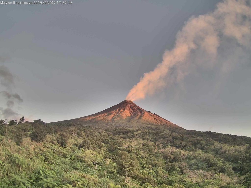
Mayon Volcano’s seismic monitoring network recorded four (4) volcanic earthquakes and two (2) rockfall events during the 24-hour observation period. Moderate emission of white steam-laden plumes that rose 250 meters before drifting west-northwest, northwest, and west-southwest was observed. Fair crater glow from the summit could be observed at night. Sulfur dioxide (SO2) emission was measured at an average of 743 tonnes/day on 26 April 2019. Precise leveling data obtained on 09 – 17 April 2019 indicate a slight inflation of the edifice relative to 20 – 26 March 2019. This is consistent with continuous GPS data showing inflation of the edifice since June 2018.
Alert Level 2 currently prevails over Mayon Volcano. This means that Mayon is at a moderate level of unrest. DOST-PHIVOLCS reminds the public that sudden explosions, lava collapses, pyroclastic density currents or PDCs and ashfall can still occur and threaten areas in the upper to middle slopes of Mayon. DOST-PHIVOLCS recommends that entry into the six kilometer-radius Permanent Danger Zone or PDZ and a precautionary seven kilometer-radius Extended Danger Zone or EDZ in the south-southwest to east-northeast sector, stretching from Anoling, Camalig to Sta. Misericordia, Sto. Domingo must be strictly prohibited. People residing close to these danger areas are also advised to observe precautions associated with rockfalls, PDCs and ashfall. Active stream/river channels and those identified as perennially lahar-prone areas on all sectors of the volcano should also be avoided especially during extreme weather conditions when there is heavy and prolonged rainfall. Civil aviation authorities must advise pilots to avoid flying close to the volcano’s summit as airborne ash and ballistic fragments from sudden explosions and PDCs may pose hazards to aircrafts.
Source : Phivolcs.
Photo : volcanodiscovery.
Indonesia , Anak Krakatau :
Information on the eruption of G. Anak Krakatau, May 14, 2019.
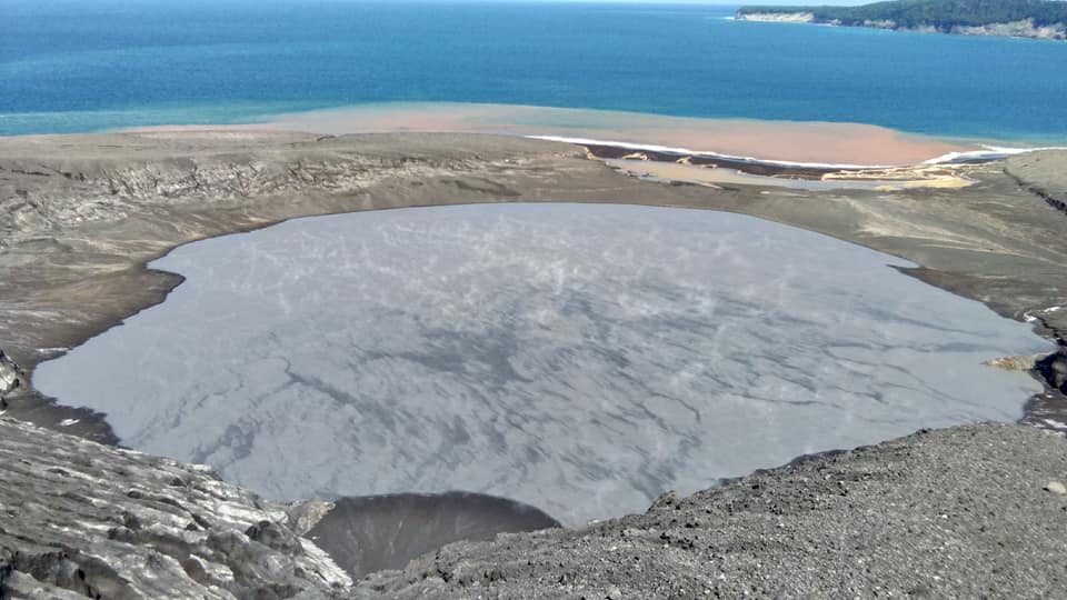
An eruption of Mount Anak Krakatau, occurred on May 14, 2019 at 00:21, but the height of the ash column was not observed. This eruption is recorded on a seismogram of maximum amplitude of 55 mm and a duration of ± 1 minute 7 seconds.
There was no noise.
Currently, G. Anak Krakatau is at alert level II (Waspada) with recommendations : People / tourists are not allowed to approach the crater within 2 km.
VOLCANO OBSERVATORY NOTICE FOR AVIATION – VONA.
Issued: May 13 , 2019
Volcano: Anak Krakatau (262000)
Current Aviation Colour Code: ORANGE
Previous Aviation Colour Code: orange
Source: Anak Krakatau Volcano Observatory
Notice Number: 2019KRA79
Volcano Location: S 06 deg 06 min 07 sec E 105 deg 25 min 23 sec
Area: Lampung, Indonesia
Summit Elevation: 502 FT (157 M)
Volcanic Activity Summary:
Eruption with ash clouds at 17h21 UTC (00h21 local time). The eruption lasted for67 seconds.
Volcanic Cloud Height:
Ash-cloud is not visible
Other Volcanic Cloud Information:
0
Remarks:
Eruption recorded on seismogram with maximum amplitude 55mm and duration 67 second.
Source : PVMBG , Magma Indonesia.
Photo : Yohannes Tyas Galih Jati / VolcanoDiscovery, Mai 2019
Mexico , Popocatepetl :
May 13, 11:00 am (May 13, 16:00 GMT).
During the last 24 hours, thanks to the surveillance systems of the Popocatépetl volcano, 33 exhalations have been identified, accompanied by steam and gas.
During the night, no glow was observed on the crater.
At the time of writing, there is a slight emission of water vapor and volcanic gases that winds are scattering from east to northeast.
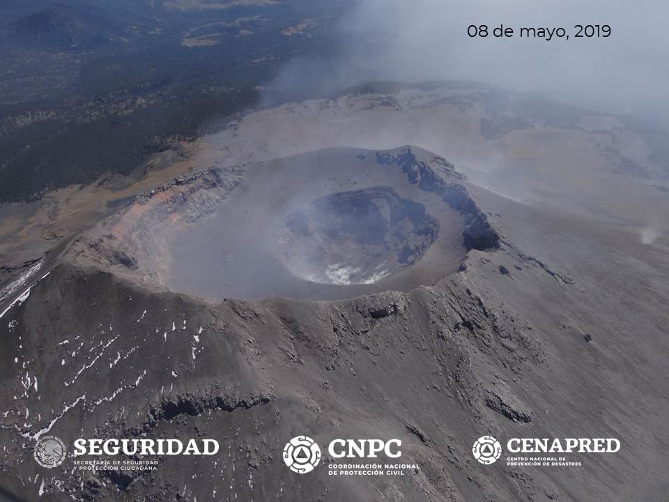
On Wednesday, May 8, an overflight was made for a reconnaissance on Popocatépetl volcano, with the support of the federal police, CENAPRED personnel and UNAM, to see the current state of the internal crater and determine the changes made to it. During the flyover, the weather conditions were good, which allowed to see clearly inside the crater. It was observed that no dome was formed and that the internal crater retained the same dimensions of about 350 m diameter and 250 m depth.
The monitoring system of the Popocatepetl volcano operates 24 hours a day. CENAPRED closely monitors any event. Any changes to the monitoring parameters will be reported promptly.
CENAPRED urges NOT to APPROACH the volcano and especially the crater, because of the risk of falling ballistic fragments, and in case of heavy rains, to move away from the bottom of the ravines because of the risk of mudslide and debris.
The Popocatepetl Volcanic Warning Light is located at the YELLOW PHASE 2 level.
Source : Cenapred .


