April 30 , 2019.
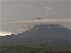
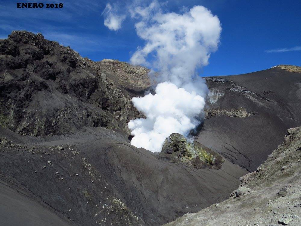
Peru , Sabancaya :
An average of 8 Explosions / day has been recorded. The activity associated with fluid movements (long period type) continues to predominate. On the other hand, the earthquakes associated with the rise of the magma (hybrid types) remain very few and not very energetic.
The columns of gas and eruptive ash reached a maximum height of about 1700 m above the crater. The dispersion of these materials occurred within a radius of approximately 20 km, mainly in the Northeast, Southeast and Southwest directions.
The volcanic gas (SO2) flow recorded on April 27 a maximum value of 4020 tons / day, a value considered important.
The GNSS-SBSE station, which measures the deformation, has detected a slight increase in the deformation associated with an apparent process of inflating the volcano.
Four thermal anomalies were recorded according to the MIROVA system, with values between 1 and 24 MW VRP (Radiated Volcano Energy).
Eruptive activity maintains moderate levels. The occurrence of explosions and / or larger emissions in the coming days is not excluded.
Source : IGP.
Photo : Ingemmet.
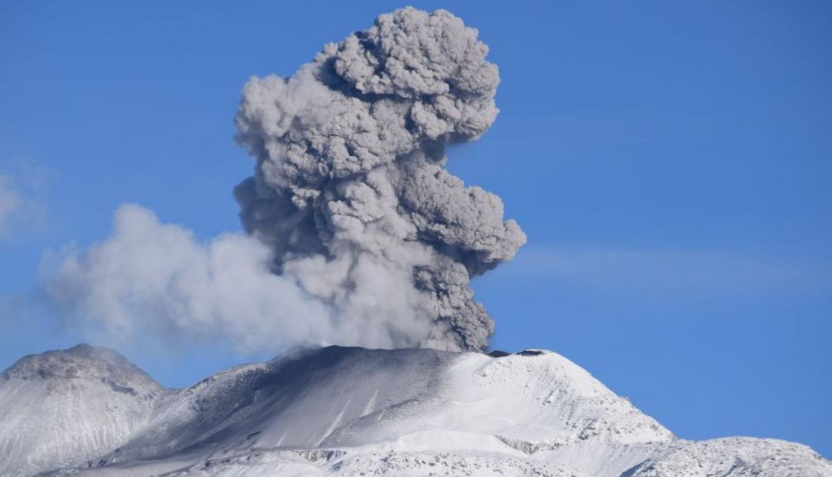
Indonesia , Agung :
VOLCANO OBSERVATORY NOTICE FOR AVIATION – VONA.
Issued: April 29 , 2019
Volcano: Agung (264020)
Current Aviation Colour Code: ORANGE
Previous Aviation Colour Code: orange
Source: Agung Volcano Observatory
Notice Number: 2019AGU19
Volcano Location: S 08 deg 20 min 31 sec E 115 deg 30 min 29 sec
Area: Bali, Indonesia
Summit Elevation: 10054 FT (3142 M)
Volcanic Activity Summary:
Eruption with volcanic ash cloud at 21h34 UTC (05h34 local).
Volcanic Cloud Height:
Best estimate of ash-cloud top is around 13254 FT (4142 M) above sea level, may be higher than what can be observed clearly. Source of height data: ground observer.
Other Volcanic Cloud Information:
Ash-cloud moving to east.
Remarks:
Seismic activity is characterized by volcanic earthquakes
An eruption of Mount Agung occurred on April 30, 2019 at 5:34 am WITA, with ash column height observed at ± 1,000 m above the summit (± 4,142 m above sea level). The column of ash was observed of gray color with a thick intensity, directed towards the East. This eruption was recorded on a seismogram of maximum amplitude of 25 mm and a duration of ± 2 minutes 15 seconds.
Currently, G. Agung is at Level III (SIAGA) with recommendations:
(1) The communities around Mount Agung and mountaineers / visitors / tourists must not climb or carry out any activity in the estimated danger zone, ie in all areas within 4 km radius of Mount Crater. Agung. The estimated risk area is dynamic and continues to be evaluated. It can be modified at any time to follow the most recent observation data from G. Agung.
(2) Communities that reside and move around the rivers that flow from the Gunung Agung must be aware of the potential secondary hazard in the form of descent of lahars that may occur especially during the rainy season and if the material eruption is always deposited in the area of the summit.
Source : Magma Indonésie , PVMBG.
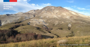
Chile , Copahue :
Special Report on Volcanic Activity (REAV), Bio-Bio Region, Copahue Volcano, 29 April 2019, 18:35 local time (mainland Chile).
The National Geological and Mining Service of Chile (Sernageomin) publishes the following PRELIMINARY information, obtained through monitoring equipment of the National Volcanic Monitoring Network (NVRN), processed and analyzed at the Volcanological Observatory of the Southern Andes (OVDAS) :
Yesterday, Monday, April 29, 2019 at 17:52 local time (21:52 UTC), monitoring stations installed near the Copahue volcano recorded an earthquake, associated with a fracturing process of rocks (volcano-tectonic type). This event was located 10.3 Km north-east of the crater El Agrio.
The characteristics of the event, after its analysis, are as follows:
TIME OF ORIGIN: 17h52 (GMT -4)
LATITUDE: -37.811 ° S
LONGITUDE: -71.058 ° W
DEPTH: 10.3 KM
LOCAL MAGNITUDE: 3.1 (ML)
OBSERVATIONS:
At the time of issuing this report, 3 smaller aftershocks were observed. In addition, the images obtained with the fixed camera do not show any superficial anomaly from the El Agrio crater.
The level of volcanic technical alert remains at the level: Yellow.
Sernageomin continues online monitoring and will inform in a timely manner about any changes observed.
Source : Sernageomin.
Photo : Sernageomin.
Guatemala , Fuego :
Type of activity: Vulcanian
Morphology: Composite Stratovolcano
Geographical location: 14 ° 28’54˝ Latitude N; 90 ° 52’54˝ Longitude O.
Height: 3,763msnm.
Weather conditions: Clear weather
Wind: North East at 3 km / h
Precipitation: 0.0 mm
Activity:
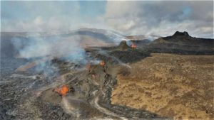
Presence of white degassing fumarole at a height of 4,400 m, dispersing in a west and south-west direction. There are 17 to 25 weak, moderate and heavy explosions per hour, which expel columns of gray ash at a height of 4500 to 4900 m / l (14764 to 16076 feet) dispersing about 15 to 20 kilometers to the south, the Southwest and West. At night and early in the morning, incandescence was observed between 200 and 300 meters above the crater, generating weak to moderate avalanches on the contour of the crater towards the ravines of Seca, Taniluyá, Ceniza, Trinidad and Las Lajas. The materials go down to the edge of the vegetation. Low to moderate rumblings are perceived which give rise to weak shock waves, causing vibrations in the roofs of homes, mainly in the communities to the west and southwest. Lava flows to the Seca ravine on the west flank for an approximate length of 500 meters. There are drops of fine ash particles in communities such as Panimache I and II, Morelia, Finca Santa Sofia, Sangre de Cristo and others located in this direction.
Source : Insivumeh
Photo : Moises Castillo / Sputnik.