February 15 , 2019.
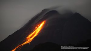
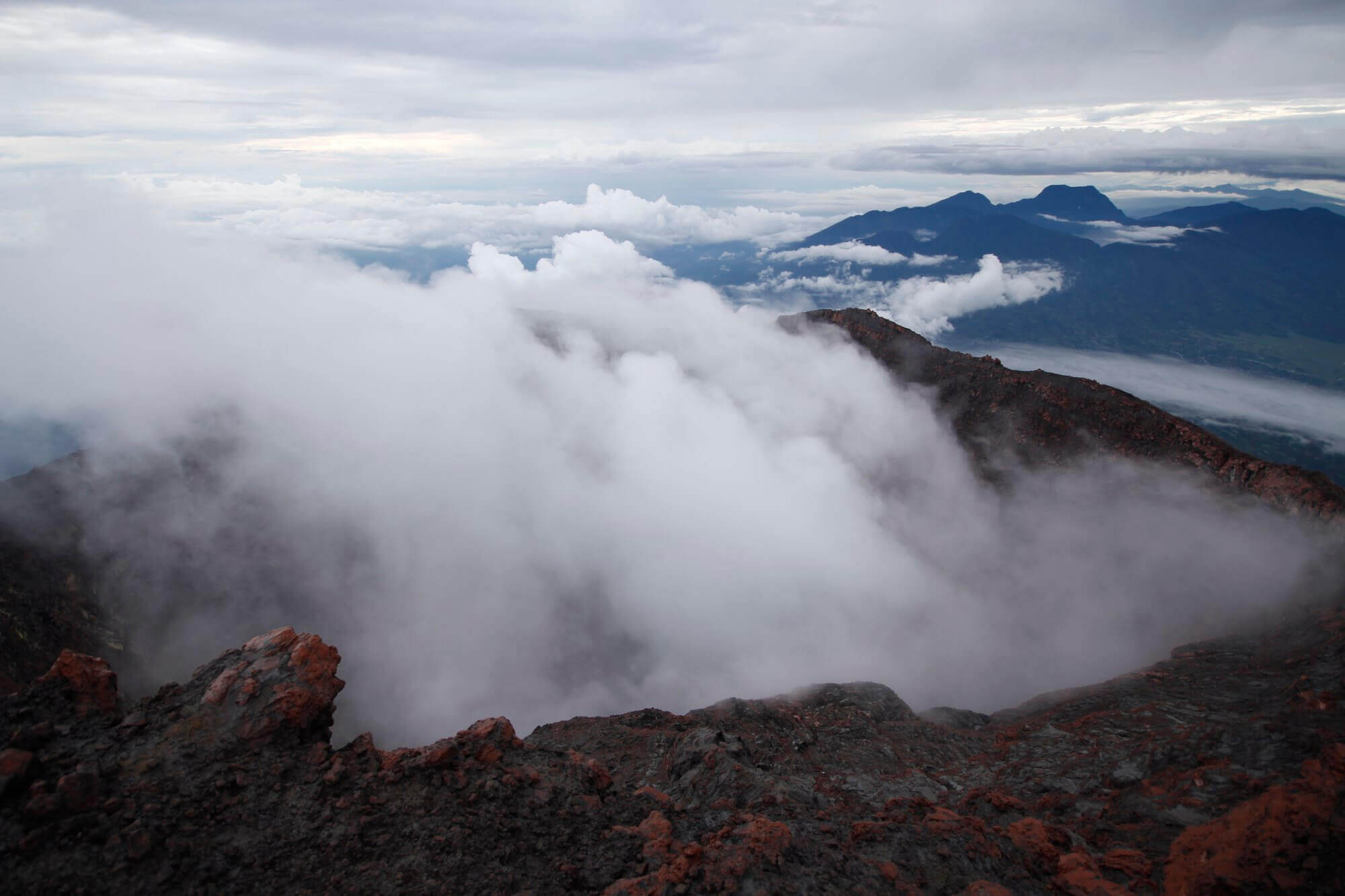
Indonesia, Agung :
Information about the eruption of G. Agung.
There was an eruption of Mount Agung in Bali on February 14, 2019 at 4:34, but the height of the ash column was not observed. This eruption is recorded on a seismogram of maximum amplitude of 17 mm and a duration of ± 3 minutes 40 seconds.
It was observed an incandescence in the crater on the webcams.
Currently, G. Agung is at Level III (SIAGA) with recommendations:
(1) The communities around Mount Agung and mountaineers / visitors / tourists must not climb or carry out any activity in the estimated danger zone, ie in all areas within 4 km radius of Mount Crater. Agung. The estimated danger zone is dynamic and continues to be evaluated. It can be modified at any time to follow the most recent observation data.
(2) Communities that reside and move around the rivers that flow from the Gunung Agung must be prepared for the potential secondary threat of the sahars that can occur especially during the rainy season and if the eruption material is still deposited in the summit area.
Source : PVMBG.
Photo : Suryana Arimbawa.
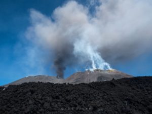
Indonesia , Kerinci :
VOLCANO OBSERVATORY NOTICE FOR AVIATION – VONA
Issued: February 13, 2019
Volcano: Kerinci (261170)
Current Aviation Color Code: YELLOW
Previous aviation color code: orange
Source: Kerinci Volcano Observatory
Notice number: 2019KER02
Location of the volcano: S 01 deg 41 min 49 sec E 101 deg 15 min 50 sec
Region: Jambi, West Sumatra, Indonesia
Elevation of the summit: 12176 ft (3805 m)
Summary of volcanic activity:
on February 13, 2019, a brownish-white ash emission ejected from the vent was observed continuously at 06:09 UTC (1h30 local)
Height of the volcanic cloud:
The best ash cloud summit estimate is around 13456 FT (4205 M) above sea level, which may be higher than can be clearly seen. Source of height data: ground observer.
Other information about volcanic clouds:
ash emission moving north-east
Remarks:
Seismicity is dominated by continuous volcanic tremor
Source : PVMBG.
Photo : Wild Sumatra .
Chile , Planchon Peteroa :
Special Report on Volcanic Activity (REAV), Maule Region, 14 February 2019, 12:30 local time (mainland Chile).
The National Geological and Mining Service of Chile (Sernageomin) publishes the following information, obtained from the surveillance equipment of the National Volcanic Monitoring Network (RNVV), processed and analyzed at the Volcanological Observatory of the Southern Andes (OVDAS):
Today, Thursday, February 14, 2019, through surveillance cameras, installed in the vicinity of the Planchon Peteroa volcanic complex recorded an increase in the height of particulate emissions, with a column of emission rising from 2000 m approximately above the crater, dispersing to the northeast. Concerning the tremor type signal, this one does not show significant variations, with reduced displacement values not greater than 1 cm2.
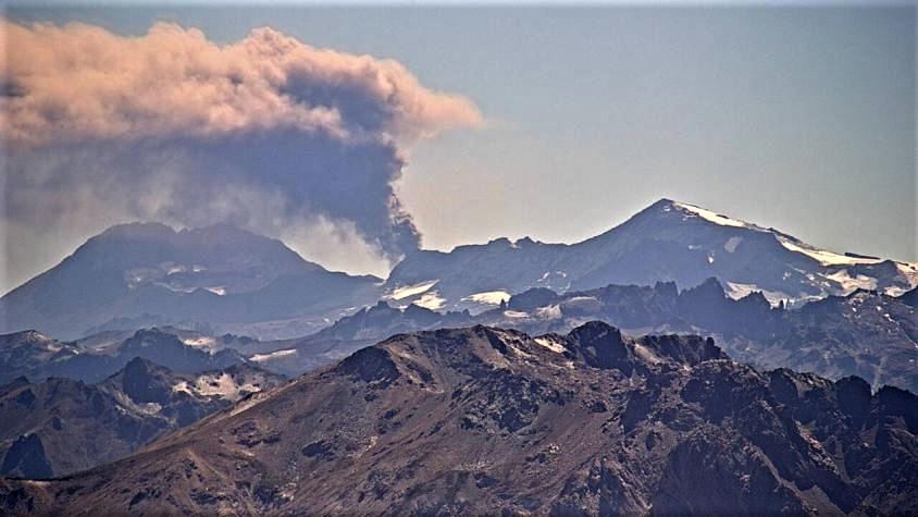
This increase in surface activity is similar to that reported in the REAV report issued on February 1, suggesting an oscillatory behavior of the volcanic system.
In this context, it is possible that new events such as the one recorded in the last few hours will occur, and include more energy, as described in some previous activity reports.
OBSERVATIONS:
At the time of issuing this report, the surface activity continues at the level described above.
The level of volcanic technical alert remains at the level: Yellow.
Sernageomin continues online monitoring and will inform in a timely manner about any changes observed.
Source et photo : Sernageomin.
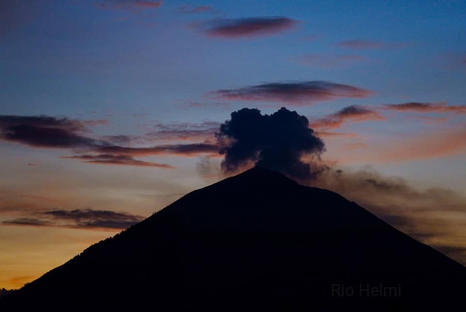
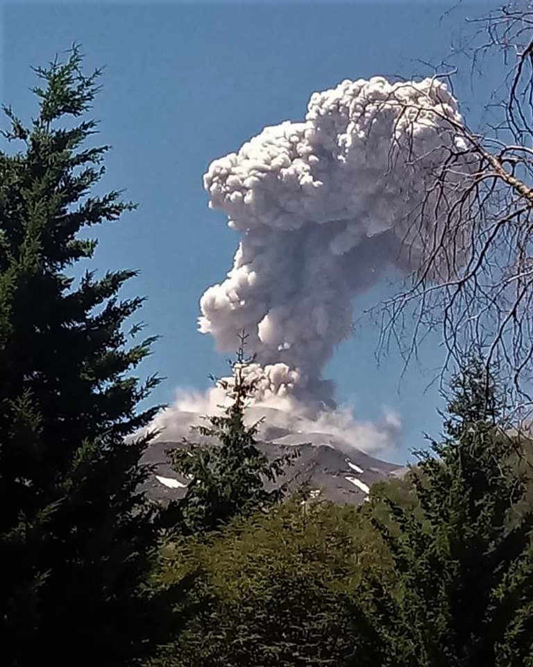
Chile , Nevados de Chillan :
Nuble Region, Nevados Volcano of Chillan, February 15, 2019, 02:00 local time (mainland Chile)
The National Geological and Mining Service of Chile (Sernageomin) publishes the following PRELIMINARY information, obtained from monitoring equipment of the National Volcanic Monitoring Network (RNVV), processed and analyzed at the Volcanological Observatory of the Southern Andes (OVDAS) :
Today, Friday 15 February 2019 at 01h09 local time (04:09 UTC 15 February), monitoring stations near the Nevados volcano of Chillan recorded an explosive event, associated with the occurrence of a long earthquake period (LP), which was associated with fluid dynamics within the volcanic system.
The location of the earthquake after its analysis is:
TIME OF ORIGIN: 01h09 Local time (04h09 UTC)
LATITUDE: 36.8635 ° S
LONGITUDE: 71.375667 ° W
DEPTH: 0.5 KM
REDUCED MOVEMENT: 1196.87 cm2
ACOUSTIC SIGNAL: 32.71 Pa reduced to 1 KM
OBSERVATIONS:
The explosion was associated with the recording of a seismic signal having a reduced displacement value (seismic energy) of 1196.87 cm2 considered high. Also, it was possible to observe an incandescence associated with emissions of gas and particulate materials at high temperatures, falling on the surroundings of the active crater. The preceding events make it possible to envisage a partial destruction of the dome located in the crater. This event is consistent with the scenario of the current level of activity present. At the time of this report, no other abnormal signals were recorded.
The level of volcanic technical alert remains at the level: ORANGE.
Sernageomin continues online monitoring and will inform in a timely manner about any changes observed.
Source : Sernageomin .
Photo : OVDAS
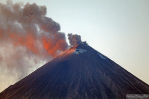
Guatemala , Fuego :
Type of activity: Vulcanian
Morphology: Composite Stratovolcano
Geographical location: 14 ° 28’54˝ Latitude N; 90 ° 52’54˝Longitude West.
Height: 3,763 meters above sea level
Weather conditions: Clear weather.
Wind: South.
Precipitation: 0.0 mm.
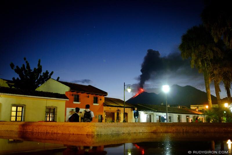
Activity:
A white fumarolic activity is observed. The OVFGO reports weak, moderate, and strong explosions in a range of 11 to 16 per hour, expelling gray ash columns at heights of 4,400 and 4,800 meters. (14435 to 15749 feet) which spread to the east and south-east of the volcanic complex over a distance of 10 to 15 kilometers. Some explosions generate moderate rumblings, accompanied by shock waves, that make the roofs and windows of the houses vibrate at San Juan Alotenango, La Finca La Candelaria, El Porvenir and others on this flank. Following the blasts, ash falls were reported in San Juan Alotenango and others in the region, as well as in Cudad Vieja and Antigua Guatemala. In the night, an incandescent source located 150-300 meters above the crater was observed. Constant avalanches have been observed from the crater contour towards the Cenizas, Las Lajas, Taniluya and Barranca Seca ravines.
Source : Insivumeh.
Photo : Rudygiron
Mexico , Popocatepetl .
February 14, 11:00 am (February 14, 17:00 GMT)
During the last 24 hours, 140 exhalations were identified using the monitoring systems of the Popocatépetl volcano, accompanied by steam and gas. In addition, five volcano – tectonic earthquakes were recorded, the first three recorded yesterday at 12:52, 21:44 and 21:50, the two remaining today at 08:29 and 08:36, with a calculated magnitude of 1.8, 1, 8, 2.1, 1.9 and 2.0, respectively; during the night, the crater was not visible.
Updated February 14 at 10:30 pm (February 15 at 4:30 GMT)
From 21:00, an emission of incandescent fragments on the slopes of the volcano was observed, as well as the continuous emission of volcanic gases and ash dispersed towards the South-West, so that falls of the ashes are probable in the localities of this sector. Initially, the height of the column reached 800 m. However, at the time of this update, a height of 2 km was observed.
This type of activity is considered in phase 2 of the Yellow Volcanic Warning Level. Any changes will be reported as soon as possible.
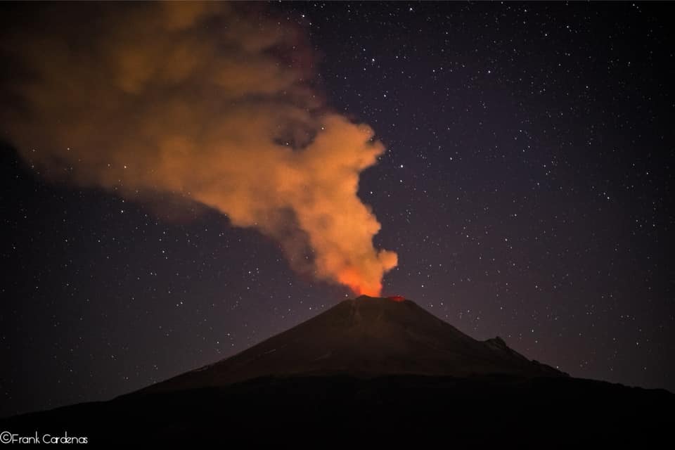
Updated February 15th at 12:00 am (February 15th at 6:00 am GMT)
At the time of this update, the eruptive activity started at 21:00 continues with the emission of incandescent fragments, a short distance on the slopes of the volcano, as well as ashes, with an eruption column height of 2 km scattered to the southwest. The ash fall in the localities of this sector is probable.
This type of activity is considered in phase 2 of the Yellow Volcanic Warning Level. Any changes will be reported as soon as possible.
At the time of this report, we can observe the slight continuous emission of volcanic gases that disperse in the South-East direction.
CENAPRED urges NOT to APPROACH the volcano and especially the crater, because of the risk of falling ballistic fragments, and in case of heavy rains, to move away from the bottom of the ravines because of the risk of landslides and mudslides.
The Popocatepetl warning light is located at Amarillo Phase 2.
Source : Cenapred .
Photo : Frank Cardenas