January 26 , 2019.
Alaska , Cleveland :
52°49’20 » N 169°56’42 » W,
Summit Elevation 5676 ft (1730 m)
Current Volcano Alert Level: WATCH
Current Aviation Color Code: ORANGE
Strongly elevated surface temperatures were observed in satellite imagery January 19-20 reflecting growth of a lava dome. Since January 20, satellite views have been obscured by clouds. No explosions have been detected since January 9, although the presence of the new lava dome since January 12 may increase the likelihood of explosive activity at the volcano.
Intermittent explosions are common at Cleveland and will likely occur without warning. Most explosions have a short duration and only present a hazard to aviation in the immediate vicinity of the volcano. Larger explosions that present a more widespread hazard to aviation are possible, but less likely and/or frequent.
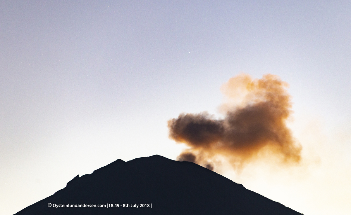
Alaska Airlines pilot Dave Clum took this photo of the Islands of the Four Mountains on the afternoon of Saturday, January 19, 2019. A small steam plume at the summit of Cleveland volcano is visible in the middle of the photo.
The local infrasound array and a second seismic station near Cleveland that have been offline since September 23, 2018, began returning data again on January 25. The local web camera remains offline. Despite this improvement, Cleveland volcano is only monitored by two seismic stations limiting AVO’s ability to detect precursory unrest that may lead to an explosive eruption. Rapid detection of an ash-producing eruption may be possible using a combination of seismic, infrasound, lightning, and satellite data.
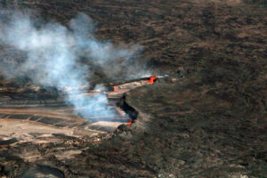
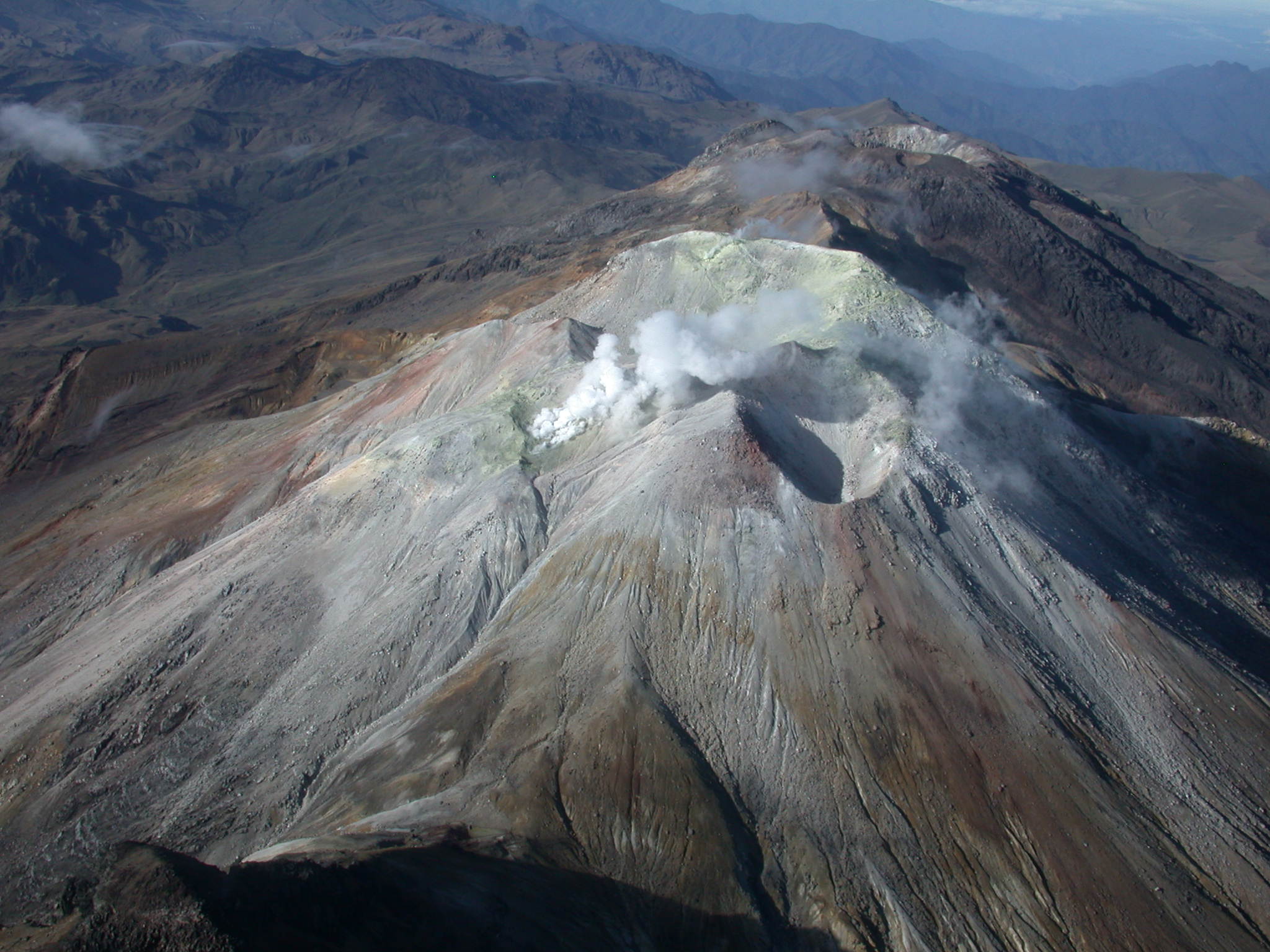
Cleveland volcano forms the western portion of Chuginadak Island, a remote and uninhabited island in the east central Aleutians. The volcano is located about 75 km (45 mi) west of the community of Nikolski, and 1500 km (940 mi) southwest of Anchorage. The most recent significant period of eruption began in February, 2001 and produced 3 explosive events that generated ash clouds as high as 39,000 ft above sea level. The 2001 eruption also produced a lava flow and hot avalanche that reached the sea. Since then, Cleveland has been intermittently active producing small lava flows, often followed by explosions that generate small ash clouds generally below 20,000 ft above sea level. These explosions also launch debris onto the slopes of the cone producing hot pyroclastic avalanches and lahars that sometimes reach the coastline.
Source : AVO
Photo : Clum, Dave, Daily mail.
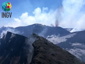
Colombia , Cumbal :
Weekly activity of the volcano Cumbal.
The level of activity of the volcano continues at the level: YELLOW LEVEL or (III): CHANGES IN THE BEHAVIOR OF THE VOLCANIC ACTIVITY.
Following the activity of the CUMBAL VOLCANIC COMPLEX, the COLOMBIAN GEOLOGICAL SERVICE (SGC) reports that:
For the period January 15 to 21, 2019, seismic occurrence levels were maintained with values similar to those reported in previous periods, with a total for this week of 427 events. Seismicity classified as volcano-tectonic type and associated fractures of the cortical material was predominant. Most of these earthquakes have been located near the Mundo Nuevo crater (south-southwest of the Cumbal volcanic complex) at shallow depths; the maximum local magnitude was M 0.6 on the Richter scale.
Favorable atmospheric conditions at the summit made it possible on January 17 to observe the gas emissions coming mainly from the El Verde fumarol field north-northeast of the volcanic complex; the emission columns were observed of white color, of height and direction variable according to the action of the winds.
The COLOMBIAN GEOLOGICAL SERVICE is attentive to the evolution of the volcanic phenomenon and will continue to inform in a timely manner of the observed changes.
Source : SGC
Photo : Ingeominas.
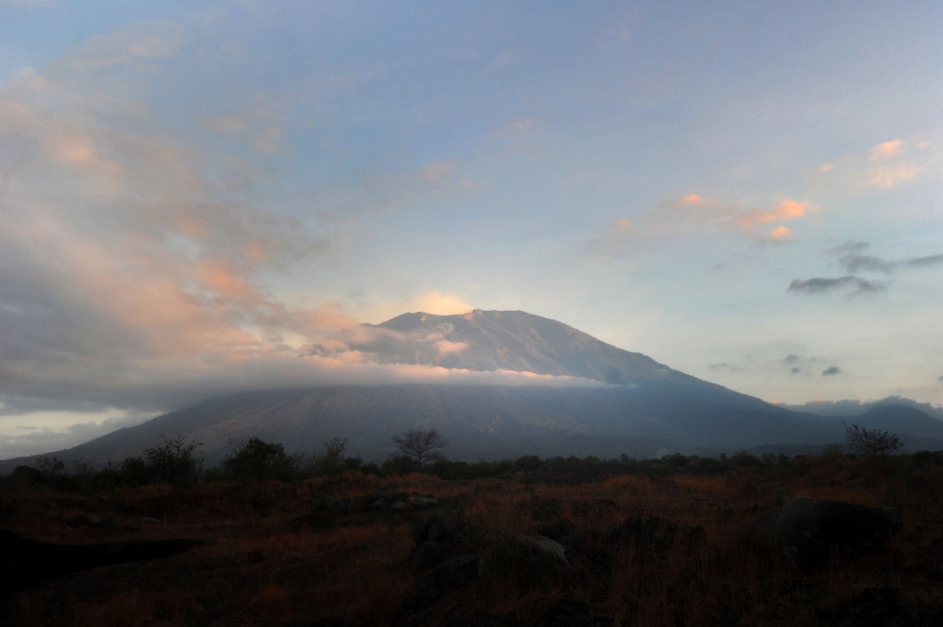
Indonesia , Agung :
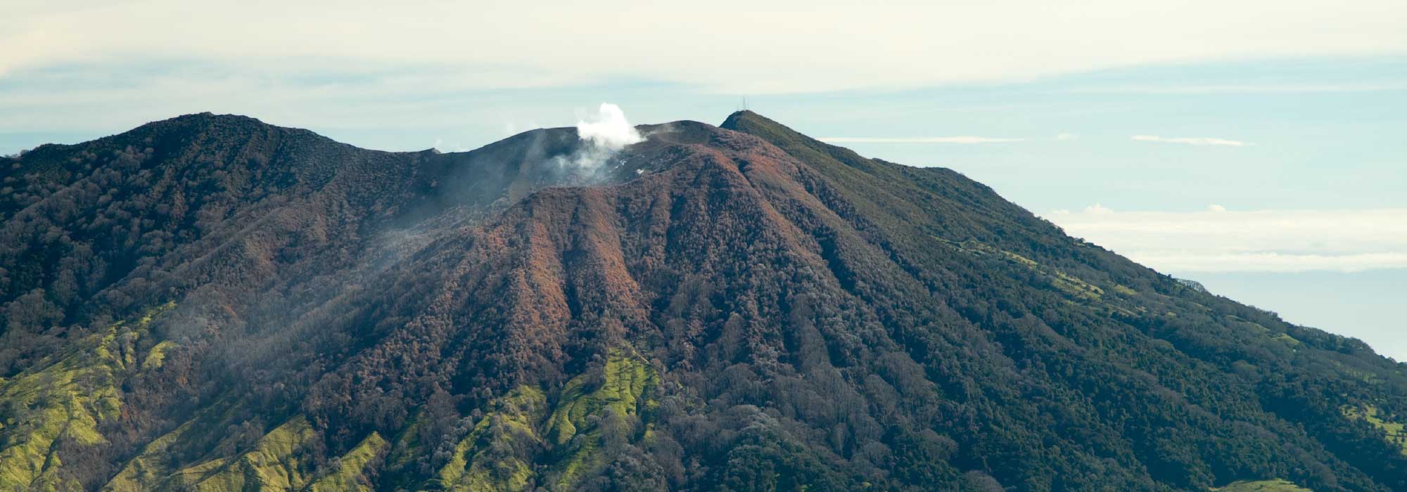
Level of Activity at Level III (SIAGA). G. Agung (3142 m altitude) has been in crisis since 21 November 2017. The last eruption took place on 23 January 2019.
Since yesterday and until this morning, the volcano was clearly visible until it was covered with fog, weak winds rose in the East. The smoke from the crater is white, thin and rises 50 meters above the summit.
Through the seismographs, on January 25, 2019, it was recorded:
1 earthquake emission
1 shallow volcanic earthquake
7 distant tectonic earthquakes
The seismicity of January 26, 2019 (00: 00-06: 00 WITA) noted:
1 shallow volcanic earthquake
1 distant tectonic earthquake
Recommendation:
The communities around G. Agung and mountaineers / visitors / tourists do not have to be active in the estimated risk zone, ie in all areas within a radius of 4 km around Mount Agung crater.
The estimated danger zone is dynamic and continues to be evaluated. It can be modified at any time to follow the most recent observation data.
Communities that live and move around streams from Gunung Agung are sensitized to the potential secondary hazard in the form of lahar descents that can occur especially during the rainy season and if the eruption material is still exposed in the peak area.
VONA: the last VONA code sent a color code ORANGE, published on January 23, 2019 at 3:18 AM WITA, related to eruptive emissions with a height of the column of ash can not be observed because the mountain was covered with fog. The amplitude of the earthquake was 23 mm and its duration was 116 seconds.
A Russian man has been found injured on the slopes of Mount Agung in Bali on Friday, 10 hours after he was declared missing. The man who was identified only as Alexander was found with an injury to his leg and wrist.
Alexander was reported missing by his friends on Thursday night. The 28-year-old was climbing the volcano with three other people, two from Ukraine and one from France. They had ignored the authorities’ alert status that advised people to stay away from the volcano’s peak.
They had started to hike the mountain on Thursday morning. Alexander separated from the group during the journey and went missing.
The Bali Search and Rescue Agency immediately started an operation to find him and entered the forbidden zone on the volcano. He was found safe at around 10 a.m. on Friday morning at a height of 2,049 meters above sea level.
“[The climbers] are safe. [Alexander] suffered an injury to his leg and wrist,” said agency head I Made Junetra on Friday.
Karangasem Disaster Mitigation Agency head Ida Bagus Ketut Arimbawa deplored the action of Alexander and his friends. “Hiking Mt. Agung is prohibited as the volcano could erupt at any time,” Arimbawa said.
Arimbawa explained that the volcano is now on the third alert level and the area 4 kilometers from the summit is prohibited for any activity.
The Volcanology and Geological Disaster Mitigation Center has announced that the alert status of the volcano is at the third level out of four stages of emergency status, which means that hiking and other activities are not allowed within a radius of 4 km from the summit.
The authorities have forbidden climbing Mt. Agung since volcanic activity increased in 2017.
“We hope that all people, including tourists, obey there rules,” said Arimbawa.
Source : PVMBG , The Jakartapost.
Photos : Oystein Lund Andersen ,Sonny Tumbelaka .
Costa Rica , Turrialba / Poas / Rincon de la Vieja :
Daily State Report of Volcanoes, Date: January 25, 2019, Updated at: 10:55:00.
Turrialba Volcano:
No eruption is reported.
The seismic activity is lower than yesterday.
At the time of this report, the winds are blowing west.
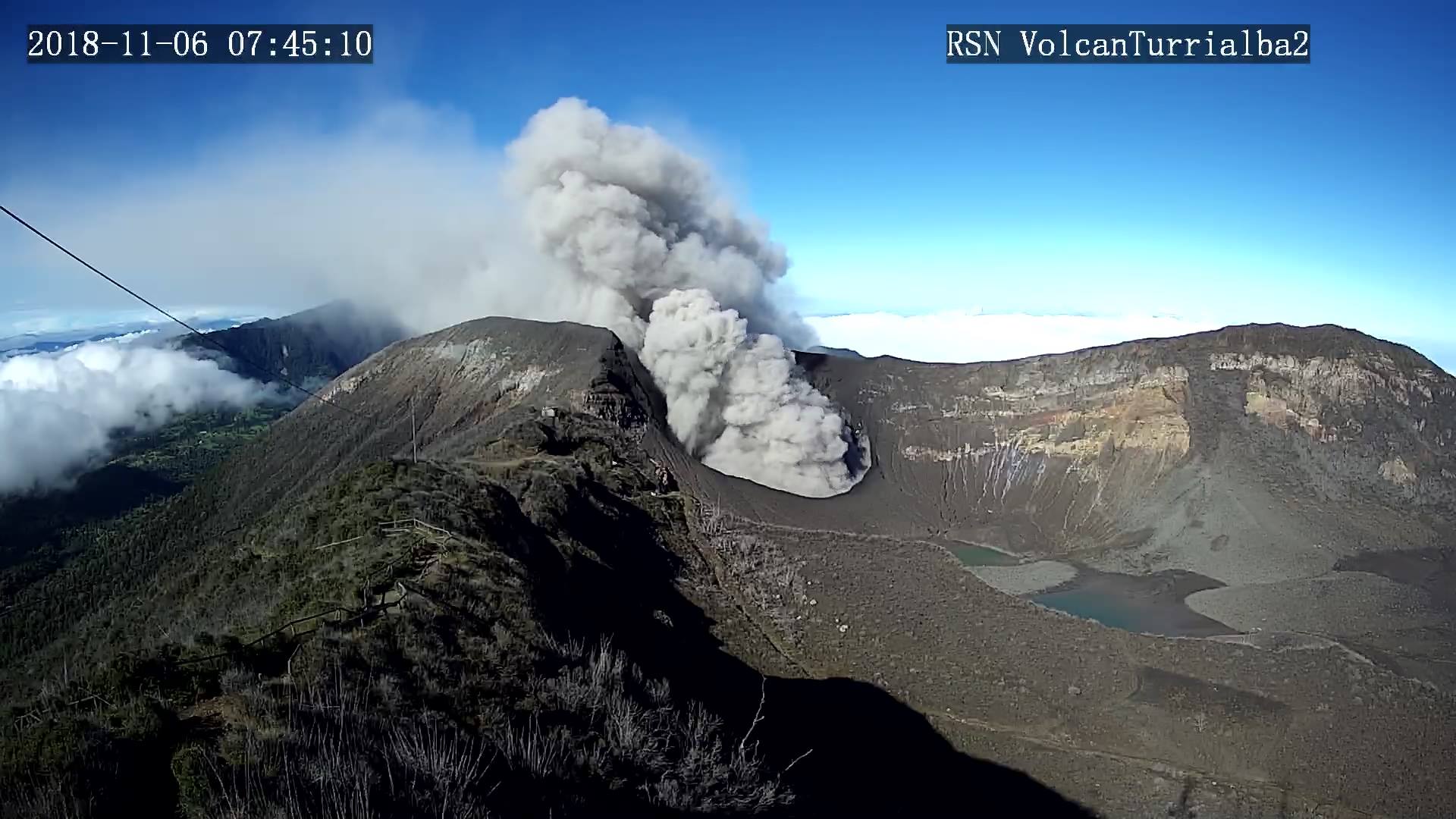
The Turrialba volcano maintains small, less frequent expirations and low passive degassing. There are no earthquakes or volcano-tectonic earthquakes, but only low frequency volcanic earthquakes in fewer numbers than in previous months.
Poas Volcano:
No eruption is reported.
The seismic activity is similar to that of yesterday.
At the time of writing, winds are blowing from the southwest.
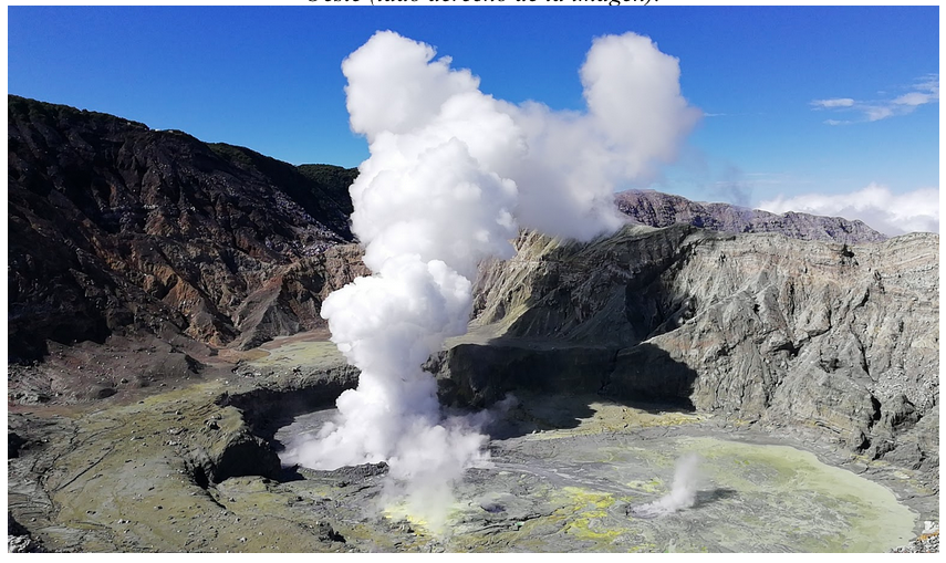
The Poás volcano maintains a strong outgassing through the three aerial fumaroles, mainly from the fumarole forming the ancient dome. There is still a large number of low frequency volcanic earthquakes, but of very low amplitude.
Rincon de la Vieja Volcano:
No eruption is reported.
The seismic activity is more important compared to the day yesterday.
At the time of this report, the winds are blowing west.
The Rincón de la Vieja volcano continues to exhibit sporadic eruptions. However, between 11 am yesterday and 11 am today, there was no eruption. Sporadic low frequency volcanic earthquakes and prolonged tremors of low amplitude are recorded.
Source : OVSICORI-UNA
Photos : Archives RSN , Ovsicori , Auteur inconnu.