July 25 , 2018.
Italy / Sicily , Etna :
Etna shows signs of awakening: strombolian activity at the top.
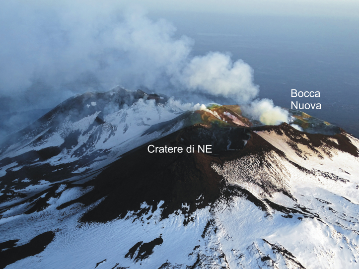
More than 14 months have passed since the last eruption of Etna. An eruptive activity that, between January and April 2017, produced numerous lava flows and Strombolian explosions from the summit of the new Southeast crater. Now, Etna shows signs of gradual awakening, with strombolian eruptive activity that focuses on the mouths of the volcano, especially the New Bocca and the Northeast Crater.
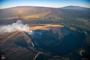
Figure 1 – Aerial view of Mount Etna, taken on 25 April 2018 by Boris Behncke (INGV-OE) during a flight over Etna with Orazio Aleppo.
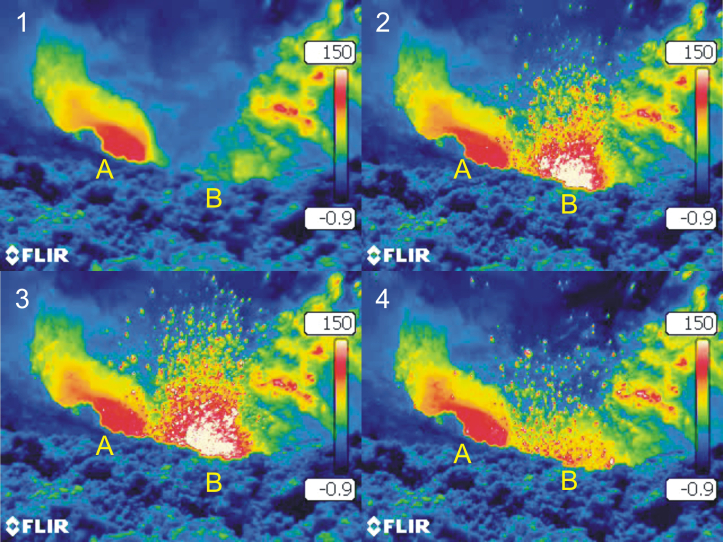
The first to « wake up » is the Bocca Nuova, which has been producing a strong and continuous roar for a few weeks. In recent days, the intensity of activity has gradually increased and now, the thermal images taken during the surveillance inspections clearly show strombolian explosions that occur from two mouths located at the bottom of the crater. From time to time, flakes of incandescent lava are thrown into the air until they reach the edge of the New Mouth, falling mainly indoors (Figure 2).
Figure 2 – Thermal images of a Strombolian explosion, located at the bottom of the crater of Bocca Nuova (from 1 to 4). At the bottom of the crater are two openings (A and B), which project flames of incandescent lava up to a few tens of meters high. The images were taken on July 17, 2018 by Giuseppe Salerno (INGV-OE) during a direct surveillance inspection of the eruptive activity of Etna.
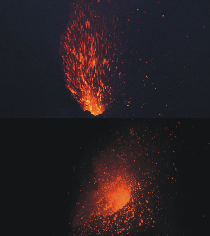
Even the crater of the Northeast has been reactivated significantly. Remember that during the eruption of May 2016, this crater was completely blocked by eruption products, but in November 2017 it reopened and began to emit the gas plume that characterizes it. These days, the Northeast crater shows a crescendo of activity, with the gradual opening of several mouths on the bottom of its crater, one of which produces small Strombolian explosions. In this case as well, the flames of incandescent lava fall, for the moment, in the same crater North-East (Figure 3).
Figure 3 – Strombolian explosions occurred at the bottom of the Northeast crater and resumed on 20 and 21 July 2018, photo taken by Michele Mammino, thanked for the concession. At the bottom of the crater, there are three vents, one of which projects incandescent lava into the air up to a few tens of meters high.
The direct monitoring of the volcanic activity completes the analyzes carried out through the instrumental networks of the INGV and thus allows to have a complete and precise image of the activity status of the volcano. A particularly necessary work in this summer, when the volcano is frequented by a multitude of tourists and fans of Etna.
Source : Dr Boris Behncke et Marco Neri
https://ingvvulcani.wordpress.com/2018/07/24/letna-da-segni-di-risveglio-attivita-stromboliana-in-area-sommitale/
Hawai , Kilauea :
Tuesday, July 24, 2018, 12:43 PM HST (Tuesday, July 24, 2018, 22:43 UTC)
19°25’16 » N 155°17’13 » W,
Summit Elevation 4091 ft (1247 m)
Current Volcano Alert Level: WARNING
Current Aviation Color Code: ORANGE
Kīlauea Volcano Lower East Rift Zone
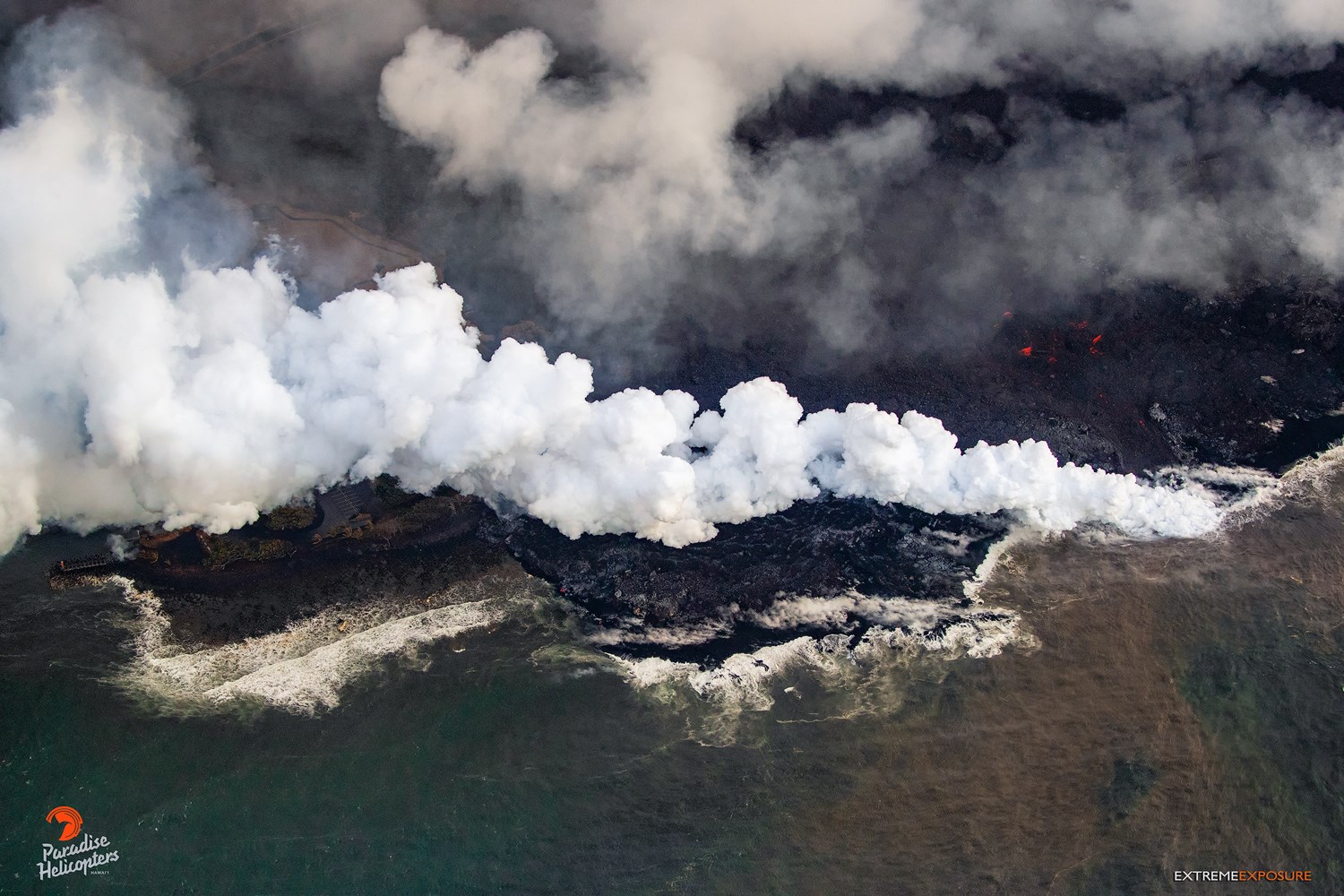
Fissure 8 continues to erupt lava into the channel leading northeastward from the vent. Crews in the field today do not report an increase in lava output from Fissure 8 following this morning’s summit collapse event at 6:41 HST.
In the last day, ooze outs along the edge of the lava flow in the Ahalanui area have caused the flow to expand westward. The flow is now about 175 m (0.1 miles) from the Pohoiki boat ramp in Isaac Hale Park. The active ocean entry is still a few hundred yards to the east of this lava flow edge.
No other fissures are active this morning.
Kīlauea Volcano Summit
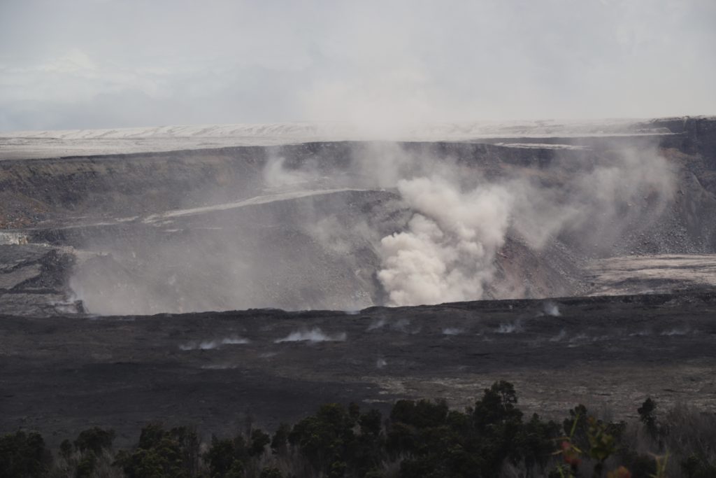
Dust rising from the south side of the crater produced by a prolonged rockfall this afternoon.
The last collapse event occurred at 6:41 AM HST today, July 24, and was similar in character and magnitude to previous events. Seismicity is currently relatively quiet, but the number of earthquakes is expected to increase again in the next few hours. The next collapse event is expected tomorrow afternoon or evening.
Source : HVO.
Colombia , Galeras :
Subject: Weekly Activity Bulletin of Galeras Volcano
The level of activity of the volcano continues at the level:
YELLOW LEVEL ■ (III): CHANGES IN THE BEHAVIOR OF VOLCANIC ACTIVITY.
Following the activity of the GALERAS volcano, SERVICIO GEOLÓGICO COLOMBIANO informs that:
For the period from July 17 to 23, 2018, earthquakes associated with rock fracturing, called volcano-tectonic types, continue to predominate, showing a slight increase in both number and released seismic energy relative to the previous week. Most earthquakes continue to be recorded north-east of the summit of the volcanic building up to a distance of 9 km, with depths of less than 9 km from the top of the volcano (4,200 m.s.n.m.). Other earthquakes are scattered at distances up to 17 km, with depths less than 15 km from the top of the volcano. The events recorded on July 18 at 12:12, 23 July at 3:57 and 23 July at 4:31 magnitudes respectively 2,3, 1,4 and 1,7, were reported as felt by residents north of the city of Pasto.
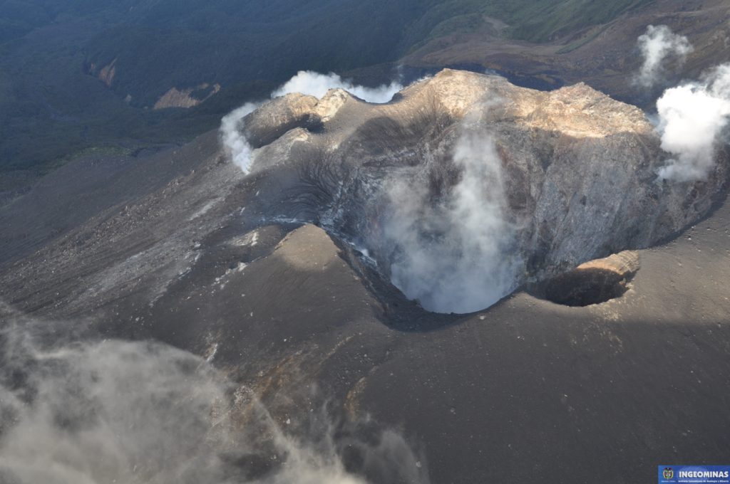
During the assessment period, when weather conditions in the volcano region allowed, it was possible to observe the emissions of gases from the main fumarole fields on the top of the active cone with low exit pressure. , a white color, a low altitude and a direction of dispersion variable according to the direction of the winds.
The other parameters of the geophysical and geochemical type of volcanic monitoring of the Galeras do not record any variations showing a change in the activity level of the volcano.
The SERVICIO Geologico COLOMBIANO remain attentive to the evolution of the volcanic phenomenon and continue to inform in due time the observed changes.
Source : SGC
Indonesia , Anak Krakatau :
Level of Activity at Level II (WASPADA). Anak Krakatau (305 m above sea level) has experienced an increase in volcanic activity since 18 June 2018.
From yesterday to this morning, the volcano was covered with fog. The winds were weak and oriented north and northwest. Crater smoke was not observed.
Thanks to the seismographs of July 24, 2018, it was recorded:
Continuous tremor with a maximum amplitude of 5 to 78 mm (dominant value: 65 mm)
Recommendation: People / tourists are not allowed to approach the crater within 1 km of the crater.
VONA: The latest VONA report received the color code ORANGE, published on July 16, 2018 at 18:45, relating to the eruption recorded with a seismogram of maximum amplitude of 30 mm for a duration of approximately 44 seconds. The height of the eruption column was about 805 m above sea level or 500 m above the peak.
Source : PVMBG.
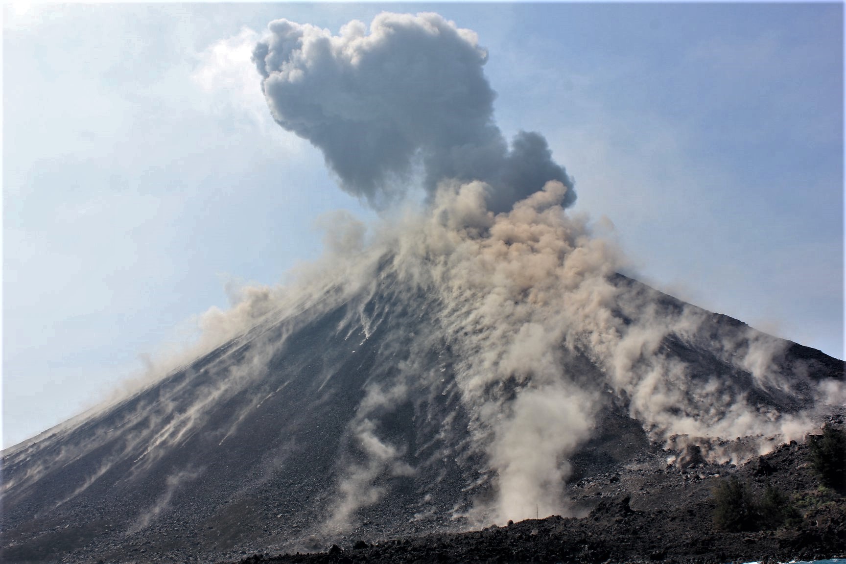
Photo : Xavier Grobet , Activité éruptive des 17/18/19 Juillet.
Indonesia , Agung :
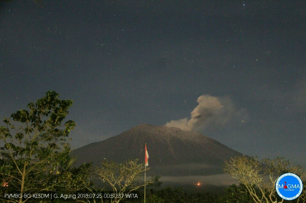
There was an eruption of Mount Agung, Bali, on July 25, 2018 at 00:41 WITA with a height of the ash column observed at ± 700 m above the summit (± 3,842 m above sea level). The column of ash observed is white to gray with a strong intensity, inclined to the east and south-east. This eruption is recorded on seismograms with a maximum amplitude of 7 mm and a duration of ± 2 minutes 15 seconds.
At present, the Agung is at Level III (SIAGA) with the recommendations:
Communities around Mount Agung and climbers / visitors / tourists must not be present, climb or exercise any activity within the estimated danger zone, in all areas within 4 km radius of Mount Agung Crater. The hazard estimation area is dynamic and continues to be evaluated and can be modified at any time after the development of the most current G. Agung observation data.
People living and traveling around the rivers flowing from Mount Agung are aware of the potential threat of secondary hazards in the form of lahars, especially during the rainy season and if the eruptive material is still deposited. The area of the lahars flows follows the streams upstream of Mount Agung.
Source : PVMBG

