July 05 , 2018.
Indonesia , Agung :
Monitoring data:
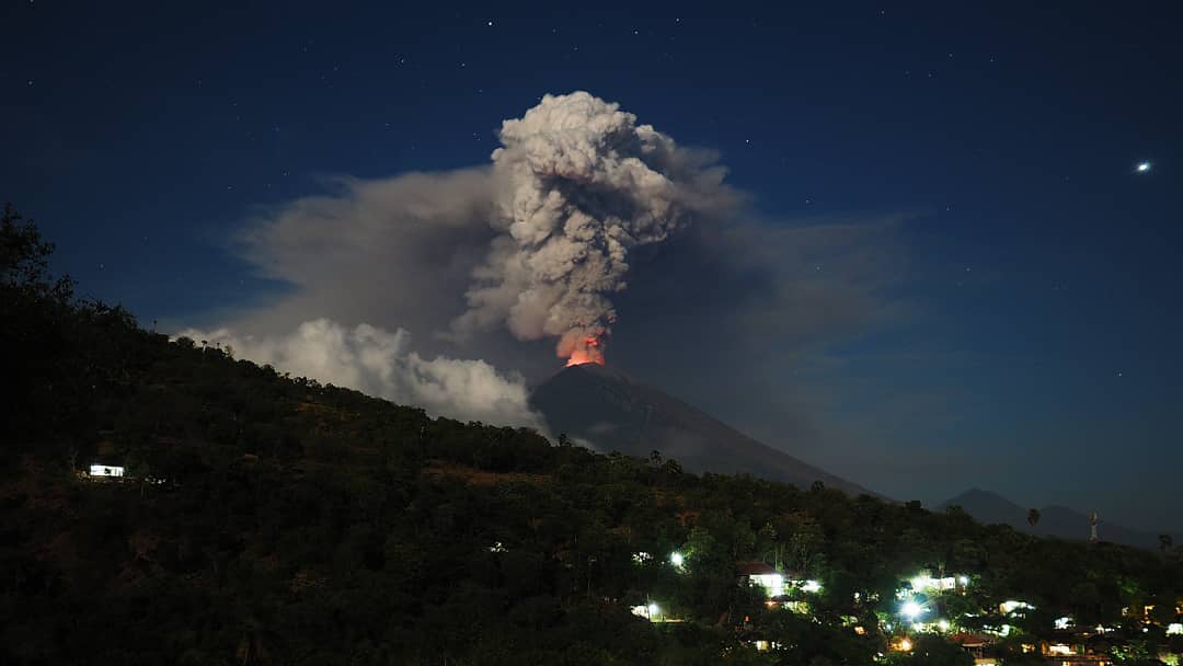
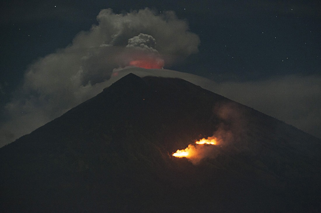
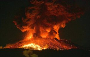
Visually, surface activity is still dominated by eruptions and emission events. The eruption is effusive with a lava flow in the crater or explosive with jets of stone / incandescent lava and ashes. The ashes spread westward following the direction of the wind. A Strombolian eruption occurred on July 2, 2018 at 21:04 h, accompanied by a thud and a thick column of ash that rose 2000 m above the summit and threw rocks / lava radially over the crater area, up to about 2 kilometers. The threat of immediate life-threatening hazards, such as incandescent stone / lava emissions, is still located within a 4 km radius.
Seismically, Gunung Agung’s activity is still dominated by low-frequency earthquakes reflecting the flow of fluids to the surface. The high frequency of volcanic earthquakes reflect the movements of the new magma and are still recorded with relatively low intensity as well as local tectonic earthquakes. The predominance of low frequency seismicity with respect to the high frequency reflects that the flow of magmatic fluid to the surface is relatively smooth when the system tends to be open.
On the deformation, after last week’s eruption series, the Gunung Agung’s body experienced a deflationary trend with decreasing magma fluid pressure inside the volcano. Deformation, however, tends to deflation. Eruptions can occur during an increase in pressure (inflation) as well as in the phase of pressure drop (deflation). The deformation data still indicate that the activity of the
Gunung Agung is not yet stable and that it is still prone to eruptions.
Geochemically, magma gas SO2 is always recorded with a relatively high flux. The flow of SO2 as of July 3, 2018 was in the range of 1400-2400 tonnes / day and the SO2 flow of July 4, 2018 in the range of 400-1500 tonnes / day.
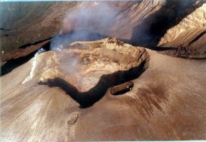
The thermal satellite images indicate that eruptive effusive activity is still ongoing with a lava dome growth volume of around 4-5 million cubic meters last week. The volume of the old lava dome varies around 23 million cubic meters, so the total volume of the lava dome 2017-2018 represents about 50% of the crater empty volume.
Analysis:
Mount Agung is still likely to produce explosive eruptions (strombolian or ash) and effusive (lava flows in the crater).
Recent multi-method monitoring data indicate that the potential for major eruptions accompanied by hot clouds has not been observed.
The activities of Gunung Agung are always dynamic and the trends of the activity can change at any time.
Potential hazards
The most likely hazard at this time is rock / lava emissions from the inside to the outside of the crater, as well as ash columns, the fall of which depends on the direction of wind and its propagation. speed. The descent of Lahars can occur in case of rain and bring eruptive material into the streams flowing from the summit of Mount Agung. Toxic volcanic gas emissions are likely to be present around the crater area.
Source : PVMGB
Photos : rockintravel Xabi Naxwell ( 28 Juin ) , Antara/Nyoman Budhiana .
Hawai , Kilauea :
Wednesday, July 4, 2018, 8:53 AM HST (Wednesday, July 4, 2018, 18:53 UTC)
19°25’16 » N 155°17’13 » W,
Summit Elevation 4091 ft (1247 m)
Current Volcano Alert Level: WARNING
Current Aviation Color Code: ORANGE
Kīlauea Volcano Lower East Rift Zone
The eruption in the lower East Rift Zone (LERZ) continues with no significant change during the past 24 hours.
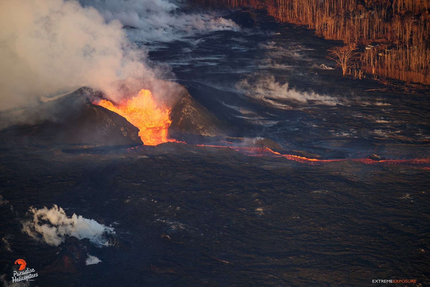
A front view of fissure 8 pumping out approximately 100 cubic meters of molten lava per second!
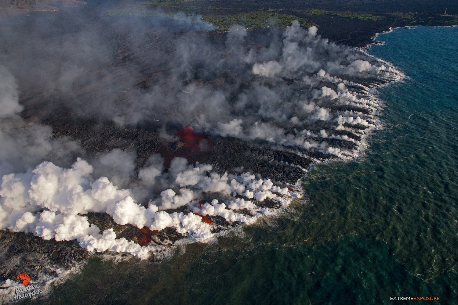
Fountains from Fissure 8 spatter cone continue to supply lava to the open channel with intermittent small, short-lived overflows. The spatter cone is now about 55 m (180 ft) tall at its highest point, and fountains rarely rise above that point. At the coast, the northern margin of the flow field is still oozing pasty lava at several points in the area of Kapoho Ag and Beach Lots. Lava was entering the sea over a broad area this morning primarily on the northern side of the flow front. As shown by the July 02 thermal map of the flow field, the lava channel has crusted over about 0.8 km (0.5 mi) inland of the ocean entry; lava is oozing from the flow’s molten interior into the ocean along most of its broad front. Temporary channel blockages of the Fissure 8 channel causing minor overflows were observed just north of Kapoho Crater by USGS and Civil Air Patrol overflights.
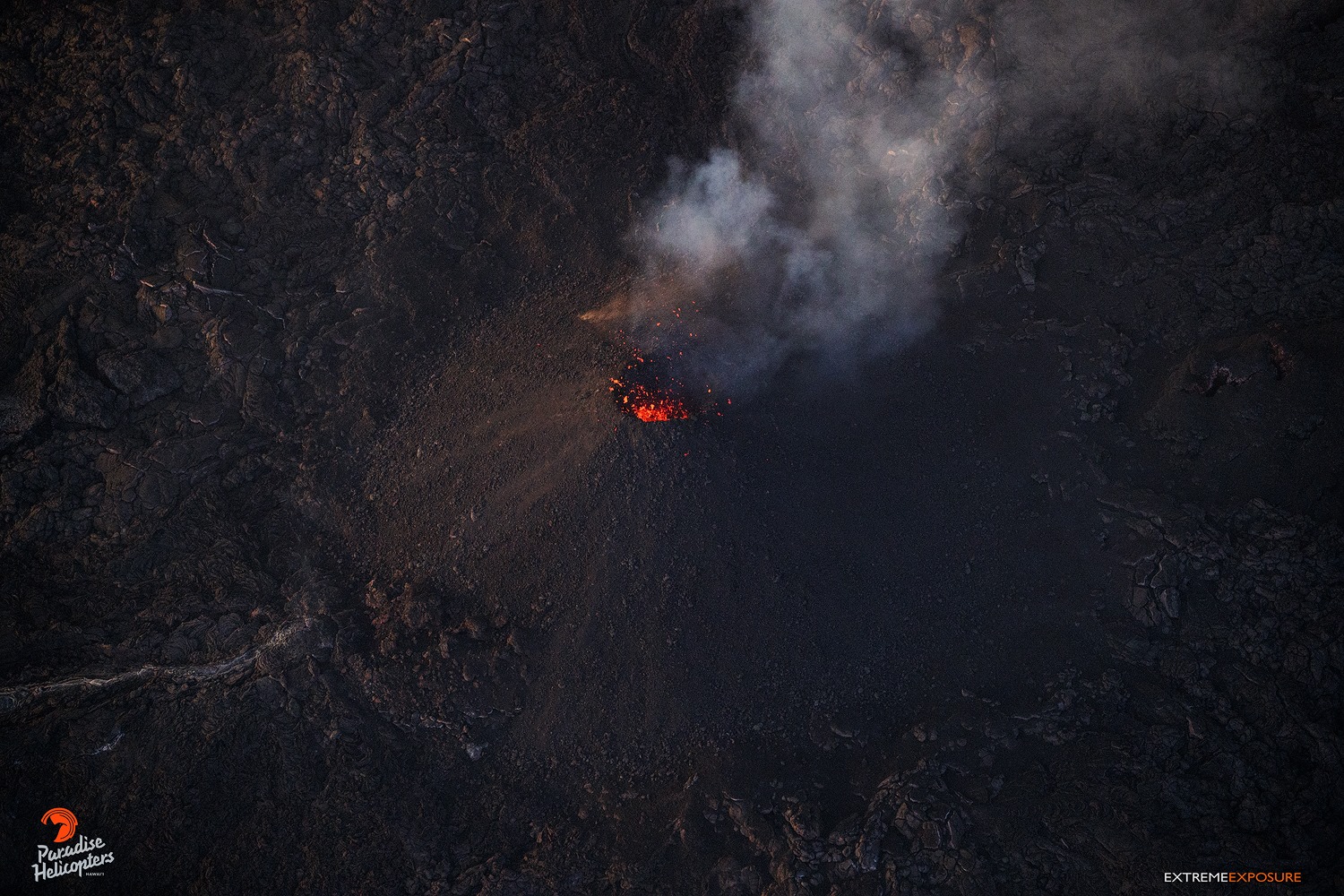
Fissure 22 is spattering about 50-80 m above a conical spatter cone and feeding a short lava flow that is moving slowly to the northeast along the edge of earlier flows.
Pele’s hair and other lightweight volcanic glass fragments from the lava fountain at Fissure 8 continue to fall downwind of the fissure, dusting the ground within a few hundred meters (yards) of the vent. High winds may waft lighter particles to greater distances. Residents are urged to minimize exposure to these volcanic particles, which can cause skin and eye irritation similar to volcanic ash.
HVO field crews are on site tracking the fountains, lava flows, and spattering from Fissure 8 as conditions allow and are reporting information to Hawaii County Civil Defense. Observations are also collected on a daily basis from cracks in the area of Highway 130; no changes in temperature, crack width, or gas emissions have been noted for several days.
Fissure 22 continues to spatter bits of lava and clouds of gas, while the flow leading from it seems to have stagnated, as there was no visible glow during our overflight.
The ocean entry is a hazardous area. Venturing too close to an ocean entry on land or the ocean exposes you to flying debris from sudden explosive interaction between lava and water. Also, the lava delta is unstable because it is built on unconsolidated lava fragments and sand. This loose material can easily be eroded away by surf, causing the new land to become unsupported and slide into the sea. Additionally, the interaction of lava with the ocean creates « laze », a corrosive seawater plume laden with hydrochloric acid and fine volcanic particles that can irritate the skin, eyes, and lungs.
Magma continues to be supplied to the Lower East Rift Zone. Seismicity remains relatively low in the area with numerous small magnitude earthquakes and low amplitude background tremor. Low amplitude tremor increased slightly on June 29 associated with renewed activity at Fissure 22. Higher amplitude tremor is occasionally being recorded on seismic stations close to the ocean entry.
An approximately 2 mile wide flow front enters the sea at Kapoho, forever altering the coastline and shape of the island.
Kīlauea Volcano Summit
After the 02:17 AM HST July 3, a collapse explosion event at Kīlauea’s summit, seismicity dropped abruptly for several hours but has since returned to 20-40 earthquakes per hour, a number of which are in the magnitude 2-3 range. Another collapse explosion is expected within the next few hours. Inward slumping of the rim and walls of Halemaʻumaʻu continues in response to ongoing subsidence at the summit.
Sulfur dioxide emissions from the volcano’s summit have dropped to levels that are about half those measured prior to the onset of the current episode of eruptive activity. This gas and minor amounts of ash are being transported downwind, with small bursts of ash and gas accompanying intermittent explosive activity.
Source : HVO
Photos : Bruce Omori.
Vidéo : USGS
New Zealand , White Island :
Volcanic Alert BulletinWI – 2018/02 2018-07-04 13:40:00 +1200 +1200; White Island Volcano
Volcanic Alert Level remains at 1
Aviation Colour Code remains at Green
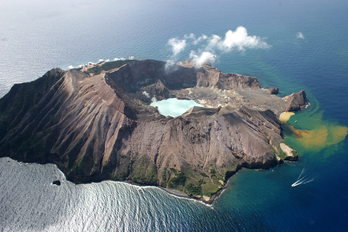
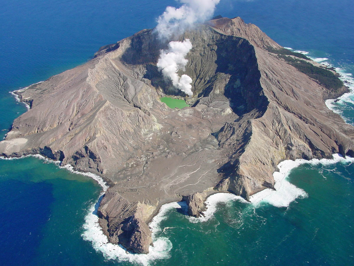
The Crater Lake at White Island continues to grow, which may cause hydrothermal surface activity. The Volcanic Alert Level remains at 1.
As the water level rises it is encroaching on the larger and hotter gas vents on the 2012 lava dome area and will soon start to drown them. Changes in surface hydrothermal activity are expected as vents are drowned, however it is uncertain what form this will take.
Previous lakes have flooded active gas vents and larger scale fumaroles. These vents and fumaroles have been slightly different each time, ranging from wide open vent areas in depressions to individual fumaroles and contrast with the dome environment now present. Drowning of these vents has usually lead to localised steam driven activity; geysering and small hydrothermal eruptions. Some have formed small debris-tuff cones around the active areas during the more violent hydrothermal activity. It is difficult to quantify the style of activity that will occur as the vents are drowned.
In April-May visitors to the island experienced loud sounds from the active crater area. These have now stopped as the geothermal system adjusts to the new lake.
If the lake continues to fill at the current rate it is expected the features on the side of the dome will be drowned early to mid-August and the dome will be totally drowned in 3-4 months’ time. The lake is now 17 metres below overflow and is filling at about 2000 m3 per day. This is essentially the same rate as seen in 2003-4, 2007-8 and 2013.
Observations during a recent monitoring visit to the Island confirmed volcanic activity remains at a steady and low level. The gas rich vents on the western side of the active crater (the Dome area) continue to emit hot, clear gas. The maximum temperature obtained from the vents on the dome was 244 °C, a slight rise. While the temperature of Fumarole Zero continues to decline, now measuring 138 °C. The seismic and acoustic activity generally remain low, and the SO2 gas flux is also low. The lake temperature is 30.4 °C. The ground deformation survey confirms the subsidence pattern towards the active vents continues.
There is no substantial change in the level of volcanic activity at White Island. Crater Lakes have formed in the past and we do see changes in the geothermal activity associated with this, but no signs of increased volcanic unrest. Therefore, current observations are consistent with minor volcanic unrest behavior and because of this, we remain at Volcanic Alert Level 1 and the Aviation Colour Code stays at Green.
Volcano Alert Level 1 corresponds to minor volcanic unrest and the associated hazards. While this is the case, it is a useful reminder that eruptions can occur with little or no warning. GNS Science continues to closely monitor White Island and our other active volcanoes.
Source : Geonet / Brad Scott.
Vanuatu , Yasur :
19.532°S, 169.447°E
Elevation 361 m
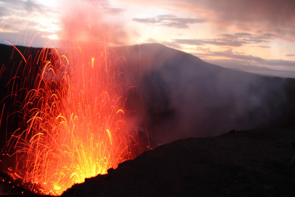
The Vanuatu Meteorology and Geo-hazards Department reported some stronger explosions at Yasur during 27-28 June. Based on webcam images the Wellington VAAC reported that on 29 June intermittent, low-level ash plumes rose to an altitude of 1.8 km (6,000 ft) a.s.l. and drifted NW. The Alert Level remained at 2 (on a scale of 0-4). VGO reminded residents and tourists that hazardous areas were near and around the volcanic crater, within a 395-m-radius permanent exclusion zone, and that volcanic ash and gas could reach areas impacted by trade winds.
The volcanic unrest continues at Yasur. The volcanic activity is likely to continue at similar levels, consistent with Volcanic Alert Level 2; The Danger Zone for life safety is limited in the Permanent Exclusion Zone which is always closed (Shouldn’t be Access) and about 395 m around the eruptive vents .
Observations and seismic data analysis in May confirm that the activity is confined in the crater. The activity consists of ongoing explosions. Some explosions remain strong and volcanic bombs may fall in and/or around the crater. Eruptive vents may emit volcanic gases and ashes cloud. Gas will be continue to be smelt while approaching the caldera and crater.
Alert Level for Yasur has been at the Level 2 since 18th October 2016. The current observations are consistent with the Alert Level 2 activity. Level 2 indicates ‘Major Unrest; Danger Zone is at 395 m around the eruptive vents ’ .
Yasur is the best known and most frequently visited of the Vanuatu volcanoes. It has been in more-or-less continuous Strombolian activity since Captain Cook observed ash eruptions in 1774. This type of activity may have continued since ages. The active cone is largely contained within the small Yenkahe caldera, and is one of the youngest Holocenes volcano (11 700 years to present) of Vanuatu.
Sources: GVP , Département de météorologie et de géo-risques du Vanuatu, Centre consultatif de cendres volcaniques de Wellington (VAAC)

