March 12 , 2018.
Shinmoedake , Japan :
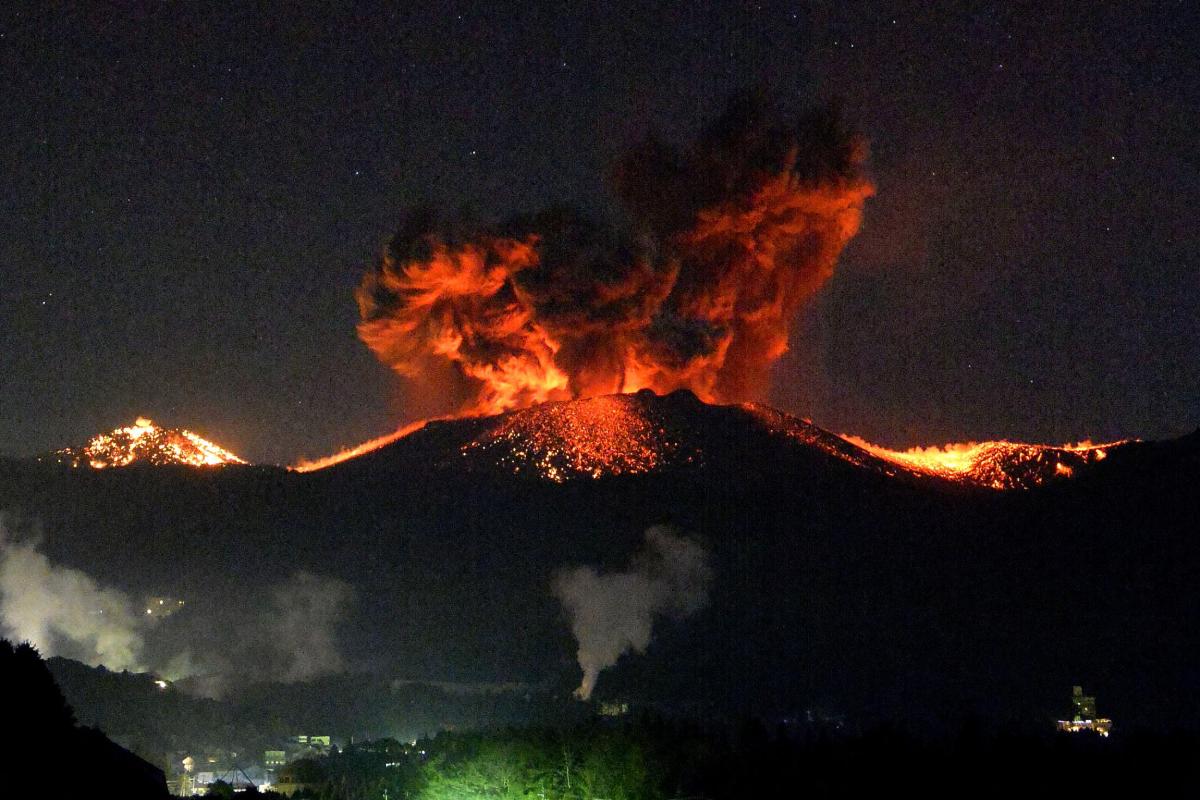
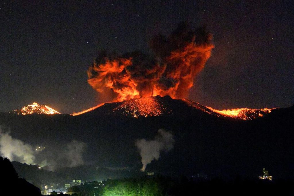
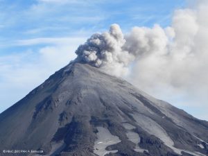
A series of « explosive » eruptions overnight at Mount Shinmoedake in southern Kyushu led the Japan Meteorological Agency to issue new warnings about staying far away from the mountain due to large rocks spewed out of the crater.
Shortly after 5 a.m. on March 10, the agency expanded its advisory about being on the alert for flying large rocks within a 4-kilometer radius of the crater instead of the 3-km caution range that had been in place.
The alert level was kept unchanged at 3, meaning people should keep away from the 1,421-meter mountain.
The last time the JMA cited an area of 4 kilometers from the crater was in March 2011.
According to JMA officials, large volcanic explosions occurred at 1:54 a.m. and again at 4:27 a.m. on March 10. Large rocks were hurled as far as 1,800 meters from the crater.
Smoke and fumes rose 4,500 meters into the air, the highest recorded since the latest eruption flared March 1.
Volcanic explosions continued, causing vibrations of glass and other objects over a wide area due to wind generated by the explosions.
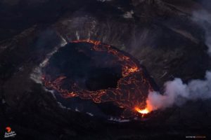
Molten lava flowed over the northwestern side of the volcano.
Officials at the JMA’s Fukuoka Regional Headquarters said the latest eruption bore striking similarities to one in 2011 and estimates that the volcanic activity will continue for several months.
Mount Shinmoedake straddles Miyazaki and Kagoshima prefectures.
Source : Asahi Shinbum
Mayon , Philippines :
MAYON VOLCANO BULLETIN 12 March 2018 08:00 A.M.
Mayon’s activity in the past 24 hours was characterized by general quiescence. Degassing at the active vent could not be observed due to thick clouds covering the summit. At night, lava flows were observed to continue moving downslope within 3.3 kilometers, 4.5 kilometers and 1.9 kilometers from the crater on the Miisi, Bonga and Basud Gullies, respectively.
A total of twenty-six (26) volcanic earthquakes and thirty-nine (39) rockfall events were recorded by Mayon’s seismic monitoring network. Sulfur dioxide (SO2) emission was measured at an average of 2,060 tonnes/day on 08 March 2018. Deflation of the lower flanks that began on 20 February is still being recorded by electronic tilt, although a period of slight inflation of has been recorded by Precise Levelling (PL) surveys this past week. Overall ground deformation data indicate that the edifice is still swollen or inflated relative to pre-eruption baselines.
Alert Level 3 currently prevails over Mayon Volcano. This means that although Mayon’s unrest continues, there is a decreased likelihood of hazardous explosive eruption to occur. PHIVOLCS-DOST reminds the public of sudden explosions, lava collapses, pyroclastic density currents or PDCs and ashfall can still occur and threaten areas in the upper to middle slopes of Mayon. PHIVOLCS-DOST recommends that entry into the six kilometer-radius Permanent Danger Zone or PDZ and a precautionary seven kilometer-radius Extended Danger Zone or EDZ in the south-southwest to east-northeast sector, stretching from Anoling, Camalig to Sta. Misericordia, Sto. Domingo, must be strictly prohibited. People residing close to these danger areas are also advised to observe precautions associated with rockfalls, PDCs and ashfall. Active river channels and those perennially identified as lahar prone areas in the southern and eastern sectors should also be avoided especially during bad weather conditions or when there is heavy and prolonged rainfall. Civil aviation authorities must advise pilots to avoid flying close to the volcano’s summit as airborne ash and ballistic fragments from sudden explosions and PDCs may pose hazards to aircrafts.
PHIVOLCS-DOST is closely monitoring Mayon Volcano’s activity and any new significant development will be immediately communicated to all stakeholders.
Source : Phivolcs.
Dukono , Indonesia :
VOLCANO OBSERVATORY NOTICE FOR AVIATION – VONA.
Issued: March 11 , 2018 .
Volcano: Dukono (268010)
Current Aviation Colour Code: ORANGE
Previous Aviation Colour Code: orange
Source: Dukono Volcano Observatory
Notice Number: 2018DUK30
Volcano Location: N 01 deg 41 min 35 sec E 127 deg 53 min 38 sec
Area: North Maluku, Indonesia
Summit Elevation: 3933 FT (1229 M)
Volcanic Activity Summary:
Eruption with volcanic ash cloud at 22h30 UTC (07h30 local).
Volcanic Cloud Height:
Best estimate of ash-cloud top is around 4893 FT (1529 M) above sea level, may be higher than what can be observed clearly. Source of height data: ground observer.
Other Volcanic Cloud Information:
Ash cloud moving to South.
Remarks:
Eruption and ash emission is continuing.
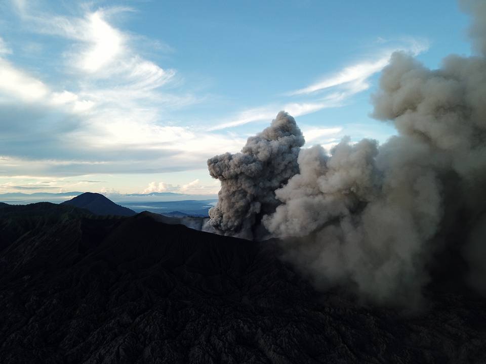
Activity Level at Level II (WASPADA). The Dukono (1229 m above sea level) has a continuous eruption.
Since yesterday until this morning visually the summit of the volcano is often covered with fog. A column of gray ash, high pressure is observed, rising between 100 and 200 m. The wind is oriented towards the South.
The seismographs, dated March 10, 2018 recorded:
1 earthquake of eruption.
1 shallow volcanic earthquake.
A continuous tremor associated with an ash eruption with an amplitude of 0.5 to 15 mm (dominant value of 2 mm).
Recommendation:
Communities around G. Dukono and visitors / tourists should not be active, climb and approach the Malupang Warirang crater within 2 km.
Source : Magma , VSI.
Photo : Sylvain Chermette , 80 jours voyage.
Copahue , Chile :
During this period, two hundred and twelve seismic events, of which eighty-nine were classified as volcano-tectonics (VT type), associated with rock fracturing, were recorded. The most energetic event was associated with a local magnitude (ML) equal to M3.1 and was located 8.2 km east (E) of the active crater El Agrio, at a depth of 3 km.
Similarly, one hundred and twenty three earthquakes associated with fluid dynamics within the volcano, twenty-five of which were classified as long-period type (LP) events, with a maximum reduced displacement value (ROC) of 3 4 cm2 were recorded. In addition, ninety-eight very long-lived earthquakes (VLP type) were recorded, with a maximum displacement value reduced by 6.3 cm2.
Throughout the period, a constant low level tremor signal was recorded, mainly associated with the El Agrio crater gas outlet.
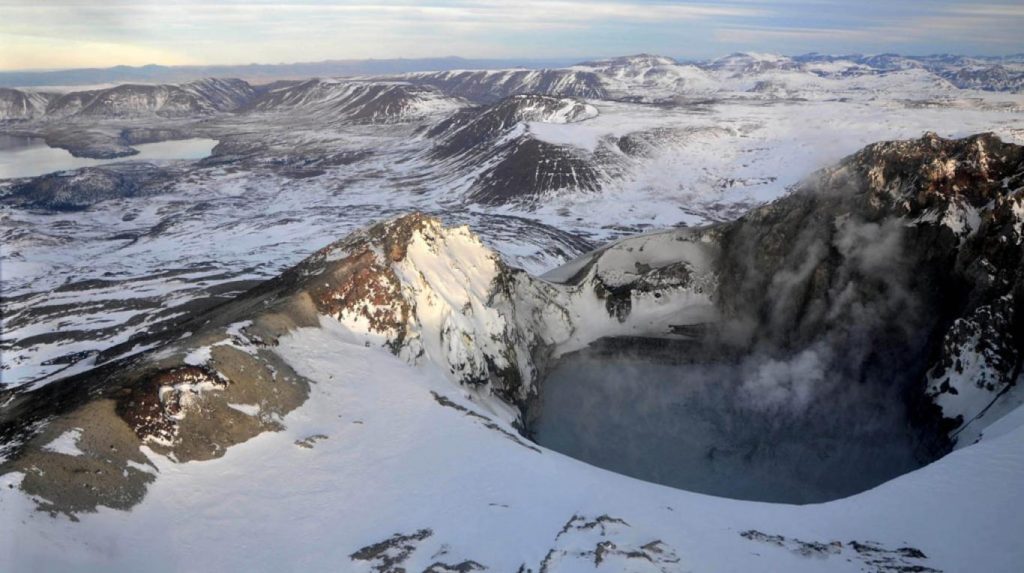
IP cameras installed near the volcano recorded a constant degassing of the active crater (El Agrio), with a maximum height of 550 m. The images obtained in the field were able to confirm the restoration of the crater lake, which had been drained by the magmatic activity present in the 2015-2017 period.
According to the data provided by the two active GNSS stations installed on the volcano, no deformation of the observed surface due to changes in the internal dynamics of the volcano has been noted.
The Sulfur Dioxide Emissions (SO2) recorded by Mellizas Station Equipment (Spectrometric Differential Absorption, DOAS), located 5 km east-northeast (ENE) of the active crater, show an average value for the period of 377 ± 256 t / day, and a maximum daily value of 1096 t / day reported on 9 February. S02 emissions are in base levels for this volcano.
No thermal warning has been reported in the volcano area, according to data processed by the mean infrared observation of volcanic activity (Mirova) (http://www.mirovaweb.it/) and MODVOLC (http: / /modis.higp.hawaii.edu/).
The previous monitoring settings indicate that the system is in a stable state. As a result, the volcano remains at the technical alert level:
GREEN LEVEL: Active volcano with stable behavior – No immediate risk – Time for possible eruption: MONTH / YEARS.
Source : Sernageomin.
San Miguel , ( Chaparrastique ) , El Salvador :
Special Report No. 5
The activity of the Chaparrastic volcano continues with the presence of tremor.
Date and time of publication: 2018-03-09 11:00:00
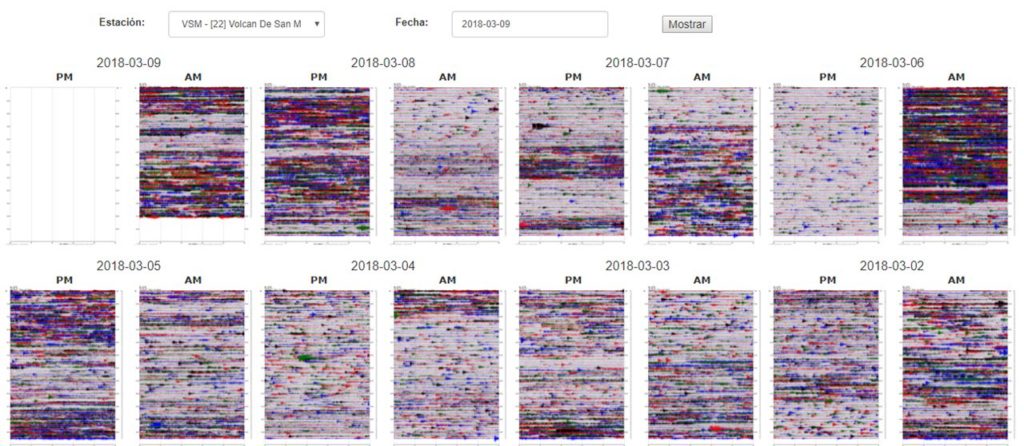
The constant persistence of intermittent signals called volcanic tremors (Figure 1), which are more seismic signals in relation to the fluid flow inside the volcano, which, when passing through cracks or faults is recorded. They are caused by vibrations in the walls from which they transmit energy to the environment in the form of seismic waves that can last from a few minutes to several hours or days, which indicates the active state of the Chaparrastic volcano.
These methods, in addition to the recording of seismic stations, can be observed when the degassing rate is increasing from the central crater indicating that the main duct is not blocked, allowing the circulation of vapors and magmatic gases. to the surface.
Given the current behavior, it is not excluded that in the coming hours the volcano continues to have longer periods of degassing, which could be accompanied by small emissions of ashes. Because of the prevailing wind direction, if this episode occurs, the materials will be transported to the south and west flanks of the crater.
Seismograms recorded by the VSM station During the last 8 days, the illuminated bands reflect the presence of volcanic tremors in the internal system of the volcano.
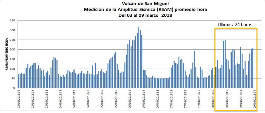
In the last 24 hours, the seismic vibration has fluctuated between 68 and 248 RSAM units, with an average of 156 units, the acceptable threshold being 150 units. (Figure 2)
Figure 2: fluctuation of the measurement of the seismic amplitude recorded during the last 7 days in the VSM station.
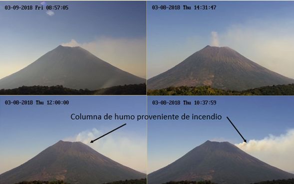
The volcano continues to emit magmatic gases, which are transported to the southwest. The images also capture smoke plumes from a fire that develops in the upper third of the South-South-West side of the volcano (Figure 3).
Figure 3: Different degassing stages captured by the surveillance camera located on the Pacayal volcano. With the black arrows, there are columns of smoke from a fire in the southwestern area of the volcano.
The Ministry of Environment and Natural Resources (MARN) continues the systematic monitoring of the volcano and maintains close communication with the Directorate General of Civil Protection and local observers.
In addition, he asks the general population to stay away from the top of the volcano, as sudden changes in behavior often occur.
If the activity does not evolve, the next report will be published on Friday, March 16, 2018.
Source : Snet.

