November 7 , 2025.
Chile , Planchón Peteroa :
The seismic activity during this period was characterized by the recording of:
39 VT-type seismic events, associated with rock fracturing (volcano-tectonics). The strongest earthquake, with a local magnitude (ML) of 1.8, was located 3.2 km north-northeast of the volcanic edifice, at a depth of 4.9 km.
1,963 LP-type seismic events, associated with fluid dynamics within the volcanic system (long period). The amplitude of the largest earthquake, measured by the reduced displacement parameter (DR), was 17 cm².
2,149 TR-type seismic events, associated with sustained fluid dynamics within the volcanic system (TRemor). The amplitude of the largest earthquake, measured by the reduced displacement parameter (DR), was 22 cm².
Three VLP-type seismic events, associated with the dynamics of large volumes of fluid within the volcanic system (very long period), were recorded. The largest earthquake, measured using the reduced displacement parameter (DR), had a magnitude of 8 cm².
Fluid Geochemistry:
Eight anomalies in sulfur dioxide (SO₂) emissions into the atmosphere were reported near the volcanic complex, according to data published by geoservice.dlr.de. Similarly, the Mounts platform reported a peak SO₂ emission of 1,970 tons for the period of October 26.
Satellite Thermal Anomalies:
Based on the analytical processing of images from the Sentinel-2-L2A satellite, a thermal radiation anomaly was recorded on October 24 in the southwest crater, corresponding to the area of gas and pyroclastic emissions. Furthermore, the MIROVA sensors recorded a thermal anomaly of 1.5 MW with MODIS, four anomalous values with VIIRS750 (maximum of 3.5 MW), and twelve measurements with VIIRS350 (maximum radiative power of 4.2 MW). All peak values were measured on October 20.
Geodesy
Geodetic monitoring of the period, based on an electronic inclinometer located 9.5 km from the emission center and on satellite radar imagery, indicates that:
– No significant variation was observed on the inclinometer that would indicate deep intrusions of material.
– No deformation was observed around the complex by radar interferometry (InSAR) of Sentinel-1A images.
Therefore, no significant deformation or modification associated with deep intrusions was observed in the volcanic system.
Monitoring Cameras
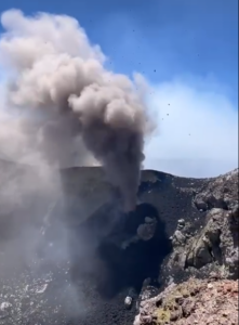
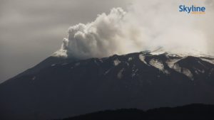
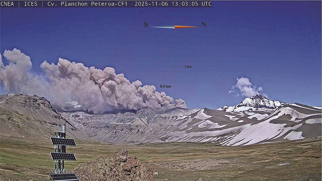
Images from fixed cameras recorded continuous degassing and recurrent pyroclastic emissions from the Southwest Crater, with a maximum column height of 1,600 m above the crater rim. During the evaluation period, high pyroclastic flow events were observed, notably those of October 17 and 25, with respective heights of 1,440 m and 1,100 m.
Furthermore, the activity of October 26 was noteworthy, corresponding to the emission of a significant pyroclastic column. Although it reached a lower height (approximately 700 m), its emission was continuous and lasted for more than an hour.
Satellite Geomorphological Analysis
Based on the photo-interpretation of PlanetScope and Sentinel-2LA satellite images in false and true color, the following conclusions were drawn:
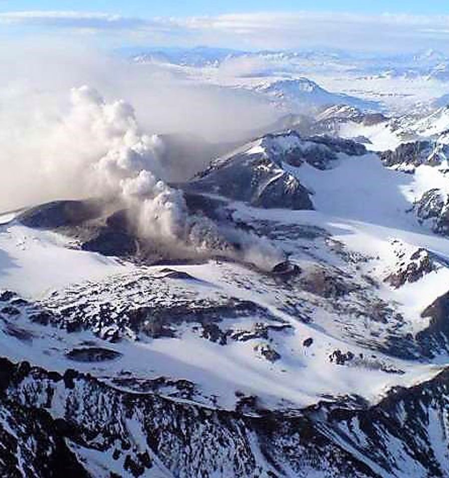
Pyroclastic material emissions generated a fallout deposit with a maximum range of 8.4 km to the southeast and 4.5 km to the north of the active crater, measured between October 26 and 29, 2025. The highest concentration of pyroclastic material was located less than 5 km southeast of the crater and 1 km to the north. The activity visible in the satellite images is concentrated exclusively in the southwest crater, whose crater lake has a surface area of 5,536 m², smaller than that measured during the previous two weeks.
No morphological changes indicating pyroclastic material emissions or other types of volcanic activity were detected in the surrounding craters. However, an increase in the surface area of the North Crater Lake was observed, from 1,328 to 6,795 m². There was no evidence of activation in the other areas during the study period.
During the second half of the month, the Planchón-Peteroa volcanic complex maintained activity levels above baseline, with persistent records of fluid-dynamic earthquakes (some short-duration and others long-duration). At the surface, pulsatile gas plumes persisted, accompanied by localized increases in particulate matter.
These results suggest a transition from a predominantly hydrothermal domain to one with a stronger magmatic component, where deep influx would have intensified interaction with the shallow hydrothermal system, promoting sustained degassing processes and greater openness of the surface system. This transition explains the intensification of emissions, the appearance of incandescences, the SO₂ anomalies and the recently observed seismic variations, justifying the maintenance of the volcanic technical alert: YELLOW TECHNICAL ALERT: Changes in the behavior of volcanic activity.
Source et photos : Sernageomin
Indonesia , Marapi :
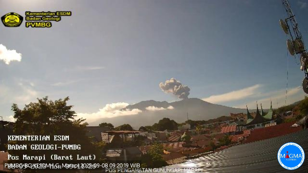
Mount Marapi erupted on Monday, November 3, 2025, at 10:57 AM West Indonesia Time. An ash column was observed approximately 300 meters above the summit (at an altitude of about 3,191 meters). This ash column was gray and denser towards the southeast. The eruption was recorded by a seismograph with a maximum amplitude of 22.5 mm and a duration of 29 seconds.
VOLCANO OBSERVATORY NOTICE FOR AVIATION – VONA
Issued : November 3 , 2025
Volcano : Marapi (261140)
Current Aviation Colour Code : YELLOW
Previous Aviation Colour Code : yellow
Source : Marapi Volcano Observatory
Notice Number : 2025MAR083
Volcano Location : S 0 deg 22 min 52 sec E 100 deg 28 min 23 sec
Area : West Sumatra, Indonesia
Summit Elevation : 9251 FT (2891 M)
Volcanic Activity Summary :
Increasing in volcanic activity.
Volcanic Cloud Height :
Ash-cloud is not observed.
Other Volcanic Cloud Information :
Ash-cloud is not observed.
Remarks :
Eruption recorded on seismogram with maximum amplitude 30.1 mm and maximum duration 32 second.
Source et photo : Magma Indonésie .
Colombia , Los Coconucos volcanic chain:
Popayán, November 4, 2025, 3:00 PM
Regarding the monitoring of activity at the Puracé volcano – Los Coconucos volcanic chain – the Colombian Geological Survey (SGC), an agency under the Ministry of Mines and Energy, reports the following:
During the week of October 28 to November 3, 2025, a continuous volcanic tremor signal continued to be recorded, associated with increased degassing in the Puracé volcano crater since September. Earthquakes related to fluid movement were low-energy and primarily located beneath the western flank of the crater, at depths of less than 1 km. Compared to previous weeks, fracture seismicity remained stable, both in number and seismic energy released. The events mainly occurred between the Puracé, Piocollo and Curiquinga volcanoes, at depths between 1 and 3 km, and with a magnitude of less than 1. Satellite observations and field instruments showed that sulfur dioxide (SO₂) emissions remained constant, with values similar to those of previous weeks.
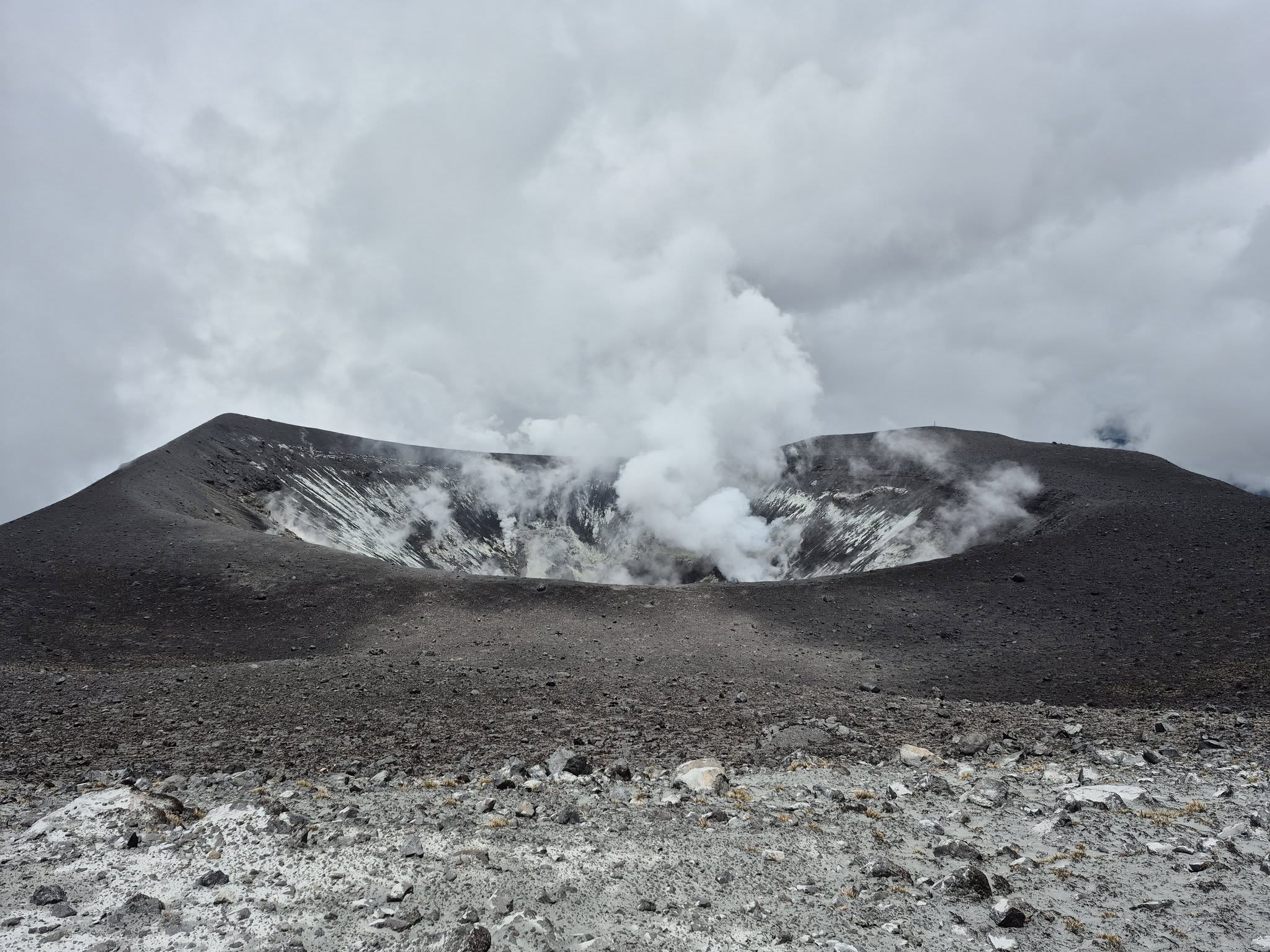
Furthermore, the slow deformation process persists between the Puracé, Piocollo, and Curiquinga volcanoes. This process was detected after the Curiquinga eruption on January 20, 2025. Images captured by satellite sensors and visible and infrared webcams continued to show degassing processes, with a maximum column height of approximately 1.3 km measured from the summit of Puracé volcano, as well as thermal anomalies inside the crater and in the fumarole field on the outer rim.
In conclusion, the variations observed at Puracé volcano and the Los Coconucos volcanic chain indicate that the system remains active and that monitoring parameters remain above their reference values. Therefore, the public is strongly advised against traveling to the upper part of the volcanic chain.
The alert level for volcanic activity remains yellow:
Active volcano showing changes in the basic behavior of monitored parameters and other manifestations.
Source et photo : SGC.
Hawaii , Kilauea :
HAWAIIAN VOLCANO OBSERVATORY DAILY UPDATE , U.S. Geological Survey
Thursday, November 6, 2025, 9:25 AM HST (Thursday, November 6, 2025, 19:25 UTC)
19°25’16 » N 155°17’13 » W,
Summit Elevation 4091 ft (1247 m)
Current Volcano Alert Level: WATCH
Current Aviation Color Code: ORANGE
During the lapse in appropriations, the USGS Hawaiian Volcano Observatory (HVO) continues to maintain monitoring networks and issue updates and notifications of volcanic activity via the Hazard Notification Service. Volcano monitoring data will continue to be available on the HVO website. Static website content will not be updated until further notice and information may become outdated over time.
Activity Summary:
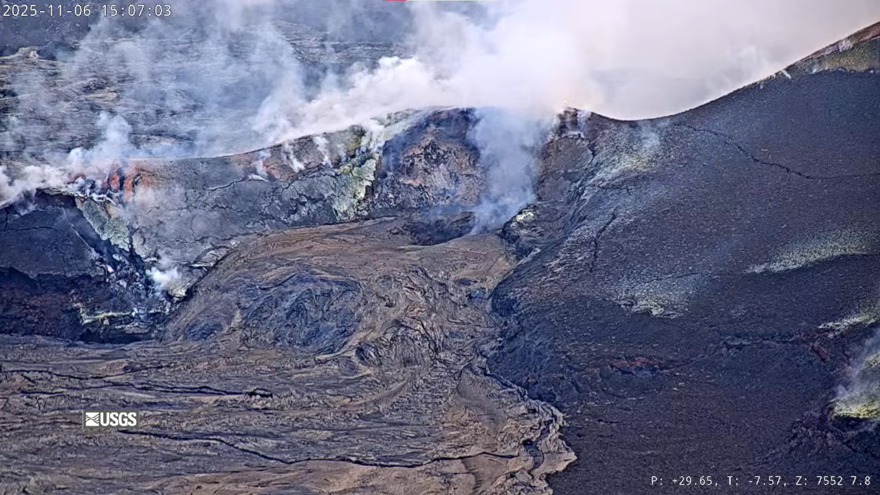
Overflows of degassed lava continued from the south vent until 12am this morning while three small overflow episodes occurred from the north vent into the early morning. Both vents showed strong glow and minor spattering overnight. The last overflows came from the north vent near 4 a.m. HST on November 6. Kīlauea’s summit inflation has stalled over the past several days, lengthening the forecast window. However, repeated overflows in the last day from the north and south vents indicate the start of episode 36 may be close. Models suggest a likely forecast window of November 6–11 for episode 36.
Summit Observations:
Since 4 a.m. HST this morning there has been a pause in overflow activity at the north and south vents. Preceding this period, the north vent produced a number of large overflows with many of these events developing hemispherical dome fountains. Overflows and the dome fountains had very little spattering until drainback, indicating that mostly degassed magma is being erupted at this time.
The summit has not shown strong changes in deformation in the last 24 hours. The Uēkahuna tiltmeter (UWD) has recorded approximately 0.5 microradian of deflationary tilt over the past 24 hours yielding 25.2 microradians of inflationary tilt since the end of episode 35. Tremor patterns until midnight were consistent with periods of low tremor correlating with pond filling and/or overflows followed by longer 15-75 minute tremor spikes related to drainback. That pattern changed just after 1 a.m. HST with more constant and higher tremor marked by small spikes (typically 1 minute) of high tremor occurring sporadically.
Plumes of gas continue from both vents this morning and sulfur dioxide (SO2) gas emissions remain at background levels, typically between 1,200 and 1,500 tonnes per day. Yesterday wind conditions were favorable and the SO2 array southwest of the vent detected « puffs » of gas related to drainback events as is expected during gas pistoning events.
Source et photo : HVO
Kamchatka , Sheveluch :
VOLCANO OBSERVATORY NOTICE FOR AVIATION (VONA)
Issued: November 6 , 2025
Volcano: Sheveluch (CAVW #300270)
Current aviation colour code: ORANGE
Previous aviation colour code: orange
Source: KVERT
Notice Number: 2025-130
Volcano Location: N 56 deg 38 min E 161 deg 18 min
Area: Kamchatka, Russia
Summit Elevation: 3283 m (10768.24 ft), the dome elevation ~2500 m (8200 ft)
Volcanic Activity Summary:
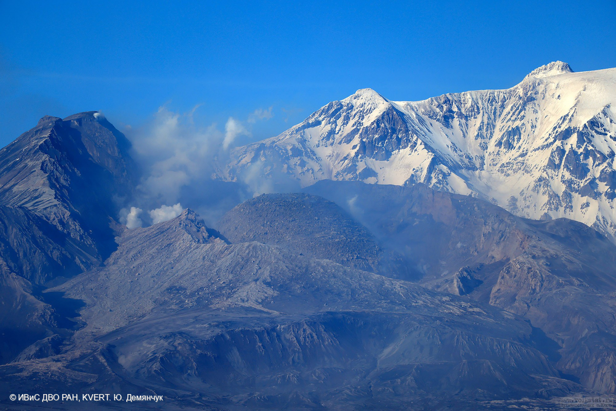
Satellite data by KVERT shows a strong wind lifts ash from the eastern slopes of Sheveluch volcano, and a plume of resuspended ash is extending about 55 km to the east of the volcano.
There is NO eruption, but an resuspended ash. Ongoing activity could affect low-flying aircraft.
Volcanic cloud height:
2500-3000 m (8200-9840 ft) AMSL Time and method of ash plume/cloud height determination: 20251106/0130Z – Himawari-9 14m15
Other volcanic cloud information:
Distance of ash plume/cloud of the volcano: 55 km (34 mi)
Direction of drift of ash plume/cloud of the volcano: E / azimuth 98 deg
Time and method of ash plume/cloud determination: 20251106/0130Z – Himawari-9 14m15
Source : Kvert.
Photo : Yu. Demyanchuk, IVS FEB RAS, KVERT ( archive).